
Garbh Bheinn
Good walks are even better shared.
Overview
Garbh Bheinn: A Scottish Gem
Garbh Bheinn stands proudly at 987 meters, welcoming hikers with its craggy peaks and captivating scenery. Nestled in the heart of the Scottish Highlands, this Corbett offers a blend of challenge and beauty that is hard to resist.
Geology
The mountain is primarily composed of schist, a metamorphic rock that gives it a unique character. Its rugged appearance is a result of countless geological events, showcasing nature's artistry over millennia.
Routes
Two popular routes lead to the summit:
- Northwest Ridge Route: This path, starting from Loch Sunart, is a great introduction to the area. It covers about 7.5 km and typically takes around 4 hours. Perfect for those who enjoy taking their time to soak in the sights!
- South East Approach: For those craving quiet solitude, this challenging route from Strontian is ideal. Spanning 9 km and requiring about 5 hours, it’s worth every step for the breathtaking views.
Summit Features
At the summit, hikers will find a prominent cairn that not only marks the high point but also serves as a perfect photo-op stunt!
Terrain
Expect a mix of rocky terrain, grassy patches, and the delightful experience of boggy ground in some areas. Be prepared!
Views
Upon reaching the summit, you will be greeted by stunning vistas, including Loch Sunart and the surrounding majestic peaks. The best time to enjoy these views is during Late Spring or early Autumn when the visibility is at its peak.
Hazards
Be mindful of the hazards—a little unexpected rain can turn the terrain into a slippery adventure, and loose rocks may try to make you a bit more 'intimate' with the ground.
Access
- Nearest Parking: Loch Sunart car park is conveniently located and well-marked.
- Public Transport: There are bus services from nearby towns, but do check their schedules!
- Nearest Town: The charming village of Strontian is nearby, boasting local cafes and shops.
Facilities
For a warm meal or a comforting cup of tea, Strontian has several options that cater to weary walkers.
History
The name 'Garbh Bheinn' translates to 'Rough Mountain' in Gaelic, a fitting description of its terrain. This mountain not only adds beauty to the landscape but also holds a significant place in local folklore.
Conclusion
Garbh Bheinn might just be the kind of mountain that makes you wish for a few more hours in the day. Whether you are conquering its peaks or merely enjoying a picnic at its base, it embodies the wild spirit of the Scottish Highlands.
Happy hiking, and may you always have a path ahead!
Explore routes near Garbh Bheinn
Walks starting near this hill. Open a route to check its map, distance and full itinerary.
Ben Nevis via Mountain Path
View route
Banavie to Glen Loy Aqueduct: Neptune’s Staircase Canal Towpath
View route
Fort Augustus to Kytra Lock: Caledonian Canal Towpath
View route
Crinan Canal: Bellanoch and Dunardry towpath return
View route
Route planning notes
These notes describe possible approaches. Check a route's map and access information when planning your walk.
Northwest Ridge Route
A popular and scenic approach that leads from the car park at Loch Sunart, offering stunning views of the surrounding landscape.
South East Approach
A less trodden but equally rewarding path that starts from the village of Strontian, perfect for those seeking a bit of solitude.
Make a day of it, together
Find someone to share the walk with, or organise a day out along a route you like.
Hill facts and local notes
Classifications
Elevation
885m
2,904 ft
Prominence
687m
Coordinates
56.7045, -5.4250
NM904622
OS Map
40
Explorer: 391
At the Summit
The summit is adorned with a substantial cairn, a fine place to rest while taking in the stunning panoramic views.
Terrain & Geology
Garbh Bheinn is primarily composed of rugged schist, which gives it a beautiful dark appearance, interspersed with lighter quartz veins. The mountain's structure is a testament to millions of years of geological processes including metamorphism and erosion.
Views & Scenery
From the summit, you can see the picturesque Loch Sunart, the rugged peaks of the Scottish Highlands, and on a clear day, even the islands off the coast.
History & Heritage
Name Origin
Garbh Bheinn translates to 'Rough Mountain' in Gaelic, a fitting name given its quintessentially rugged Highland character.
Historical Significance
Aside from its natural beauty, Garbh Bheinn embodies the cultural heritage of the region, often featured in local folklore and stories passed down through generations.
Getting There & Facilities
Parking
Parking is available at the Loch Sunart car park, which is well-signposted and can accommodate several vehicles.
Public Transport
Buses operate from nearby towns to Strontian, though services are limited, so check the timetable!
Nearby Facilities
Although there are no facilities directly on the mountain, Strontian offers cafes and shops where you can refuel your energy before or after your hike.
Safety Information
Known Hazards
- Loose rocks, sudden changes in weather, and boggy ground—always keep an eye out or you might find yourself knee-deep in 'Scottish surprise'.
General Safety Tips
- Check weather conditions before setting out
- Carry appropriate clothing and equipment
- Let someone know your planned route
- Take a map, compass, and GPS device
- Carry emergency supplies: food, water, first aid kit, torch
Hills
Some common questions about the hills answered
Are there group walks up Garbh Bheinn?
Many walkers use Walkmates to join or organise walks with others. You can check for group walks around Garbh Bheinn through the maps
Are there other walkers around Garbh Bheinn?
Activity varies by location and time, but Walkmates lets you see whether others have shared walks or shown interest in this area. Find other people through the walking friends search walking friends for Garbh Bheinn search or of course create your own walk for Garbh Bheinn
Can I organise a walk to Garbh Bheinn?
Yes. If there aren’t any walks listed already, you can create a walk and make it available for others to join.
If you're signed up to Walkmates, you can create a walk to Garbh Bheinn.
How do I find a walk up this hill?
There are often multiple ways to walk this hill, depending on experience and route preference. Walkmates helps you explore walks and routes that others have shared.
Can I suggest a new route up Garbh Bheinn?
Yes. You can suggest or create routes to share with others. Walkmates focuses on the social side of walking, so routes are used to help people organise walks and explore areas together, rather than as detailed navigation tools or route libraries.
Other uses really appreciate knowledgeable walkers sharing their routes. Share your favourite route to Garbh Bheinn here
The is an error or something incorrect about this hill. How do I let you know?
We always strive to keep the information on Walkmates as accurate as possible. If you find an error, please let us know through the contact form and we'll aim to correct it as quickly as possible
Community Discussion
Comments
Location
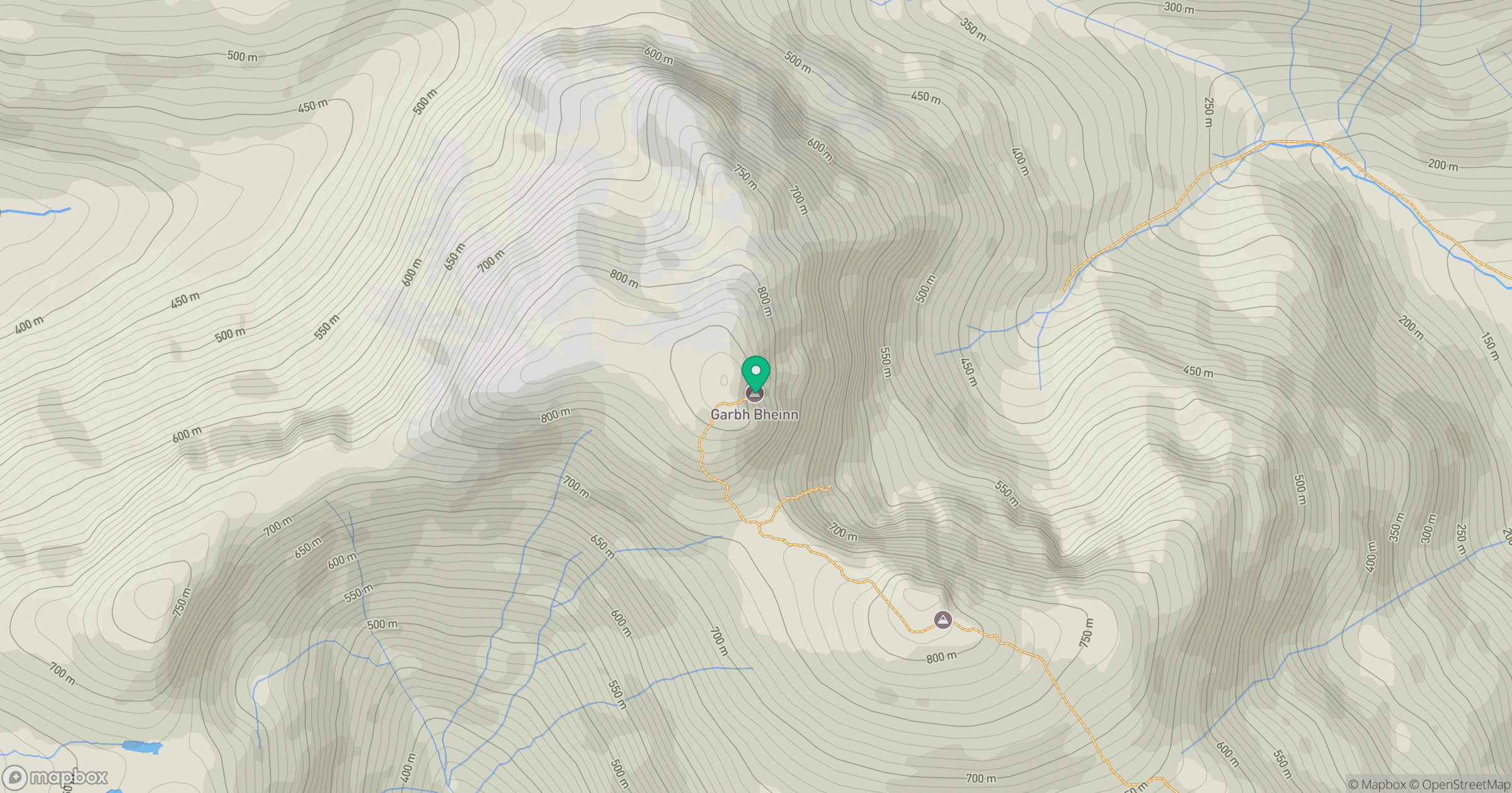
Grid reference: NM904622
View on OpenStreetMapOpens a map in a new tab, centred on the hill.
No comments yet. Be the first.