

Gallt y Wenallt
Good walks are even better shared.
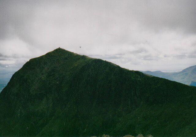
SH6453 : Gallt y Wenallt
Phil Brandon Hunter Photo source
Overview
Gallt y Wenallt: A Hidden Gem in Snowdonia
Introduction
Nestled in the heart of Snowdonia National Park, Gallt y Wenallt is a delightful destination for hikers and nature lovers alike. With an elevation of 469 meters, it's a Marilyn, which means it boasts a relative prominence that makes it stand out among the rolling hills.
Geology
Interesting tidbits about Gallt y Wenallt include its geological composition. The slopes are adorned with ancient slate and remnants of volcanic activity, providing a fascinating backdrop for geology enthusiasts. This area's history is written in the stones, showcasing the epic tale of tectonic forces and glacial sculpting.
Routes
The most inviting route is the Blaen y Cwm Route. Spanning about 4.5 km and taking roughly 2.5 hours, this moderate trail winds through verdant valleys which are a feast for the senses. Make sure you pack your sense of adventure and a good pair of boots!
Summit Features
At the summit, you'll be greeted by a charming stone cairn, a perfect spot to catch your breath and ponder life's mysteries—like why the kettle always boils when you leave the room.
Terrain Type
The terrain is a mix of grassy slopes and rocky paths, with some boggy patches that require careful navigation. It’s a reminder that nature can be a bit cheeky at times!
Views
As you catch your breath atop Gallt y Wenallt, the views are nothing short of breathtaking. Gaze over to the towering peaks of Snowdon and the glistening lakes dotting the landscape. Late spring and early autumn are particularly magical times to experience this scenic grandeur, so don't forget your camera!
Hazards
In the mountains, conditions can change in the blink of an eye. Be mindful of sudden weather shifts, and keep an eye out for slippery rocks. A good pair of hiking boots will serve you well in the boggier sections.
Nearby Summits
Don’t forget to explore nearby giants like Foel Fras (942 meters) and Carnedd Gwenllian (1000 meters) for more hiking adventures.
Access
Parking is available at a small area starting the Blaen y Cwm route, but arrive early on weekends to secure your spot. Public transport options are limited, primarily revolving around local bus services that connect to nearby villages. The nearest town is Llanrwst, where you can stock up on supplies or enjoy a warm meal.
Facilities
In terms of facilities, take a stroll into Llanrwst for cafes and shops, perfect for a post-hike treat.
History
The name 'Gallt y Wenallt' tells a story of its own, meaning 'The Hill of the White Grove', alluding to the tree-covered slopes of the past. This area has rich historical importance, particularly in terms of its natural heritage.
In summary, Gallt y Wenallt is more than just a peak; it’s a tale of nature, history, and stunning views waiting to be explored. So lace up those boots and enjoy your adventure!
Explore routes near Gallt y Wenallt
Walks starting near this hill. Open a route to check its map, distance and full itinerary.
Snowdon Pyg Track returning by Miner's Track
View route
Beddgelert Forest: Derwen Circuit and Llyn Llywelyn
View route
Beddgelert Forest: Llyn Llywelyn Woodland Circuit
View route
Llyn Crafnant: Lakeside Circuit from the NRW Car Park
View route
Route planning notes
These notes describe possible approaches. Check a route's map and access information when planning your walk.
Blaen y Cwm Route
A popular route that starts at the base of the hill, offering a moderate ascent through lush valleys and rocky paths.
Make a day of it, together
Find someone to share the walk with, or organise a day out along a route you like.
Photo Gallery
View all Photo could not load
SH6453 : Gallt y Wenallt
Phil Brandon Hunter
 Photo could not load
SH6453 : Gallt y Wenallt
Rude Health
Hill facts and local notes
Classifications
Elevation
619m
2,031 ft
Prominence
22m
Coordinates
53.0594, -4.0272
SH642532
OS Map
115
Explorer: OL17W
At the Summit
The summit features a small stone cairn, perfect for a quick selfie before heading back down. The views are the real highlight though, with expansive vistas that are a sight for sore eyes.
Terrain & Geology
Gallt y Wenallt is primarily composed of old slate and volcanic rocks, showcasing the rugged beauty of Snowdonia. The area is known for its fascinating geological history, including ancient tectonic activity and glacial erosion, resulting in spectacular formations.
Views & Scenery
From the summit, you can see the majestic peaks of Snowdonia, including Snowdon itself, as well as picturesque valleys and the shimmering waters of nearby lakes.
History & Heritage
Name Origin
The name 'Gallt y Wenallt' translates to 'The Hill of the White Grove', reflecting the area's natural beauty and possibly its ancient woodlands.
Historical Significance
Historically, the region has been of importance to both local communities and naturalists, recognised for its rich biodiversity and cultural heritage.
Getting There & Facilities
Parking
There is a small parking area at the start of the Blaen y Cwm route, located at SH655530. It can accommodate several vehicles but fills up quickly on weekends.
Public Transport
Public transport options are limited, but there are local bus services to nearby villages like Llanfairfechan and Abergele that provide access to local paths.
Nearby Facilities
Facilities are limited in immediate proximity, but Llanrwst has cafes, shops, and pubs to refuel after your hike. Public toilets can be found in the town.
Safety Information
Known Hazards
- Watch out for sudden weather changes, as conditions can shift rapidly in the mountains. Slippery rocks and boggy areas can also present a challenge, particularly after rain.
General Safety Tips
- Check weather conditions before setting out
- Carry appropriate clothing and equipment
- Let someone know your planned route
- Take a map, compass, and GPS device
- Carry emergency supplies: food, water, first aid kit, torch
Hills
Some common questions about the hills answered
Are there group walks up Gallt y Wenallt?
Many walkers use Walkmates to join or organise walks with others. You can check for group walks around Gallt y Wenallt through the maps
Are there other walkers around Gallt y Wenallt?
Activity varies by location and time, but Walkmates lets you see whether others have shared walks or shown interest in this area. Find other people through the walking friends search walking friends for Gallt y Wenallt search or of course create your own walk for Gallt y Wenallt
Can I organise a walk to Gallt y Wenallt?
Yes. If there aren’t any walks listed already, you can create a walk and make it available for others to join.
If you're signed up to Walkmates, you can create a walk to Gallt y Wenallt.
How do I find a walk up this hill?
There are often multiple ways to walk this hill, depending on experience and route preference. Walkmates helps you explore walks and routes that others have shared.
Can I suggest a new route up Gallt y Wenallt?
Yes. You can suggest or create routes to share with others. Walkmates focuses on the social side of walking, so routes are used to help people organise walks and explore areas together, rather than as detailed navigation tools or route libraries.
Other uses really appreciate knowledgeable walkers sharing their routes. Share your favourite route to Gallt y Wenallt here
The is an error or something incorrect about this hill. How do I let you know?
We always strive to keep the information on Walkmates as accurate as possible. If you find an error, please let us know through the contact form and we'll aim to correct it as quickly as possible
Community Discussion
Comments
Location
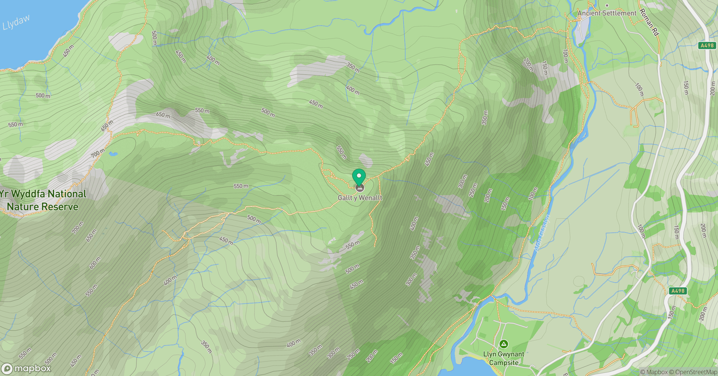
Grid reference: SH642532
View on OpenStreetMapOpens a map in a new tab, centred on the hill.
No comments yet. Be the first.