

Gallt y Daren
Good walks are even better shared.
SH7734 : Hoary Post
Michael Graham Photo source
Overview
Gallt y Daren
Gallt y Daren, standing proudly at 559 meters, is a Marilyn situated in the heart of Snowdonia National Park. This mountain may not be the tallest in the range, but its notable prominence and stunning views make it a worthy challenge for any hiker.
Geology
The mountain boasts a fascinating geological composition primarily of volcanic rocks. The rocky outcrops and scree slopes are reminders of the intense geological forces that shaped this breathtaking landscape. The craggy features add a touch of drama, perfect for those Instagram shots!
Routes
The most popular route is the Gallt y Daren Loop, which starts from the charming village of Cwm Chwefru. This scenic path takes you through verdant valleys and up exhilarating ridges. It’s about an 8.5 km trek that typically takes around 3.5 hours to complete. It leans towards the moderate side of difficulty, so bring your sense of adventure but maybe leave your stilettos at home!
Summit Features
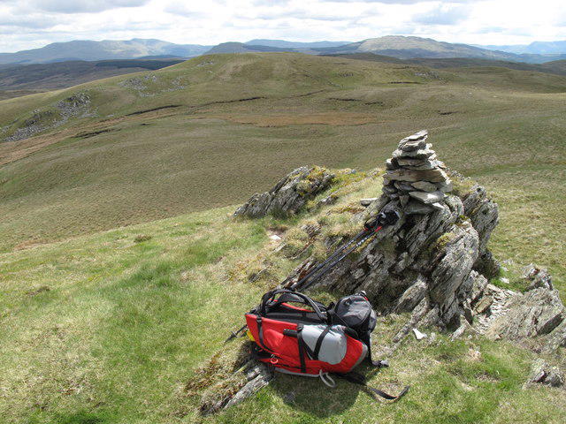
Reaching the summit rewards hikers with a sturdy cairn—a classic feature that epitomises the spirit of hiking in the UK. Rest easy at the top while gazing at the extraordinary views that have made this mountain a favourite among outdoor enthusiasts.
Terrain
Expect a delightful mix of grassy slopes peppered with rocky outcrops. This diverse terrain makes each part of the trek unique, and might give you a chance to meet some rather cheeky sheep!
Views
When conditions are just right (which, let’s be honest, can be hit or miss in Wales), the vistas are nothing short of breathtaking. With the fabulous Brecon Beacons and the iconic Snowdon massif gracing the horizon, you'll find it hard to squeeze in a picture before another stunning view catches your eye. The best time for sightseeing is during spring or early summer when wildflowers bloom and the skies clear.
Hazards
As enchanting as this area is, it’s also crucial to note the potential hazards. The terrain can be steep and rocky, with loose stones lurking about, just waiting to send you onto a surprise slide. Also, the Welsh weather can make a dramatic entrance, so always check forecasts and prepare for a sudden rain shower or a cheeky gust.
Access
You’ll find ample parking at the village hall in Cwm Chwefru, making access straightforward. If public transport is more your style, check the bus schedules from nearby towns like Builth Wells.
Facilities
While Gallt y Daren is blessed with natural beauty, amenities are a bit of a drive away in Builth Wells, where you can restock on snacks or grab a hot drink at one of the local cafes.
History
The name 'Gallt y Daren' hints at its lush surroundings, which have their own tales to tell. Historically, this area has been a coveted hunting ground with a mix of legends surrounding it that add a dash of intrigue.
So whether you’re a seasoned hiker or just looking to enjoy a brisk stroll with some great views, Gallt y Daren offers a little treat for everyone!
Conclusion
In summary, Gallt y Daren might not be the highest mountain around, but the combination of stunning views, intriguing geology, and charming routes make it a gem worth exploring. Don’t forget your camera and a quiet appreciation for the beauty that is often found off the beaten track.
Explore routes near Gallt y Daren
Walks starting near this hill. Open a route to check its map, distance and full itinerary.
Coed y Brenin: Pont Ty'n-y-groes and Mawddach Forest Trail
View route
Aran Benllyn and Aran Fawddwy from LLanuwchllyn
View route
Arenig Fach guided mountain walk
View route
Northern Rhinogydd guided mountain walk
View route
Route planning notes
These notes describe possible approaches. Check a route's map and access information when planning your walk.
Gallt y Daren Loop
This delightful loop starts from the village of Cwm Chwefru, taking you through lush valleys and along scenic ridges before culminating at the summit.
Make a day of it, together
Find someone to share the walk with, or organise a day out along a route you like.
Photo Gallery
View all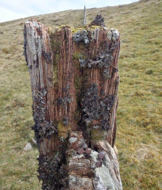 Photo could not load
SH7734 : Hoary Post
Michael Graham
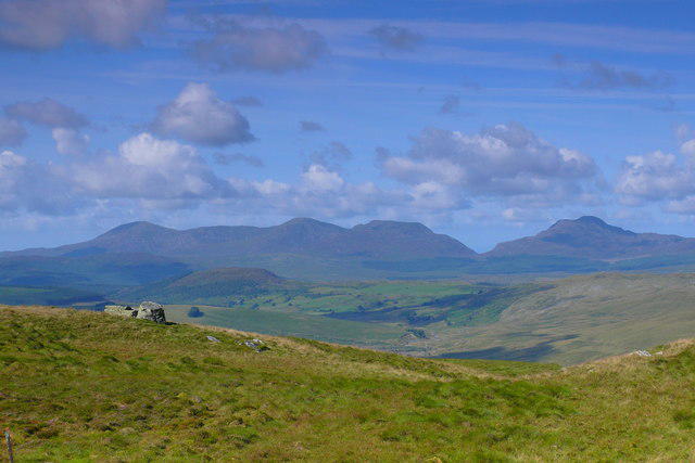 Photo could not load
SH7734 : Bwlch rhwng Foel Boeth a Gallt y Daren / Col between Foel Boeth and Gallt y Daren
Ian Medcalf
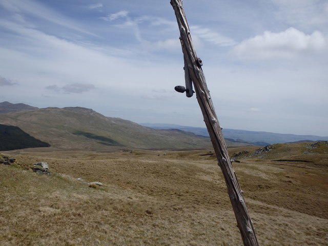 Photo could not load
SH7734 : Derelict Telephone Pole
Michael Graham
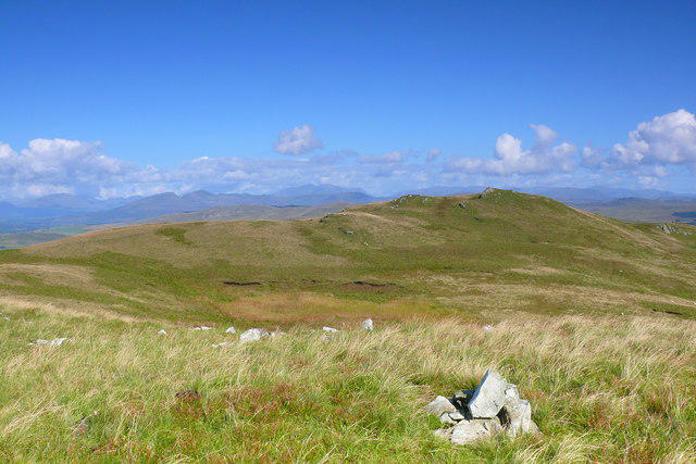 Photo could not load
SH7734 : Copa Foel Boeth / Summit of Foel Boeth
Ian Medcalf
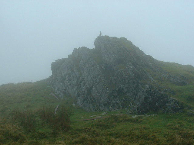 Photo could not load
SH7734 : Summit of Galt y Daren in mist
Bill Rowley
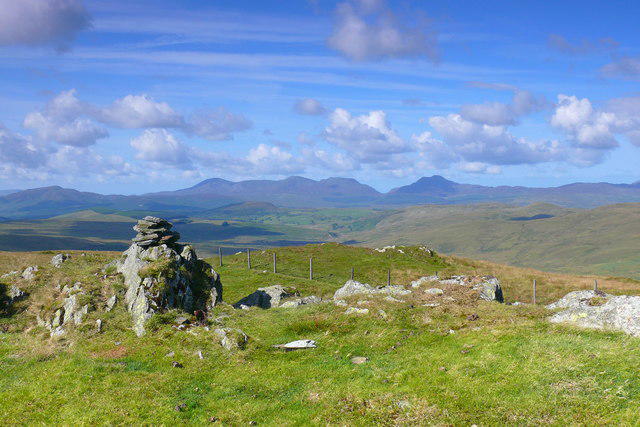 Photo could not load
SH7734 : Gallt y Daren
Ian Medcalf
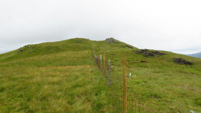 Photo could not load
SH7734 : View N along fence to the summit of Gallt y Daren
Colin Park
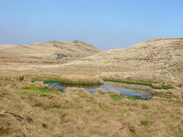 Photo could not load
SH7734 : Gallt y Daren
Dewi
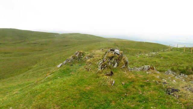 Photo could not load
SH7734 : Summit of Gallt y Daren - view S
Colin Park
SH7734 : Gallt y Daren
Rude Health
Hill facts and local notes
Classifications
Elevation
619m
2,032 ft
Prominence
113m
Coordinates
52.8938, -3.8171
SH778344
OS Map
124
Explorer: OL18E OL23E
At the Summit
The summit is characterised by an impressive cairn which serves as a beacon for weary hikers, and offers a splendid sense of accomplishment upon reaching the top.
Terrain & Geology
Gallt y Daren primarily consists of volcanic rock formations, a remnant of ancient geological activity. The landscape features scree slopes and rugged outcrops, offering a glimpse into the region's tumultuous history.
Views & Scenery
On a clear day, the views extend across the rolling hills of Mid Wales, the Brecon Beacons, and even as far as the Snowdon massif. Bring your camera—it's a sight for sore eyes!
History & Heritage
Name Origin
The name 'Gallt y Daren' translates to 'the steep woodland', reflecting the lush and challenging terrain surrounding the peak.
Historical Significance
Historically, this area has been used as a hunting ground and is steeped in local folklore. It's a place where nature meets culture.
Getting There & Facilities
Parking
There's ample parking at the village hall in Cwm Chwefru, a short distance from the trailhead.
Public Transport
Regular bus services operate from nearby towns such as Builth Wells, but it's advisable to check the schedule prior to your trip.
Nearby Facilities
A few miles away in Builth Wells, you'll find lovely cafes, pubs, and toilet facilities.
Safety Information
Known Hazards
- Be cautious of steep sections and loose rocks. Weather can change rapidly in this region, so always check forecasts before heading out.
General Safety Tips
- Check weather conditions before setting out
- Carry appropriate clothing and equipment
- Let someone know your planned route
- Take a map, compass, and GPS device
- Carry emergency supplies: food, water, first aid kit, torch
Hills
Some common questions about the hills answered
Are there group walks up Gallt y Daren?
Many walkers use Walkmates to join or organise walks with others. You can check for group walks around Gallt y Daren through the maps
Are there other walkers around Gallt y Daren?
Activity varies by location and time, but Walkmates lets you see whether others have shared walks or shown interest in this area. Find other people through the walking friends search walking friends for Gallt y Daren search or of course create your own walk for Gallt y Daren
Can I organise a walk to Gallt y Daren?
Yes. If there aren’t any walks listed already, you can create a walk and make it available for others to join.
If you're signed up to Walkmates, you can create a walk to Gallt y Daren.
How do I find a walk up this hill?
There are often multiple ways to walk this hill, depending on experience and route preference. Walkmates helps you explore walks and routes that others have shared.
Can I suggest a new route up Gallt y Daren?
Yes. You can suggest or create routes to share with others. Walkmates focuses on the social side of walking, so routes are used to help people organise walks and explore areas together, rather than as detailed navigation tools or route libraries.
Other uses really appreciate knowledgeable walkers sharing their routes. Share your favourite route to Gallt y Daren here
The is an error or something incorrect about this hill. How do I let you know?
We always strive to keep the information on Walkmates as accurate as possible. If you find an error, please let us know through the contact form and we'll aim to correct it as quickly as possible
Community Discussion
Comments
Location
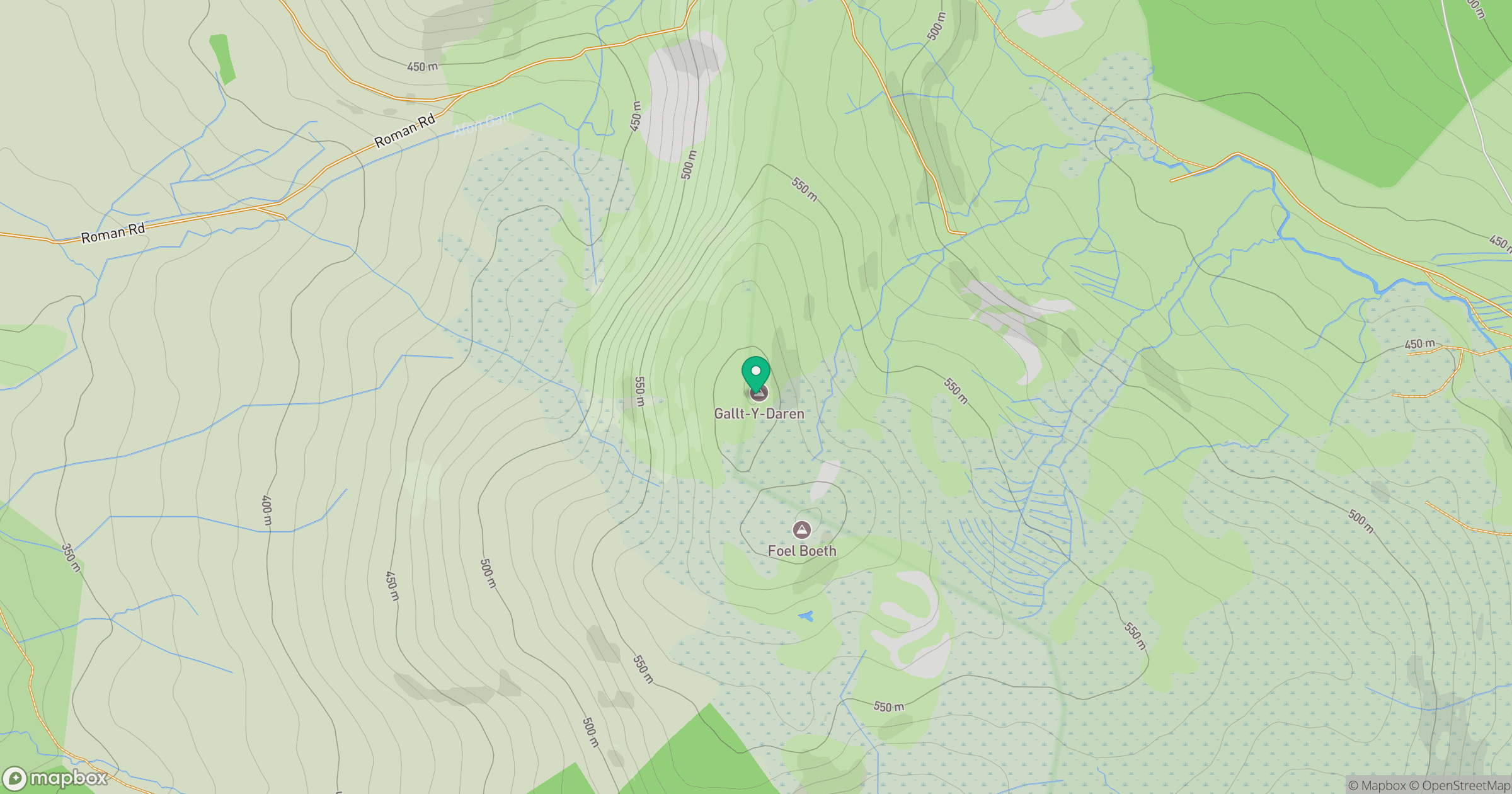
Grid reference: SH778344
View on OpenStreetMapOpens a map in a new tab, centred on the hill.
No comments yet. Be the first.