

Foel yr Erw
Good walks are even better shared.
SH5641 : A rock outcrop on Foel yr Erw
David Medcalf Photo source
Overview
Foel yr Erw: A Scenic Retreat in Snowdonia
Nestled snugly in the heart of the Snowdonia National Park, Foel yr Erw stands majestically at 317 metres above sea level. Though not towering over its more formidable neighbours, this Marilyn offers delightful views and invigorating hikes that keep both novice and seasoned hikers coming back for more.
Geology
The bedrock of Foel yr Erw comprises mostly volcanic materials, particularly rhyolite, which gives rise to its unique landscape. The geological formations here are remnants of ancient volcanic activity, shaping the present beauty you see today – just please don’t try to teach the rocks how to speak, they tend to be a bit stony!
Routes
There are a couple of well-trodden paths leading to the summit:
- Treks from Cwm Penmachno: Spanning about 5.5 km, this moderate trail packs plenty of scenic delights and is achievable in approximately 2.5 hours.
- From Capel Curig: Slightly longer at 6.2 km, this path leads you through a wildflower tapestry and might take around 3 hours.
Both options will set your heart racing with beautiful views and the gentle sounds of nature.
Summit Features
Upon reaching the summit, you’ll be greeted by a small stone cairn and a trig point that tirelessly keeps watch over the stunning landscape. Make sure to take a moment; the summit is as fine a place as any to catch your breath — or take a selfie!
Terrain Type
The terrain here is predominantly grassy, with occasional rocky outcrops. The lower slopes are adorned with bracken and heather, creating an inviting backdrop for your ascent.
Views
The views from Foel yr Erw are simply fantastic. You can see Llyn Crafnant to the east and a panoramic sweep of Snowdonia's rugged peaks, including Snowdon itself – all giving a dramatic display that’s absolutely worth the climb. The best times to enjoy these vistas are spring and autumn, when the skies are usually clearer and nature is in full bloom.
Hazards
As with all mountains, there are some potential hazards: be cautious of slippery rocks and sections that can become treacherous during rainy weather. Fog can also roll in unexpectedly, obscuring your precious views. So, plan your visit accordingly and maybe bring a map — just in case.
Nearby Summits
Here are a couple of nearby giants for those who wish to extend their adventure:
- Carnedd Llewelyn (1064 m)
- Moel Siabod (872 m)
If you're feeling particularly game and fancy a challenge, these peaks are fantastic next stops!
Access
Nearest Parking
You’ll find parking available at Cwm Penmachno, which is just a stone's throw from the trailheads.
Public Transport
Betws-y-Coed is the nearest hub, offering a train service followed by a bus to Cwm Penmachno.
Nearest Town
The quaint town of Betws-y-Coed is your best bet for provisions before hitting the hills.
Facilities
Amenities are scant in Cwm Penmachno, but Betws-y-Coed offers a lovely selection of cafes and toilets to ensure you don't head out on an empty stomach.
History
Name Meaning
Foel yr Erw translates to 'hill of the field' in Welsh, highlighting its agrarian history.
Significance
The significance of the area traces back to its pastoral roots. Local communities have used this landscape for farming and grazing for generations.
So why not lace up those hiking boots, pack a sarnie, and enjoy the charm of Foel yr Erw? Remember, there’s more than one way to climb a mountain, but reaching the top is always a good exercise for the soul!
Explore routes near Foel yr Erw
Walks starting near this hill. Open a route to check its map, distance and full itinerary.
Beddgelert Forest: Llyn Llywelyn Woodland Circuit
View route
Beddgelert Forest: Derwen Circuit and Llyn Llywelyn
View route
Northern Rhinogydd guided mountain walk
View route
Snowdon Pyg Track returning by Miner's Track
View route
Route planning notes
These notes describe possible approaches. Check a route's map and access information when planning your walk.
Treks from Cwm Penmachno
A scenic route commencing from the valley of Cwm Penmachno, offering a pleasant ascent with panoramic views in the background.
From Capel Curig
Starting from the picturesque village of Capel Curig, this trail winds through bracken and heather, leading directly to the summit of Foel yr Erw.
Make a day of it, together
Find someone to share the walk with, or organise a day out along a route you like.
Photo Gallery
View all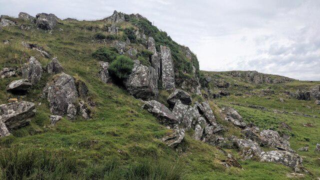 Photo could not load
SH5641 : A rock outcrop on Foel yr Erw
David Medcalf
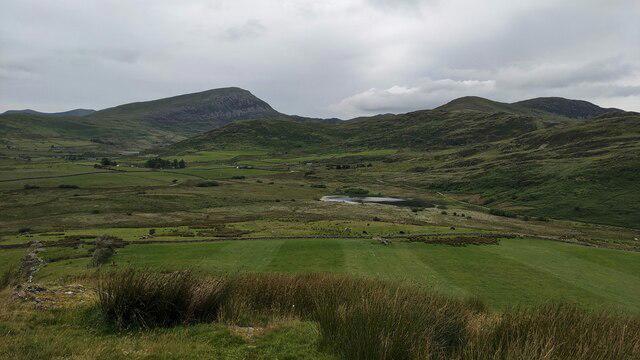 Photo could not load
SH5641 : A green field below Foel yr Erw
David Medcalf
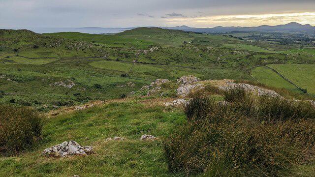 Photo could not load
SH5641 : Rushes on Foel yr Erw
David Medcalf
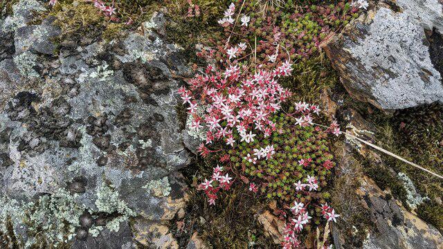 Photo could not load
SH5641 : Stonecrop and lichen on Foel yr Erw
David Medcalf
Hill facts and local notes
Classifications
Elevation
280m
919 ft
Prominence
44m
Coordinates
52.9549, -4.1445
SH560418
OS Map
124
Explorer: OL18W 254
At the Summit
The summit features a small stone cairn and a trig point, perfect for that Instagram shot (or just for confirming you've reached the top!).
Terrain & Geology
Foel yr Erw is primarily composed of volcanic rocks, with significant outcrops of rhyolite. The unique geological processes in the area contribute to its striking landscape.
Views & Scenery
Breathtaking views of the surrounding valleys, including Llyn Crafnant and the peaks of Snowdonia National Park, including the mighty Snowdon in the distance.
History & Heritage
Name Origin
The name Foel yr Erw roughly translates to 'hill of the field' in Welsh, reflecting its pastoral surroundings.
Historical Significance
The area has historical significance as part of the ancient landscape used for farming and grazing by past communities.
Getting There & Facilities
Parking
Parking is available at Cwm Penmachno village, which provides access to numerous trails.
Public Transport
The nearest public transport options are train services to Betws-y-Coed, followed by a bus to Cwm Penmachno.
Nearby Facilities
Limited facilities in Cwm Penmachno; better options are available in nearby Betws-y-Coed, where you can find cafes and toilets.
Safety Information
Known Hazards
- Watch for slippery sections during wet weather, and areas where visibility can drop unexpectedly in fog.
General Safety Tips
- Check weather conditions before setting out
- Carry appropriate clothing and equipment
- Let someone know your planned route
- Take a map, compass, and GPS device
- Carry emergency supplies: food, water, first aid kit, torch
Hills
Some common questions about the hills answered
Are there group walks up Foel yr Erw?
Many walkers use Walkmates to join or organise walks with others. You can check for group walks around Foel yr Erw through the maps
Are there other walkers around Foel yr Erw?
Activity varies by location and time, but Walkmates lets you see whether others have shared walks or shown interest in this area. Find other people through the walking friends search walking friends for Foel yr Erw search or of course create your own walk for Foel yr Erw
Can I organise a walk to Foel yr Erw?
Yes. If there aren’t any walks listed already, you can create a walk and make it available for others to join.
If you're signed up to Walkmates, you can create a walk to Foel yr Erw.
How do I find a walk up this hill?
There are often multiple ways to walk this hill, depending on experience and route preference. Walkmates helps you explore walks and routes that others have shared.
Can I suggest a new route up Foel yr Erw?
Yes. You can suggest or create routes to share with others. Walkmates focuses on the social side of walking, so routes are used to help people organise walks and explore areas together, rather than as detailed navigation tools or route libraries.
Other uses really appreciate knowledgeable walkers sharing their routes. Share your favourite route to Foel yr Erw here
The is an error or something incorrect about this hill. How do I let you know?
We always strive to keep the information on Walkmates as accurate as possible. If you find an error, please let us know through the contact form and we'll aim to correct it as quickly as possible
Community Discussion
Comments
Location
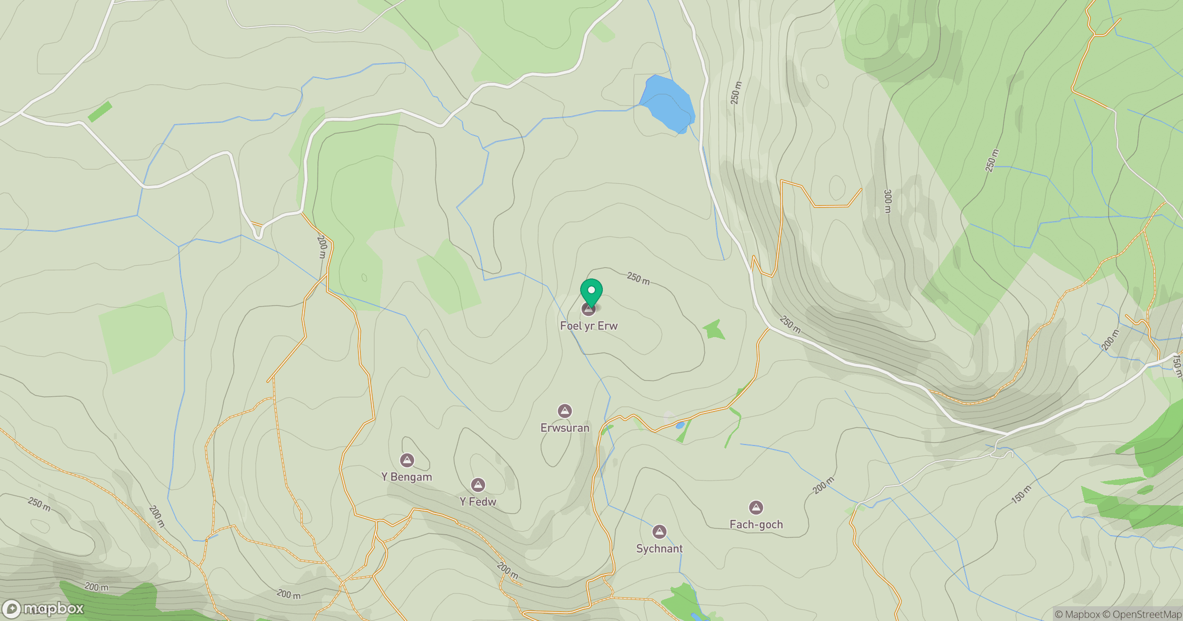
Grid reference: SH560418
View on OpenStreetMapOpens a map in a new tab, centred on the hill.
No comments yet. Be the first.