

Five Sisters Bing
Good walks are even better shared.
NT0064 : The Five Sisters
Richard Webb Photo source
Overview
Overview
Five Sisters Bing, a Marilyn located in Central Scotland, boasts an elevation of 110 meters. This hill, with its friendly stature, is a favourite among locals and visitors alike, offering a pocket of tranquillity amid the hustle and bustle of industrial history.
Geology
The geological composition of Five Sisters Bing draws hikers not only for its beauty but also for its rich sedimentary layers. Formed during the Carboniferous period, the siltstone and sandstone speak to a bygone era shaped by the mighty glaciers that sculpted this landscape. It's a narrative in stone, so make sure to admire those rocky bits as you stroll on up.
Routes
The Broombank Path provides an inviting route to the summit, winding through picturesque moorland. At a distance of 3.5 km and generally thought of as an easy walk, this trail is perfect for families, walkers, and those looking to dust off their boots without breaking a sweat. However, it’s always wise to pack a snack - nothing spoils an adventure like a rumbling belly!
Summit Features
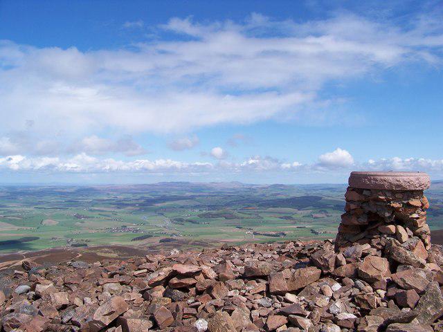
Upon reaching the summit, you’ll be greeted by a sturdy cairn, standing proud like a lighthouse guiding wayward souls to the spectacular views that await them. It’s the ideal spot to catch your breath (and your lunch) while soaking in the scenery.
Terrain
The terrain is primarily grassy, punctuated by the occasional rocky patch, giving your hike that ‘real outdoor’ feel without turning into a rock-climbing expedition. Just watch out for the odd boggy patch - nobody wants to be that hiker who returns two shades of muddy!
Views
From the summit, the panorama is nothing short of breathtaking. You can see the Firth of Forth stretching out before you, flanked by the undulating hills of the Pentland Range. Clear days can even reward you with views of the distant peaks of the Highlands - a sight guaranteed to make you feel alive. Do make sure your camera is at the ready!
Hazards
As with many great hikes, there are some hazards to keep in mind. After heavy rainfall, certain areas might turn into miniature lakes, so good waterproof footwear will keep you from getting your boots soaked and your spirits dampened.
Access
Getting to the trailhead is piece of cake. A small car park along the A71 is just 1 km from the start of the path. If public transport is more your style, regular bus services from Edinburgh to West Calder will get you quite close, and a quick taxi ride will seal the deal.
Facilities
For those who might feel the call of a cup of tea post-hike, West Calder is your best bet for cafes, pubs, and toilet facilities. Nothing like a good cuppa to end your adventure!
Conclusion
Five Sisters Bing might not be the tallest or most challenging, but what it lacks in elevation, it more than makes up for in charm and accessibility. It’s a place where one can safely lace up their walking boots, immerse in nature, and turn life’s hectic pace down a notch or two. So grab your boots and get out there!
Explore routes near Five Sisters Bing
Walks starting near this hill. Open a route to check its map, distance and full itinerary.
East Calder: Almondell, Mandela Bridge and River Almond Circuit
View route
Linlithgow: Beecraigs Loch and Southern Woodland Circuit
View route
Falkirk Wheel: Bonnybridge and Doctor's Pend Canal Walk
View route
Devilla Forest: Bordie Loch, Moor Loch and Peppermill Dam Circuit
View route
Route planning notes
These notes describe possible approaches. Check a route's map and access information when planning your walk.
The Broombank Path
A gentle ascent starting from the nearby A71, this path winds through scenic moorland, offering a straightforward approach to the summit.
Make a day of it, together
Find someone to share the walk with, or organise a day out along a route you like.
Photo Gallery
View all Photo could not load
NT0064 : The Five Sisters
Richard Webb
 Photo could not load
NT0064 : The Five Sisters
Paul Thomson
 Photo could not load
NT0064 : Five Sisters
Richard Webb
 Photo could not load
NT0063 : Breich Way
Anne Burgess
 Photo could not load
NT0064 : Five Sisters close up
Richard Webb
 Photo could not load
NT0064 : Woods, Breich
Richard Webb
 Photo could not load
NT0063 : Three of the Five Sisters
M J Richardson
 Photo could not load
NT0064 : The north section of the Five Sisters
M J Richardson
 Photo could not load
NT0064 : Breich Path
Anne Burgess

NT0064 : Five Sisters - North valley
Ian Dodds
Hill facts and local notes
Classifications
Elevation
231m
758 ft
Prominence
73m
Coordinates
55.8595, -3.5872
NT007640
OS Map
65
Explorer: 344
At the Summit
The summit is marked by a prominent cairn, providing a perfect spot for weary hikers to rest and enjoy the breathtaking views of the surrounding landscape.
Terrain & Geology
The Five Sisters Bing is primarily composed of siltstone and sandstone, formed during the Carboniferous period. These layers of sediment have been shaped by glacial activity, giving the area its characteristic contours and impressive views.
Views & Scenery
From the summit, you can see the stunning Firth of Forth, the rolling hills of the Pentland Range, and on clear days, even the distant peaks of the Highlands.
History & Heritage
Name Origin
The term 'Bing' in Scots refers to a mound or hill built from waste materials, specifically associated with coal mining in the area. Thus, the name reflects the location's industrial heritage.
Historical Significance
Historically, the area surrounding Five Sisters Bing was heavily industrialised due to coal mining, which played a crucial role in the region's development.
Getting There & Facilities
Parking
There is a small car park located along the A71, approximately 1 km from the starting point of the trail.
Public Transport
Regular bus services run from Edinburgh to West Calder, where you can catch a taxi to the trailhead.
Nearby Facilities
The nearest facilities are located in West Calder, including cafes, pubs, and public toilets.
Safety Information
Known Hazards
- Some sections of the path can be boggy, especially after heavy rains; sturdy waterproof footwear is recommended.
General Safety Tips
- Check weather conditions before setting out
- Carry appropriate clothing and equipment
- Let someone know your planned route
- Take a map, compass, and GPS device
- Carry emergency supplies: food, water, first aid kit, torch
Hills
Some common questions about the hills answered
Are there group walks up Five Sisters Bing?
Many walkers use Walkmates to join or organise walks with others. You can check for group walks around Five Sisters Bing through the maps
Are there other walkers around Five Sisters Bing?
Activity varies by location and time, but Walkmates lets you see whether others have shared walks or shown interest in this area. Find other people through the walking friends search walking friends for Five Sisters Bing search or of course create your own walk for Five Sisters Bing
Can I organise a walk to Five Sisters Bing?
Yes. If there aren’t any walks listed already, you can create a walk and make it available for others to join.
If you're signed up to Walkmates, you can create a walk to Five Sisters Bing.
How do I find a walk up this hill?
There are often multiple ways to walk this hill, depending on experience and route preference. Walkmates helps you explore walks and routes that others have shared.
Can I suggest a new route up Five Sisters Bing?
Yes. You can suggest or create routes to share with others. Walkmates focuses on the social side of walking, so routes are used to help people organise walks and explore areas together, rather than as detailed navigation tools or route libraries.
Other uses really appreciate knowledgeable walkers sharing their routes. Share your favourite route to Five Sisters Bing here
The is an error or something incorrect about this hill. How do I let you know?
We always strive to keep the information on Walkmates as accurate as possible. If you find an error, please let us know through the contact form and we'll aim to correct it as quickly as possible
Community Discussion
Comments
Location
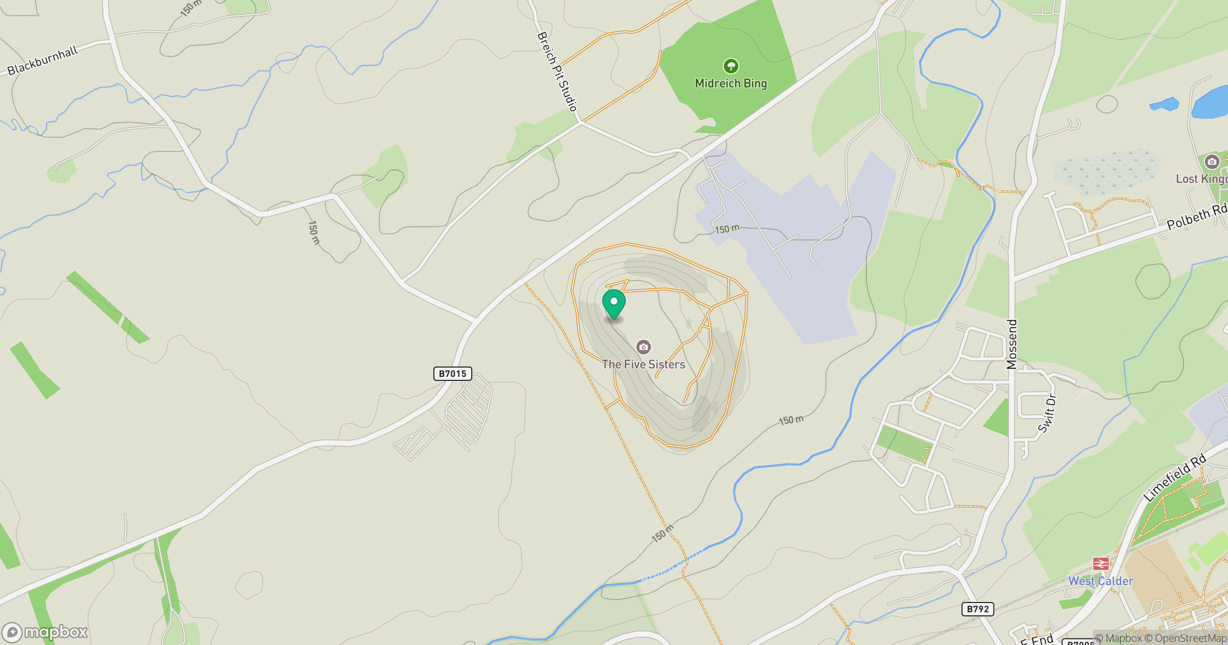
Grid reference: NT007640
View on OpenStreetMapOpens a map in a new tab, centred on the hill.
No comments yet. Be the first.