

Firle Beacon
Good walks are even better shared.
TQ4805 : The South Downs Way east of Firle Beacon
N Chadwick Photo source
Overview
Firle Beacon is a 218.4 m Marilyn on the South Downs chalk escarpment in East Sussex. The summit knoll lies just west of the trig point, with views over the Weald and towards the Channel. Walks range from a ridge out-and-back to longer circuits through Firle village, parkland and surrounding farms.
Firle Beacon
Summit and landscape
Firle Beacon rises to 218.4 m on the South Downs chalk escarpment in East Sussex. It is a Marilyn with 197.7 m of prominence. The recorded summit is a knoll 10 m west of the trig point, 1.1 m above the highest ground beside the trig. In clear weather, views extend across the Weald and towards Newhaven, Seaford and the English Channel.
The north-facing scarp supports chalk grassland and drops steeply below the ridge. Chalk formed from microscopic marine remains; flints and dry valleys are characteristic of the surrounding downs. Leave rocks, plants and archaeological remains undisturbed.
Choosing a walk
- For a summit out-and-back, start at the ridge car park at TQ467058, follow the South Downs Way east to Firle Beacon and return along the same path.
- The published open-access circuit starts and finishes in Firle village. It crosses the park, climbs the eastern scarp, follows the ridge west over the summit to Beddingham Hill, then returns via Preston Court Farm. Its 11.5 km, 315 m ascent and 3–4 hour estimate cover the entire circuit.
- The longer Fancy Free Walks circuit starts at the ridge car park and visits Firle Beacon, Bo Peep, Alciston, Charleston and Firle village, before climbing through Littledene to Beddingham Hill and returning along the ridge. Its 16 km distance covers the whole loop.
Use a current map alongside route directions. These are distinct itineraries, with different starts and returns. Longer linear walks along the South Downs Way need a separately planned finish and onward transport.
Access and facilities
Firle Beacon car park is reached by Firle Bostal and is fee-paying. The separate village visitor car park, beside the Ram Inn, is free but limited. Use designated spaces and keep village streets and farm entrances clear.
Cuckmere 25 serves Firle Park Gates on Tuesdays, Thursdays and Saturdays; Sunday 25X serves Firle Road and the A27 turning. Timetables change on 25 October 2026; check current times and return journeys. Glynde and Lewes have rail connections, but neither is the summit trailhead.
The Ram Inn and village shop offer refreshments subject to opening hours. Pub or attraction toilets depend on their opening and customer arrangements; check before relying on them and carry water for the walk.
Terrain and safety
Expect grassy paths, chalk or flint underfoot, steep scarp slopes, gates and stiles. Wet chalk and mud can be slippery, and lower field paths can be muddy. The open ridge has little shelter from wind, rain or strong sun; take suitable layers, water and navigation equipment. Allow daylight for the return, especially on the longer circuits. Keep dogs controlled around livestock and follow local signs.
Check East Sussex County Council's current path-closure information and notices on the ground. Seasonal restrictions on local byways concern specified vehicles; they do not themselves close the walking routes.
Heritage and surroundings
Historic England records three bowl barrows at the summit, with the South Downs Way passing between them. The largest mound was used as a beacon during the Napoleonic Wars. A nearby long barrow is a separate monument. Firle Estate's village history links the name Firle to the Anglo-Saxon Fierol, meaning oak-covered land.
Firle Place and Charleston lie below the downs. Mount Caburn is a separate 150 m hill northwest of Firle Beacon; Wilmington Hill, 214.7 m, lies to the east. Either needs its own route plan rather than being an assumed extension to a Firle circuit.
Explore routes near Firle Beacon
Walks starting near this hill. Open a route to check its map, distance and full itinerary.
Hellingly to Horam: Cuckoo Trail railway bridges and old station return
View route
Seven Sisters Birling Gap and Friston Forest Circular
View route
Brighton Walk with Men Walking & Talking
View route
Ashdown Forest Wellington Crash Site and Airman's Grave
View route
Route planning notes
These notes describe possible approaches. Check a route's map and access information when planning your walk.
Firle village escarpment and Beacon circuit
Start in Firle village at TQ470072. Cross Firle Park, climb across the steep eastern scarp, then follow the South Downs Way west over Firle Beacon and past the ridge car park to Beddingham Hill. Descend from beyond the radio masts and return via Preston Court Farm and Firle Park. The open-access leaflet gives 11.5 km, 315 m ascent and 3–4 hours for this whole circuit. Expect rough slopes, stiles and some indistinct paths.
Firle Beacon, Alciston and Charleston circuit
Start and finish at Firle Beacon car park, TQ467058. Follow the South Downs Way east over the summit to Bo Peep, descend to Alciston, then cross the lower fields via Charleston and Firle village. Return uphill through Littledene to Beddingham Hill and east along the ridge to the car park. Fancy Free Walks gives 16 km for the complete loop. It includes stiles, muddy fields, grazing livestock and a sustained final climb.
Firle Beacon car park summit out-and-back
From the fee-paying Firle Beacon car park at TQ467058, follow the signed South Downs Way east along the grassy ridge to the summit area and trig point. The recorded highest point is the knoll 10 m west of the trig. Retrace the same ridge path to the car park. This exposed walk includes gates and uneven ground.
Make a day of it, together
Find someone to share the walk with, or organise a day out along a route you like.
Photo Gallery
View all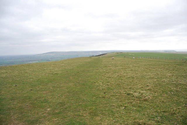 Photo could not load
TQ4805 : The South Downs Way east of Firle Beacon
N Chadwick
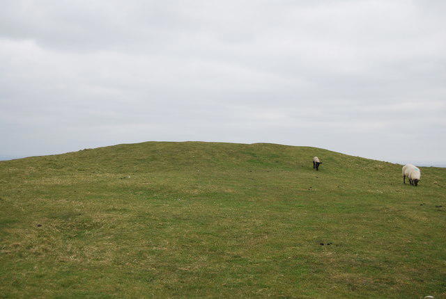 Photo could not load
TQ4805 : Tumulus on top of Firle Beacon
N Chadwick
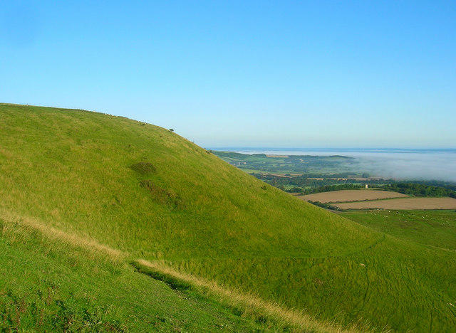 Photo could not load
TQ4805 : Firle Beacon
Simon Carey
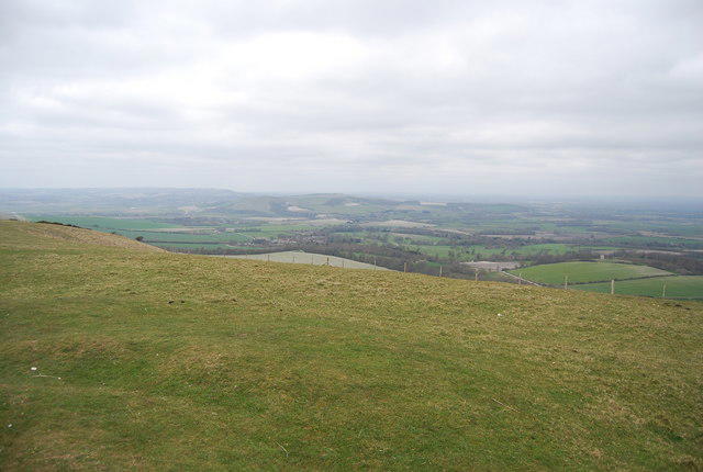 Photo could not load
TQ4805 : View NW from Firle Beacon
N Chadwick
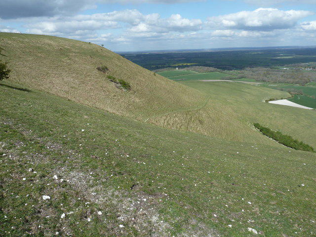 Photo could not load
TQ4805 : Northern escarpment of Firle Beacon
Dave Spicer
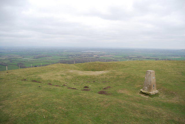 Photo could not load
TQ4805 : View east from the top of Firle Beacon
N Chadwick
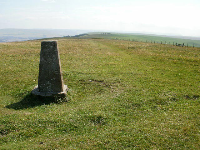 Photo could not load
TQ4805 : Firle Beacon trig point
Peter S
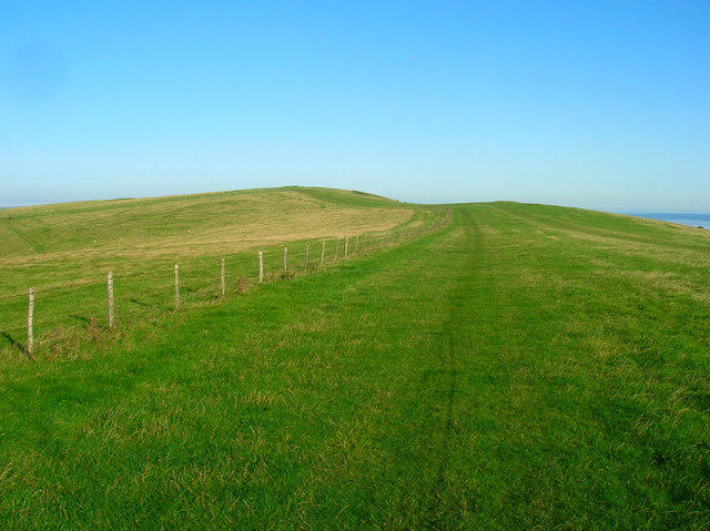 Photo could not load
TQ4805 : South Downs Way
Simon Carey
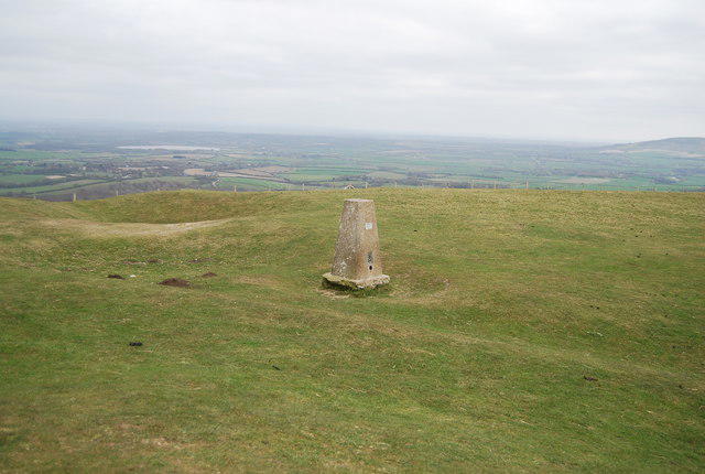 Photo could not load
TQ4805 : Triangulation Pillar, Firle Beacon
N Chadwick
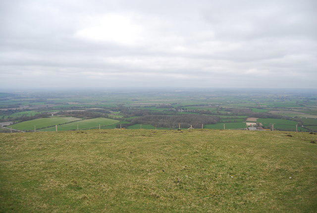
TQ4805 : View north from Firle Beacon
N Chadwick
Hill facts and local notes
Classifications
Elevation
218m
717 ft
Prominence
198m
Coordinates
50.8338, 0.1082
TQ485059
OS Map
198
Explorer: OL25 123
At the Summit
The recorded summit is a knoll 10 m west of the trig point, 1.1 m higher than the highest ground beside the trig. Three prehistoric bowl barrows stand around the summit area, with the South Downs Way passing between them.
Terrain & Geology
Firle Beacon forms part of the South Downs chalk escarpment. Chalk is a fine-grained limestone formed largely from microscopic marine skeletal remains, and local exposures include flint-bearing chalk. Dry valleys and coombes cut the surrounding downs. Grassland covers much of the escarpment.
Views & Scenery
In clear weather, the ridge overlooks the Weald to the north and Newhaven, Seaford and the English Channel to the south. The surrounding South Downs and Firle countryside are visible from the open escarpment; distant views depend on conditions.
Best Seasons
Spring and summer bring flowering chalk grassland to the escarpment. Keep to appropriate paths, avoid trampling plants and give grazing animals and nesting birds space.
History & Heritage
Name Origin
Firle Estate's village history derives Firle from the Anglo-Saxon Fierol, meaning oak-covered land.
Historical Significance
Historic England records three bowl barrows at the summit, a scheduled monument crossed by the South Downs Way. The largest was excavated in 1820 and used as a beacon mound during the Napoleonic Wars. A nearby long barrow is a separate monument.
Getting There & Facilities
Parking
Firle Beacon car park at TQ467058, reached by Firle Bostal, is a fee-paying ridge start west of the summit. Firle village has a separate free visitor car park beside the Ram Inn, with limited space. Choose the car park for the intended route and check signs for charges or restrictions. Do not park in the narrow village streets or block farm access.
Public Transport
Cuckmere 25 serves Firle Park Gates on Tuesdays, Thursdays and Saturdays. Sunday 25X serves Firle Road and the A27 turning. Timetables change on 25 October 2026; check current times and the last return. Service 125 is limited to schoolday journeys. Glynde and Lewes have rail connections, with an onward journey needed to the walk start.
Nearby Facilities
The Ram Inn and village shop in Firle are refreshment options, subject to opening hours. Toilets at a pub or attraction depend on its opening and customer arrangements; check before relying on them. Carry water and food for the downs.
Safety Information
Known Hazards
- Steep scarp slopes, uneven grass and flinty paths require care; wet chalk and muddy field paths can be slippery.
- The open ridge is exposed to wind, rain and strong sun. Take suitable layers, water and navigation equipment.
- Longer circuits include stiles, gates and indistinct paths. Use a current map and allow daylight for the return.
- Livestock graze the downs and parkland. Give animals space, keep dogs controlled and follow local signs.
Seasonal Hazards
Wet weather can leave lower fields muddy and chalk paths slippery. Strong winds, short winter days and ice increase the difficulty of exposed ridge walks. Check the forecast, path-closure notices and the last bus before setting out.
General Safety Tips
- Check weather conditions before setting out
- Carry appropriate clothing and equipment
- Let someone know your planned route
- Take a map, compass, and GPS device
- Carry emergency supplies: food, water, first aid kit, torch
Hills
Some common questions about the hills answered
Are there group walks up Firle Beacon?
Many walkers use Walkmates to join or organise walks with others. You can check for group walks around Firle Beacon through the maps
Are there other walkers around Firle Beacon?
Activity varies by location and time, but Walkmates lets you see whether others have shared walks or shown interest in this area. Find other people through the walking friends search walking friends for Firle Beacon search or of course create your own walk for Firle Beacon
Can I organise a walk to Firle Beacon?
Yes. If there aren’t any walks listed already, you can create a walk and make it available for others to join.
If you're signed up to Walkmates, you can create a walk to Firle Beacon.
How do I find a walk up this hill?
There are often multiple ways to walk this hill, depending on experience and route preference. Walkmates helps you explore walks and routes that others have shared.
Can I suggest a new route up Firle Beacon?
Yes. You can suggest or create routes to share with others. Walkmates focuses on the social side of walking, so routes are used to help people organise walks and explore areas together, rather than as detailed navigation tools or route libraries.
Other uses really appreciate knowledgeable walkers sharing their routes. Share your favourite route to Firle Beacon here
The is an error or something incorrect about this hill. How do I let you know?
We always strive to keep the information on Walkmates as accurate as possible. If you find an error, please let us know through the contact form and we'll aim to correct it as quickly as possible
Community Discussion
Comments
Location
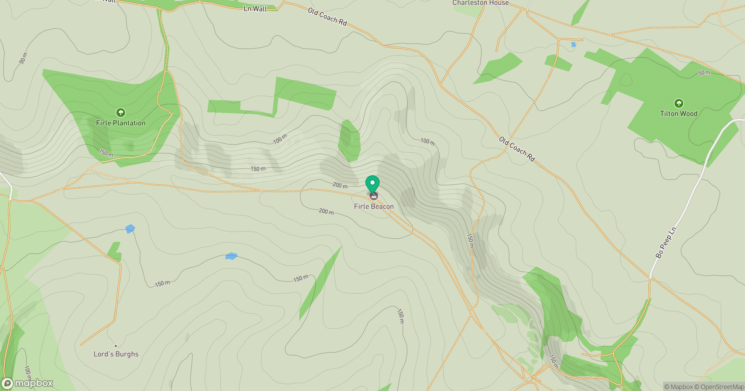
Grid reference: TQ485059
View on OpenStreetMapOpens a map in a new tab, centred on the hill.
Nearby Hills
Ditchling Beacon
248m
Leith Hill
294m
Worcestershire Beacon
425m
Glastonbury Tor
158m
Titterstone Clee Hill
533m
No comments yet. Be the first.