

Ditchling Beacon
Good walks are even better shared.
TQ3313 : Old Boundary Marker on Ditchling Beacon
J Blemings Photo source
Overview
Ditchling Beacon is the 248 m high point of East Sussex, on the South Downs Way above Ditchling. Its chalk downland, Iron Age hillfort remains and wide views over the Weald and towards the coast make it a popular walking destination. The summit is close to the hilltop car park; longer walks descend steep scarp paths or follow the ridge.
Ditchling Beacon
Ditchling Beacon rises to 248 m on the South Downs above Ditchling and is the highest point in East Sussex. It is a Marilyn, with 212.7 m of prominence. The recorded summit is unmarked ground 4 m north of the trig point.
Landscape and views
The hill belongs to the chalk escarpment of the South Downs, with a steep northern scarp and gentler slopes to the south. Look across the Weald, along the ridge and towards the Channel coast. Flower-rich grassland supports downland butterflies in the warmer months.
Walking routes
- The National Trust’s history circuit starts and finishes at Ditchling Beacon car park: 4.32 km, about 2.5 hours, graded Challenging. It passes the summit area, descends Ditchling Down and climbs Burnthouse Bostal before returning along the South Downs Way.
- For an out-and-back ridge walk, head west from the car park past the summit area and dew ponds to the Jack and Jill windmills, then retrace the route to the same car park. Jack is private and Jill has selected opening dates.
- The Ashcombe Bottom circuit heads east from the car park to Blackcap, loops through woodland, then returns along the ridge. The National Trust gives 9.6 km and 2.5–4 hours, graded Moderate. Visiting Ditchling Beacon’s summit adds a separate short detour west of the car park.
- The linear walk to Devil’s Dyke follows the South Downs Way west via Pyecombe and Saddlescombe Farm, finishing at Devil’s Dyke car park. The National Trust gives 11.2 km and about 3 hours, graded Moderate. Arrange onward travel or a lift back to the starting car park; these figures exclude the return.
Access and facilities
Use the National Trust hilltop car park on Ditchling Road, grid reference TQ333130. Parking is limited and charges apply to non-members. Breeze 79 runs from Brighton to the Beacon on weekends and public holidays; check the dated timetable and last return before setting out. Toilets and refreshments are in Ditchling village; a seasonal ice-cream van may serve the hilltop car park.
Terrain and safety
The ridge has grassy and flinty tracks; scarp routes can be steep, slippery and interrupted by stiles or steps. Wet chalk needs care, and the exposed top offers little shelter. The road has fast traffic and blind corners: cross carefully and use walking paths rather than the road. Share the bridleway with cyclists and horse riders, and keep dogs on leads around sheep.
History
The remains of an Iron Age hillfort surround the summit area. A later warning beacon occupied the mound now carrying the trig pillar. The protected archaeological site also includes a historic dewpond and parish boundary stone.
Explore routes near Ditchling Beacon
Walks starting near this hill. Open a route to check its map, distance and full itinerary.
Brighton Walk with Men Walking & Talking
View route
Ashdown Forest Wellington Crash Site and Airman's Grave
View route
Twilight wildlife walk at Old Lodge
View route
Crawley Down: Worth Way Railway Trail to East Grinstead and Back
View route
Route planning notes
These notes describe possible approaches. Check a route's map and access information when planning your walk.
Ditchling Beacon history circuit
Start at Ditchling Beacon car park. Walk west past the hillfort and trig point, descend the steep Ditchling Down path and cross the lower fields towards Burnthouse Farm. Climb Burnthouse Bostal, then turn east along the South Downs Way to return to Ditchling Beacon car park. National Trust route; includes stiles and rough slopes.
Ditchling Beacon to Jack and Jill Windmills and back
From Ditchling Beacon car park, head west on the South Downs Way past the summit area and dew ponds. Take the signed branch towards Clayton windmills. Return east along the same ridge route to Ditchling Beacon car park. Jack is private; Jill opens only on selected dates.
Ditchling Beacon to Ashcombe Bottom circuit
Start at Ditchling Beacon car park, cross Ditchling Road carefully and follow the South Downs Way east to Blackcap. Leave it for the northern edge of Ashcombe Bottom, loop through the woodland and climb back to Blackcap. Retrace the ridge path west to Ditchling Beacon car park. National Trust estimates 2.5–4 hours. The summit west of the car park is a separate short detour.
Ditchling Beacon to Devil's Dyke (linear)
Start at Ditchling Beacon car park and follow the South Downs Way west past the summit, then via Pyecombe and Saddlescombe Farm to Devil's Dyke car park (TQ258110). Use the signed road crossings. This is one-way: arrange onward transport or a lift back to Ditchling Beacon car park. The distance and time exclude the return journey.
Make a day of it, together
Find someone to share the walk with, or organise a day out along a route you like.
Photo Gallery
View all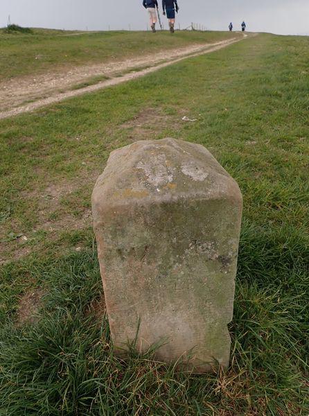 Photo could not load
TQ3313 : Old Boundary Marker on Ditchling Beacon
J Blemings
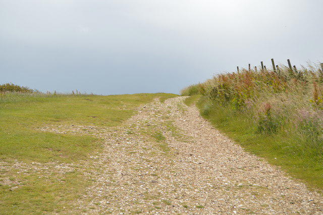 Photo could not load
TQ3313 : South Downs Way, Ditchling Beacon
N Chadwick
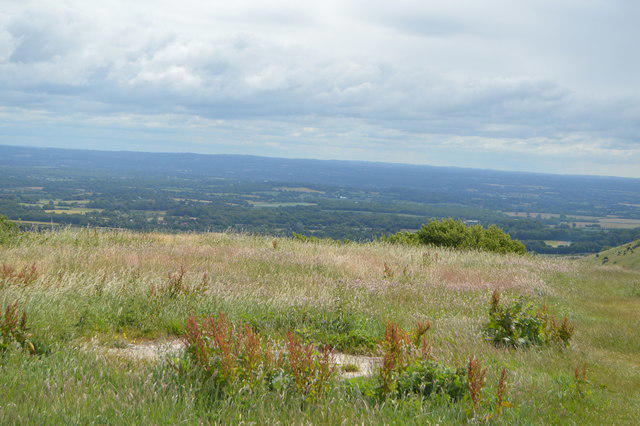 Photo could not load
TQ3313 : View from Ditchling Beacon - north east
N Chadwick
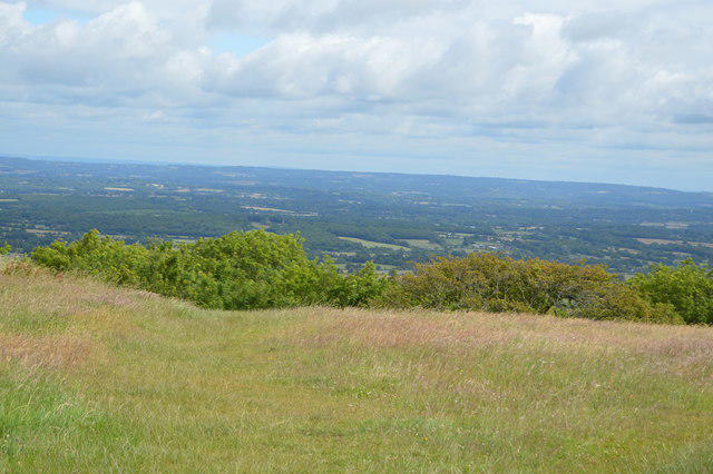 Photo could not load
TQ3313 : View from Ditchling Beacon - north
N Chadwick
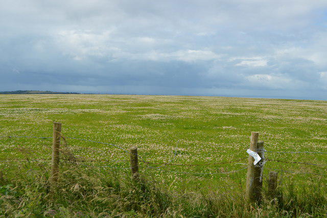 Photo could not load
TQ3313 : View from Ditchling Beacon - south
N Chadwick
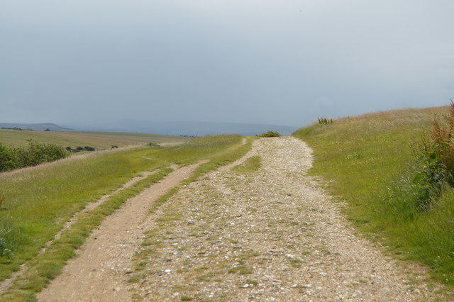 Photo could not load
TQ3313 : South Downs Way
N Chadwick
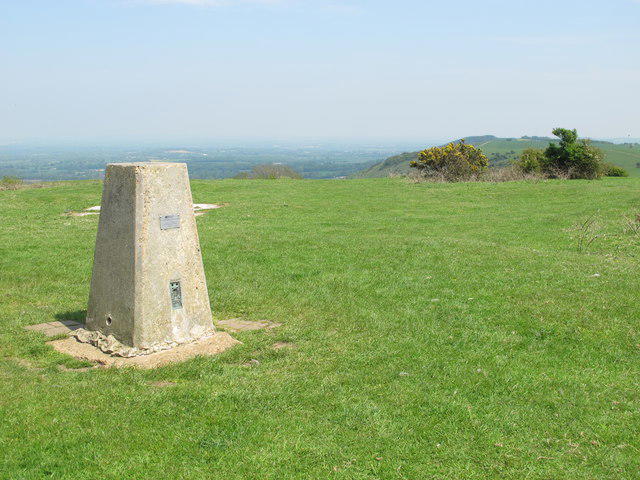 Photo could not load
TQ3313 : Ditchling Beacon
Mike Quinn
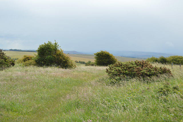 Photo could not load
TQ3313 : View from Ditchling Beacon - east
N Chadwick
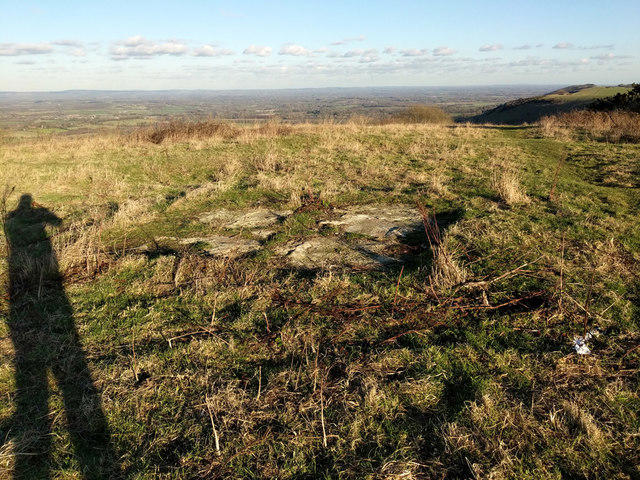 Photo could not load
TQ3313 : Old concrete base, Ditchling Beacon
Robin Webster
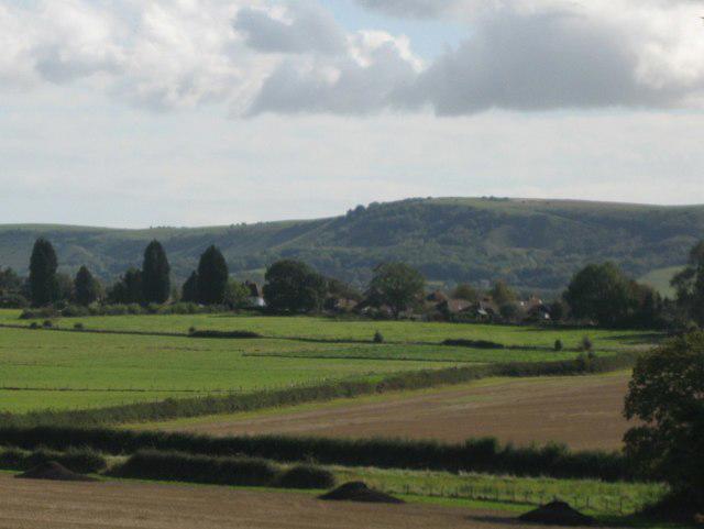
TQ3313 : Ditchling Beacon
Mike Quinn
Hill facts and local notes
Classifications
Elevation
248m
814 ft
Prominence
213m
Coordinates
50.9017, -0.1077
TQ331130
OS Map
198
Explorer: OL11 122
At the Summit
The highest ground is unmarked, 4 m north of the trig point. The pillar stands on a former beacon mound within the Iron Age hillfort. The summit area is a short walk west of Ditchling Beacon car park.
Terrain & Geology
Ditchling Beacon forms part of the South Downs chalk escarpment. A steep north-facing scarp overlooks the Weald, while the land slopes more gently southwards. Chalk and flint occur on the paths, and former chalk workings cut into nearby Ditchling Down.
Views & Scenery
Views north across the Weald, south towards Brighton and the Channel coast, and east and west along the South Downs. Clear conditions can reveal Ashdown Forest and the North Downs.
Best Seasons
Spring and summer bring downland wildflowers and butterflies, including marbled whites and silver-spotted skippers. Round-headed rampion flowers in summer; winter can bring flocks of linnets and redwings.
History & Heritage
Name Origin
“Beacon” refers to the warning fire formerly maintained on this prominent hill as part of a chain of South Downs beacons.
Historical Significance
An Iron Age hillfort occupies the ridge; ploughing has reduced some of its earthworks. The later beacon belonged to a South Downs warning chain. Historic England’s scheduled monument also includes an 18th- or 19th-century dewpond and a post-medieval parish boundary stone.
Getting There & Facilities
Parking
National Trust Ditchling Beacon car park, just off Ditchling Road at TQ333130, close to the summit. Spaces are limited and it can fill at weekends. Non-members pay; National Trust members must register their parking. Check the current signs or National Trust visitor information for charges.
Public Transport
Brighton & Hove Breeze 79 links Brighton with Ditchling Beacon car park on weekends and public holidays. Check the operator’s dated timetable before travelling, especially for the last return bus. Falmer and Hassocks are the nearby rail options, but neither station is at the hilltop.
Nearby Facilities
Toilets and refreshments are available in Ditchling village. A seasonal ice-cream van may be at Ditchling Beacon car park; bring food and water for longer walks.
Safety Information
Known Hazards
- Steep, rough scarp paths with steps and stiles.
- Ditchling Road has blind bends and fast traffic; take care crossing and use the footpaths rather than walking along the road.
- The South Downs Way is shared with cyclists and horse riders. Keep dogs on leads around grazing sheep.
Seasonal Hazards
Chalk and steep paths can be slippery when wet. The open hilltop has little shelter from strong winds.
General Safety Tips
- Check weather conditions before setting out
- Carry appropriate clothing and equipment
- Let someone know your planned route
- Take a map, compass, and GPS device
- Carry emergency supplies: food, water, first aid kit, torch
Hills
Some common questions about the hills answered
Are there group walks up Ditchling Beacon?
Many walkers use Walkmates to join or organise walks with others. You can check for group walks around Ditchling Beacon through the maps
Are there other walkers around Ditchling Beacon?
Activity varies by location and time, but Walkmates lets you see whether others have shared walks or shown interest in this area. Find other people through the walking friends search walking friends for Ditchling Beacon search or of course create your own walk for Ditchling Beacon
Can I organise a walk to Ditchling Beacon?
Yes. If there aren’t any walks listed already, you can create a walk and make it available for others to join.
If you're signed up to Walkmates, you can create a walk to Ditchling Beacon.
How do I find a walk up this hill?
There are often multiple ways to walk this hill, depending on experience and route preference. Walkmates helps you explore walks and routes that others have shared.
Can I suggest a new route up Ditchling Beacon?
Yes. You can suggest or create routes to share with others. Walkmates focuses on the social side of walking, so routes are used to help people organise walks and explore areas together, rather than as detailed navigation tools or route libraries.
Other uses really appreciate knowledgeable walkers sharing their routes. Share your favourite route to Ditchling Beacon here
The is an error or something incorrect about this hill. How do I let you know?
We always strive to keep the information on Walkmates as accurate as possible. If you find an error, please let us know through the contact form and we'll aim to correct it as quickly as possible
Community Discussion
Comments
Location
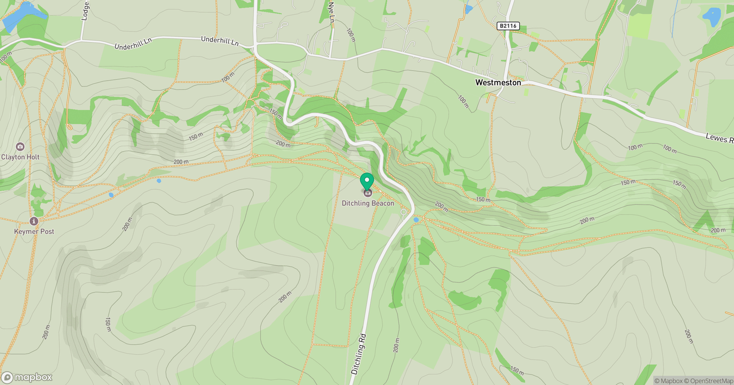
Grid reference: TQ331130
View on OpenStreetMapOpens a map in a new tab, centred on the hill.
Nearby Hills
Leith Hill
294m
Worcestershire Beacon
425m
Glastonbury Tor
158m
Titterstone Clee Hill
533m
The Roaches
505m
No comments yet. Be the first.