

Cliffe Hill
Good walks are even better shared.
TQ4310 : Cliffe Hill
Rude Health Photo source
Overview
Cliffe Hill: A Gem in The Leicestershire Hills
Introduction
Cliffe Hill stands proudly at 262 meters, rising above the surrounding terrain with an elevation that offers spectacular views and a sense of achievement. A Marilyn by classification, it’s a delightful destination for hikers of all levels.
Geology
Composed of Jurassic limestone, Cliffe Hill is an excellent showcase of geological processes. The exposed rock formations tell tales of ancient times and environmental shifts. For rock enthusiasts, a walk around the summit is akin to reading a history book in stone - every layer tells a story.
Hiking Routes
Cliffe Hill Circular Route
- Distance: 4.5 km
- Time: Approximately 1.5 hours
- Difficulty: Easy
This route is perfect for family outings and casual strolls. A gentle ascent will lead you through charming landscapes while providing a great vantage point for photos.
The Quarry Trail
- Distance: 3.5 km
- Time: Around 2 hours
- Difficulty: Moderate
If you're feeling a bit more adventurous, this trail will guide you through the old quarry area, showcasing Cliffe Hill’s impressive geology up close. Just watch your step!
Summit Features
At the summit, you will find a trig point marking the highest point, accompanied by a modest cairn. You’ll feel on top of the world here, and rightly so!
Terrain Type
The terrain is a mix of grassy paths, rocky outcrops, and some muddy sections that dare you to embrace your inner child.
Views
Highlights
The view from Cliffe Hill is simply stunning, with the Cotswolds rolling away in the distance and the Peak District peaks poking through the horizon like excited children at a school play.
Best Seasons
Spring and early autumn are the crème de la crème for views—vibrant greens and autumnal golds will make your Instagram pop!
Hazards
Keep an eye out for slick paths after a good rain and the occasional sheep grazing without a care in the world - they believe this is their domain!
Nearby Summits
Just a stone’s throw away, you’ll find Bardon Hill, the highest point in Leicestershire, that also begs to be climbed.
Access
Nearest Parking
You'll find parking facilities at the foot of Cliffe Hill, making it easy to lace up those boots and set off on an adventure.
Public Transport
Local buses run services to nearby towns; check your schedule for timings and the best routes to get here.
Nearest Town
Markfield is your best bet for amenities before heading out to tackle those hills.
Facilities
After your hike, treat yourself at the nearby café in Markfield, perfect for refreshing coffee and a slice of cake to celebrate your success.
History
Name Meaning
The name ‘Cliffe’ derives from Old English, echoing the steep nature of the area.
Significance
Beyond its natural beauty, Cliffe Hill holds historical significance, being a navigation point in the local folklore and routes.
Conclusion
In summary, Cliffe Hill is a must-visit for those exploring the Leicestershire Hills. Whether you're an avid hiker or just looking for a pleasant walk, the views and fresh air will revitalise your spirits.
Happy hiking!
Explore routes near Cliffe Hill
Walks starting near this hill. Open a route to check its map, distance and full itinerary.
Brighton Walk with Men Walking & Talking
View route
Hellingly to Horam: Cuckoo Trail railway bridges and old station return
View route
Cuckoo Trail: Heathfield to Polegate Station
View route
Ashdown Forest Wellington Crash Site and Airman's Grave
View route
Route planning notes
These notes describe possible approaches. Check a route's map and access information when planning your walk.
Cliffe Hill Circular Route
A scenic circular route starting from the main car park that offers a gentle ascent with panoramic views.
The Quarry Trail
A more challenging route through the old quarry, taking you along steeper paths and offering closer views of the fascinating geology.
Make a day of it, together
Find someone to share the walk with, or organise a day out along a route you like.
Photo Gallery
View all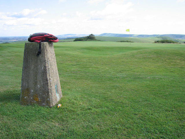 Photo could not load
TQ4310 : Cliffe Hill
Rude Health
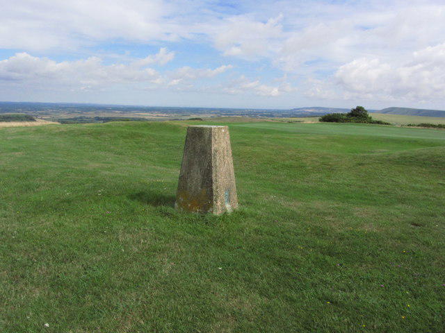 Photo could not load
TQ4310 : Trig point at Cliffe Hill above Lewes
Colin Park
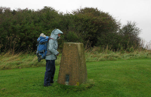 Photo could not load
TQ4310 : Downland hilltop with trig point
Trevor Littlewood
Hill facts and local notes
Classifications
Elevation
164m
539 ft
Prominence
150m
Coordinates
50.8781, 0.0370
TQ434107
OS Map
198
Explorer: OL11 OL25 122 123
At the Summit
The summit is crowned with a trig point and boasts a small cairn. The views from here are particularly stunning, making it a popular spot for hillwalkers.
Terrain & Geology
Composed primarily of Jurassic limestone, Cliffe Hill features a unique mix of sedimentary and igneous rock formations. The exposed rock layers provide excellent insights into the geological history of the region.
Views & Scenery
From the summit, one can see as far as the rolling hills of the Cotswolds and the distant peaks of the Peak District on a clear day.
History & Heritage
Name Origin
The name 'Cliffe' is derived from Old English, suggesting a steep or cliff-edge terrain, aptly suited to the landscape.
Historical Significance
Historically, Cliffe Hill has been a key landmark for navigation as well as a site of local folklore.
Getting There & Facilities
Parking
There is a small car park at the base of Cliffe Hill, offering convenient access to the trails.
Public Transport
Bus services operate from nearby towns with stops within a short walk of the main trailhead.
Nearby Facilities
There's a lovely cafe in Markfield for a quick coffee or bite, along with public toilets near the parking area.
Safety Information
Known Hazards
- Be mindful of slippery paths after rainfall and watch for wildlife, including grazing sheep.
General Safety Tips
- Check weather conditions before setting out
- Carry appropriate clothing and equipment
- Let someone know your planned route
- Take a map, compass, and GPS device
- Carry emergency supplies: food, water, first aid kit, torch
Hills
Some common questions about the hills answered
Are there group walks up Cliffe Hill?
Many walkers use Walkmates to join or organise walks with others. You can check for group walks around Cliffe Hill through the maps
Are there other walkers around Cliffe Hill?
Activity varies by location and time, but Walkmates lets you see whether others have shared walks or shown interest in this area. Find other people through the walking friends search walking friends for Cliffe Hill search or of course create your own walk for Cliffe Hill
Can I organise a walk to Cliffe Hill?
Yes. If there aren’t any walks listed already, you can create a walk and make it available for others to join.
If you're signed up to Walkmates, you can create a walk to Cliffe Hill.
How do I find a walk up this hill?
There are often multiple ways to walk this hill, depending on experience and route preference. Walkmates helps you explore walks and routes that others have shared.
Can I suggest a new route up Cliffe Hill?
Yes. You can suggest or create routes to share with others. Walkmates focuses on the social side of walking, so routes are used to help people organise walks and explore areas together, rather than as detailed navigation tools or route libraries.
Other uses really appreciate knowledgeable walkers sharing their routes. Share your favourite route to Cliffe Hill here
The is an error or something incorrect about this hill. How do I let you know?
We always strive to keep the information on Walkmates as accurate as possible. If you find an error, please let us know through the contact form and we'll aim to correct it as quickly as possible
Community Discussion
Comments
Location
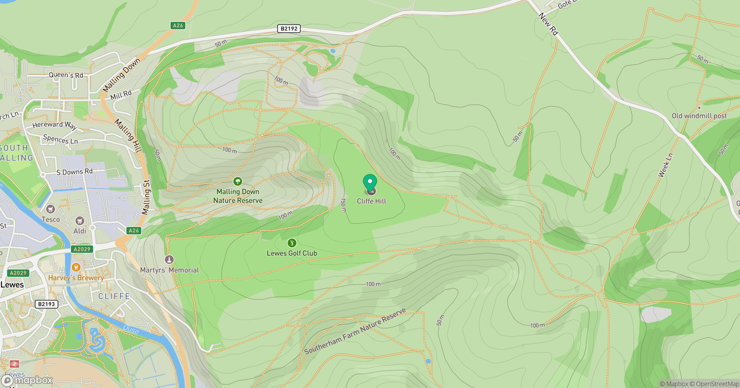
Grid reference: TQ434107
View on OpenStreetMapOpens a map in a new tab, centred on the hill.
Nearby Hills
Ditchling Beacon
248m
Leith Hill
294m
Worcestershire Beacon
425m
Glastonbury Tor
158m
Titterstone Clee Hill
533m
No comments yet. Be the first.