

Farragon Hill
Good walks are even better shared.
NN8455 : Summit cairn on Farragon Hill
Russel Wills Photo source
Overview
Exploring Farragon Hill
Farragon Hill, soaring to 547 meters in the beautiful Central Highlands of Scotland, is a delightful Marilyn that offers adventurers a rewarding trek without the ferocity of higher peaks. As you set out from Moulin, prepare to immerse yourself in a blend of natural beauty and exhilarating views.
Geology
The hill is carved from a mix of volcanic and sedimentary rocks, remnants of ancient geological processes that shaped this stunning landscape. Despite its petite stature among the towering giants nearby, the geological diversity here is a testament to its rich history.
Routes
The most popular choice is the Farragon Hill Circular Walk, stretching about 6.5 km and taking roughly 2.5 hours to complete. Expect a moderate challenge that will get your heart racing and your lungs thanking you for the fresh highland air. This route takes you through lovely woodlands before ascending towards the summit, where you’ll likely spot other enthusiastic hikers sharing in the experience.
Summit Features
At the summit, you will find a friendly little cairn and a trig point, perfect spots to pause and enjoy your surroundings—don't forget the camera!
Terrain
The terrain might surprise you; it vacillates between grassy slopes and rocky outcrops, occasionally leading you through muddy patches—helpful for a cheeky laugh about 'Scottish boot baths' when you lose your footing!
Views
Anticipate stunning panoramas! The summit provides expansive views over the Tay Valley, with breathtaking sights of nearby Schiehallion and, on a clear day, the Grampian range taking a rightful bow in the distance. The best seasons to soak in these views are arguably spring and autumn, as nature shows off its finest colours.
Hazards
Keep an eye out for the terrain to become slippery when wet. The weather can also change on a dime, so pack that waterproof! And while you're at it, be cautious of the boggy areas that can swallow a boot whole.
Nearby Summits
If you're keen on more summits, nearby are the mighty Schiehallion (1083 m) and Ben Lawers (1214 m), both worthy contenders for your hiking playlist.
Access
Access to the hill is pretty straightforward. There’s ample parking at Moulin and even convenient bus services from Perth. Just remember that Pitlochry is your nearest bustling town and a great spot to grab a coffee (or a slice of tradition in the form of shortbread) before or after your trek!
Facilities
The local facilities in Pitlochry will have you sorted with plenty of cafes, pubs, and public toilets to ensure you're not left high and dry!
History
Farragon Hill’s name, meaning 'little man', speaks of its gentle demeanor among the more imposing peaks. It has been a beloved spot for locals and visitors alike for centuries, igniting creativity in countless writers and artists.
Whether you're a seasoned walker or just someone looking to enjoy the splendours of the Highlands, Farragon Hill is certainly worth the effort. Lace-up your hiking boots and prepare for a splendid day out in nature—who knows what wonders you might encounter along the way!
Explore routes near Farragon Hill
Walks starting near this hill. Open a route to check its map, distance and full itinerary.
Aberfeldy: Glassie Woodland and River Tay Circular
View route
Kenmore: Drummond Hill Black Rock Trail above Loch Tay
View route
Crieff: Lady Mary's Walk and the River Earn
View route
Killin: Falls of Dochart, Finlarig and Moirlanich Longhouse
View route
Route planning notes
These notes describe possible approaches. Check a route's map and access information when planning your walk.
Farragon Hill Circular Walk
A scenic route starting from the car park near the village of Moulin, taking you through woodlands and up to the summit, with spectacular views along the way.
Make a day of it, together
Find someone to share the walk with, or organise a day out along a route you like.
Photo Gallery
View all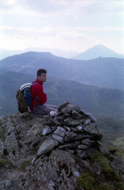 Photo could not load
NN8455 : Summit cairn on Farragon Hill
Russel Wills
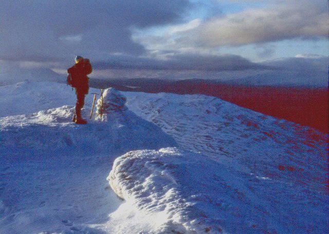 Photo could not load
NN8455 : Summit cairn on Farragon Hill
Alan Reid
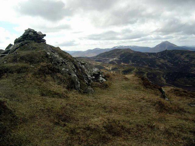 Photo could not load
NN8455 : Summit cairn on Farragon Hill
Gordon Brown
Hill facts and local notes
Classifications
Elevation
782m
2,567 ft
Prominence
186m
Coordinates
56.6751, -3.8942
NN840553
OS Map
52
Explorer: OL49E 386E
At the Summit
The summit boasts a modest cairn and a trig point, perfect for the obligatory summit selfie. On a clear day, you may even spot a local red deer or two wondering what all the fuss is about.
Terrain & Geology
Farragon Hill is primarily composed of volcanic and sedimentary rocks, characteristic of this part of the Scottish Highlands. The hill’s formation can be linked to ancient tectonic activity, resulting in the intriguing geological features you see today.
Views & Scenery
From the summit, you can enjoy breathtaking views of the Tay Valley, the imposing Schiehallion to the west, and even glimpses of the distant Grampians.
History & Heritage
Name Origin
The name 'Farragon' is derived from the Gaelic 'Feargagan', meaning 'little man', a tribute to the hill’s gentle but unwavering stance.
Historical Significance
Farragon Hill has been a local landmark for centuries, often frequented by writers and artists seeking inspiration from its tranquil beauty.
Getting There & Facilities
Parking
There is a small car park at Moulin, which serves as the main starting point for the circular route.
Public Transport
Regular bus services run from Perth to Moulin, but do check the latest timetables!
Nearby Facilities
In Pitlochry, you’ll find a range of cafes, pubs, and public toilets. Just remember to indulge in some delicious Scottish shortbread!
Safety Information
Known Hazards
- Watch out for slippery rocks and boggy areas, especially after rain. It's also wise to be aware of changing weather conditions in the Highlands.
General Safety Tips
- Check weather conditions before setting out
- Carry appropriate clothing and equipment
- Let someone know your planned route
- Take a map, compass, and GPS device
- Carry emergency supplies: food, water, first aid kit, torch
Hills
Some common questions about the hills answered
Are there group walks up Farragon Hill?
Many walkers use Walkmates to join or organise walks with others. You can check for group walks around Farragon Hill through the maps
Are there other walkers around Farragon Hill?
Activity varies by location and time, but Walkmates lets you see whether others have shared walks or shown interest in this area. Find other people through the walking friends search walking friends for Farragon Hill search or of course create your own walk for Farragon Hill
Can I organise a walk to Farragon Hill?
Yes. If there aren’t any walks listed already, you can create a walk and make it available for others to join.
If you're signed up to Walkmates, you can create a walk to Farragon Hill.
How do I find a walk up this hill?
There are often multiple ways to walk this hill, depending on experience and route preference. Walkmates helps you explore walks and routes that others have shared.
Can I suggest a new route up Farragon Hill?
Yes. You can suggest or create routes to share with others. Walkmates focuses on the social side of walking, so routes are used to help people organise walks and explore areas together, rather than as detailed navigation tools or route libraries.
Other uses really appreciate knowledgeable walkers sharing their routes. Share your favourite route to Farragon Hill here
The is an error or something incorrect about this hill. How do I let you know?
We always strive to keep the information on Walkmates as accurate as possible. If you find an error, please let us know through the contact form and we'll aim to correct it as quickly as possible
Community Discussion
Comments
Location
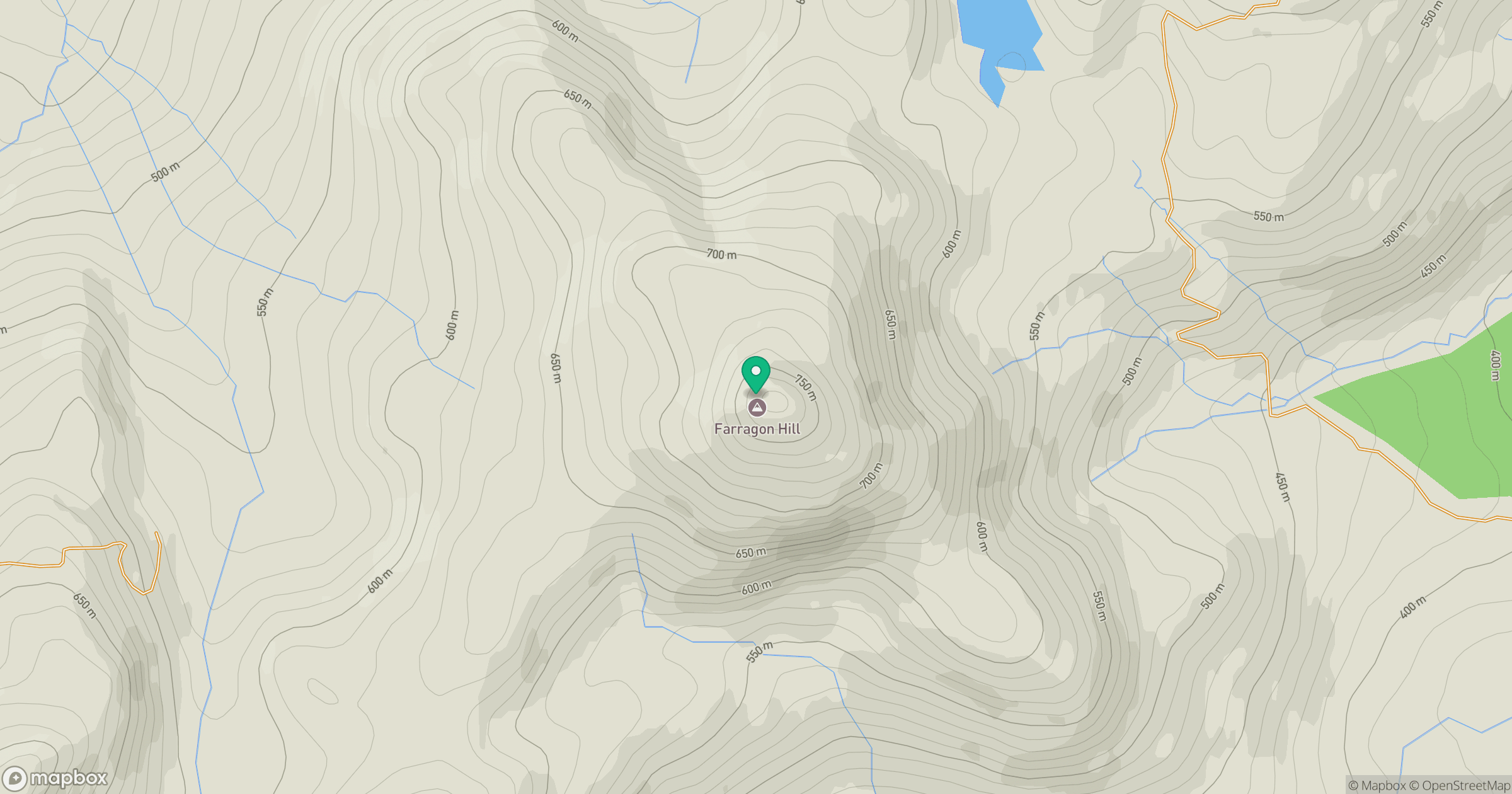
Grid reference: NN840553
View on OpenStreetMapOpens a map in a new tab, centred on the hill.
No comments yet. Be the first.