
Beenmore
Good walks are even better shared.
Overview
Beenmore: A Hidden Gem of the Southern Uplands
Introduction
Located near the quaint borders of Thornhill, Beenmore is a delightful Marilyn that beckons hikers with its rolling slopes and stunning vistas. At an elevation of 318 meters, it may not be the tallest peak, but its charm lies in the journey rather than the height. Whether you're looking for a leisurely walk or a bit of a challenge, Beenmore has something to offer.
Geology
As you traverse Beenmore, take a moment to appreciate its Carboniferous geology. The rocks reveal a history bursting at the seams with stories of ancient seas. The terrain varies, offering rocky outcrops for scrambling and easy grassy paths for a more laid-back stroll. Just remember, rocks won't give you a rematch – don’t take a tumble!
The Ascent
The most popular route begins from the northeast. It’s a moderate trek – just enough to get your heart rate up without leaving you gasping for air like a fish out of water. At about 5 km round trip, it's achievable for most fitness levels, but be sure to wear sturdy footwear.
Summit Features
Upon reaching the summit, you’ll be greeted by a humble cairn, a great spot to rest those weary legs. Spread out before you is a panorama that could make even the most reluctant walker see the beauty of the outdoors – just don’t forget to snap a picture!
Views and Best Seasons
The views from Beenmore's peak are a kaleidoscope of greens, blues, and in the autumn, warm reds and golds. For those who love a good sunrise or sunset, the early risers and evening strollers will not be disappointed. Spring and summer display the landscape in its finest attire, making every hike feel like a walk in a painting.
Hazards
While shaping up for your adventure, it’s wise to be aware of potential hazards. The terrain can be tricky in places, particularly the bogs that might sneak up and ambush your boots. The weather can also play its tricks – sunny one minute, pouring the next. Always good to carry a waterproof jacket unless you fancy a natural shower!
Access
Reaching Beenmore is fairly straightforward. There is convenient parking along the nearby minor road, but as popular spots can fill up, arriving early is the key to a stress-free start.
Public transport isn’t entirely off the table; catch a bus from Dumfries to Thornhill to kick off your adventure.
Facilities
In Thornhill, you’ll find a lovely cafe to refuel. Though it would be wise to pack your own provisions for the hike to ensure you're not left hungry mid-peak!
Conclusion
A visit to Beenmore is sure to lift your spirits and may even offer a good chuckle or two as you navigate its quirks. Perfect for families, friends, or solo adventurers, this hill is a wonderful reminder that sometimes it’s the smaller hills that provide the biggest smiles. Enjoy your hike, and remember – the only thing missing is your sense of adventure!
Explore routes near Beenmore
Public walks starting within 80 km of this hill. Nearby does not mean a route reaches the summit; check its map and access before setting out.
No public routes are currently listed within 80 km of Beenmore on Walkmates. This does not mean there are no paths here. Explore the map and check local access information before planning a walk.
Route planning notes
These notes describe possible approaches, not verified navigable routes or permission to cross land. Check current paths, local access rules and conditions before setting out.
Beenmore Hill from the Northeast
A scenic route starting from the minor road leading up to the northeast of the hill. A perfect choice for a moderate day walk with fantastic views.
Make a day of it, together
Find someone to share the walk with, or organise a day out along a route you like.
Hill facts and local notes
Classifications
Elevation
240m
787 ft
Prominence
107m
Coordinates
52.2352, -10.3413
Q401118
OS Map
70
At the Summit
The summit is marked by a small, weathered stone cairn, which has likely witnessed many a wandering soul scratching their head at the panoramic views.
Terrain & Geology
Beenmore is primarily composed of Carboniferous sedimentary rocks, which tell tales of ancient shallow seas that once covered this area. The rugged terrain offers a variety of features, including rocky outcrops and gentle slopes.
Views & Scenery
From the summit, one can gaze upon the rolling hills of the Southern Uplands and the sprawling landscapes stretching towards the Lake District, depending on visibility. On clear days, the sight can take your breath away – but don't forget to breathe!
History & Heritage
Name Origin
The name 'Beenmore' may derive from local Gaelic terms, possibly translating to 'the mountain of the meadows' or reflecting the lush landscape.
Historical Significance
Beenmore has been a silent witness to local history, from ancient settlers traversing its slopes to present-day hikers soaking in its beauty.
Getting There & Facilities
Check current local access restrictions, parking rules and transport timetables before travelling. These notes do not confirm public access to the summit.
Parking
Parking is available along the minor road nearby (Grid Reference: NX 203 051), where you can safely leave your vehicle. It’s a popular spot, so arrive early to nab a good space.
Public Transport
The nearest bus service can be accessed from the town of Dumfries, followed by a scenic walk to the starting point. Buses run several times a day, but check the latest schedules to avoid an unexpected hike back!
Nearby Facilities
Facilities in Thornhill include quaint cafes for a lovely cuppa and restrooms, but bring your snacks for the hike as options are limited near Beenmore.
Safety Information
Known Hazards
- Watch out for sudden weather changes, especially in the spring and autumn months. Boggy ground can lead to unexpected mud baths, so keep a keen eye on your footing!
General Safety Tips
- Check weather conditions before setting out
- Carry appropriate clothing and equipment
- Let someone know your planned route
- Take a map, compass, and GPS device
- Carry emergency supplies: food, water, first aid kit, torch
Hills
Some common questions about the hills answered
Are there group walks up Beenmore?
Many walkers use Walkmates to join or organise walks with others. You can check for group walks around Beenmore through the maps
Are there other walkers around Beenmore?
Activity varies by location and time, but Walkmates lets you see whether others have shared walks or shown interest in this area. Find other people through the walking friends search walking friends for Beenmore search or of course create your own walk for Beenmore
Can I organise a walk to Beenmore?
Yes. If there aren’t any walks listed already, you can create a walk and make it available for others to join.
If you're signed up to Walkmates, you can create a walk to Beenmore.
How do I find a walk up this hill?
There are often multiple ways to walk this hill, depending on experience and route preference. Walkmates helps you explore walks and routes that others have shared.
Can I suggest a new route up Beenmore?
Yes. You can suggest or create routes to share with others. Walkmates focuses on the social side of walking, so routes are used to help people organise walks and explore areas together, rather than as detailed navigation tools or route libraries.
Other uses really appreciate knowledgeable walkers sharing their routes. Share your favourite route to Beenmore here
The is an error or something incorrect about this hill. How do I let you know?
We always strive to keep the information on Walkmates as accurate as possible. If you find an error, please let us know through the contact form and we'll aim to correct it as quickly as possible
Community Discussion
Comments
Location
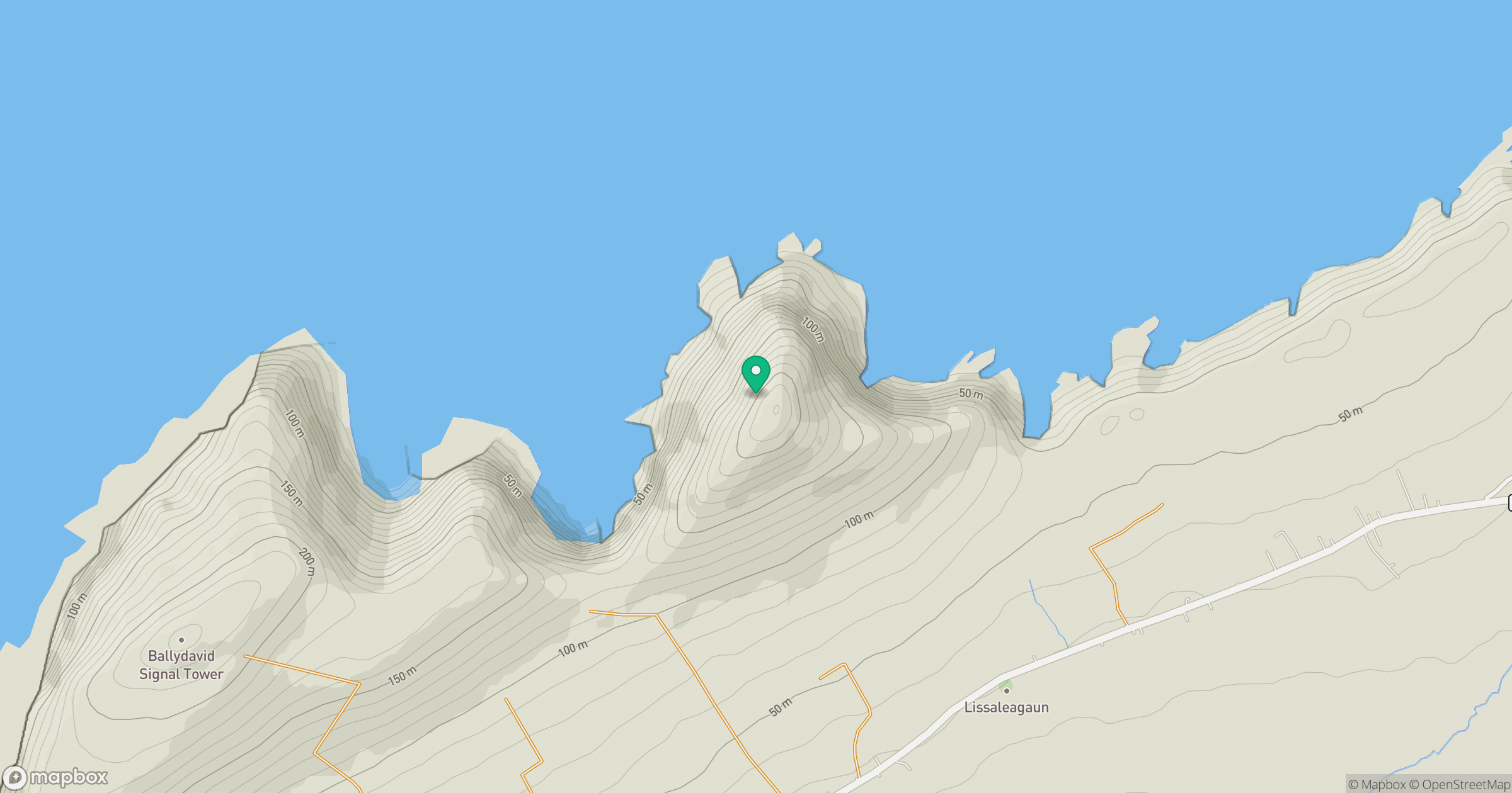
Grid reference: Q401118
View on OpenStreetMapOpens a map in a new tab, centred on the hill.
Hills within 30 km
Straight-line distance, not a walking route or confirmation of access.
Ballydavid Head
251m
Brandon Mountain
952m
Ballysitteragh
622m
Brandon Peak
839m
Cruach Mharthain [Croaghmarhin]
401m
No comments yet. Be the first.