

Esgair Penygarreg
Good walks are even better shared.
Overview
Esgair Penygarreg
Nestled in the heart of the Brecon Beacons National Park, Esgair Penygarreg is a hidden gem for those who relish a good hiking challenge without the crowds. Standing at 494 meters, it may not be the highest peak, but the views it offers make every step worth your while.
Geology
Esgair Penygarreg is primarily composed of ancient sedimentary rock from the Old Red Sandstone period. This unique geology contributes to both the diverse ecosystems found here and the dramatic landscapes that surround it. If you're lucky, you might even spot a few fossilised treasures—just remember, they belong here!
Routes
One of the more popular routes starts from the A470, a scenic path that meanders through lush woodlands and expansive moorlands. Spanning approximately 6.5 km, it's a moderate hike that usually takes around three hours to complete, allowing ample time to stop and admire the flora and fauna—and perhaps to catch your breath!
Summit Features
Reaching the summit, you'll find a trig point sitting proudly at the top—an invitation for a triumphant selfie. The area is grassy, making it an excellent place for a picnic, just don’t let your sandwiches get away in the brisk winds!
Terrain Type
Expect a mix of grassy terrain with rocky outcrops and a few boggy patches at the base. Ensure you're wearing sturdy footwear; no one likes soggy socks!
Views
Once you've caught your breath at the summit, you'll be treated to astounding views of the surrounding hills of the Brecon Beacons and Pen y Fan to the east, that local giant dwarfs Esgair Penygarreg, while the valleys below will make you feel like you’re on top of the world. For the best vista, spring and early autumn are recommended—less chance of mudslides, and the views will take your breath away (without the elevation assistance).
Hazards
Keep an eye on the weather! Conditions can change swiftly in this part of the world. Slippery paths in the rain are an all-too-common annoyance, so best to pack your trekking poles and those trusty waterproofs just in case.
Nearby Summits
Esgair Penygarreg is not alone in its majesty. Just a stone's throw away are Mynydd Llangatwg at 562 meters and Cribyn standing tall at 795 meters, both of which serve as excellent extension hikes for those feeling extra adventurous.
Access
For those driving in, a small car park near the A470 is your best bet (only about 2 km from the trailhead). Public transport options are limited; however, local buses do run from Brecon if you're prepared to stretch those legs a tad further.
Facilities
Before or after your hike, locals in Llangorse provide a hearty welcome, with cafés and public toilets available for those necessary pit stops—gotta keep hydrated and fed!
History
Ever wondered what “Esgair Penygarreg” means? It translates to 'ridge of the rocky hill' in Welsh, which is quite fitting, I’d say! This mountain is steeped in local folklore and cultural significance, making it not just a hike, but a walk through the pages of the area's history.
So, lace up those hiking boots, pack a snack, and get ready to discover the charm and beauty of Esgair Penygarreg. You won't regret it!
Explore routes near Esgair Penygarreg
Public walks starting within 80 km of this hill. Nearby does not mean a route reaches the summit; check its map and access before setting out.
Elan Valley: Reservoir Trail to Pen y Garreg Dam
View route
Hafren Forest: full Source of the Severn Trail
View route
Ystwyth Trail: Black Covert to Llanilar and back
View route
Dolaucothi Estate: Cothi Valley and Red Waymarked Circuit
View route
Route planning notes
These notes describe possible approaches, not verified navigable routes or permission to cross land. Check current paths, local access rules and conditions before setting out.
Starting from the A470
A scenic route that takes you past lush woodland and open moorland, offering a pleasant trek up to the summit.
Make a day of it, together
Find someone to share the walk with, or organise a day out along a route you like.
Photo Gallery
View all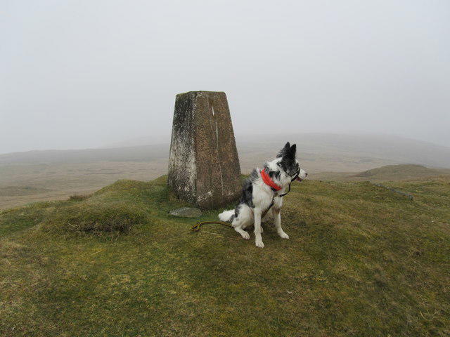 Photo could not load
SN9268 : Dewey bagging
John Horner
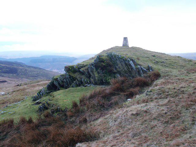 Photo could not load
SN9268 : Esgair Penygarreg
Anton Ciritis
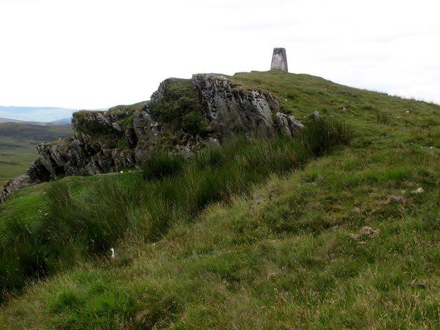 Photo could not load
SN9268 : Esgair Penygarreg
Rude Health
Hill facts and local notes
Classifications
Elevation
533m
1,747 ft
Prominence
100m
Coordinates
52.3068, -3.5763
SN926687
OS Map
136 147
Explorer: 200W
At the Summit
The summit boasts a modest grassy area with a prominent trig point, providing a perfect spot to catch your breath and enjoy the view.
Terrain & Geology
Esgair Penygarreg is primarily composed of sedimentary rock from the Old Red Sandstone period. This ancient rock formation gives the mountain its unique terrain and vibrant ecosystems.
Views & Scenery
From the top, hikers can admire the rolling hills of the Brecon Beacons, Pen y Fan to the east, and the sprawling valleys below.
History & Heritage
Name Origin
The name Esgair Penygarreg loosely translates to 'ridge of the rocky hill' in Welsh, reflecting its topography.
Historical Significance
The mountain is a popular spot for both locals and tourists, often associated with local folklore and historical narratives.
Getting There & Facilities
Check current local access restrictions, parking rules and transport timetables before travelling. These notes do not confirm public access to the summit.
Parking
There is a small car park near the A470, approximately 2 km from the trailhead.
Public Transport
Buses run from Brecon to nearby villages, though be prepared for some walking from the nearest stop.
Nearby Facilities
There are public toilets and a few cafes in Llangorse for refreshments before and after your hike.
Safety Information
Known Hazards
- Be aware of changing weather conditions, and the potential for slippery paths in wet weather.
General Safety Tips
- Check weather conditions before setting out
- Carry appropriate clothing and equipment
- Let someone know your planned route
- Take a map, compass, and GPS device
- Carry emergency supplies: food, water, first aid kit, torch
Hills
Some common questions about the hills answered
Are there group walks up Esgair Penygarreg?
Many walkers use Walkmates to join or organise walks with others. You can check for group walks around Esgair Penygarreg through the maps
Are there other walkers around Esgair Penygarreg?
Activity varies by location and time, but Walkmates lets you see whether others have shared walks or shown interest in this area. Find other people through the walking friends search walking friends for Esgair Penygarreg search or of course create your own walk for Esgair Penygarreg
Can I organise a walk to Esgair Penygarreg?
Yes. If there aren’t any walks listed already, you can create a walk and make it available for others to join.
If you're signed up to Walkmates, you can create a walk to Esgair Penygarreg.
How do I find a walk up this hill?
There are often multiple ways to walk this hill, depending on experience and route preference. Walkmates helps you explore walks and routes that others have shared.
Can I suggest a new route up Esgair Penygarreg?
Yes. You can suggest or create routes to share with others. Walkmates focuses on the social side of walking, so routes are used to help people organise walks and explore areas together, rather than as detailed navigation tools or route libraries.
Other uses really appreciate knowledgeable walkers sharing their routes. Share your favourite route to Esgair Penygarreg here
The is an error or something incorrect about this hill. How do I let you know?
We always strive to keep the information on Walkmates as accurate as possible. If you find an error, please let us know through the contact form and we'll aim to correct it as quickly as possible
Community Discussion
Comments
Location
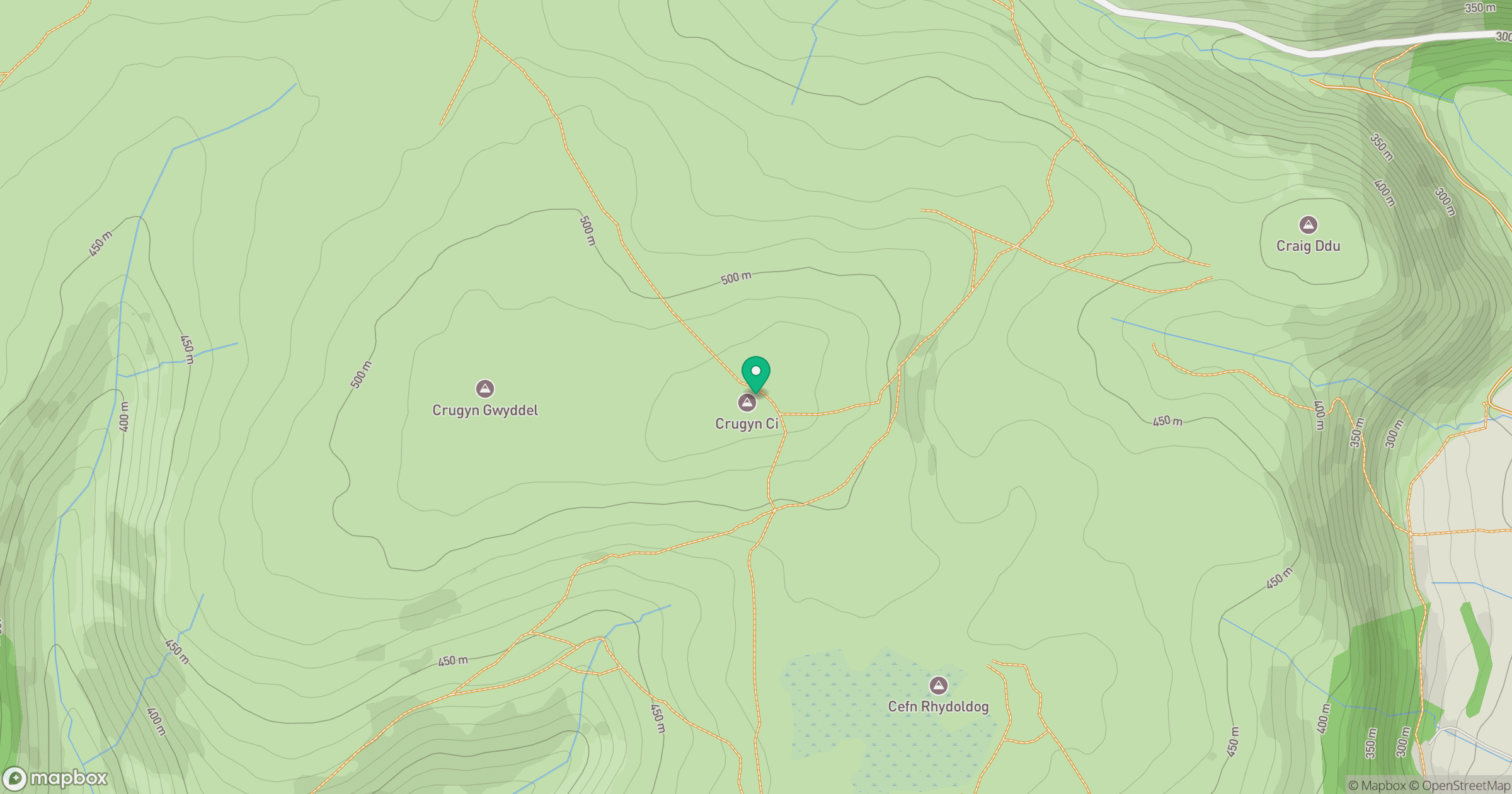
Grid reference: SN926687
View on OpenStreetMapOpens a map in a new tab, centred on the hill.
Hills within 30 km
Straight-line distance, not a walking route or confirmation of access.
No comments yet. Be the first.