

Dunster Castle
Good walks are even better shared.
SS9943 : Dunster Castle Garden
Ian Capper Photo source
Overview
Dunster Castle: A Gem of Somerset
Nestled atop a hill overlooking the charming village of Dunster, Dunster Castle is a site steeped in history and surrounded by picturesque landscapes. Originally built as a defensive fortification in the late 11th century, this castle has evolved through the ages into a stunning family home laden with stories.
Geology
The castle itself is built predominantly from local sandstone, enriched by limestone formations that have provided a sturdy foundation over centuries. The resilience of this stone is evident in the castle's enduring architecture.
Routes
Whether you're feeling active or simply in the mood for a leisurely stroll, there are routes aplenty:
- Dunster Castle Loop: A delightful 4.5 km loop that takes you around the grounds and lush parklands surrounding the castle. Perfect for families and those wishing to soak in the sights at a relaxed pace.
- Castle Hill Path: For those who prefer a more direct approach, this moderate 1.2 km path from Dunster village offers an invigorating ascent to the castle.
Summit Features
At the summit, you'll find the majestic Dunster Castle, complete with an imposing keep, beautifully manicured rose gardens, and sweeping views of the surrounding landscapes. It’s like something out of a fairy tale—only with less brooding and more afternoon tea!
Terrain
The terrain is primarily grassy, interspersed with rocky outcrops, particularly around the castle walls. It’s an easy walk unless the rain decides to join in!
Views
The views from Dunster Castle are truly breathtaking. To the north, the rolling hills of the Quantocks beckon, while to the south, the landscape eventually gives way to the sparkling waters of the Bristol Channel. Spring and autumn are particularly splendid for showcasing vibrant colours and clarity.
Hazards
While the paths are generally manageable, some may be slippery after rain. Exercise caution, especially on the castle's ancient stone steps, which can be charmingly uneven.
Nearby Summits
For those seeking further adventures, nearby summits like Dunster Hill and Grabbist Hill offer additional walking opportunities and lovely vistas.
Access
Getting to Dunster Castle is straightforward:
- Nearest parking: The village car park is a convenient five-minute walk from the castle entrance.
- Public transport: Regular buses from Minehead connect directly to Dunster, and the West Somerset Railway adds a dash of nostalgia to your journey.
- Nearest town: The lively town of Minehead is just a stone's throw away, filled with amenities and more history to explore.
Facilities
After a day of exploration, indulge in a well-earned rest at the castle's café, known for its delicious cream teas and freshly baked scones. There are also toilets and gift shops selling handcrafted local products to satisfy those souvenir cravings.
History
The name 'Dunster' reflects its geographic significance, while the castle has served not only as a fort but also as a noble family residence, lending it great historical importance.
In conclusion, whether you’re an avid historian, a nature lover, or just someone looking for a picturesque day out, Dunster Castle is an ideal destination that promises both adventure and a slice of tranquillity. Don't forget to stop by the café, because where there's scone, there's a way!
Explore routes near Dunster Castle
Walks starting near this hill. Open a route to check its map, distance and full itinerary.
Dunster, Gallox Bridge and Bats Castle: deer park hillfort circuit
View route
Dunkery Beacon sunset ranger walk
View route
Bossington Hill dusk and dark-sky walk
View route
Ramscombe, Dead Woman’s Ditch and Adscombe woodland circuit, Quantock Hills
View route
Route planning notes
These notes describe possible approaches. Check a route's map and access information when planning your walk.
Dunster Castle Loop
A scenic loop trail around the castle and through the adjacent parklands.
Castle Hill Path
A direct ascent leading up to the castle from Dunster village, perfect for those looking to stretch their legs.
Make a day of it, together
Find someone to share the walk with, or organise a day out along a route you like.
Photo Gallery
View all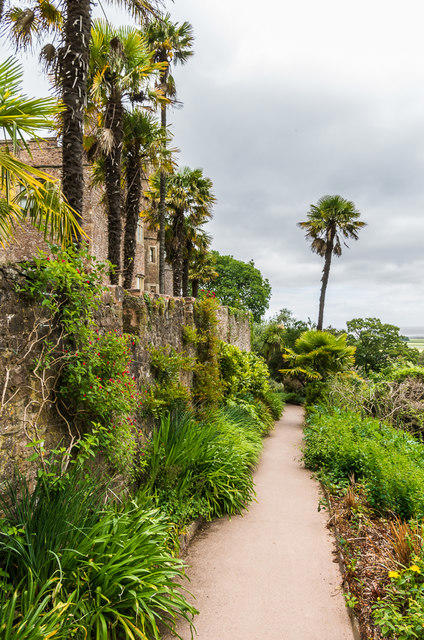 Photo could not load
SS9943 : Dunster Castle Garden
Ian Capper
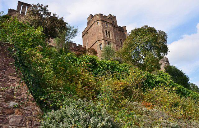 Photo could not load
SS9943 : Dunster Castle: Steep Fortification
Mr Eugene Birchall
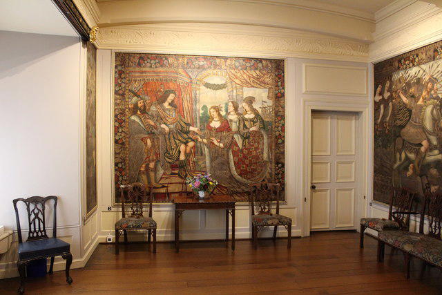 Photo could not load
SS9943 : Dunster Castle (7)
Chris' Buet
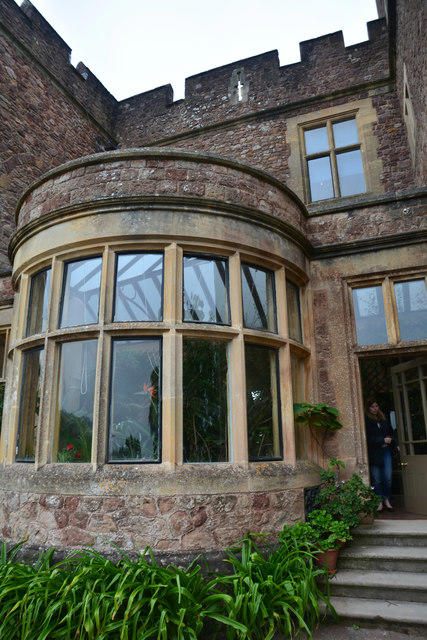 Photo could not load
SS9943 : Dunster : Dunster Castle
Lewis Clarke
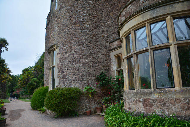 Photo could not load
SS9943 : Dunster : Dunster Castle
Lewis Clarke
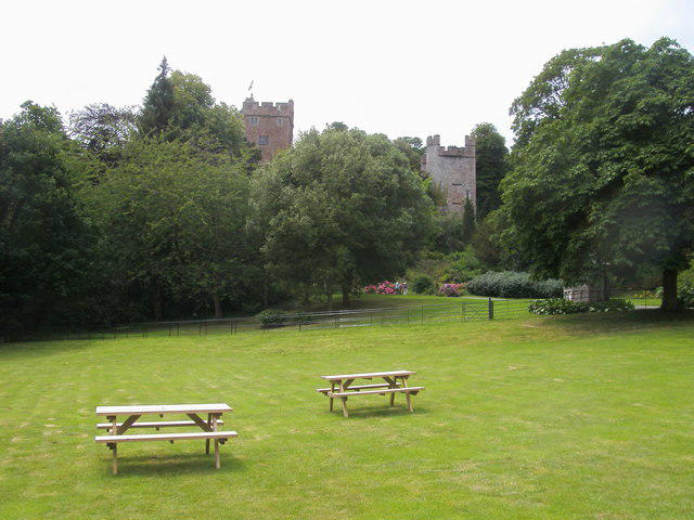 Photo could not load
SS9943 : Dunster Castle
Shaun Ferguson
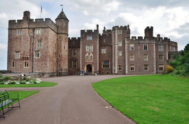 Photo could not load
SS9943 : Dunster Castle: Main Entrance
Mr Eugene Birchall
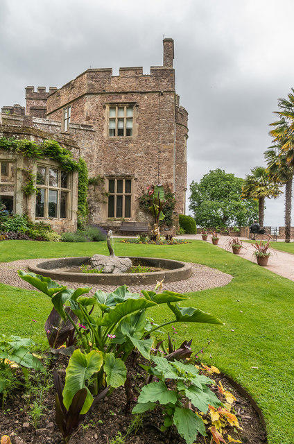 Photo could not load
SS9943 : Dunster Castle
Ian Capper
 Photo could not load
SS9943 : Dunster: Castle
Michael Garlick
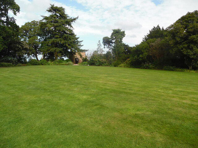
SS9943 : Keep Garden at Dunster Castle
David Hillas
Hill facts and local notes
Classifications
Elevation
85m
279 ft
Prominence
43m
Coordinates
51.1814, -3.4448
SS991434
OS Map
181
Explorer: OL9E
At the Summit
The summit boasts the iconic Dunster Castle with its impressive keep, beautifully manicured gardens, and panoramic views.
Terrain & Geology
Predominantly made of local sandstone with some limestone formation, providing a sturdy base that has withstood the test of time.
Views & Scenery
Outstanding views of the Quantock Hills, Exmoor National Park, and the Bristol Channel.
History & Heritage
Name Origin
The name 'Dunster' originates from the Old English 'Dun', meaning hill or down, and 'stěr', meaning a place.
Historical Significance
Dunster Castle has been a focal point of history since the Norman Conquest and is steeped in stories of legendary lords and ladies.
Getting There & Facilities
Parking
Dunster village car park, located just 5 minutes’ walk from the castle entrance.
Public Transport
Regular bus services operate from Minehead to Dunster, with access to the West Somerset Railway.
Nearby Facilities
Visitor centre with toilets, a café serving delicious cream teas, and gift shops selling local crafts.
Safety Information
Known Hazards
- Potentially slippery paths in wet weather; always tread carefully, especially on the castle's stone steps.
General Safety Tips
- Check weather conditions before setting out
- Carry appropriate clothing and equipment
- Let someone know your planned route
- Take a map, compass, and GPS device
- Carry emergency supplies: food, water, first aid kit, torch
Hills
Some common questions about the hills answered
Are there group walks up Dunster Castle?
Many walkers use Walkmates to join or organise walks with others. You can check for group walks around Dunster Castle through the maps
Are there other walkers around Dunster Castle?
Activity varies by location and time, but Walkmates lets you see whether others have shared walks or shown interest in this area. Find other people through the walking friends search walking friends for Dunster Castle search or of course create your own walk for Dunster Castle
Can I organise a walk to Dunster Castle?
Yes. If there aren’t any walks listed already, you can create a walk and make it available for others to join.
If you're signed up to Walkmates, you can create a walk to Dunster Castle.
How do I find a walk up this hill?
There are often multiple ways to walk this hill, depending on experience and route preference. Walkmates helps you explore walks and routes that others have shared.
Can I suggest a new route up Dunster Castle?
Yes. You can suggest or create routes to share with others. Walkmates focuses on the social side of walking, so routes are used to help people organise walks and explore areas together, rather than as detailed navigation tools or route libraries.
Other uses really appreciate knowledgeable walkers sharing their routes. Share your favourite route to Dunster Castle here
The is an error or something incorrect about this hill. How do I let you know?
We always strive to keep the information on Walkmates as accurate as possible. If you find an error, please let us know through the contact form and we'll aim to correct it as quickly as possible
Community Discussion
Comments
Location
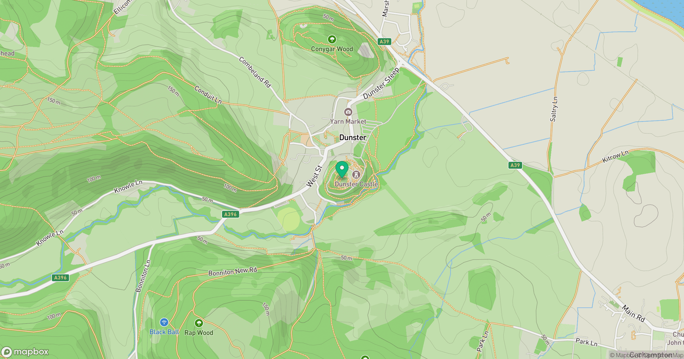
Grid reference: SS991434
View on OpenStreetMapOpens a map in a new tab, centred on the hill.


No comments yet. Be the first.