

Dunrod Hill
Good walks are even better shared.
NS2372 : Dunrod Hill
Thomas Nugent Photo source
Overview
Dunrod Hill: A Hidden Gem in Central Scotland
Dunrod Hill, standing at a modest 146 meters, may not be the tallest of Scotland's hills, but what it lacks in height, it certainly makes up for in charm. Nestled in the heart of Central Scotland, this Marilyn offers a delightful escape for hikers looking for a leisurely afternoon in the outdoors.
Geology
The hill's geology is a fascinating mix, primarily consisting of Quaternary deposits that cover older schists and granites. You'll notice unique erosion patterns shaped by ancient glaciers, showcasing nature's artistry. Perfect for those keen on geology while out for a stroll—there's a lot more to rocks than meets the eye!
Routes
The most popular trek is the Dunrod Hill Trail, a 4.5 km loop that is a perfect introduction to hill walking. With a moderate difficulty level, it provides a gradual ascent that most fitness levels can enjoy. Along the route, you'll wander through beautiful heather moorland, offering stunning views that will make you stop and pause just to take it all in.
Summit Features
Upon reaching the summit, adventurous souls will find a well-constructed cairn—a glorious spot for selfies! Just be careful not to have too much fun with the wind; you wouldn’t want your hat to go flying!
Terrain Type
The terrain is primarily grassy but includes rocky patches that keep your footwork interesting. It's a pleasant, varied hiking experience that rewards with serenity and stunning views.
Views
From the summit, hikers can enjoy panoramic views of the Campsie Fells and Loch Lomond. On a clear day, the highlands may even reveal themselves in the distance, reminding you just how glorious nature can be!
Hazards
Keep an eye on your footing; the ground can be uneven and slippy, particularly after rain. Also, watch out for local cattle—they may seem friendly but can be quite curious. A gentle 'hello' goes a long way!
Access
Accessing Dunrod Hill is straightforward. There is limited parking along the B837 road nearby. A public bus service operates from nearby towns, but be sure to check local timetables. The nearest town, Milngavie, is a short drive away and boasts various amenities to kickstart your adventure.
Facilities
If you find yourself peckish after your hill-climb, head back to Milngavie where you can treat yourself in local cafés and shops. Don’t worry, they won’t mind if you smell a bit like a mountain goat!
History
Dunrod, from Gaelic origins, makes you ponder the ancient stories held within its rocky embrace. The hill has been a silent witness to centuries of history, and today it remains a beloved destination for those seeking respite from the hustle and bustle.
In conclusion, Dunrod Hill may be modest in stature, but it offers a wealth of experiences for those willing to explore. Whether you're a seasoned hiker or just seeking a good stroll in nature, Dunrod's beauty awaits.
Now, grab your boots, bring a friend, and get ready to discover why this charming little hill deserves a spot on every hiker’s list!
Explore routes near Dunrod Hill
Walks starting near this hill. Open a route to check its map, distance and full itinerary.
West Bay walk and talk
View route
West Bay walk and talk
View route
West Bay morning walk and silent disco
View route
Bishop’s Glen group walk
View route
Route planning notes
These notes describe possible approaches. Check a route's map and access information when planning your walk.
Dunrod Hill Trail
A looped route starting from the main road, offering a gradual ascent through scenic heather moorland.
Make a day of it, together
Find someone to share the walk with, or organise a day out along a route you like.
Photo Gallery
View all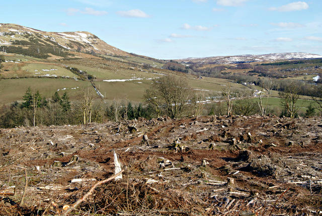 Photo could not load
NS2372 : Dunrod Hill
Thomas Nugent
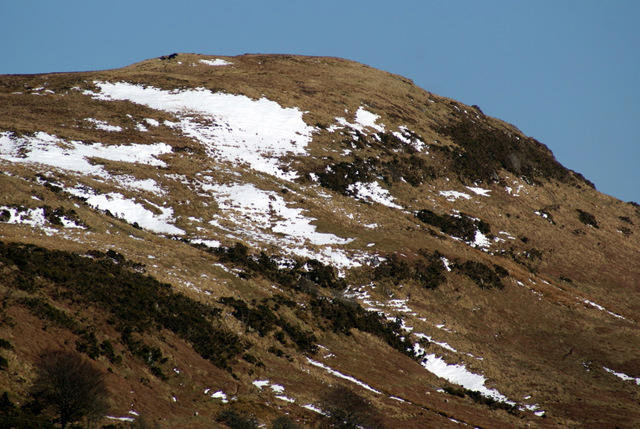 Photo could not load
NS2372 : Dunrod Hill
Thomas Nugent
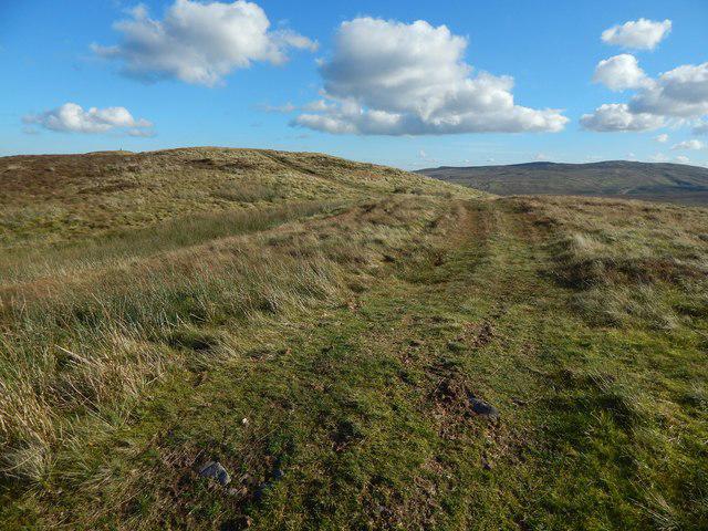 Photo could not load
NS2372 : A track on Laverockhouse Hill
Lairich Rig
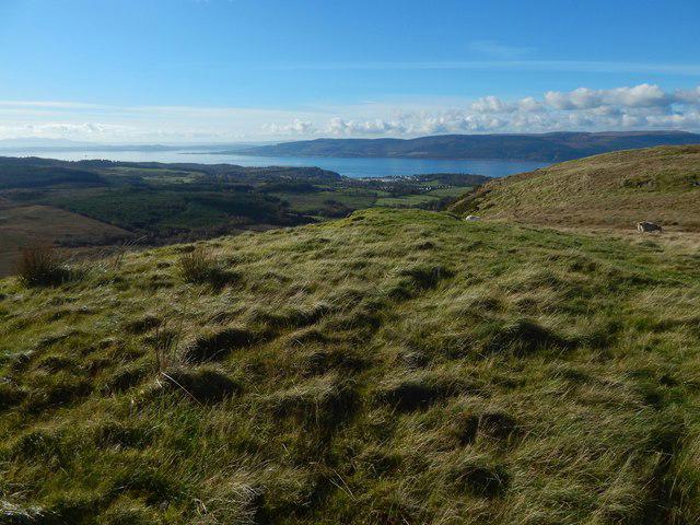 Photo could not load
NS2372 : The slopes of Dunrod Hill
Lairich Rig
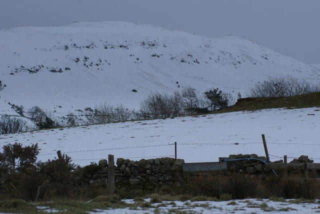 Photo could not load
NS2372 : Dunrod Hill
Thomas Nugent
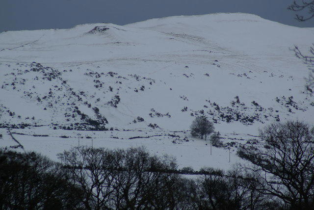 Photo could not load
NS2372 : Dunrod Hill
Thomas Nugent
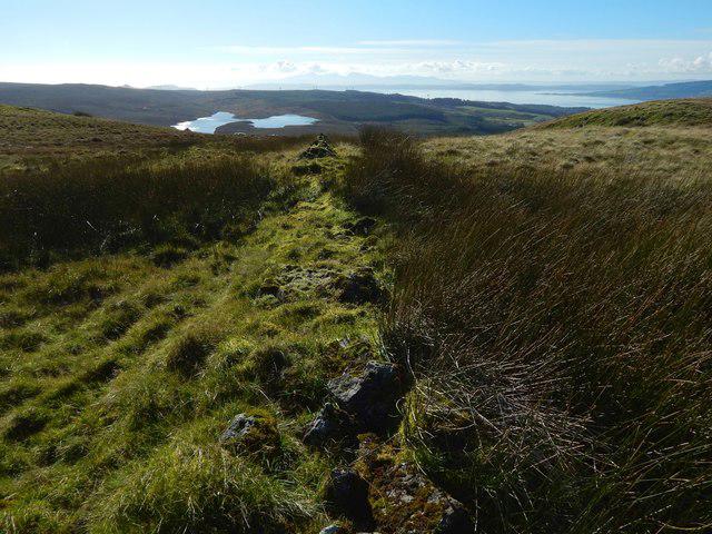 Photo could not load
NS2372 : The line of an old dry-stone wall
Lairich Rig
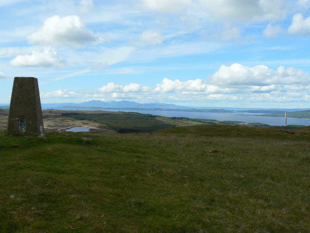 Photo could not load
NS2372 : Dunrod Hill
william craig
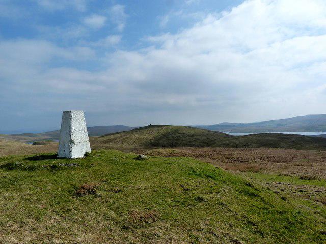 Photo could not load
NS2372 : Dunrod Hill (trig point)
Raibeart MacAoidh
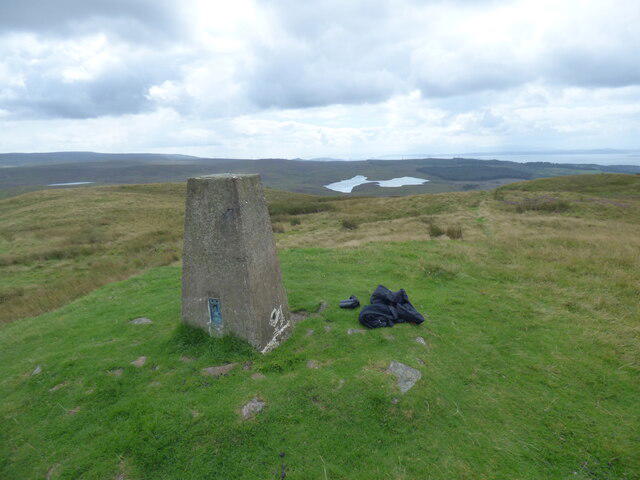
NS2472 : Dunrod Trigpoint in Renfrewshire
John P Reeves
Hill facts and local notes
Classifications
Elevation
298m
978 ft
Prominence
82m
Coordinates
55.9145, -4.8177
NS239726
OS Map
63
Explorer: 341N
At the Summit
Cairn marking the summit, providing a nice spot for a photo op. Just remember to take your selfie before the wind takes off with your hat!
Terrain & Geology
Primarily composed of Quaternary deposits, with underlying schists and granites. The hill features some interesting erosion patterns that tell tales of glacial movement. Perfect for budding geologists! One might even say it's rock-solid!
Views & Scenery
Spectacular views of the Campsie Fells, Loch Lomond, and on a clear day, you might even glimpse the highlands looming in the distance.
History & Heritage
Name Origin
The name 'Dunrod' is believed to derive from the Gaelic 'Dun' meaning 'fort' and 'Rod' possibly referencing a local family name or land feature.
Historical Significance
This hill holds historical significance as part of the rugged scenery that has been home to settlers for centuries, and it continues to attract nature lovers and hikers today.
Getting There & Facilities
Parking
There is limited roadside parking near the start of the trail on the B837 road. Be considerate and park safely!
Public Transport
Buses operate from nearby towns, with the nearest stop about 1.5 km from the trailhead. Best to check the local timetable as schedules can be as erratic as Scottish weather!
Nearby Facilities
Basic facilities can be found in Milngavie, including cafés, shops, and public toilets.
Safety Information
Known Hazards
- Uneven ground can lead to slips and trips, especially in wet conditions. Be mindful of the cattle in the area – they're more curious than dangerous but can be a bit pushy!
General Safety Tips
- Check weather conditions before setting out
- Carry appropriate clothing and equipment
- Let someone know your planned route
- Take a map, compass, and GPS device
- Carry emergency supplies: food, water, first aid kit, torch
Hills
Some common questions about the hills answered
Are there group walks up Dunrod Hill?
Many walkers use Walkmates to join or organise walks with others. You can check for group walks around Dunrod Hill through the maps
Are there other walkers around Dunrod Hill?
Activity varies by location and time, but Walkmates lets you see whether others have shared walks or shown interest in this area. Find other people through the walking friends search walking friends for Dunrod Hill search or of course create your own walk for Dunrod Hill
Can I organise a walk to Dunrod Hill?
Yes. If there aren’t any walks listed already, you can create a walk and make it available for others to join.
If you're signed up to Walkmates, you can create a walk to Dunrod Hill.
How do I find a walk up this hill?
There are often multiple ways to walk this hill, depending on experience and route preference. Walkmates helps you explore walks and routes that others have shared.
Can I suggest a new route up Dunrod Hill?
Yes. You can suggest or create routes to share with others. Walkmates focuses on the social side of walking, so routes are used to help people organise walks and explore areas together, rather than as detailed navigation tools or route libraries.
Other uses really appreciate knowledgeable walkers sharing their routes. Share your favourite route to Dunrod Hill here
The is an error or something incorrect about this hill. How do I let you know?
We always strive to keep the information on Walkmates as accurate as possible. If you find an error, please let us know through the contact form and we'll aim to correct it as quickly as possible
Community Discussion
Comments
Location
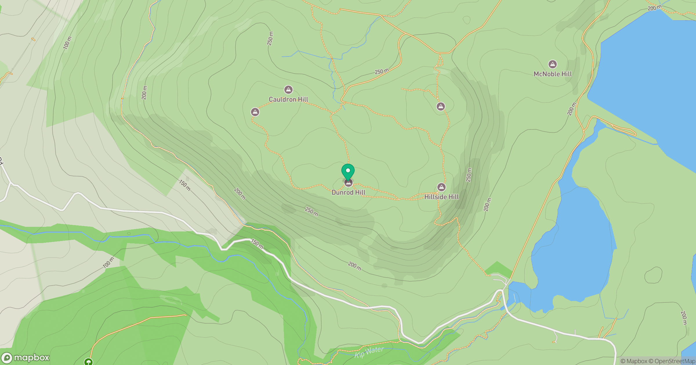
Grid reference: NS239726
View on OpenStreetMapOpens a map in a new tab, centred on the hill.
![The Cobbler [Ben Arthur]](https://cdn.walkmates.com/gallery-images/a1b697040769474a8338b3fb586ebc7a.jpg)
No comments yet. Be the first.