

Hill of Stake
Good walks are even better shared.
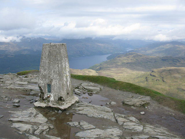
NS2763 : Hill of Stake (cairn)
Raibeart MacAoidh Photo source
Overview
Hill of Stake
Located within the picturesque Southern Uplands, the Hill of Stake rises to an elevation of 533 meters, offering a lovely day out for walkers who want to enjoy both the social and the solitary aspects of hiking. Whether you're a seasoned pro or just taking the first step (pun intended!), this hill has something for everyone.
Geology
The geological formation of the Hill is quite interesting. Primarily composed of sedimentary rocks with igneous underpinnings, these ancient formations present an outdoor classroom on their rugged surfaces. Watch your footing, though; these outcrops can be less forgiving than your usual hiking trail!
Routes
The Glenmuckloch Route is the most popular and well-trodden path. Stretching about 8.2 km in distance, this moderate hike takes approximately 3.5 hours with ample breaks to catch your breath (and maybe mug for some selfies).
Summit Features
Once you reach the summit, you’re greeted by a sturdy trig point and a cairn that practically begs for a group selfie. After all, if you’ve climbed a hill and haven’t taken a picture, did you even climb it?
Terrain Type
Expect a medley of grassy slopes and rocky outcrops. Also, keep an eye out for the odd boggy patch—shoes can get muddier than they may like, and no one enjoys that surprise!
Views
From the summit, the panoramic views are simply breathtaking. On clear days, witness a mixture of surrounding peaks and the shimmering Ayrshire coast in the distance. The best time for these views is during spring and autumn when nature’s hues are at their most vibrant.
Hazards
While the hill may not offer extreme dangers, the weather can change quicker than a squirrel on caffeine. It’s wise to bring appropriate clothing and keep an eye out for shifting mists. Also, the rocky and boggy terrains have a few tricks up their sleeves, so heed their warning!
Nearby Summits
Combine your experience with nearby peaks such as Black Hill (581m) and the higher Merrick (843m). It's a beautiful way to make a solid day of hiking amidst spectacular sights.
Access
Getting to the glen is quite straightforward. The nearest parking is at NS 266 612, with spots to hold around 5-6 cars. If you're relying on public transport, a bus service runs from Stranraer to Dalmellington, leaving you with a short walk to the starting point.
Facilities
Dalmellington, the closest town, offers a few cafés and public toilets, though it's wise to come prepared with your own provisions to avoid disappointment.
History
The name 'Hill of Stake' evokes curiosity and holds tales of land markers from long ago, bringing a touch of historical significance to your hiking adventure.
So lace up those boots, pack that rucksack, and give Hill of Stake a go! You won’t regret it—well, at least not until your legs remind you of the descent!
Explore routes near Hill of Stake
Walks starting near this hill. Open a route to check its map, distance and full itinerary.
West Bay walk and talk
View route
West Bay walk and talk
View route
West Bay morning walk and silent disco
View route
Bishop’s Glen group walk
View route
Route planning notes
These notes describe possible approaches. Check a route's map and access information when planning your walk.
Glenmuckloch Route
A scenic route starting from Glenmuckloch, meandering through lush greenery and providing a steady ascent to the summit.
Make a day of it, together
Find someone to share the walk with, or organise a day out along a route you like.
Photo Gallery
View all Photo could not load
NS2763 : Hill of Stake (cairn)
Raibeart MacAoidh
 Photo could not load
NS2763 : Hill of Stake - Benchmark Stone
Raibeart MacAoidh
 Photo could not load
NS2763 : Hill of Stake (trig point)
Raibeart MacAoidh
 Photo could not load
NS2763 : Hill of Stake (trig point)
Raibeart MacAoidh
 Photo could not load
NS2763 : Hill of Stake (trig point)
Raibeart MacAoidh
 Photo could not load
NS2763 : Hill of Stake (trig point)
Raibeart MacAoidh
 Photo could not load
NS2763 : Hill of Stake (trig point)
Raibeart MacAoidh
Hill facts and local notes
Classifications
Elevation
522m
1,713 ft
Prominence
486m
Coordinates
55.8293, -4.7579
NS273630
OS Map
63
Explorer: 341N
At the Summit
The summit features a prominent trig point, which is a beloved landmark for hikers seeking their Instagram moments! A small stone cairn also sits nearby for an additional photo opportunity.
Terrain & Geology
The Hill of Stake is primarily composed of sedimentary rocks with underlying igneous formations. The rocky outcrops scattered across the hill tell a story of geological history stretching back millions of years.
Views & Scenery
On a clear day, the views encompass the surrounding peaks of the Southern Uplands and even stretch towards the distant Ayrshire coast.
History & Heritage
Name Origin
The name 'Hill of Stake' is thought to have originated from historical landmarks or markers that signified land boundaries.
Historical Significance
While not steeped in extensive historical lore, the hill is part of a landscape rich in local folklore pertaining to the Southern Uplands.
Getting There & Facilities
Parking
There is a small parking area at NS 266 612, suitable for 5-6 cars at the start of the Glenmuckloch route.
Public Transport
Public transport is limited, but a bus service runs from Stranraer to Dalmellington, with a walk required from the stopping point.
Nearby Facilities
Dalmellington offers a few local cafes and a public toilet facility. However, it’s advised to bring your own supplies as options may be limited.
Safety Information
Known Hazards
- Beware of changing weather conditions; it's not unusual for the top to be shrouded in mist. Also, watch your step on the rocky and occasionally boggy terrain.
General Safety Tips
- Check weather conditions before setting out
- Carry appropriate clothing and equipment
- Let someone know your planned route
- Take a map, compass, and GPS device
- Carry emergency supplies: food, water, first aid kit, torch
Hills
Some common questions about the hills answered
Are there group walks up Hill of Stake?
Many walkers use Walkmates to join or organise walks with others. You can check for group walks around Hill of Stake through the maps
Are there other walkers around Hill of Stake?
Activity varies by location and time, but Walkmates lets you see whether others have shared walks or shown interest in this area. Find other people through the walking friends search walking friends for Hill of Stake search or of course create your own walk for Hill of Stake
Can I organise a walk to Hill of Stake?
Yes. If there aren’t any walks listed already, you can create a walk and make it available for others to join.
If you're signed up to Walkmates, you can create a walk to Hill of Stake.
How do I find a walk up this hill?
There are often multiple ways to walk this hill, depending on experience and route preference. Walkmates helps you explore walks and routes that others have shared.
Can I suggest a new route up Hill of Stake?
Yes. You can suggest or create routes to share with others. Walkmates focuses on the social side of walking, so routes are used to help people organise walks and explore areas together, rather than as detailed navigation tools or route libraries.
Other uses really appreciate knowledgeable walkers sharing their routes. Share your favourite route to Hill of Stake here
The is an error or something incorrect about this hill. How do I let you know?
We always strive to keep the information on Walkmates as accurate as possible. If you find an error, please let us know through the contact form and we'll aim to correct it as quickly as possible
Community Discussion
Comments
Location
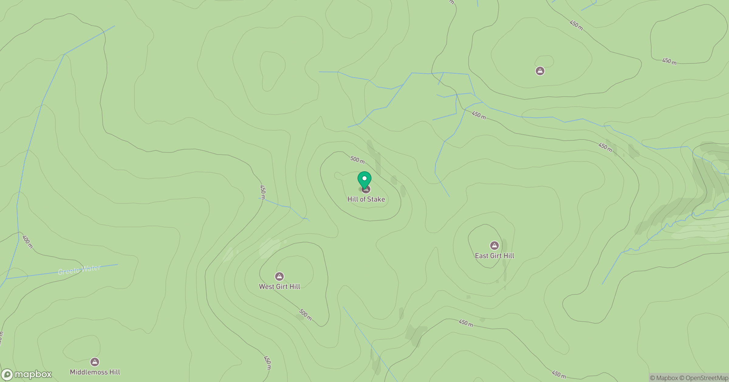
Grid reference: NS273630
View on OpenStreetMapOpens a map in a new tab, centred on the hill.

No comments yet. Be the first.