

Barbay Hill
Good walks are even better shared.
Overview
Barbay Hill
Situated in the picturesque Northern Ireland, Barbay Hill stands at an elevation of 180 meters and offers a moderate challenge for avid hikers. With its rounded top and scenic trails, it attracts not only seasoned climbers but also families looking for a delightful day out in the wild.
Geology
The geological composition of Barbay Hill primarily comprises sedimentary rocks, showcasing the region’s rich geologic history. The sandstone and shale layers speak volumes of the natural forces that shaped this land over millennia. Keep your eyes peeled for ancient fossils that might be hidden in the rocky outcrops!
Trail Information
The Barbay Hill Circular Trail is a great starting point for your adventure. This 5.5 km route weaves through lush fields and gradually ascends to the summit. Estimated to take about 2.5 hours, it provides an enjoyable hike with manageable inclines and glorious vistas as you make your way up.
Summit Features
Reaching the summit, you'll be greeted by a resilient trig point, a staple for hillwalkers. This is the perfect spot to rest and take in the stunning views of surrounding peaks and valleys. Maybe snap a few selfies while you’re at it; after all, those sunsets won’t capture themselves!
Terrain
The terrain is primarily grassy with gentle slopes interspersed with rocky patches. Suitable footwear is recommended, particularly if you're looking to avoid an embarrassing tumble while trying to pose for a photo!
Views
From the summit, you'll be treated to sweeping views of the Sperrin Mountains, Lough Foyle, and on particularly clear days—the majestic Mourne Mountains in the distance. If you’re an early riser, consider hiking at sunrise; it’s a sight not to be missed!
Hazards
As always, be cautious and watch for potentially slippery areas, especially during rainy weather. The weather can change surprisingly quickly in this region, so it's wise not to be caught out without a jacket—or a good sense of humour!
Nearby Summits
Not far from Barbay Hill, you’ll find Slieve Gallion and Tievebulliagh, both worthy additions to your hiking list and excellent spots for those looking to extend their adventure.
Access
From Dungiven, you can easily access the hill with ample parking spaces available near the trailhead. The local bus services also connect to Derry, making it convenient even for those without a car.
Facilities
After conquering Barbay Hill, you might want to refuel. Dungiven offers quaint cafes and local shops to cater to your hunger!
History
Intriguingly, the name ‘Barbay’ derives from the Gaelic word ‘Bearbh’, which hints at the rugged nature of the hill. Historically, it’s been a landmark for locals, providing both function and folklore to the community.
So lace up those boots, grab your sense of adventure, and head to Barbay Hill for a day of exploration like no other! Bring along friends, and don't forget to capture those 'I conquered Barbay Hill' photos. Happy hiking!
Explore routes near Barbay Hill
Public walks starting within 80 km of this hill. Nearby does not mean a route reaches the summit; check its map and access before setting out.
Greenock Cut: the full circuit from Cornalees
View route
West Bay walk and talk
View route
West Bay walk and talk
View route
Bishop’s Glen group walk
View route
Route planning notes
These notes describe possible approaches, not verified navigable routes or permission to cross land. Check current paths, local access rules and conditions before setting out.
Barbay Hill Circular Trail
This circular route begins at the small village of Dungiven and leads you through lush green fields before a steady ascent to the summit of Barbay Hill.
Make a day of it, together
Find someone to share the walk with, or organise a day out along a route you like.
Photo Gallery
View all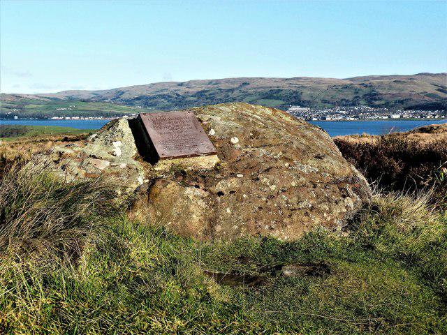 Photo could not load
NS1657 : Barbay Hill - Isle of Cumbrae
Raibeart MacAoidh
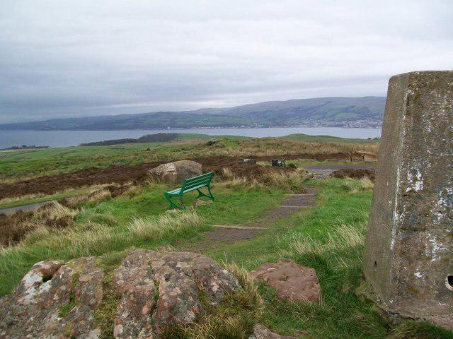 Photo could not load
NS1657 : Highest point on Cumbrae
rod collier
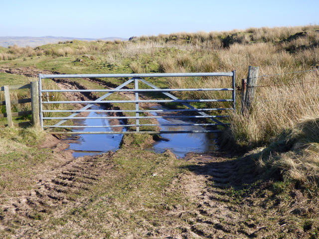 Photo could not load
NS1657 : Gate at Figgatoch Farm
Thomas Nugent
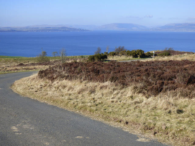 Photo could not load
NS1657 : The Firth of Clyde from Barbay Hill
Thomas Nugent
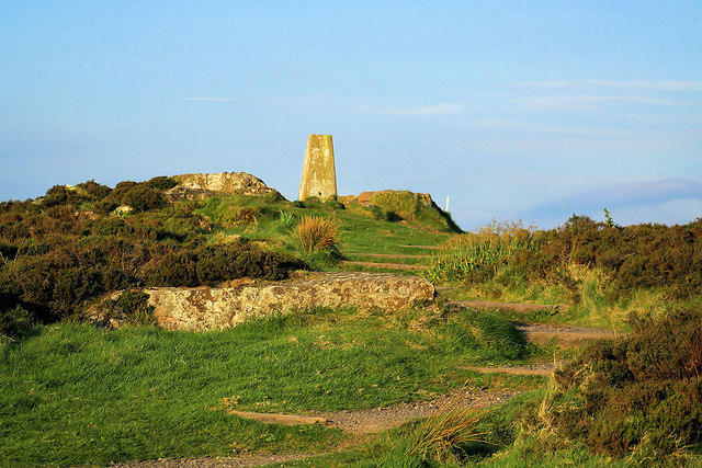 Photo could not load
NS1657 : Glaidstone, Isle of Cumbrae
John McLeish
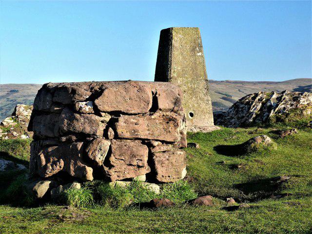 Photo could not load
NS1657 : Barbay Hill - Isle of Cumbrae
Raibeart MacAoidh
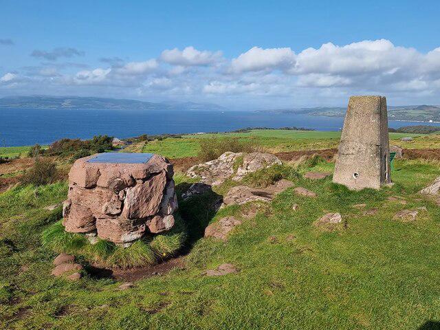 Photo could not load
NS1657 : Trig pillar on the highest point on Great Cumbrae
Oliver Dixon
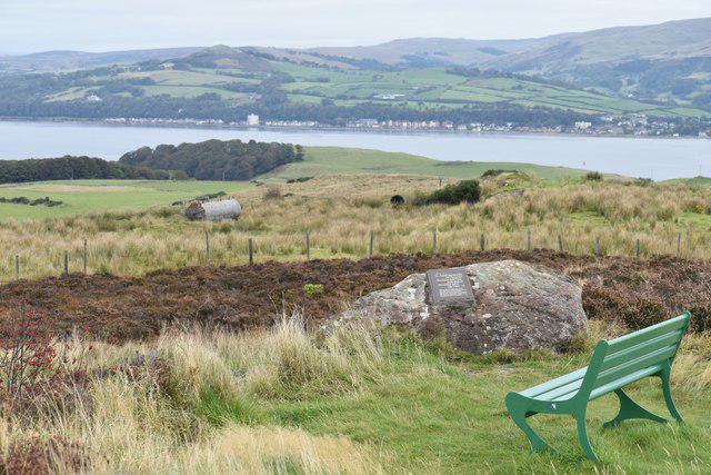 Photo could not load
NS1657 : Bench seat on the top of Great Cumbrae
David Martin
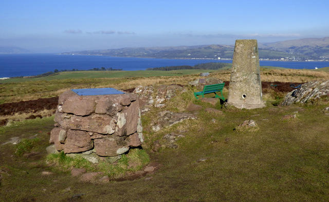 Photo could not load
NS1657 : Toposcope and trig point on Barbay Hill
Thomas Nugent
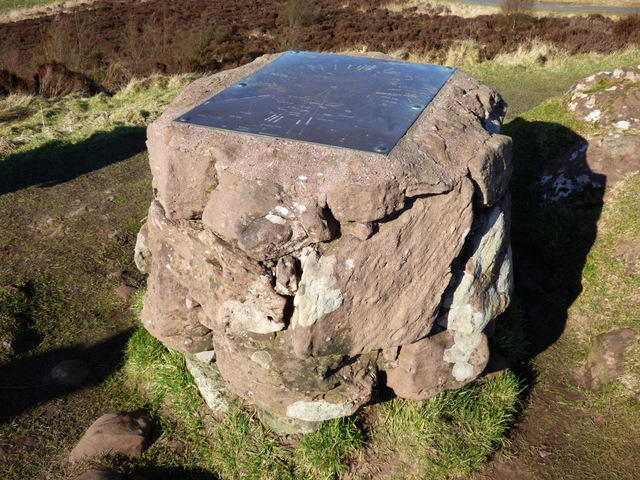
NS1657 : Barbay Hill toposcope
Thomas Nugent
Hill facts and local notes
Classifications
Elevation
127m
417 ft
Prominence
127m
Coordinates
55.7716, -4.9224
NS167570
OS Map
63
Explorer: 341S
At the Summit
At the summit, hikers are greeted by a sturdy trig point that stands resolutely against the elements, providing not only a sense of accomplishment but also a fantastic vantage point.
Terrain & Geology
Barbay Hill is primarily composed of sedimentary rocks, predominantly sandstone and shale, which has formed the rugged landscapes characteristic of this region. The erosion patterns showcase the hill's geological history, giving treasures to geology enthusiasts.
Views & Scenery
On a clear day, the sweeping views encompass the Sperrin Mountains, Lough Foyle, and the Donegal coast. You might even catch a glimpse of the distant peaks of the Mourne Mountains!
History & Heritage
Name Origin
The name 'Barbay' is believed to derive from the Gaelic 'Bearbh', meaning 'harsh' or 'rough', aptly describing the nature of the terrain.
Historical Significance
The hill has been a prominent landmark in the area, often used for navigation and as a gathering place for local events.
Getting There & Facilities
Check current local access restrictions, parking rules and transport timetables before travelling. These notes do not confirm public access to the summit.
Parking
There is a small parking area in Dungiven, just a short walk from the trailhead. Arrive early on weekends, as spots fill up quickly!
Public Transport
Regular bus services run from Derry to Dungiven, making it accessible for those relying on public transport.
Nearby Facilities
There are a few quaint cafes and shops in Dungiven where you can grab a bite to eat or freshen up before heading out on your adventure.
Safety Information
Known Hazards
- Watch for slippery rocks during wet conditions and be aware of sudden weather changes typical of the region.
General Safety Tips
- Check weather conditions before setting out
- Carry appropriate clothing and equipment
- Let someone know your planned route
- Take a map, compass, and GPS device
- Carry emergency supplies: food, water, first aid kit, torch
Hills
Some common questions about the hills answered
Are there group walks up Barbay Hill?
Many walkers use Walkmates to join or organise walks with others. You can check for group walks around Barbay Hill through the maps
Are there other walkers around Barbay Hill?
Activity varies by location and time, but Walkmates lets you see whether others have shared walks or shown interest in this area. Find other people through the walking friends search walking friends for Barbay Hill search or of course create your own walk for Barbay Hill
Can I organise a walk to Barbay Hill?
Yes. If there aren’t any walks listed already, you can create a walk and make it available for others to join.
If you're signed up to Walkmates, you can create a walk to Barbay Hill.
How do I find a walk up this hill?
There are often multiple ways to walk this hill, depending on experience and route preference. Walkmates helps you explore walks and routes that others have shared.
Can I suggest a new route up Barbay Hill?
Yes. You can suggest or create routes to share with others. Walkmates focuses on the social side of walking, so routes are used to help people organise walks and explore areas together, rather than as detailed navigation tools or route libraries.
Other uses really appreciate knowledgeable walkers sharing their routes. Share your favourite route to Barbay Hill here
The is an error or something incorrect about this hill. How do I let you know?
We always strive to keep the information on Walkmates as accurate as possible. If you find an error, please let us know through the contact form and we'll aim to correct it as quickly as possible
Community Discussion
Comments
Location
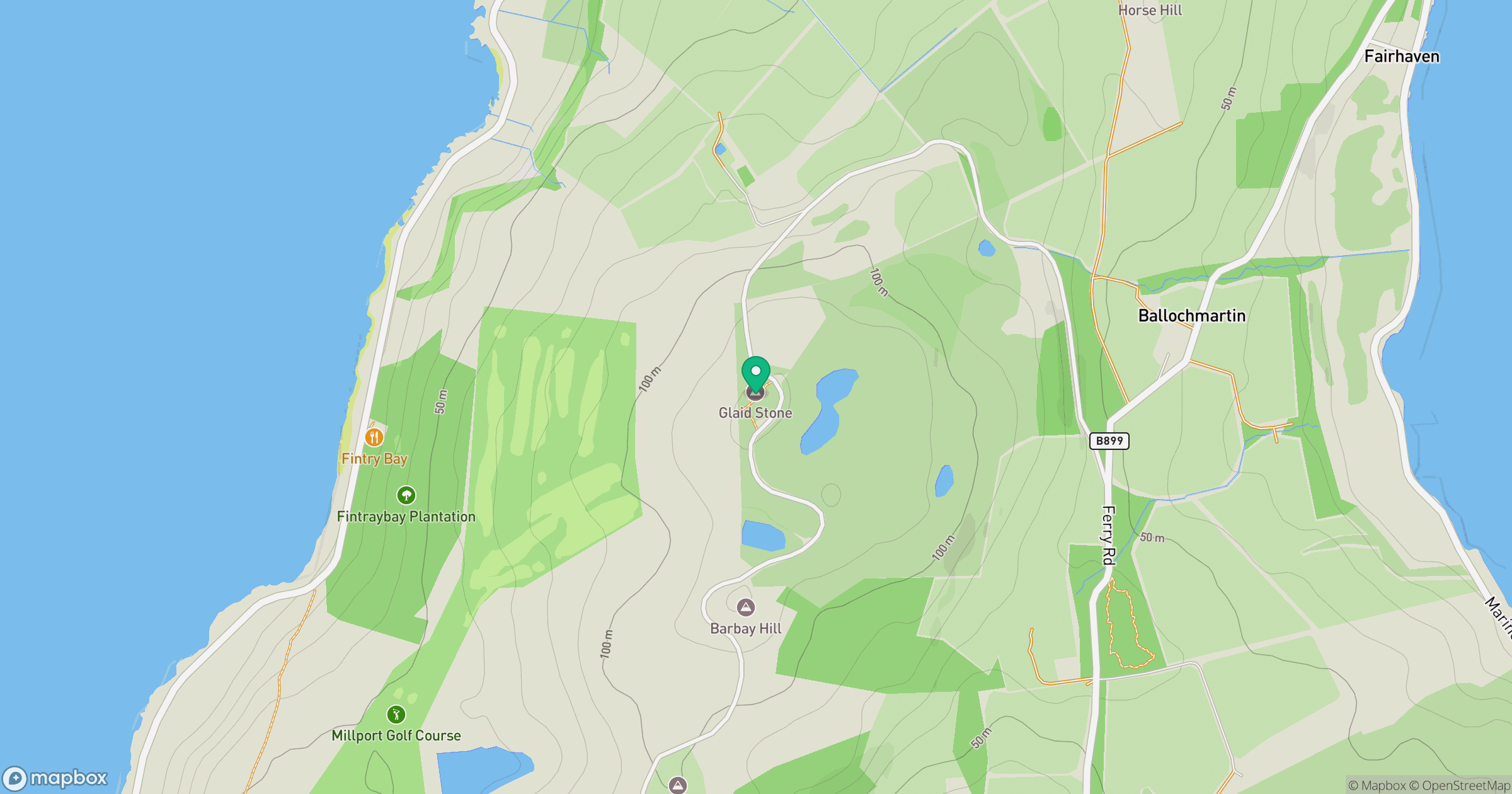
Grid reference: NS167570
View on OpenStreetMapOpens a map in a new tab, centred on the hill.
Hills within 30 km
Straight-line distance, not a walking route or confirmation of access.
Goatfell [Goat Fell]
875m
Cir Mhor
798m
Suidhe Chatain
157m
Common Hill [Canada Hill]
132m
North Hill [Knockewart Hills]
242m
No comments yet. Be the first.