

Dumbarton Castle
Good walks are even better shared.
NS3974 : Dumbarton Rock: The Guard House
Lairich Rig Photo source
Overview
Dumbarton Castle
Overview
Dumbarton Castle is a historic fortress perched upon a volcanic rock formation on the outskirts of Dumbarton. This majestic castle is not just a feast for the eyes; it is also steeped in centuries of history, making it a must-visit for any lover of the outdoors and history.
Geology
Constructed largely from volcanic rock, the site of Dumbarton Castle offers a glimpse into the earth's fiery past. Its striking cliffs and crags were formed by ancient lava flows, creating a dramatic backdrop that has defended this site for over a thousand years.
Routes
The most popular route to reach the castle is the Castle Hill Path. It begins in the heart of Dumbarton and leads adventurers gradually uphill. Expect charming viewpoints along the way, ideal for those Instagram snaps! The path is approximately 1.5 km long and can be tackled in about an hour, making it suitable for families and casual walkers.
Summit Features
Upon reaching the summit, visitors are treated to remnants of the castle itself, including the impressive Great Hall and the rugged battlements that overlook the Firth of Clyde. The views from the top are nothing short of breathtaking, featuring panoramic vistas of the river below and the rolling hills beyond.
Terrain Type
The terrain is mostly grassy, with paved paths leading the way. As you get closer to the summit, you’ll encounter rocky outcrops that add a touch of adventure to your hike.
Views
Highlights
The summit offers stunning views over the Firth of Clyde and the iconic peaks of the Scottish Highlands, including Ben Lomond in the distance. On clear days, the scenery is truly remarkable.
Best Seasons
Spring and autumn will reward visitors with the best views, providing clear skies and the added bonus of experiencing nature in full bloom or dressed in lovely fall colours.
Hazards
Be mindful that the paths can become slippery after rainfall, so it’s wise to wear appropriate footwear to prevent any unexpected tumbles.
Nearby Summits
If you’re itching for more mountain magic, consider a trip to Ben Lomond, standing tall at 974 meters, offering its own set of challenges and rewards.
Access
Nearest Parking: There’s public parking conveniently available in Dumbarton town centre, only a short stroll to the trailhead.
Public Transport: For those relying on public transport, Dumbarton has a railway station with regular services from Glasgow, and plenty of buses to help you out.
Nearest Town: The nearest town is, unsurprisingly, Dumbarton itself—your launchpad for this epic adventure.
Facilities
Post-hike, enjoy a visit to one of the many cafes or restaurants in Dumbarton where you can replenish those lost calories. Public toilets are also available, so you can freshen up before heading on your way.
History
Name Meaning
The name 'Dumbarton' is derived from the Scottish Gaelic 'Dùn Breatainn', translating to 'Fort of the Britons'. Quite the regal title!
Significance
Historically, Dumbarton Castle has served as a critical military fortification. It was the capital of the Kingdom of Strathclyde and has seen its fair share of sieges, battles, and intriguing tales, remaining a beacon of Scottish heritage.
In conclusion, Dumbarton Castle isn't just a castle but a key to understanding Scotland's rich tapestry of history, nature, and geology. So pack your walking boots, camera, and maybe a raincoat, and prepare for an adventure!
Explore routes near Dumbarton Castle
Walks starting near this hill. Open a route to check its map, distance and full itinerary.
Paisley Walk with Men Walking & Talking
View route
Finnich Glen geology walk
View route
West Bay walk and talk
View route
West Bay walk and talk
View route
Route planning notes
These notes describe possible approaches. Check a route's map and access information when planning your walk.
Castle Hill Path
A well-maintained path leading from the town centre up to the castle, offering a gradual ascent with plenty of accessible viewpoints along the way.
Make a day of it, together
Find someone to share the walk with, or organise a day out along a route you like.
Photo Gallery
View all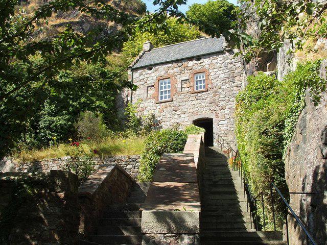 Photo could not load
NS3974 : Dumbarton Rock: The Guard House
Lairich Rig
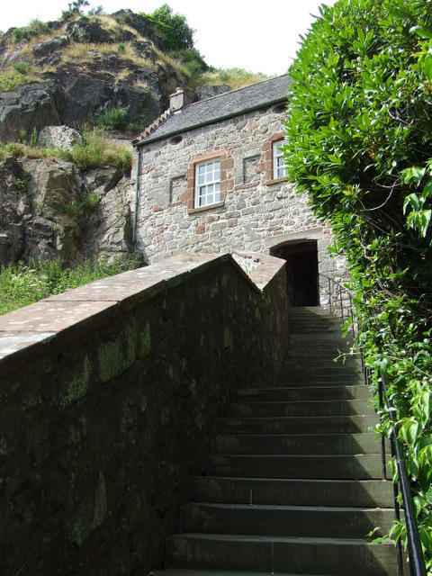 Photo could not load
NS3974 : Dumbarton Rock and Castle
Thomas Nugent
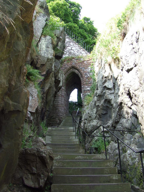 Photo could not load
NS3974 : Dumbarton Rock and Castle
Thomas Nugent
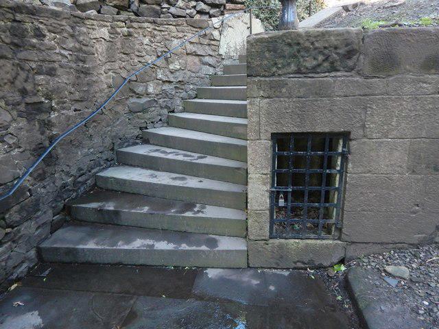 Photo could not load
NS3974 : Dumbarton Castle: small chamber beyond the Portcullis Arch
Lairich Rig
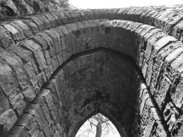 Photo could not load
NS3974 : Dumbarton Castle: slot in the Portcullis Arch
Lairich Rig
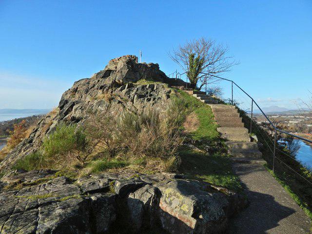 Photo could not load
NS3974 : Dumbarton Castle: White Tower Crag
Lairich Rig
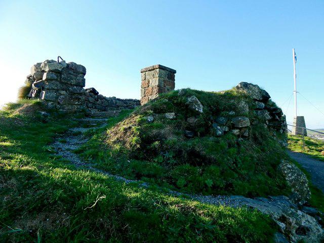 Photo could not load
NS3974 : Dumbarton Castle: remains of a circular structure
Lairich Rig
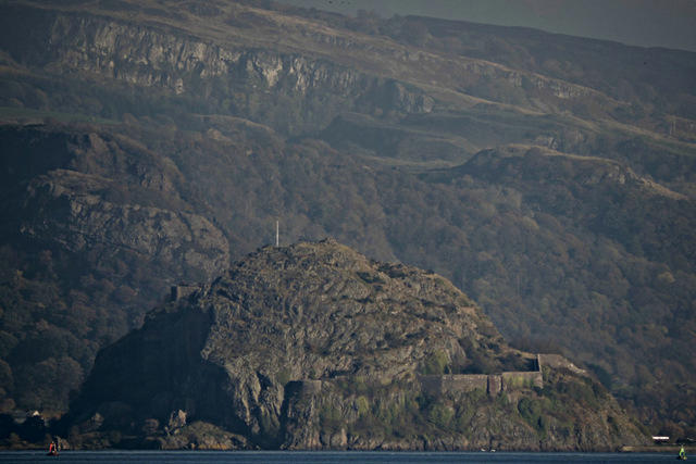 Photo could not load
NS3974 : Dumbarton Rock
Thomas Nugent
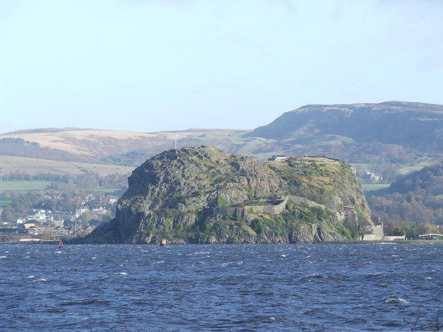 Photo could not load
NS3974 : Dumbarton Rock
Thomas Nugent
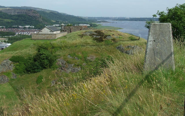
NS3974 : Dumbarton Rock and Castle
Thomas Nugent
Hill facts and local notes
Classifications
Elevation
74m
243 ft
Prominence
71m
Coordinates
55.9367, -4.5641
NS399744
OS Map
63 64
Explorer: OL38 341N 347
At the Summit
The summit features impressive ruins of the castle itself, including the Great Hall and battlements, along with a stunning viewpoint overlooking the river and surrounding countryside.
Terrain & Geology
Dumbarton Castle is primarily composed of volcanic rock, formed from ancient lava flows. The unique geological features afford stunning panoramic views over the Firth of Clyde.
Views & Scenery
From the summit, you can enjoy views of the Clyde Firth, the hills of Argyll, and the iconic Ben Lomond in the distance.
History & Heritage
Name Origin
The name 'Dumbarton' is derived from the Scottish Gaelic 'Dùn Breatainn', meaning 'Fort of the Britons'.
Historical Significance
Dumbarton Castle holds a significant historical role, being the capital of the ancient Kingdom of Strathclyde and has seen many battles and sieges throughout history.
Getting There & Facilities
Parking
There is public parking available in Dumbarton town centre, just a short walk from the trailhead.
Public Transport
Dumbarton has a railway station with services from Glasgow. Bus services also connect regularly.
Nearby Facilities
The town of Dumbarton offers several cafes, restaurants, and public toilets, making it a convenient stop before or after your hike.
Safety Information
Known Hazards
- At times, the path may be slippery after rain, so good footwear is advised.
General Safety Tips
- Check weather conditions before setting out
- Carry appropriate clothing and equipment
- Let someone know your planned route
- Take a map, compass, and GPS device
- Carry emergency supplies: food, water, first aid kit, torch
Hills
Some common questions about the hills answered
Are there group walks up Dumbarton Castle?
Many walkers use Walkmates to join or organise walks with others. You can check for group walks around Dumbarton Castle through the maps
Are there other walkers around Dumbarton Castle?
Activity varies by location and time, but Walkmates lets you see whether others have shared walks or shown interest in this area. Find other people through the walking friends search walking friends for Dumbarton Castle search or of course create your own walk for Dumbarton Castle
Can I organise a walk to Dumbarton Castle?
Yes. If there aren’t any walks listed already, you can create a walk and make it available for others to join.
If you're signed up to Walkmates, you can create a walk to Dumbarton Castle.
How do I find a walk up this hill?
There are often multiple ways to walk this hill, depending on experience and route preference. Walkmates helps you explore walks and routes that others have shared.
Can I suggest a new route up Dumbarton Castle?
Yes. You can suggest or create routes to share with others. Walkmates focuses on the social side of walking, so routes are used to help people organise walks and explore areas together, rather than as detailed navigation tools or route libraries.
Other uses really appreciate knowledgeable walkers sharing their routes. Share your favourite route to Dumbarton Castle here
The is an error or something incorrect about this hill. How do I let you know?
We always strive to keep the information on Walkmates as accurate as possible. If you find an error, please let us know through the contact form and we'll aim to correct it as quickly as possible
Community Discussion
Comments
Location
View the hill's mapped position and surrounding paths.
Grid reference: NS399744
View on OpenStreetMapOpens a map in a new tab, centred on the hill.
No comments yet. Be the first.