

Auchineden Hill
Good walks are even better shared.
Overview
Auchineden Hill: A Hidden Gem Near Glasgow
Nestled in the Scottish Highlands, Auchineden Hill may not be the tallest in the region, but what it lacks in height, it more than makes up for in charm and scenic views. At an elevation of 580 meters, this Marilyn offers a manageable climb for people of all ages while still rewarding you with panoramic vistas.
Geology
The hill is composed mainly of old volcanic rock, the remnants of ancient eruptions that shaped the landscape. Its distinctive features include steep slopes, rocky outcrops, and luscious greenery, all resulting from the glacial melt that sculpted the area over thousands of years.
Access
Accessing the hill is a cinch. The nearest parking area is located along the B757, which aligns perfectly with the trailhead. Public transport options are available, with buses running from Glasgow to the quaint town of Kirkintilloch, situated just a stone's throw from the hill. Make sure to check bus times before embarking on your adventure!
Trail Description
The circular route known as the 'Auchineden Hill Circular' provides a wonderful introduction to the pleasures of hiking in this region. Spanning approximately 4.5 km, the walk typically takes around 1.5 hours, making it a splendid choice for families and less seasoned hikers. The trail begins gently, leading you through picturesque scenery before the final ascent to the summit, where the views will make you feel on top of the world — with extra pounds for your effort!
Summit Features
Reaching the summit, you’ll find a classic trig point standing proud alongside a charming stone cairn, perfect for some photo opportunities to show off to family and friends — because if it's not on social media, did it even happen?
Hazards
While the terrain is generally accessible, be cautious of the notorious Highlands weather; it can turn from sunny to soggy faster than you can say 'scotch mist.' Make sure you've got sturdy footwear as the paths can be muddy and slippery, mainly in wet weather.
Nearby Attractions
While you’re in the area, don't miss out on the opportunity to wander over to the Campsie Fells or even tackle the mighty Ben Lomond. Auspiciously positioned for hiking adventures, Auchineden Hill is an excellent base for exploring further afield.
Conclusion
In conclusion, Auchineden Hill may not be the highest point in the Highlands, but it certainly holds its own when it comes to offering breathtaking views, delightful trails, and a healthy dose of fresh air. Don't forget your camera, and remember that every step brings you closer to the summit — and to that well-deserved cake back in Kirkintilloch!
Happy hiking!
Explore routes near Auchineden Hill
Public walks starting within 80 km of this hill. Nearby does not mean a route reaches the summit; check its map and access before setting out.
Strathkelvin Railway Path: Strathblane to Kirkintilloch
View route
West Highland Way: Milngavie to Drymen
View route
Paisley Walk with Men Walking & Talking
View route
Kirkintilloch to Twechar Bridge: Forth and Clyde Canal Return
View route
Route planning notes
These notes describe possible approaches, not verified navigable routes or permission to cross land. Check current paths, local access rules and conditions before setting out.
Auchineden Hill Circular
A scenic route starting from the parking area near the B757 road, taking you around the hill before ascending to the summit.
Make a day of it, together
Find someone to share the walk with, or organise a day out along a route you like.
Photo Gallery
View all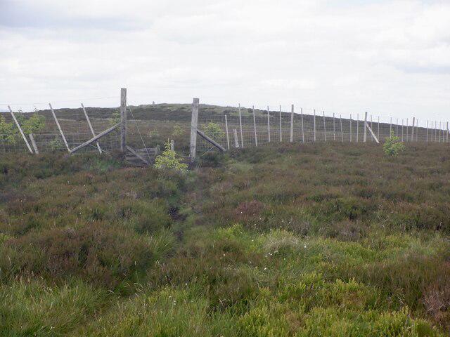 Photo could not load
NS4980 : Fence, and gap, Aucheneden Hill
Richard Webb
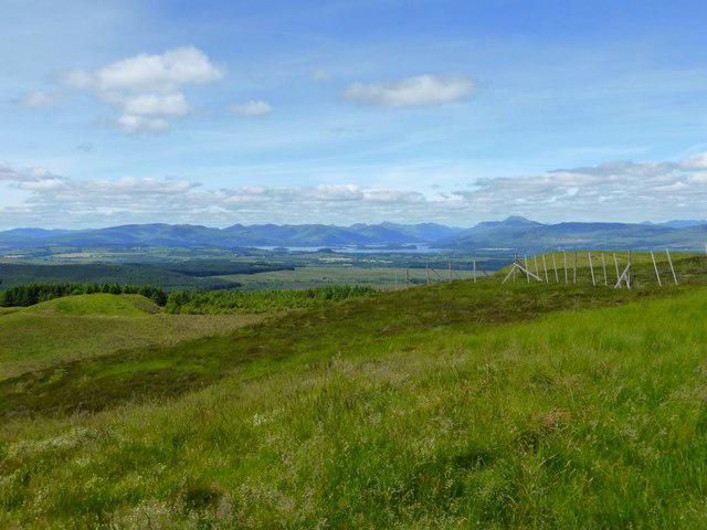 Photo could not load
NS4980 : Auchineden Hill [7]
Robert Murray
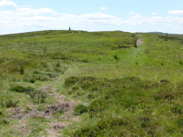 Photo could not load
NS4980 : Auchineden Hill [3]
Robert Murray
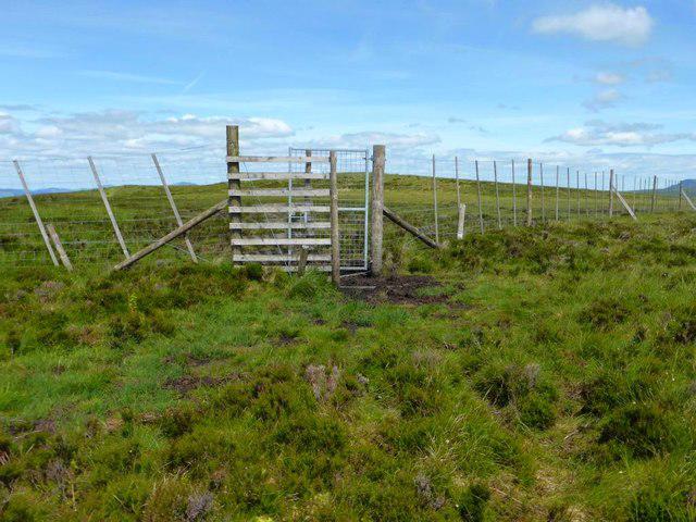 Photo could not load
NS4980 : Auchineden Hill [6]
Robert Murray
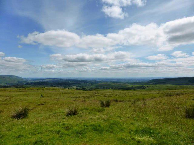 Photo could not load
NS4980 : Auchineden Hill [5]
Robert Murray
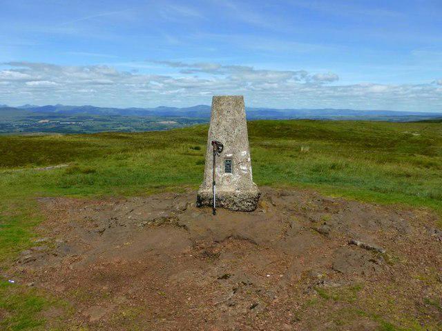 Photo could not load
NS4980 : Auchineden Hill [4]
Robert Murray
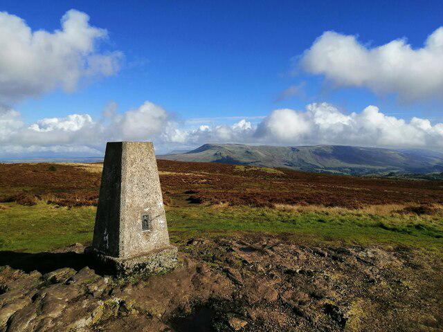 Photo could not load
NS4980 : Auchineden Hill trig point
Alec MacKinnon
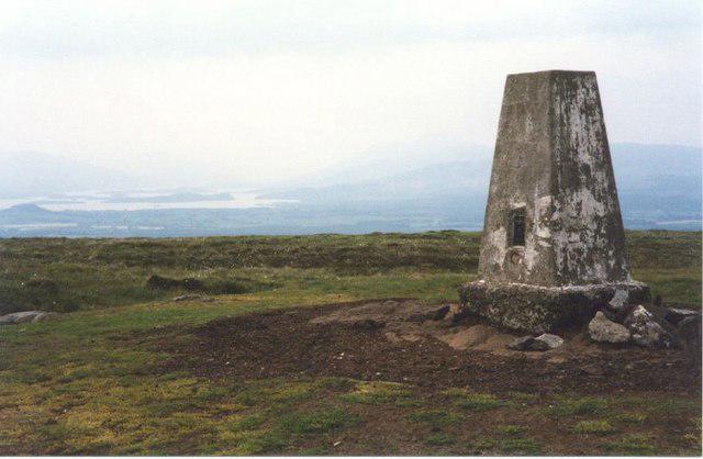 Photo could not load
NS4980 : Trig Point on Auchineden Hill
Sarah Charlesworth
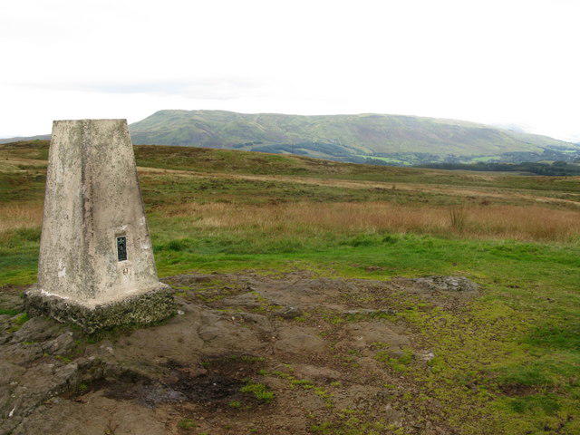 Photo could not load
NS4980 : Auchineden Hill Trig Point
G Laird
Hill facts and local notes
Classifications
Elevation
357m
1,171 ft
Prominence
108m
Coordinates
55.9933, -4.4160
NS494804
OS Map
64
Explorer: OL38 347
At the Summit
The summit is marked by a well-maintained trig point which offers a perfect backdrop for a selfie or two. There’s also a small stone cairn that’s been used by generations of hikers.
Terrain & Geology
The hill primarily consists of volcanic rock, with remnants of ancient lava flows. Its geological history is reflected in the varied topography, shaped by glacial activity during the last Ice Age.
Views & Scenery
From the summit, you can catch glimpses of the mighty Campsie Fells, the city of Glasgow to the south, and on a clear day, the distant outline of Ben Lomond.
History & Heritage
Name Origin
The name 'Auchineden' comes from the Scottish Gaelic 'Achadh Eidhne,' meaning 'field of the ivy,' which refers to the area's verdant foliage.
Historical Significance
This hill has been a beloved spot for local hikers for decades and serves as a popular training ground for those looking to tackle the more prominent peaks in the Highlands.
Getting There & Facilities
Check current local access restrictions, parking rules and transport timetables before travelling. These notes do not confirm public access to the summit.
Parking
There is a small parking area on the B757 road, just off the junction where the road meets the Auchineden Road (NS488813). Space can be a bit tight on busy weekends, so arrive early.
Public Transport
Regular bus services run from Glasgow to Kirkintilloch. It’s a short walk from the bus stop to the start of the trail.
Nearby Facilities
There are no facilities on the hill itself, but Kirkintilloch offers several cafes and toilets. The nearby Luss is also a lovely spot for a tea break after a day spent getting a dose of fresh air.
Safety Information
Known Hazards
- Beware of sudden weather changes in the Highlands. The path can be slippery in wet conditions, particularly in the grassy and boggy areas.
General Safety Tips
- Check weather conditions before setting out
- Carry appropriate clothing and equipment
- Let someone know your planned route
- Take a map, compass, and GPS device
- Carry emergency supplies: food, water, first aid kit, torch
Hills
Some common questions about the hills answered
Are there group walks up Auchineden Hill?
Many walkers use Walkmates to join or organise walks with others. You can check for group walks around Auchineden Hill through the maps
Are there other walkers around Auchineden Hill?
Activity varies by location and time, but Walkmates lets you see whether others have shared walks or shown interest in this area. Find other people through the walking friends search walking friends for Auchineden Hill search or of course create your own walk for Auchineden Hill
Can I organise a walk to Auchineden Hill?
Yes. If there aren’t any walks listed already, you can create a walk and make it available for others to join.
If you're signed up to Walkmates, you can create a walk to Auchineden Hill.
How do I find a walk up this hill?
There are often multiple ways to walk this hill, depending on experience and route preference. Walkmates helps you explore walks and routes that others have shared.
Can I suggest a new route up Auchineden Hill?
Yes. You can suggest or create routes to share with others. Walkmates focuses on the social side of walking, so routes are used to help people organise walks and explore areas together, rather than as detailed navigation tools or route libraries.
Other uses really appreciate knowledgeable walkers sharing their routes. Share your favourite route to Auchineden Hill here
The is an error or something incorrect about this hill. How do I let you know?
We always strive to keep the information on Walkmates as accurate as possible. If you find an error, please let us know through the contact form and we'll aim to correct it as quickly as possible
Community Discussion
Comments
Location
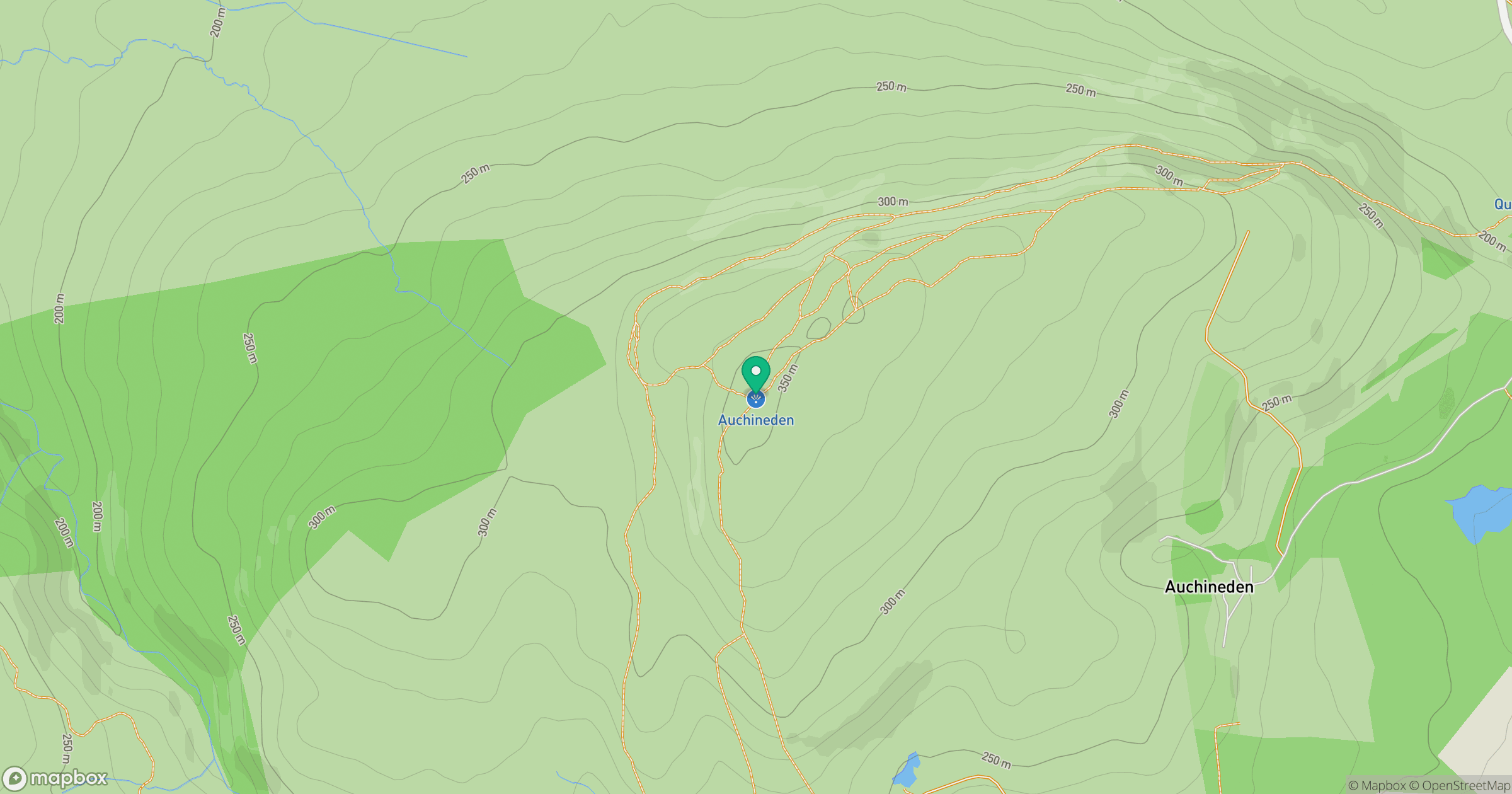
Grid reference: NS494804
View on OpenStreetMapOpens a map in a new tab, centred on the hill.
Hills within 30 km
Straight-line distance, not a walking route or confirmation of access.
No comments yet. Be the first.