

Disley Hill
Good walks are even better shared.
SJ9685 : Footpath at Disley Golf Course
Chris Wimbush Photo source
Overview
Disley Hill
Overview
Disley Hill, standing proudly at 300 meters, is more than just a bump on the map; it’s a charming Marilyn that offers both scenic beauty and a taste of the Peak District's geological history.
Geology
The hill is primarily composed of limestone and sandstone, laid down during the Carboniferous period. The area features intriguing karst formations, making it a geologist's playground. Don't be surprised if the rocks appear to have stories etched into them; they’ve been here far longer than we have!
Routes
The most popular route is the Disley Hill Circular Walk, which provides a great balance of scenery and challenge. This moderately difficult trek is about 5.5 km and takes roughly 1.5 hours. The route includes woodlands, fields, and fantastic views that make the occasional uphill struggle worthwhile.
Summit Features
Upon reaching the summit, hikers are greeted by a modest cairn. It’s a perfect spot for a break and a photo op – after all, who doesn’t want to show off their latest adventure on social media?
Terrain Type
The terrain here is wonderfully varied, with grassy patches giving way to rocky outcrops. It’s akin to a walk through nature's buffet – you get a little bit of everything!
Views
From the summit, you can take in spectacular views including the Peak Forest and the commanding Kinder Scout. The best seasons for these vistas are spring and autumn; however, a frosty winter morning can offer bouts of serene beauty as well. Just don't forget your camera — or a hot drink to sip while you admire the scenery!
Hazards
While the views are fantastic, do keep an eye on your footing, as some rocks can be a bit slippery, particularly on descents. Weather conditions can change quickly here; pack layers and be prepared for some classic British unpredictability.
Nearby Summits
If you're in the mood for more adventures, nearby summits include Kinder Scout, the highest point in the Peak District, and Shining Tor, both just a short distance away.
Access
Parking
Free parking is available at the Disley village car park, conveniently located just a quick stroll from the starting point of your trek.
Public Transport
For those relying on public transport, Disley Station is handy; trains from Manchester arrive reasonably frequently.
Nearest Town
The nearest town is Disley itself, famous for its delightful charm and warm local hospitality.
Facilities
There are a few local cafes and pubs in Disley for post-hike refreshments, along with public toilets to freshen up before your journey home.
History
Name Meaning
The name 'Disley' originates from Old English, meaning 'the clearing by the ditch', which speaks to the area’s agricultural heritage.
Significance
Historically, Disley Hill played a role in the lives of local miners and farmers, with its paths being part of a working landscape.
In conclusion, whether you’re looking to stretch your legs, enjoy the views, or dive into some local history, Disley Hill is an excellent destination that offers a little slice of the Peak District's charm without the fuss.
Happy hiking! 🎒
Explore routes near Disley Hill
Walks starting near this hill. Open a route to check its map, distance and full itinerary.
Mill Hill Liberator Wreckage via Harry Hut
View route
Old Glossop and Bleaklow Head Circular with B-29 Crash Site
View route
Longdendale Trail: Hadfield to Woodhead and back
View route
Quarry Bank: Styal Village and Arthur's Wood Long Loop
View route
Route planning notes
These notes describe possible approaches. Check a route's map and access information when planning your walk.
Disley Hill Circular Walk
A scenic route starting from the village of Disley, taking you through woodlands and open fields with stunning views.
Make a day of it, together
Find someone to share the walk with, or organise a day out along a route you like.
Photo Gallery
View all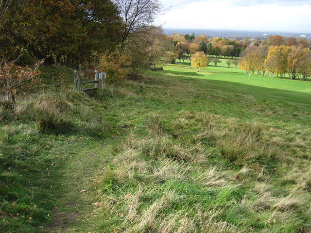 Photo could not load
SJ9685 : Footpath at Disley Golf Course
Chris Wimbush
Hill facts and local notes
Classifications
Elevation
240m
787 ft
Prominence
57m
Coordinates
53.3628, -2.0501
SJ967851
OS Map
109
Explorer: OL1W 268N
At the Summit
The summit boasts a small cairn alongside a great vantage point for photographs, perfect for the proud Instagrammer.
Terrain & Geology
Primarily a limestone and sandstone hill, Disley Hill exhibits characteristic formations of the Carboniferous era, featuring intriguing karst landscapes.
Views & Scenery
Visible landmarks include the stunning Peak Forest and the iconic Kinderscout plateau, making for a postcard perfect panorama.
History & Heritage
Name Origin
The name 'Disley' is derived from Old English, meaning 'the clearing by the ditch'.
Historical Significance
Historically, Disley Hill was part of a working landscape, and its trails were used by local miners and farmers.
Getting There & Facilities
Parking
Free parking is available in the Disley village car park, just a short walk to the trailhead.
Public Transport
Accessible via the local train service from Manchester; Disley station is conveniently close to the walk's starting point.
Nearby Facilities
A few local cafes and pubs in Disley offer refreshments, along with public toilets available in the village.
Safety Information
Known Hazards
- Watch for loose stones, especially on descent. Also, be aware of sudden changes in weather, as the hill can be quite exposed.
General Safety Tips
- Check weather conditions before setting out
- Carry appropriate clothing and equipment
- Let someone know your planned route
- Take a map, compass, and GPS device
- Carry emergency supplies: food, water, first aid kit, torch
Hills
Some common questions about the hills answered
Are there group walks up Disley Hill?
Many walkers use Walkmates to join or organise walks with others. You can check for group walks around Disley Hill through the maps
Are there other walkers around Disley Hill?
Activity varies by location and time, but Walkmates lets you see whether others have shared walks or shown interest in this area. Find other people through the walking friends search walking friends for Disley Hill search or of course create your own walk for Disley Hill
Can I organise a walk to Disley Hill?
Yes. If there aren’t any walks listed already, you can create a walk and make it available for others to join.
If you're signed up to Walkmates, you can create a walk to Disley Hill.
How do I find a walk up this hill?
There are often multiple ways to walk this hill, depending on experience and route preference. Walkmates helps you explore walks and routes that others have shared.
Can I suggest a new route up Disley Hill?
Yes. You can suggest or create routes to share with others. Walkmates focuses on the social side of walking, so routes are used to help people organise walks and explore areas together, rather than as detailed navigation tools or route libraries.
Other uses really appreciate knowledgeable walkers sharing their routes. Share your favourite route to Disley Hill here
The is an error or something incorrect about this hill. How do I let you know?
We always strive to keep the information on Walkmates as accurate as possible. If you find an error, please let us know through the contact form and we'll aim to correct it as quickly as possible
Community Discussion
Comments
Location
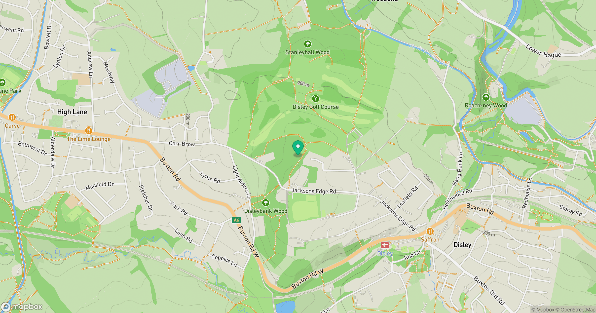
Grid reference: SJ967851
View on OpenStreetMapOpens a map in a new tab, centred on the hill.
Nearby Hills

Kinder Scout
636m
The Roaches
505m
Winter Hill
456m

Pendle Hill
557m
Rombalds Moor [Ilkley Moor]
402m
No comments yet. Be the first.