

Crug Mawr
Good walks are even better shared.
SO2622 : Crug Mawr, Patrishow
Alan Richards Photo source
Overview
Crug Mawr: An Adventure Awaits
Crug Mawr, standing proudly at 420 meters, is more than just a hill in the picturesque Brecon Beacons National Park; it’s a treasure trove of natural beauty, rich history, and spectacular views.
Geology
The geological makeup of Crug Mawr is primarily composed of sandstone and mudstone, typical of the captivating Cambrian landscape. The varied rock formations tell the story of a time long past when this area was shaped by the forces of nature. Keep an eye out for exposed strata as you ascend!
Routes
Crug Mawr Circular Walk
A gentle yet rewarding circular route, perfect for families and those looking for a brisk leg stretch—or a leisurely meander. Starting from the designated car park, this 5.5 km trail can typically be completed in about 2.5 hours, giving you ample time to soak in the scenery.
Direct Ascent from Cwmdu
For those seeking a bit more of a workout, the direct ascent from Cwmdu village presents a challenging option. This route measures approximately 4 km and will take around 2 hours, weaving through lush farmland and onto the more rugged terrain. Don’t forget your walking poles!
Summit Features
Upon reaching the summit, you're greeted by a robust stone cairn and breathtaking vistas that you’ll be inclined to photograph (or brag about later). From the top, take a moment to enjoy the sweeping views of Pen y Fan to the north and the enchanting Black Mountains stretching to the east.
Terrain Type
Expect a delightful mix of grassy slopes interspersed with rocky patches. Be mindful of boggy areas after a downpour, as they can turn even the keenest hiker into an impromptu mud wrestler!
Views
Crug Mawr delivers some of the finest panoramic views in the region. On a clear day, you can enjoy sights of the Severn Estuary, Pen y Fan, and beyond! Your camera will thank you for carrying it.
Hazards
As tempting as it may be, avoid skirting too close to the edge of the rocky outcrops, and keep an eye out for slippery paths, particularly if you've been graced by Welsh rain.
Access
The access point is conveniently positioned with a small car park near the start of the Crug Mawr Circular Walk. For those relying on public transport, Cwmdu village offers limited bus services—be sure to check schedules before your adventure.
Facilities
After your hike, treat yourself at a local café in Cwmdu, where you can grab a hot drink and use the facilities. You’ve earned it!
History
The name 'Crug Mawr' means 'Big Barrow', reminiscent of its historical roots. It’s believed that this area has been significant historically, with ancient burial mounds worth exploring.
In summary, whether you’re seeking a gentle stroll or an exhilarating climb, Crug Mawr has something for everyone. Pack your boots, grab your coat, and enjoy the great outdoors!
Happy Hiking!
Explore routes near Crug Mawr
Walks starting near this hill. Open a route to check its map, distance and full itinerary.
A Very Merry Winter Walk ending with Cake & a Hot Drink!
View route
Goytre Wharf to Pentre Bridge: Mon and Brec Canal Walk
View route
Clytha Estate: River Usk, Chapel Ruins and Castle Woods
View route
Brecon Basin to Brynich Aqueduct: Canal Towpath Walk
View route
Route planning notes
These notes describe possible approaches. Check a route's map and access information when planning your walk.
Crug Mawr Circular Walk
A scenic circular route starting from the car park at the base, providing lovely views at every turn.
Direct Ascent from Cwmdu
A more challenging direct ascent from Cwmdu village, ascending through open farmland and onto rocky terrain.
Make a day of it, together
Find someone to share the walk with, or organise a day out along a route you like.
Photo Gallery
View all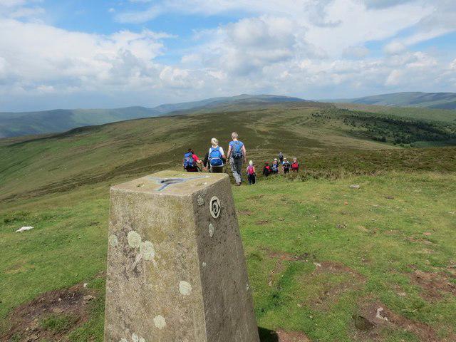 Photo could not load
SO2622 : Crug Mawr, Patrishow
Alan Richards
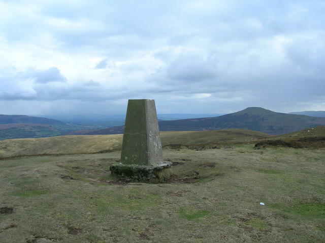 Photo could not load
SO2622 : Crug Mawr
James Ayres
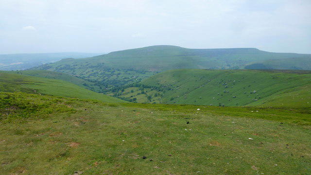 Photo could not load
SO2622 : View from Crug Mawr, 2
Jonathan Billinger
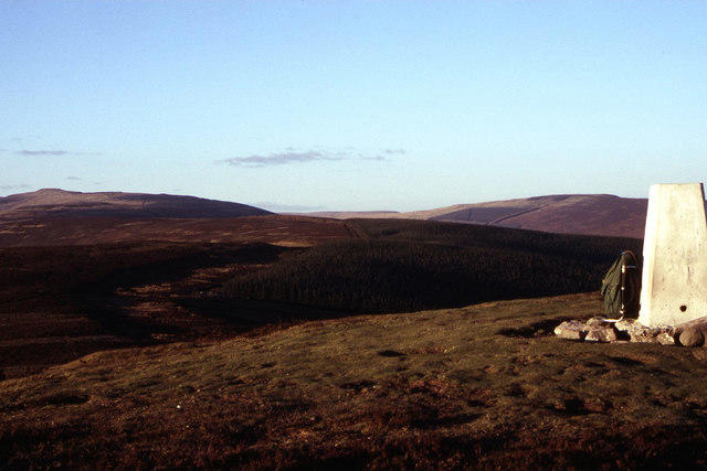 Photo could not load
SO2622 : Late afternoon on the summit of Crug Mawr
Colin Park
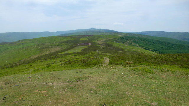 Photo could not load
SO2622 : View from Crug Mawr, 3
Jonathan Billinger
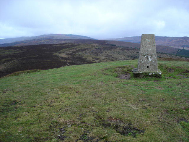 Photo could not load
SO2622 : Trig point on Crug Mawr
Philip Halling
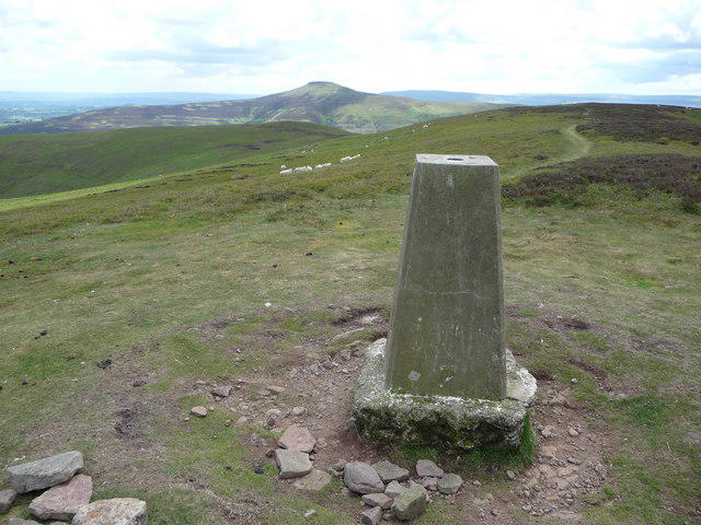 Photo could not load
SO2622 : Trig point on Crug Mawr with the Sugar Loaf to the south
Jeremy Bolwell
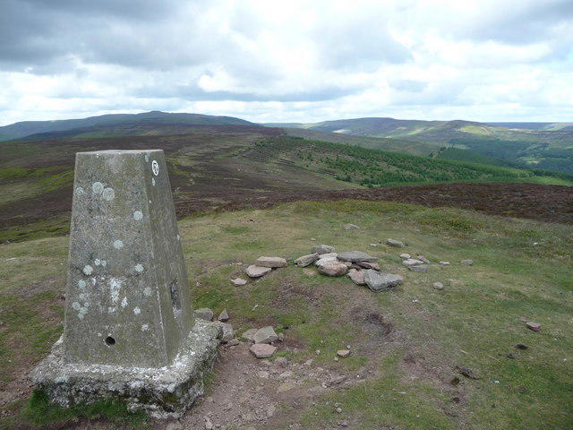 Photo could not load
SO2622 : The summit of Crug Mawr looking northwards
Jeremy Bolwell
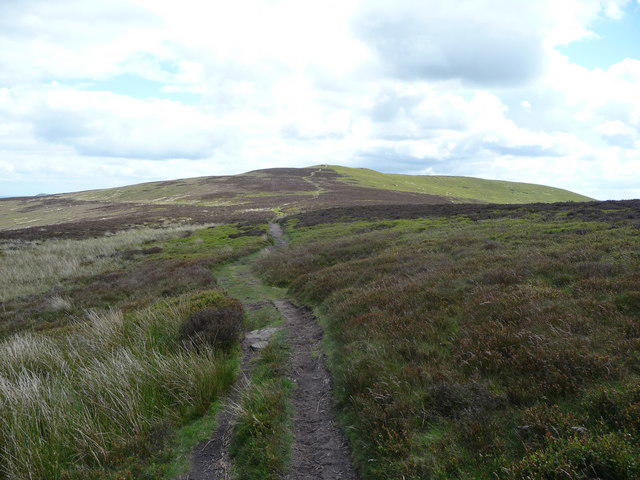 Photo could not load
SO2622 : Path leading south to Crug Mawr
Jeremy Bolwell
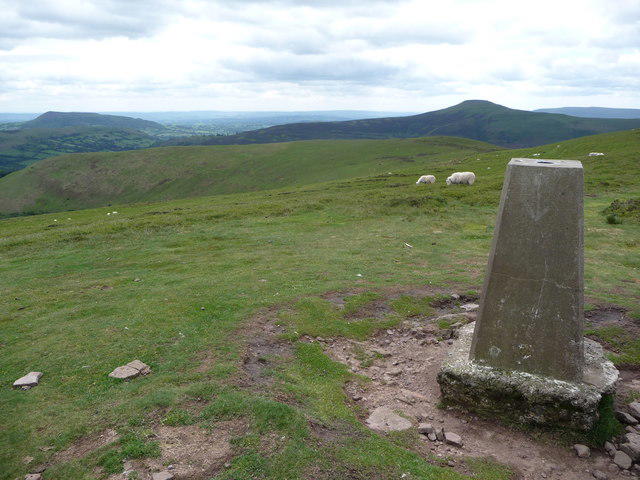
SO2622 : The summit of Crug Mawr
Jeremy Bolwell
Hill facts and local notes
Classifications
Elevation
550m
1,804 ft
Prominence
28m
Coordinates
51.8977, -3.0736
SO262226
OS Map
161
Explorer: OL13S
At the Summit
The summit features a well-built stone cairn and panoramic views of the surrounding Beacons and the Black Mountains in the distance.
Terrain & Geology
Dominated by sandstone and mudstone, Crug Mawr features classic Cambrian geology and offers fascinating insights into the region’s geological past.
Views & Scenery
Stunning views of Pen y Fan, Sugar Loaf, and the majestic Black Mountains. On a clear day, you might even spot the Severn Estuary.
History & Heritage
Name Origin
The name 'Crug Mawr' translates to 'Big Barrow', likely reflecting its historic significance as a burial site or marker.
Historical Significance
The area has archaeological significance, with evidence of ancient burial mounds and settlements, making it an intriguing stop for history buffs.
Getting There & Facilities
Parking
There is a small car park at the start of the Crug Mawr Circular Walk, providing a convenient base for your hike.
Public Transport
The nearest bus stop is in the village of Cwmdu, with limited services available. Check local schedules before planning your trip.
Nearby Facilities
The nearest facilities are in Cwmdu, which boasts a charming café serving refreshments and toilets.
Safety Information
Known Hazards
- Beware of slippery terrain, particularly after rain, and take care in the rocky areas. Mobile reception may be minimal.
General Safety Tips
- Check weather conditions before setting out
- Carry appropriate clothing and equipment
- Let someone know your planned route
- Take a map, compass, and GPS device
- Carry emergency supplies: food, water, first aid kit, torch
Hills
Some common questions about the hills answered
Are there group walks up Crug Mawr?
Many walkers use Walkmates to join or organise walks with others. You can check for group walks around Crug Mawr through the maps
Are there other walkers around Crug Mawr?
Activity varies by location and time, but Walkmates lets you see whether others have shared walks or shown interest in this area. Find other people through the walking friends search walking friends for Crug Mawr search or of course create your own walk for Crug Mawr
Can I organise a walk to Crug Mawr?
Yes. If there aren’t any walks listed already, you can create a walk and make it available for others to join.
If you're signed up to Walkmates, you can create a walk to Crug Mawr.
How do I find a walk up this hill?
There are often multiple ways to walk this hill, depending on experience and route preference. Walkmates helps you explore walks and routes that others have shared.
Can I suggest a new route up Crug Mawr?
Yes. You can suggest or create routes to share with others. Walkmates focuses on the social side of walking, so routes are used to help people organise walks and explore areas together, rather than as detailed navigation tools or route libraries.
Other uses really appreciate knowledgeable walkers sharing their routes. Share your favourite route to Crug Mawr here
The is an error or something incorrect about this hill. How do I let you know?
We always strive to keep the information on Walkmates as accurate as possible. If you find an error, please let us know through the contact form and we'll aim to correct it as quickly as possible
Community Discussion
Comments
Location
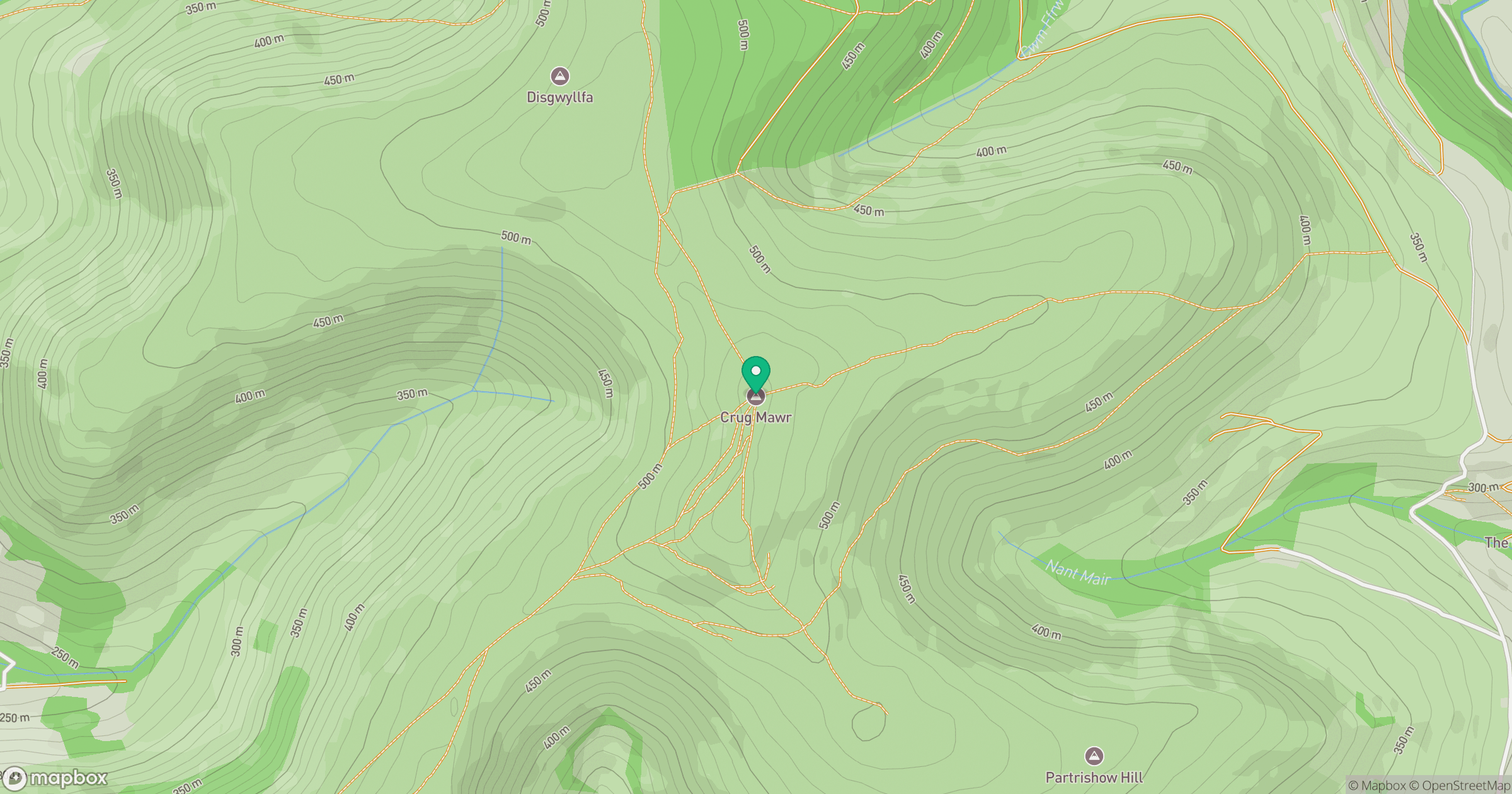
Grid reference: SO262226
View on OpenStreetMapOpens a map in a new tab, centred on the hill.


No comments yet. Be the first.