

Crich Beacon
Good walks are even better shared.
SK3455 : Abandoned aggregate sorter at Crich Cliff Quarry
Graham Hogg Photo source
Overview
Crich Beacon: A Summit with a View
Overview
Crich Beacon stands proudly at 402 meters, welcoming trekkers with its stunning vistas and accessible trails. Located in the heart of Derbyshire, it offers a slice of the Peak District that is not to be missed.
Geology
This magnificent hill is primarily composed of limestone, which results in some striking geological features. Additionally, the limestone karst formations in the area add to Crich Beacon's intrigue and are worth a gander for geology enthusiasts.
Access
Reaching Crich Beacon is a breeze! Start your journey at the Crich Hill car park located on the A615, which provides easy access to the trails. Buses also regularly service the village of Crich from surrounding towns, so you can leave the car behind.
Routes
The Crich Hill Loop is a delightful 4.5 km round trip that should take approximately 1.5 hours. It’s considered moderate, making it perfect for families and those looking to enjoy the scenery. The adventure begins in the woods and escalates to breathtaking views that will make your Instagram followers envious.
Summit Features
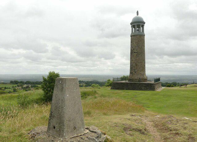
Upon reaching the top, you'll be greeted by a trig point proudly proclaiming its presence. It’s a great spot to snap some 'I conquered this peak' photos! Take a moment to soak in the panoramic view that stretches across the Peak District, and don’t forget to look out for Matlock and even Derby on a clear day.
Terrain
Expect a mix of grassy paths with some rocky sections. The terrain is generally friendly, though do watch your step on the more uneven stretches! Remember, the ground can be slippery after rain, so tread carefully.
Views
One of the highlights from the summit is undoubtedly the sweeping views of the surrounding hills and valleys. Spring and early autumn are particularly delightful times to visit, when the landscape bursts with colour and visibility is at its peak.
Hazards
While the trails are generally safe, please be cautious near rocky areas, especially when they're wet. You wouldn’t want to take an unexpected tumble; it’s not quite the ‘leap of faith’ you’re aiming for!
Nearby Summits
Crich Beacon sits proudly among several other notable peaks. Nearby you’ll find Carlton Hill and Matlock Hill, both of which are worth a visit if you're looking to extend your adventure.
Facilities
Once you've made it back down, treat yourself at one of Crich's charming cafes or pubs. The village also offers public toilet facilities for those in need after their jaunt.
History
The name 'Crich' has origins in Old Norse, hinting at a long history of settlement in the area. Historically, Crich Beacon served as a key navigational landmark for those wandering through the rugged landscape.
Conclusion
Crich Beacon is a must-visit for anyone seeking an easily accessible hike with rewarding views and a touch of history. Pack your walking boots, grab some snacks, and set forth on an adventure!
Explore routes near Crich Beacon
Walks starting near this hill. Open a route to check its map, distance and full itinerary.
Cromford Canal to Whatstandwell: towpath return
View route
Cromford Canal guided walk
View route
Cromford Canal guided walk
View route
Cromford Canal guided walk
View route
Route planning notes
These notes describe possible approaches. Check a route's map and access information when planning your walk.
Crich Hill Loop
A popular route starting from the village, taking you through woodlands and offering stunning views as you ascend towards the beacon.
Make a day of it, together
Find someone to share the walk with, or organise a day out along a route you like.
Photo Gallery
View all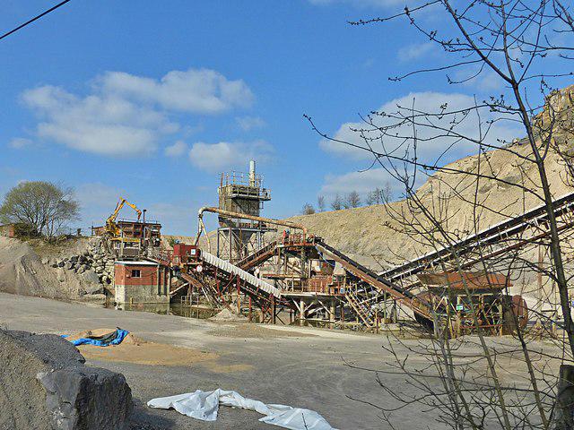 Photo could not load
SK3455 : Abandoned aggregate sorter at Crich Cliff Quarry
Graham Hogg
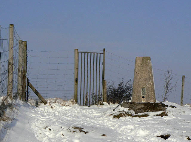 Photo could not load
SK3455 : Triangulation Pillar on Crich Stand
Alan Murray-Rust
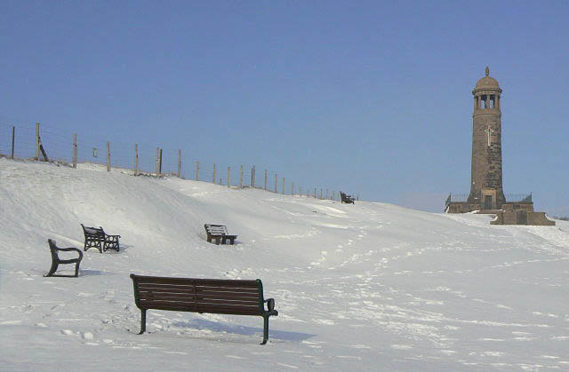 Photo could not load
SK3455 : Unused benches
Alan Murray-Rust
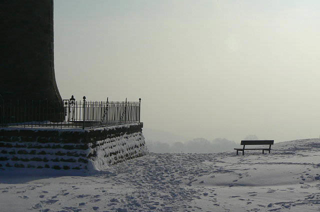 Photo could not load
SK3455 : On a clear day . . .
Alan Murray-Rust
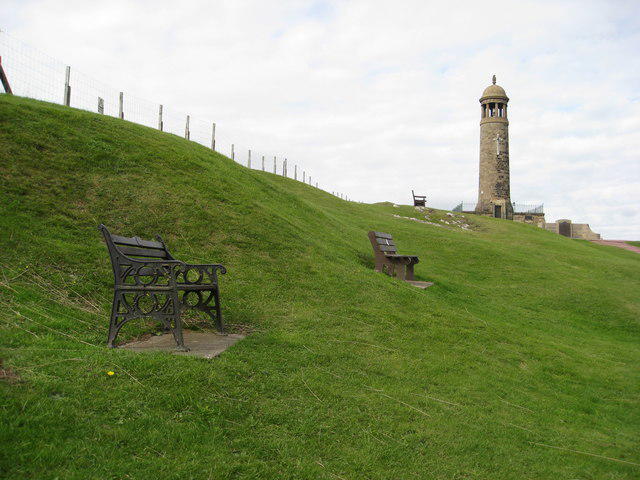 Photo could not load
SK3455 : Crich Stand
Alan Heardman
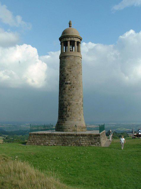 Photo could not load
SK3455 : Crich Stand
Paul Brooker
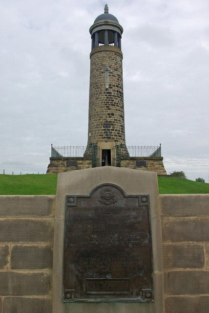 Photo could not load
SK3455 : Crich Stand
Stephen McKay
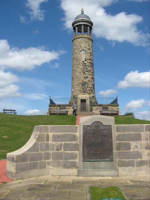 Photo could not load
SK3455 : Sherwood Foresters Memorial Crich
DTwigg
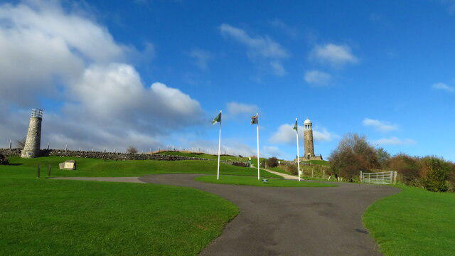 Photo could not load
SK3455 : Crich Memorial & approach path from south
Colin Park
SK3455 : Crich Stand
Alan Murray-Rust
Hill facts and local notes
Classifications
Elevation
286m
938 ft
Prominence
48m
Coordinates
53.0947, -1.4883
SK343553
OS Map
119
Explorer: OL24E 269
At the Summit
The summit features a prominent trig point, which is ideal for those 'I was here' photos. There are also breathtaking panoramic views to be enjoyed.
Terrain & Geology
Crich Beacon is primarily composed of limestone, which forms dramatic crags and rocky outcrops. The area also features some interesting karstic features due to the underlying geology.
Views & Scenery
From the summit, you can see the rolling hills of the Peak District, the quaint village of Crich, and if you're lucky, a glimpse of the distant Derby skyline.
History & Heritage
Name Origin
The name 'Crich' is thought to derive from the Old Norse word 'krik' meaning 'a bend' or 'a nook'.
Historical Significance
Historically, Crich Beacon has served as a navigation point for travellers and is tied to local folklore.
Getting There & Facilities
Parking
There is a small car park at the base of Crich Hill on the A615, offering easy access to the trailhead.
Public Transport
Buses to Crich run regularly from nearby towns such as Belper and Matlock.
Nearby Facilities
Crich boasts several cafes and pubs where you can refuel after your trek; public toilets are also available near the village centre.
Safety Information
Known Hazards
- Care should be taken on rocky sections, particularly after rain when surfaces can be slippery.
General Safety Tips
- Check weather conditions before setting out
- Carry appropriate clothing and equipment
- Let someone know your planned route
- Take a map, compass, and GPS device
- Carry emergency supplies: food, water, first aid kit, torch
Hills
Some common questions about the hills answered
Are there group walks up Crich Beacon?
Many walkers use Walkmates to join or organise walks with others. You can check for group walks around Crich Beacon through the maps
Are there other walkers around Crich Beacon?
Activity varies by location and time, but Walkmates lets you see whether others have shared walks or shown interest in this area. Find other people through the walking friends search walking friends for Crich Beacon search or of course create your own walk for Crich Beacon
Can I organise a walk to Crich Beacon?
Yes. If there aren’t any walks listed already, you can create a walk and make it available for others to join.
If you're signed up to Walkmates, you can create a walk to Crich Beacon.
How do I find a walk up this hill?
There are often multiple ways to walk this hill, depending on experience and route preference. Walkmates helps you explore walks and routes that others have shared.
Can I suggest a new route up Crich Beacon?
Yes. You can suggest or create routes to share with others. Walkmates focuses on the social side of walking, so routes are used to help people organise walks and explore areas together, rather than as detailed navigation tools or route libraries.
Other uses really appreciate knowledgeable walkers sharing their routes. Share your favourite route to Crich Beacon here
The is an error or something incorrect about this hill. How do I let you know?
We always strive to keep the information on Walkmates as accurate as possible. If you find an error, please let us know through the contact form and we'll aim to correct it as quickly as possible
Community Discussion
Comments
Location
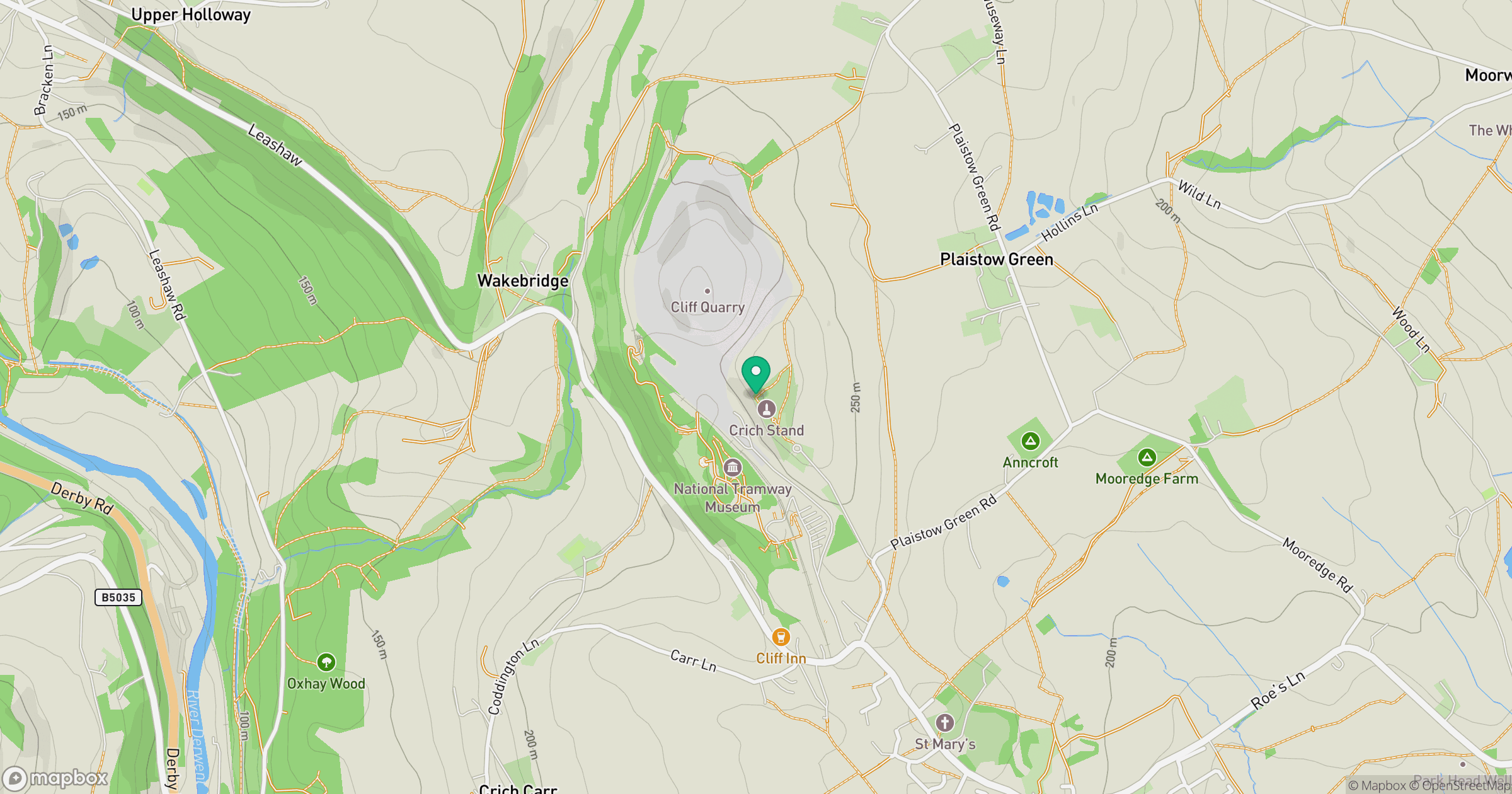
Grid reference: SK343553
View on OpenStreetMapOpens a map in a new tab, centred on the hill.
Nearby Hills

Kinder Scout
636m
The Roaches
505m
Rombalds Moor [Ilkley Moor]
402m

Pendle Hill
557m

The Wrekin
407m
No comments yet. Be the first.