

Creuch Hill
Good walks are even better shared.
NS2668 : Ruined Sheepfold on Creuch Hill
Leslie Barrie Photo source
Overview
Creuch Hill: A Hiker's Delight
Nestled in the heart of Central Scotland, Creuch Hill stands tall at an elevation of 539 meters (1,768 feet) and is classified as a Marilyn due to its prominence of 105 meters. This delightful hill is popular among hikers, offering an enticing blend of scenic beauty and geological interest.
Geology
With a composition of volcanic rock that harks back to the Tertiary period, Creuch Hill is not just another pretty face. Its rocky outcrops, remnants of ancient lava flows, make it a haven for geology buffs. Bring a rock hammer—just kidding, leave the hammer at home!
Routes
One popular route to summit Creuch Hill is the Campsie Fells Trail, which starts at the Campsie Glen. This moderate trek covers 8.0 km and typically takes about 3.5 hours. You’ll be treated to rolling hills, grazing sheep, and perhaps some curious llamas—though the latter might just be wishful thinking!
Summit Features
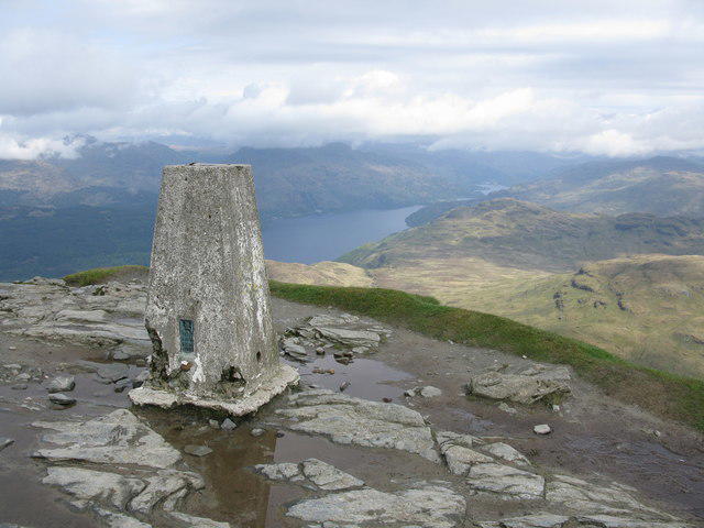
At the summit, you'll find a sturdy trig point proudly standing guard, along with a stone cairn that invites weary hikers to sit, rest, and soak in the views. It’s an Instagram paradise, provided you can catch a clear day!
Terrain
The terrain is predominantly grassy, with rocky sections that may challenge your balance (even if there’s no actual challenge!). Beware of the boggy patches that love to surprise unwary walkers. Remember, boots are your allies—keep them close!
Views
From the top, outstanding views await, showcasing significant landmarks like Loch Lomond and the Trossachs, and in fine weather, the majestic peaks of the Highlands stand proud in the distance. For the best swathes of visibility, visit in spring or autumn when nature puts on its finest coat.
Hazards
While Creuch Hill is an inviting destination, heed the potential hazards: slippery paths, sudden weather changes, and perhaps a cheeky bog that may try to claim your wellies. Stay alert, laugh in the face of danger, and be sure to pack a sense of humour!
Nearby Summits
For those keen to explore more, nearby summits include Buchanan Hill (560 m) and Dumgoyne (396 m), both worthy of your trekking time.
Access
Accessing Creuch Hill is straightforward. The nearest parking can be found at Campsie Glen, with further parking available in the village of Strathblane. Regular bus services from Glasgow head to Strathblane, making this beauty accessible to all.
Facilities
Post-hike, Strathblane welcomes you with various facilities including cafes, local shops, and public toilets at the park entrance, ensuring you can grab a bite and refresh after your adventure.
History
Creuch Hill’s name, believed to mean 'battle' or 'strife', hints at its significance in local history. It has served as a landmark for centuries, bearing testimony to the stories of those who roamed its slopes.
Creuch Hill is indeed a gem in the Central Scotland landscape, offering outdoor enthusiasts a mix of adventure, geological wonder, and peaceful vistas—all without breaking a sweat (unless it's a warm day, then all bets are off).
Conclusion
So, pack your gear, lace up your boots, and hit the trail. Creuch Hill is waiting for you, and its scenic charms promise an unforgettable outing! Don’t forget to bring your love for nature and perhaps a bit of cake for that well-deserved summit snack.
Explore routes near Creuch Hill
Walks starting near this hill. Open a route to check its map, distance and full itinerary.
West Bay walk and talk
View route
West Bay walk and talk
View route
West Bay morning walk and silent disco
View route
Bishop’s Glen group walk
View route
Route planning notes
These notes describe possible approaches. Check a route's map and access information when planning your walk.
Campsie Fells Trail
A popular route starting from the nearby Campsie Glen, winding through scenic landscapes before ascending towards the summit.
Make a day of it, together
Find someone to share the walk with, or organise a day out along a route you like.
Photo Gallery
View all Photo could not load
NS2668 : Ruined Sheepfold on Creuch Hill
Leslie Barrie
 Photo could not load
NS2668 : Ruined Sheepfold on Creuch Hill
Leslie Barrie
 Photo could not load
NS2668 : Rock outcrops on Creuch Hill
Leslie Barrie
 Photo could not load
NS2668 : Creuch Hill
Thomas Nugent
 Photo could not load
NS2668 : Creuch Hill
Raibeart MacAoidh
 Photo could not load
NS2668 : Creuch Hill (trig point)
Raibeart MacAoidh
 Photo could not load
NS2668 : Creuch Hill
Raibeart MacAoidh
 Photo could not load
NS2668 : Demolished Triangulation Pillar on Creuch Hill
Mark Nightingale
 Photo could not load
NS2668 : Trig Point remains on Creuch Hill
Leslie Barrie
 Photo could not load
NS2668 : Creuch Hill
Raibeart MacAoidh
Hill facts and local notes
Classifications
Elevation
441m
1,447 ft
Prominence
88m
Coordinates
55.8783, -4.7751
NS265685
OS Map
63
Explorer: 341N
At the Summit
The summit features a prominent trig point and a stone cairn, providing an ideal spot for a well-deserved rest and some panoramic views.
Terrain & Geology
Creuch Hill is primarily composed of volcanic rock, with remnants of ancient lava flows visible in the rocky outcrops. This geology dates back to the Tertiary period, making it a fascinating study for geology enthusiasts.
Views & Scenery
From the summit, enjoy stunning views of the Trossachs, Loch Lomond, and even the distant peaks of the Highlands on a clear day.
History & Heritage
Name Origin
The name 'Creuch' is believed to derive from the Gaelic word 'Creuch' meaning a 'battle' or 'strife', hinting at historical conflicts in the surrounding areas.
Historical Significance
Creuch Hill has long been a landmark for the local community and was once a strategic lookout point in times of yore.
Getting There & Facilities
Parking
There is limited parking at the base near the entrance of Campsie Glen, with additional space available at the village of Strathblane, which is about 3 kilometres away.
Public Transport
Regular bus services from Glasgow to Strathblane make it accessible for public transport users. Check local services for the best options.
Nearby Facilities
Strathblane offers several facilities, including cafes and small shops. Public toilets can be found at the park entrance but best take the essentials just in case!
Safety Information
Known Hazards
- Muddy and slippery paths in wet weather, sudden temperature changes, and the occasional bog that may try to swallow your boots.
General Safety Tips
- Check weather conditions before setting out
- Carry appropriate clothing and equipment
- Let someone know your planned route
- Take a map, compass, and GPS device
- Carry emergency supplies: food, water, first aid kit, torch
Hills
Some common questions about the hills answered
Are there group walks up Creuch Hill?
Many walkers use Walkmates to join or organise walks with others. You can check for group walks around Creuch Hill through the maps
Are there other walkers around Creuch Hill?
Activity varies by location and time, but Walkmates lets you see whether others have shared walks or shown interest in this area. Find other people through the walking friends search walking friends for Creuch Hill search or of course create your own walk for Creuch Hill
Can I organise a walk to Creuch Hill?
Yes. If there aren’t any walks listed already, you can create a walk and make it available for others to join.
If you're signed up to Walkmates, you can create a walk to Creuch Hill.
How do I find a walk up this hill?
There are often multiple ways to walk this hill, depending on experience and route preference. Walkmates helps you explore walks and routes that others have shared.
Can I suggest a new route up Creuch Hill?
Yes. You can suggest or create routes to share with others. Walkmates focuses on the social side of walking, so routes are used to help people organise walks and explore areas together, rather than as detailed navigation tools or route libraries.
Other uses really appreciate knowledgeable walkers sharing their routes. Share your favourite route to Creuch Hill here
The is an error or something incorrect about this hill. How do I let you know?
We always strive to keep the information on Walkmates as accurate as possible. If you find an error, please let us know through the contact form and we'll aim to correct it as quickly as possible
Community Discussion
Comments
Location
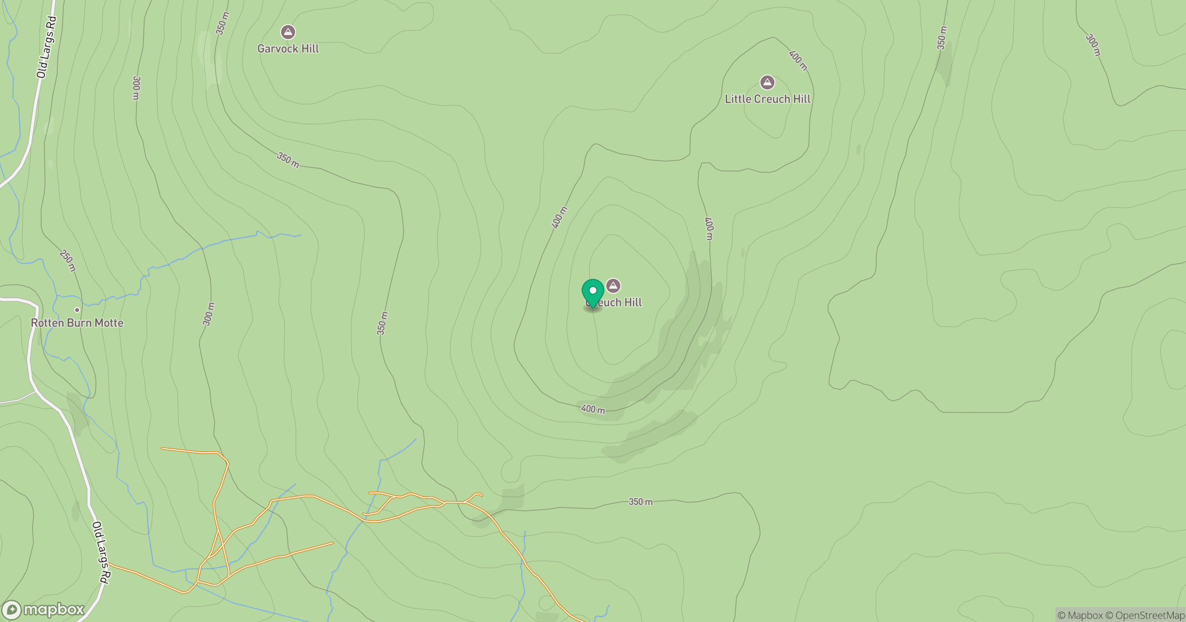
Grid reference: NS265685
View on OpenStreetMapOpens a map in a new tab, centred on the hill.

No comments yet. Be the first.