
Creag Dhearg
Good walks are even better shared.
Overview
Creag Dhearg
Introduction
Nestled in the heart of the Scottish Highlands, Creag Dhearg is a stunning Marilyn that stands at 450 meters. Its distinctive reddish sandstone and sweeping views make it a delightful destination for walkers and nature enthusiasts alike.
Geology
Creag Dhearg boasts Old Red Sandstone, which was formed millions of years ago. This rock type lends the hill its characteristic colour and provides an interesting landscape of rocky outcrops and gentle slopes. As you tread softly over its terrain, you may notice evidence of glacial activity which has shaped this beautiful part of the Highlands.
Routes
One of the most popular routes begins from Loch Duntelchaig, where you can enjoy an invigorating 6.5 km ascent. The slopes are moderate, with some rocky terrain to navigate, but don’t worry—it’s not a race against the clock! Allow about 2.5 hours for your journey, taking time to soak in the scenery along the way.
Summit Features
At the summit, you'll find a cairn waiting to welcome you at the peak. It’s a perfect spot to snap a selfie and boast to your friends about your 'mighty' ascent. The panoramic views from here are simply marvellous, allowing you to gaze upon Loch Ness and beyond.
Terrain
Prepare for a blend of rocky paths and grassy slopes; the trickiest parts may be where the bogs like to play hide and seek with your boots. Be sure to wear sturdy footwear and watch your step!
Views
If it’s a clear day, you’re in for a treat! Look out towards Ben Wyvis and enjoy the sprawling landscape of the Highlands. The best seasons for optimal views are in late spring and autumn, especially when the colours are vibrant and the air is clear.
Hazards
As always in the mountains, be mindful of changing weather patterns. Sudden downpours can make the slopes slippery, turning your walk into a rather soggy adventure. Always check the weather before setting off and bring appropriate gear.
Access
Reaching Creag Dhearg is relatively easy with a small parking area at Loch Duntelchaig. If you’re relying on public transport, regular bus services from Inverness can get you close, and taxis are easy to arrange to the trailhead.
Facilities
Inverness, just a short drive away, boasts an array of cafes to refuel and public toilets to refresh yourself before or after your hike.
Conclusion
Creag Dhearg is undoubtedly a gem of the Scottish Highlands, offering both challenge and beauty for those willing to make the climb. So, lace up your boots, grab your walking stick, and let the adventure begin!
Explore routes near Creag Dhearg
Walks starting near this hill. Open a route to check its map, distance and full itinerary.
Aberfeldy: Glassie Woodland and River Tay Circular
View route
Rothiemurchus: Beaver Trail and Lochan Mor
View route
Aviemore: Loch an Eilein and the Croft Track from Rothiemurchus
View route
Unled club outing: West Drumochter/Beinn Udlamain (coach departure)
View route
Route planning notes
These notes describe possible approaches. Check a route's map and access information when planning your walk.
The Northern Approach
Starting from the nearby loch, this route winds gently up the northern slope of Creag Dhearg, offering picturesque views as you ascend.
Make a day of it, together
Find someone to share the walk with, or organise a day out along a route you like.
Hill facts and local notes
Classifications
Elevation
664m
2,178 ft
Prominence
24m
Coordinates
56.8792, -3.6566
NN991776
OS Map
43
Explorer: OL51E 394E
At the Summit
At the summit, there is a modest cairn that has been built to mark the peak, alongside stunning panoramic views stretching across the Highlands.
Terrain & Geology
Creag Dhearg is primarily composed of Old Red Sandstone, which gives it a distinctive reddish hue. The area features typical Highland geology with glacial features and rocky outcrops.
Views & Scenery
From the summit, you can see Loch Ness to the north and the rugged peaks of the northern Highlands, including Ben Wyvis.
History & Heritage
Name Origin
The name 'Creag Dhearg' translates to 'Red Rock' in Gaelic, likely referring to the rock's reddish hue.
Historical Significance
This mountain holds cultural significance to the local Highland clans, with legends tied to nearby lochs and historical documents.
Getting There & Facilities
Parking
There is a small parking area at the trailhead near Loch Duntelchaig, providing enough room for several cars.
Public Transport
Regular bus services operate from Inverness to nearby villages, with options for taxis available from the bus stops.
Nearby Facilities
While there are no facilities directly on the mountain, Inverness offers a range of cafes and toilets, making it a convenient base for your adventure.
Safety Information
Known Hazards
- Watch out for sudden weather changes and slippery rocks, especially on the descent. The terrain can become boggy, slowing your progress if it rains.
General Safety Tips
- Check weather conditions before setting out
- Carry appropriate clothing and equipment
- Let someone know your planned route
- Take a map, compass, and GPS device
- Carry emergency supplies: food, water, first aid kit, torch
Hills
Some common questions about the hills answered
Are there group walks up Creag Dhearg?
Many walkers use Walkmates to join or organise walks with others. You can check for group walks around Creag Dhearg through the maps
Are there other walkers around Creag Dhearg?
Activity varies by location and time, but Walkmates lets you see whether others have shared walks or shown interest in this area. Find other people through the walking friends search walking friends for Creag Dhearg search or of course create your own walk for Creag Dhearg
Can I organise a walk to Creag Dhearg?
Yes. If there aren’t any walks listed already, you can create a walk and make it available for others to join.
If you're signed up to Walkmates, you can create a walk to Creag Dhearg.
How do I find a walk up this hill?
There are often multiple ways to walk this hill, depending on experience and route preference. Walkmates helps you explore walks and routes that others have shared.
Can I suggest a new route up Creag Dhearg?
Yes. You can suggest or create routes to share with others. Walkmates focuses on the social side of walking, so routes are used to help people organise walks and explore areas together, rather than as detailed navigation tools or route libraries.
Other uses really appreciate knowledgeable walkers sharing their routes. Share your favourite route to Creag Dhearg here
The is an error or something incorrect about this hill. How do I let you know?
We always strive to keep the information on Walkmates as accurate as possible. If you find an error, please let us know through the contact form and we'll aim to correct it as quickly as possible
Community Discussion
Comments
Location
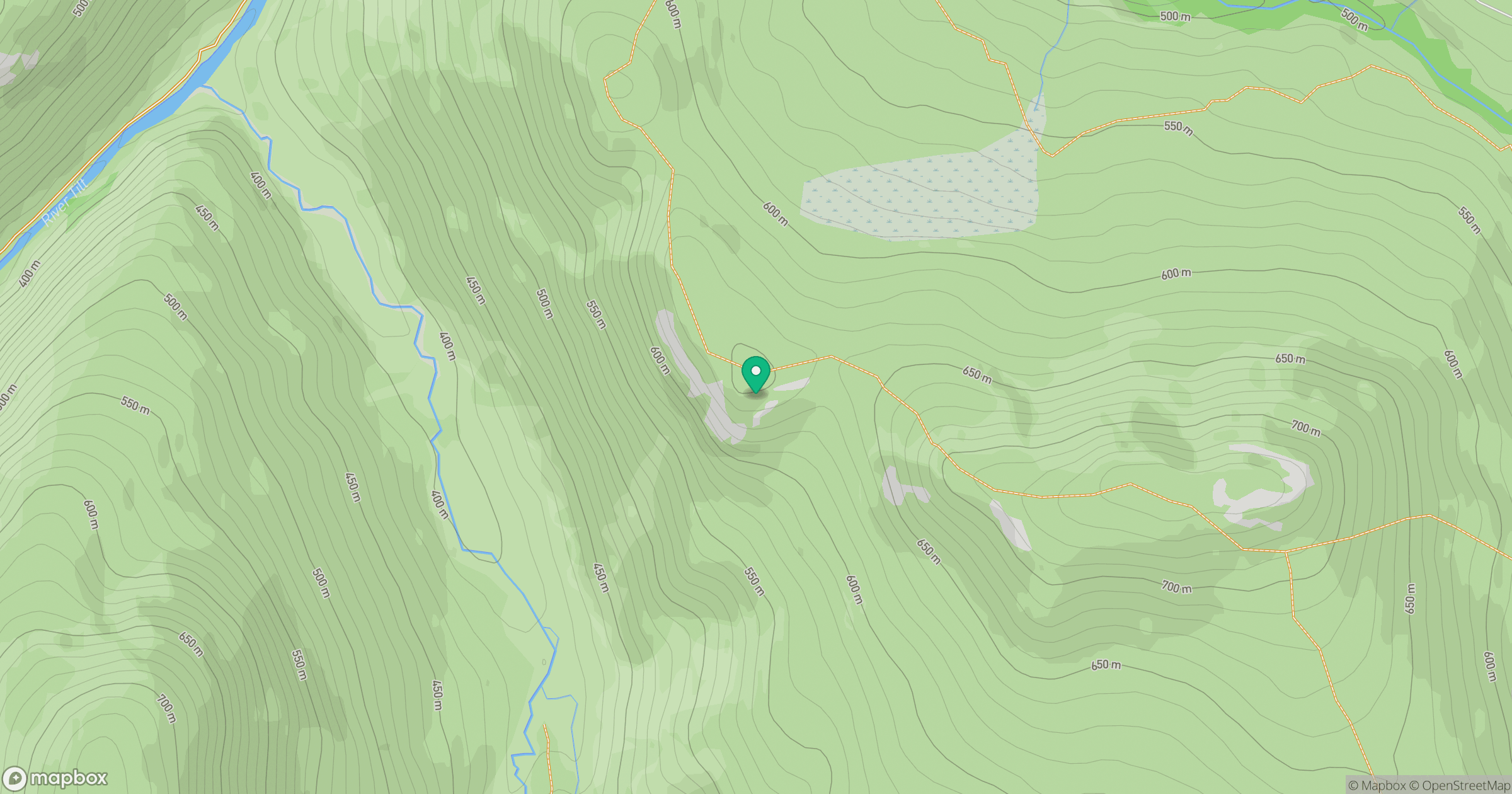
Grid reference: NN991776
View on OpenStreetMapOpens a map in a new tab, centred on the hill.
![Ben Macdui [Beinn Macduibh]](https://cdn.walkmates.com/gallery-images/e60cf32aeb394c3282fcdd14a63368f0.jpg)
No comments yet. Be the first.