

Creag an Leth-choin North Top
Good walks are even better shared.
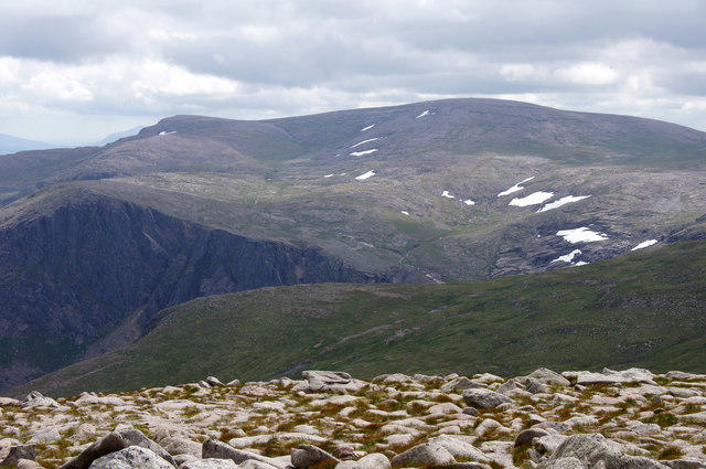
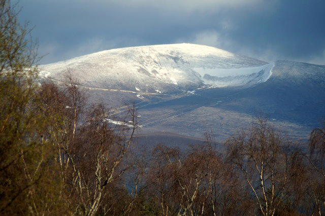
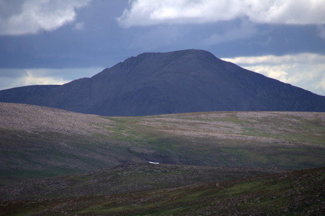
NH9603 : Northern top of Lurcher's Crag
Jim Barton Photo source
Overview
Creag an Leth-choin North Top
The Creag an Leth-choin North Top stands tall at 922 meters and is located in the breathtaking Scottish Highlands. This mountain is classified as a Hewitt and Marilyn, drawing hikers eager for both a challenge and the chance to revel in stunning vistas.
Geology
The mountain's formidable geology is underpinned by granite and gneiss, shaped by ancient glacial forces. The surrounding areas exhibit all the classic rugged beauty of the Highlands, making it a magnet for geology enthusiasts and hikers alike.
Routes
Two popular routes provide perfectly valid ways to reach the summit. The Glen Urquhart Route is a moderately paced path for those who wish to enjoy a leisurely ascent while soaking in the views of lush forestry. Alternatively, the more direct B865 Approach offers an invigorating challenge, albeit with some rugged terrain to navigate.
Summit Features
Upon reaching the summit, you'll encounter a compact cairn that serves as a great photo opportunity—proving that you indeed made it to the top! Not to mention, you’ll have spectacular views that could tempt anyone to consider abandoning the rat race altogether.
Terrain Type
Expect a mix of rocky outcrops interspersed with grassy patches and heather, giving hikers an excellent chance to test their footing while enjoying the scenic beauty.
Views
From the summit, the views extend across Loch Ness, adding allure to your hike with tales of Nessie lingering in the background. The best time for these breathtaking sights? Late spring to early autumn—when your phone's camera can truly earn its keep!
Hazards
Venture with caution; loose rocks and steep drops near the summit can create a challenging environment, particularly when the weather takes a turn for the worse. Always be sure to check conditions before heading out.
Access
The nearest parking is located at the Glen Urquhart trailhead, minimal as it is, so get there early and kickstart your adventure. Public transport to the area can be tricky; however, a quick taxi ride from Drumnadrochit is an option if you're not keen on the hoof.
Facilities
Drumnadrochit has you covered with cafes and public toilets to fuel both your stomach and your ambitions before embarking on your ascent.
History
The name 'Creag an Leth-choin' has roots in Gaelic lore, translating to 'Crag of the Half-Dog', providing a sprinkle of myth that will make your hike all the more intriguing. Who knows what mysteries lie beyond the mountains?
In summary, Creag an Leth-choin North Top is not just a hike; it's an experience layered with natural beauty and folklore that enrich your adventure in Scotland's majestic Highlands. Embrace it!
Explore routes near Creag an Leth-choin North Top
Walks starting near this hill. Open a route to check its map, distance and full itinerary.
Rothiemurchus: Beaver Trail and Lochan Mor
View route
Aviemore: Loch an Eilein and the Croft Track from Rothiemurchus
View route
Cairngorms night walk and stargazing (event meeting)
View route
Cairngorms night walk and stargazing (event meeting)
View route
Route planning notes
These notes describe possible approaches. Check a route's map and access information when planning your walk.
Glen Urquhart Route
Starting from Glen Urquhart, this route provides a gentle ascent through scenic forestry before tackling the steeper sections leading to the summit.
B865 Approach
This route offers a more direct ascent, starting from the B865, but involves navigating through heather and rough ground.
Make a day of it, together
Find someone to share the walk with, or organise a day out along a route you like.
Photo Gallery
View all Photo could not load
NH9603 : Northern top of Lurcher's Crag
Jim Barton
Hill facts and local notes
Classifications
Elevation
1,026m
3,366 ft
Prominence
8m
Coordinates
57.1150, -3.7045
NH968039
OS Map
36
Explorer: OL57S 403S
At the Summit
At the summit, expect to find a small cairn marking the highest point and a stunning panoramic view that could make you forget all about that Monday meeting.
Terrain & Geology
Creag an Leth-choin North Top is primarily composed of granite and gneiss, which give rise to its rocky outcrops. The area's geological history contributes to stunning rugged landscapes shaped by glacial activity.
Views & Scenery
From the summit, one can see the scenic Loch Ness in the distance, as well as the rugged ridgelines of the surrounding hills and mountains.
History & Heritage
Name Origin
The name 'Creag an Leth-choin' translates to 'Crag of the Half-Dog', stemming from old Gaelic tales that have blurred into myth over the years.
Historical Significance
Local folklore suggests that the area is a site of ancient settlements, adding a mysterious allure to your trek.
Getting There & Facilities
Parking
There is a small parking area at the start of the Glen Urquhart trail, accommodating approximately 5-6 vehicles. It's advisable to get there early to secure a spot.
Public Transport
Public transport options are limited; the nearest bus stop is in Drumnadrochit, approximately 5 miles away. Taxi services are available.
Nearby Facilities
Drumnadrochit offers several cafes and restaurants, as well as public toilets, so make sure to fuel up before your hike!
Safety Information
Known Hazards
- Loose rocks and steep drops near the summit can be risky, especially in wet conditions.
General Safety Tips
- Check weather conditions before setting out
- Carry appropriate clothing and equipment
- Let someone know your planned route
- Take a map, compass, and GPS device
- Carry emergency supplies: food, water, first aid kit, torch
Hills
Some common questions about the hills answered
Are there group walks up Creag an Leth-choin North Top?
Many walkers use Walkmates to join or organise walks with others. You can check for group walks around Creag an Leth-choin North Top through the maps
Are there other walkers around Creag an Leth-choin North Top?
Activity varies by location and time, but Walkmates lets you see whether others have shared walks or shown interest in this area. Find other people through the walking friends search walking friends for Creag an Leth-choin North Top search or of course create your own walk for Creag an Leth-choin North Top
Can I organise a walk to Creag an Leth-choin North Top?
Yes. If there aren’t any walks listed already, you can create a walk and make it available for others to join.
If you're signed up to Walkmates, you can create a walk to Creag an Leth-choin North Top.
How do I find a walk up this hill?
There are often multiple ways to walk this hill, depending on experience and route preference. Walkmates helps you explore walks and routes that others have shared.
Can I suggest a new route up Creag an Leth-choin North Top?
Yes. You can suggest or create routes to share with others. Walkmates focuses on the social side of walking, so routes are used to help people organise walks and explore areas together, rather than as detailed navigation tools or route libraries.
Other uses really appreciate knowledgeable walkers sharing their routes. Share your favourite route to Creag an Leth-choin North Top here
The is an error or something incorrect about this hill. How do I let you know?
We always strive to keep the information on Walkmates as accurate as possible. If you find an error, please let us know through the contact form and we'll aim to correct it as quickly as possible
Community Discussion
Comments
Location
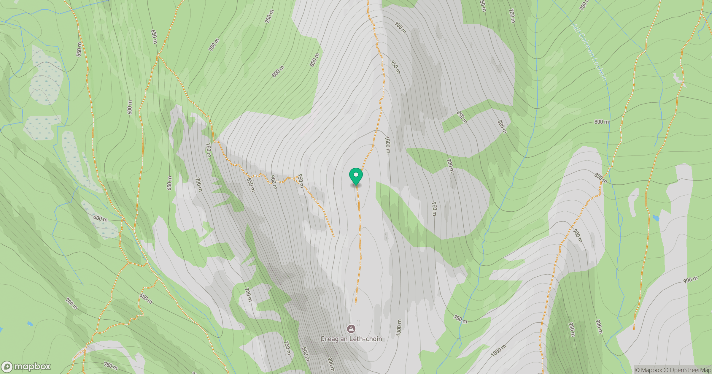
Grid reference: NH968039
View on OpenStreetMapOpens a map in a new tab, centred on the hill.
No comments yet. Be the first.