

Cock Mountain
Good walks are even better shared.
Overview
Cock Mountain: A Hidden Gem in the South Pennines
Nestled in the scenic South Pennines, Cock Mountain may not be the highest peak, but it certainly offers a rewarding experience for hikers of all levels. With its rugged terrain and captivating views, it’s a local favourite that deserves a spot on your hiking list.
Geology
Cock Mountain is primarily made of gritstone, which shapes its distinctive rocky outcrops. These geological features not only create a striking profile but also provide a fascinating insight into the Earth’s history for those with a keen interest in geology.
Routes
One of the most popular routes is The Old Quarry Route. Starting at the Upper Mill Car Park, this path offers a glimpse into the area's industrial past. It’s about 6.5 km long and generally takes around 2.5 hours to complete. Although it can be a bit challenging in parts, the route is well-marked and navigable even for those who are not expert climbers.
Summit Features
Upon reaching the summit, you’ll be greeted by a classic British trig point, not just any old stone, mind you! There are also some remnants of ancient boundary markers that hint at the rich history of the area. Make sure to snap some selfies to remember the journey!
Terrain
The terrain is a delightful mix of rocky paths and lush grassy areas, with a few boggy patches to keep things interesting. Just don’t take a dip, unless you fancy a mud bath!
Views
Once at the top, prepare to be dazzled by breathtaking panoramas. You’ll see the Peak District sprawling before you and on exceptionally clear days, the Manchester skyline twinkling in the distance. The best times for these views? Spring and early autumn, when the air is crisp and the visibility is at its peak.
Hazards
Like any great adventure, there are a few hazards to keep in mind. Loose stones can be a real trip hazard, especially on the way down. Wet conditions can also make the paths trickier, so good hiking boots are a must. And remember, the local sheep have the right of way, so pace yourself when trying to pass them!
Access
Getting to Cock Mountain is a breeze. The Upper Mill Car Park is the nearest parking option and it can fit around 20 cars. However, be sure to arrive early, particularly on sunny weekends. If you prefer to take public transport, the nearest train station is in Glossop, and local buses run frequently to Upper Mill. The village itself offers some charming cafés for post-hike refreshments, along with public toilets.
History
In terms of history, the name 'Cock Mountain' is believed to derive from references meaning to depict its prominent shape in the landscape. For centuries, it has stood as a staple landmark for farmers and shepherds, holding significant cultural value in this pastoral region.
In Conclusion
Whether you're a seasoned walker or a curious rambler, Cock Mountain offers a splendid hike infused with both natural beauty and a sprinkle of historical charm. Happy hiking!
Explore routes near Cock Mountain
Public walks starting within 80 km of this hill. Nearby does not mean a route reaches the summit; check its map and access before setting out.
Silent Valley to Ben Crom Dam: Reservoir Road Walk, County Down
View route
Tollymore Forest Park: Mountain and Drinns Trail
View route
Tollymore Forest Park: River Trail near Newcastle
View route
Castlewellan Forest Park: Lake, Arboretum and Mitchell's Lake Circuit
View route
Route planning notes
These notes describe possible approaches, not verified navigable routes or permission to cross land. Check current paths, local access rules and conditions before setting out.
The Old Quarry Route
Starting from the Car Park at Upper Mill, this route winds through an old stone quarry before ascending the mountain via a well-defined path.
Make a day of it, together
Find someone to share the walk with, or organise a day out along a route you like.
Photo Gallery
View all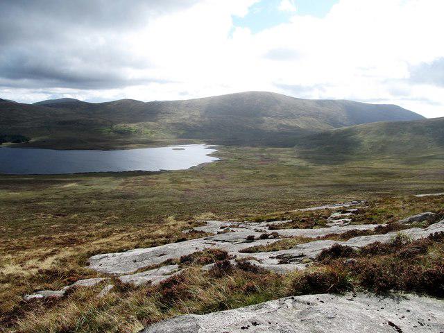 Photo could not load
J2526 : Sheet exposures on Cock Mountain
Eric Jones
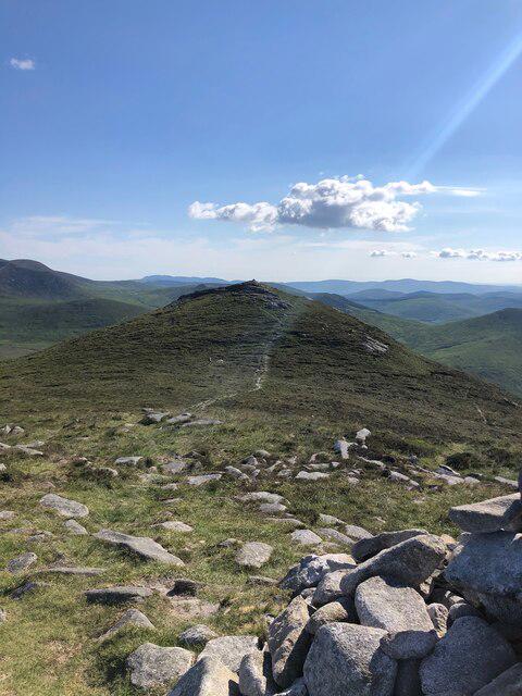 Photo could not load
J2526 : View of South Summit, Cock Mountain, from the North Summit
Philip Cornwall
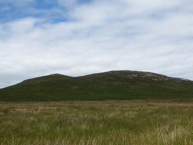 Photo could not load
J2526 : The twin summited Cock Mountain from the Spelga wetlands
Eric Jones
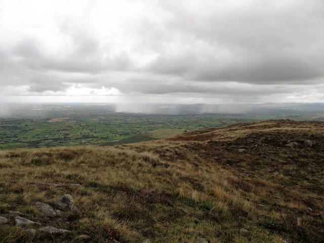 Photo could not load
J2526 : View north along the northern summit ridge of Cock Mountain
Eric Jones
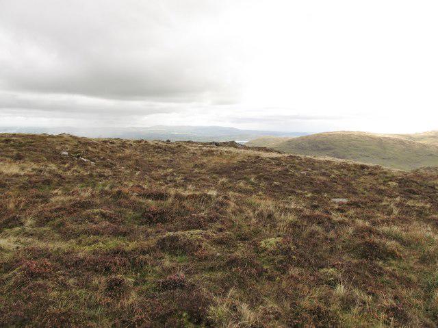 Photo could not load
J2526 : The northern summit plateau of Cock Mountain
Eric Jones
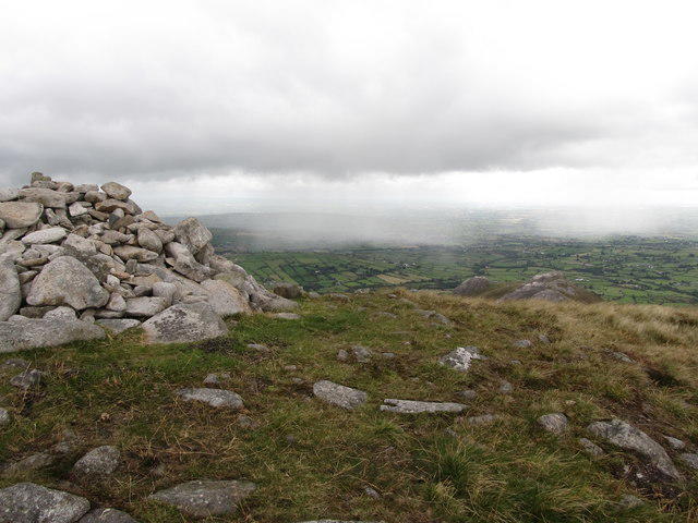 Photo could not load
J2526 : The northern summit of Cock Mountain
Eric Jones
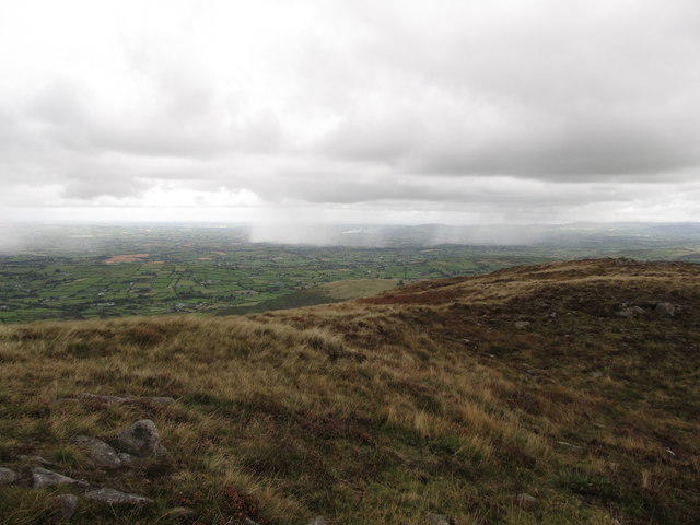 Photo could not load
J2526 : The northern summit of Cock Mountain
Eric Jones
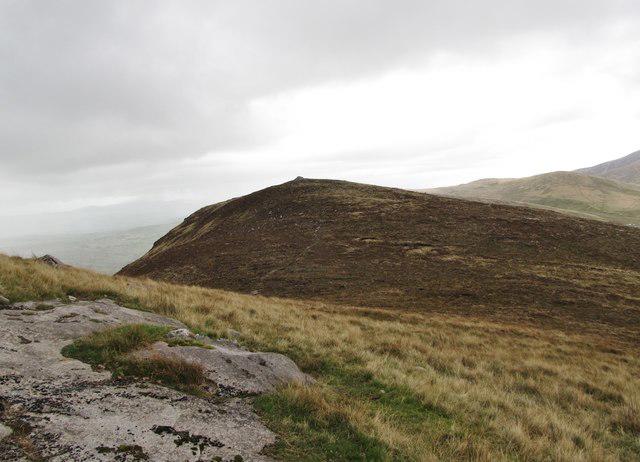 Photo could not load
J2526 : The North summit of Cock Mountain viewed from the rival South summit
Eric Jones
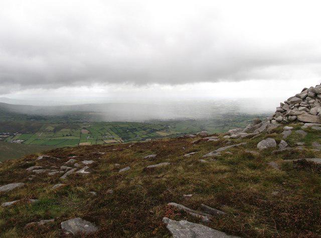 Photo could not load
J2526 : The North summit of Cock Mountain
Eric Jones
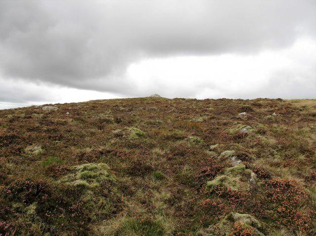 Photo could not load
J2526 : Approaching the main summit cairn of Cock Mountain
Eric Jones
Hill facts and local notes
Classifications
Elevation
505m
1,657 ft
Prominence
127m
Coordinates
54.1749, -6.0819
J253268
OS Map
29
At the Summit
At the summit, you will find a prominent trig point, perfect for a photo op. There are also historic stone pillars that mark the old boundary lines of local estates.
Terrain & Geology
Cock Mountain is largely composed of gritstone, which is characteristic of the South Pennines. The rugged nature of this rock contributes to the striking craggy features of the mountain.
Views & Scenery
From the summit, you can enjoy panoramic views of the Peak District and the distant Black Hill. On a clear day, you might even catch a glimpse of the Manchester skyline.
History & Heritage
Name Origin
The name 'Cock Mountain' is thought to derive from Old English, referencing the shape of the mountain or its prominence in the landscape.
Historical Significance
Historically, Cock Mountain served as a landmark for local shepherds and was an important part of the region's pastoral farming.
Getting There & Facilities
Check current local access restrictions, parking rules and transport timetables before travelling. These notes do not confirm public access to the summit.
Parking
Parking is available at the Upper Mill Car Park, with spots for about 20 cars. Arrive early, as spaces can fill up quickly on weekends.
Public Transport
The nearest train station is in Glossop, from which bus services run regularly to Upper Mill.
Nearby Facilities
You can find a lovely café in Upper Mill, perfect for post-hike cake and coffee. Public toilets are also available in the village.
Safety Information
Known Hazards
- Be cautious of loose stones, especially during descent. Wet conditions can make certain paths slippery, and keep an eye out for the occasional sheep - they have the right of way!
General Safety Tips
- Check weather conditions before setting out
- Carry appropriate clothing and equipment
- Let someone know your planned route
- Take a map, compass, and GPS device
- Carry emergency supplies: food, water, first aid kit, torch
Hills
Some common questions about the hills answered
Are there group walks up Cock Mountain?
Many walkers use Walkmates to join or organise walks with others. You can check for group walks around Cock Mountain through the maps
Are there other walkers around Cock Mountain?
Activity varies by location and time, but Walkmates lets you see whether others have shared walks or shown interest in this area. Find other people through the walking friends search walking friends for Cock Mountain search or of course create your own walk for Cock Mountain
Can I organise a walk to Cock Mountain?
Yes. If there aren’t any walks listed already, you can create a walk and make it available for others to join.
If you're signed up to Walkmates, you can create a walk to Cock Mountain.
How do I find a walk up this hill?
There are often multiple ways to walk this hill, depending on experience and route preference. Walkmates helps you explore walks and routes that others have shared.
Can I suggest a new route up Cock Mountain?
Yes. You can suggest or create routes to share with others. Walkmates focuses on the social side of walking, so routes are used to help people organise walks and explore areas together, rather than as detailed navigation tools or route libraries.
Other uses really appreciate knowledgeable walkers sharing their routes. Share your favourite route to Cock Mountain here
The is an error or something incorrect about this hill. How do I let you know?
We always strive to keep the information on Walkmates as accurate as possible. If you find an error, please let us know through the contact form and we'll aim to correct it as quickly as possible
Community Discussion
Comments
Location
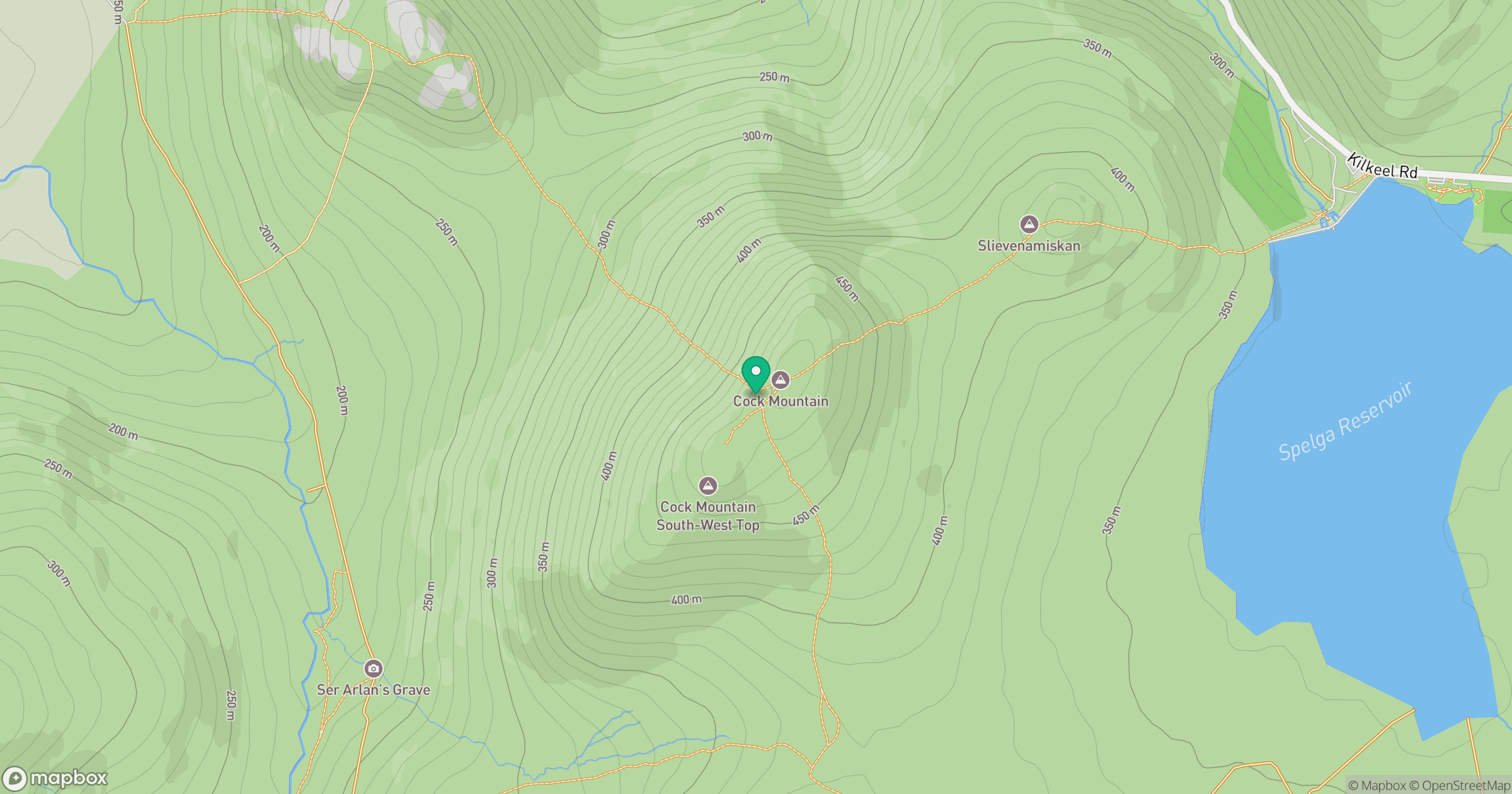
Grid reference: J253268
View on OpenStreetMapOpens a map in a new tab, centred on the hill.
Hills within 30 km
Straight-line distance, not a walking route or confirmation of access.
Slieve Bearnagh
739m
Slieve Binnian
746m
Slievelamagan
702m
Slieve Commedagh
767m
Slieve Donard
850m
No comments yet. Be the first.