

Cnoc Fyrish
Good walks are even better shared.
NH6069 : Flat summit of Cnoc Fyrish
Julian Paren Photo source
Overview
Cnoc Fyrish is a 453 m hill above the Cromarty Firth, near Alness and Evanton in Easter Ross. The Jubilee Path climbs through woodland and open moorland to the Fyrish Monument, an 18th-century folly near the unmarked natural summit. The usual car-park return is about 6 km and takes 2–2.5 hours in ordinary conditions; a longer forestry circuit is also possible. Both have uphill sections and uneven ground, with exposed weather above the trees.
Cnoc Fyrish
Overview
Cnoc Fyrish rises to 453 m above the Cromarty Firth, near Alness and Evanton in Easter Ross. It is a Tump with 77 m of prominence. Woodland covers the lower slopes, giving way to open moorland and the distinctive Fyrish Monument. The natural summit at NH607697 is unmarked ground just north of the monument; visiting the arches and locating the hill’s high point are separate things.
Routes
Jubilee Path return
Start at the Fyrish/Jubilee car park on the Boath road, around NH627715. Follow the signed path through the woods, crossing forestry tracks and the burn footbridge, then pass the lochan and continue onto the open summit area. Visit the monument and return down the same path to the same car park. The whole outing is about 6 km; allow 2–2.5 hours in ordinary conditions. It includes repeated rises, steps and steeper gravelly sections.
Walkhighlands also describes a short signed return variation near the lochan: take the left branch on descent, turn right at the T-junction and then left when you regain the outward path.
Shoulder and forestry circuit
Gillian’s longer circuit uses the same car park but leaves the Jubilee Path at the crossroads beyond the burn to climb the western shoulder. After the monument it descends northwest, turns north into the narrower woodland trail and rejoins the Jubilee Path for the return to the car park. Follow the mapped junctions carefully. The published circuit is 4.42 miles, about 7.1 km, with an average time of 2 hours 50 minutes. Its boggy forestry section and loose gravel make it less straightforward than simply retracing the main path.
Both figures describe complete outings back to their starting car park. Neither includes a visit to all three estate monuments, a climb of Cnoc Ceislein or travel from Alness station.
Access and parking
The car park is on the minor road towards Boath, reached from the B9176 north-west of Alness. NH627714 and NH627715 are guide references to the same trailhead area. Visitors walk or cycle from there; the monument is not a drive-up attraction. Keep passing places, gates and working access clear. Check current estate and Highland Council notices, and follow any signs or forestry diversions on arrival. The dated June 2025 filming restrictions are past, not a standing closure.
Terrain and safety
Expect woodland tracks, uneven stone steps, a footbridge and open moorland. Wet or icy steps and loose gravel can be slippery; the longer loop has boggier, narrower paths and several junctions. The summit area catches wind and can be hidden by cloud despite the hill’s modest height. Carry suitable footwear, warm layers, waterproofs, navigation, water, food and a headtorch. Leave enough daylight for the return and choose a route that suits the weather and the group. Call 999 or 112 and ask for Police, then Mountain Rescue, in an emergency.
These are shared paths in working woods. Respect other visitors, land-management notices and wildlife; keep dogs under close control. Do not climb the historic masonry and take litter home.
Geology and views
The hill is associated with conglomerate and pebbly sandstone of the Old Red Sandstone. Ancient rivers deposited the gravel and sand; older granite occurs as fragments within the sedimentary rock. In clear weather the views include the Cromarty Firth, Black Isle, North Sea and Ben Wyvis to the west.
Transport and facilities
Alness has a railway station and regional bus services, as well as shops and cafés. Some buses serve Evanton. Neither town arrival should be confused with arrival at the Jubilee car park: plan the extra walk or taxi and the last return service. Carry your supplies and do not rely on toilets, drinking water or refreshments at the trailhead or hilltop.
Name and history
Fyrish is an old local place-name whose origin remains uncertain. Watson proposed a Norse pine-tree derivation, then reconsidered a possible Pictish origin. A definite “great wood” translation is not supported.
General Sir Hector Munro of Novar commissioned the Category B listed monument in the 1780s. The ruin-like arches are traditionally associated with the gates of Negapatam, India. Accounts of employment during food shortages belong to local tradition; the tale of stones being rolled downhill to prolong the work is folklore. Smaller follies stand on Creag Ruadh and Meann Chnoc, away from the standard Jubilee outing.
Nearby hills
Cnoc Ceislein (523 m) is the higher hill to the north-west; Mean Chnoc (317 m) lies to the south-west. Ben Wyvis – Glas Leathad Mor (1046 m) is farther west and requires a separate mountain day.
Explore routes near Cnoc Fyrish
Walks starting near this hill. Open a route to check its map, distance and full itinerary.
Loch Migdale from Torroy: Spinningdale pinewood and loch shore walk
View route
Culbin Forest: Hill 99, Gravel Pit Ponds and Dragonfly Pool
View route
Findhorn guided night walk
View route
Glen Affric: Coire Loch Woodland Trail
View route
Route planning notes
These notes describe possible approaches. Check a route's map and access information when planning your walk.
Jubilee Path: Fyrish Monument return
Start and finish at the Fyrish/Jubilee car park on the Boath road, NH627715. Follow the signed path through woodland, across forestry-track junctions and over the burn footbridge, then climb past the lochan onto open moorland to the monument and summit area. Retrace the same path to the car park. This is approximately 6 km for the whole outing; allow 2–2.5 hours in ordinary conditions. There are repeated rises, stone steps and steeper gravelly sections. The unmarked natural high point is separate from the monument.
Fyrish shoulder and forestry circuit
From the same Fyrish/Jubilee car park, follow the Jubilee Path over the burn, then take the western branch at the next crossroads and climb the shoulder to the monument. Descend northwest on the broad gravel track, then turn north into the narrower woodland trail. Keep right at the four forks described in Gillian’s guide; at the junction with the Jubilee Path turn left to return to the original car park. The complete circuit is about 7.1 km (the guide’s 4.42 miles), with a published average of 2 hours 50 minutes. Expect boggy woodland and loose gravel; take the route map for the several junctions.
Make a day of it, together
Find someone to share the walk with, or organise a day out along a route you like.
Photo Gallery
View all Photo could not load
NH6069 : Flat summit of Cnoc Fyrish
Julian Paren
 Photo could not load
NH6069 : Bog on Cnoc Fyrish
Julian Paren
 Photo could not load
NH6069 : The Fyrish Monument
Richard Webb
 Photo could not load
NH6069 : Cnoc Fyrish monument
Douglas Nelson
 Photo could not load
NH6069 : View of Cnoc Cèislein
Richard Webb
 Photo could not load
NH6069 : Cnoc Fyrish
Ian Taylor
 Photo could not load
NH6069 : Snow on the Fyrish Monument
John Allan
 Photo could not load
NH6069 : Inner Cromarty Firth from Cnoc Fyrish
Julian Paren
 Photo could not load
NH6069 : Boggy ground on Cnoc Fyrish
Julian Paren

NH6069 : Pressure of social media - Cnoc Fyrish
Julian Paren
Hill facts and local notes
Classifications
Elevation
453m
1,486 ft
Prominence
77m
Coordinates
57.6963, -4.3377
NH607697
OS Map
21
Explorer: 438W
At the Summit
The 453 m natural summit is unmarked ground at NH 607697, just north of the Fyrish Monument. The catalogue records “no feature”; the arches are a separate historic structure. Locate the high ground as well as visiting the monument if recording a hill ascent.
Terrain & Geology
Cnoc Fyrish is associated with Old Red Sandstone conglomerate and pebbly sandstone. These sedimentary rocks formed from gravel and sand deposited by ancient rivers. The conglomerate includes fragments of older rocks, including granite; this does not make the hill a granite mass.
Views & Scenery
In clear weather the summit area overlooks the Cromarty Firth, the Black Isle and the firth’s entrance towards the North Sea, with Ben Wyvis prominent to the west. Woodland limits views on the lower path; cloud can obscure the hilltop panorama.
History & Heritage
Name Origin
The origin of “Fyrish” is uncertain. W. J. Watson first suggested a Norse pine-tree name, but later reconsidered its Gaelic form and a possible Pictish origin. It should not be given a definite translation such as “great wood”.
Historical Significance
The Fyrish Monument was commissioned by General Sir Hector Munro of Novar in the 1780s and is a Category B listed folly. Its arches are traditionally linked to the gates of Negapatam in India, captured in 1781. Local tradition connects its construction with work for people suffering food shortages and unemployment. The story that Munro rolled stones downhill to prolong the work is folklore, not an established fact.
Getting There & Facilities
Parking
Use the Fyrish/Jubilee car park on the minor Boath road off the B9176, north-west of Alness, around NH 627715. Walkhighlands gives the trail start as NH 627714; these refer to the same car-park area. From here visitors walk or cycle to the monument. Do not drive towards the summit grid reference. Space can be busy; leave gates, passing places and forestry access clear and follow signs on arrival.
Public Transport
ScotRail trains and regional Stagecoach buses serve Alness, with some buses also serving Evanton. There is no verified public bus to the Jubilee car park. Allow for a separate walk or taxi between town or station and the trailhead, plus the hill walk and return. Check current stops, operating days and last services before travelling.
Nearby Facilities
Alness has shops and cafés for supplies before or after the walk. Carry food and drinking water for the whole outing; do not rely on refreshments, toilets or drinking-water provision at the car park or summit. Check local opening arrangements before setting out.
Safety Information
Known Hazards
- Stone steps, gravel and uneven woodland paths can be slippery when wet or icy. The longer forestry circuit includes narrower, boggier ground and more junctions.
- The open summit area is exposed to wind and low cloud. Check the forecast, carry warm waterproof clothing and a map, and identify the return path before leaving the monument.
- These are working estate woods with shared paths. Follow forestry diversions and any current access notices; give other walkers and cyclists room. Keep dogs under close control and protect wildlife.
- Treat the historic monument with care and do not climb its masonry. Keep gates and working access clear when parking, and take litter home.
- Allow enough daylight for the complete return and carry food, water and a headtorch. In an emergency call 999 or 112, ask for Police and then Mountain Rescue.
Seasonal Hazards
Rain can leave steps, gravel and woodland trails slippery or boggy. Snow and ice make the climb and descent more difficult, and winter daylight is short. Carry clothing for wind and cold above the trees and choose conditions appropriate to the group. Follow any current forestry or access notices.
General Safety Tips
- Check weather conditions before setting out
- Carry appropriate clothing and equipment
- Let someone know your planned route
- Take a map, compass, and GPS device
- Carry emergency supplies: food, water, first aid kit, torch
Hills
Some common questions about the hills answered
Are there group walks up Cnoc Fyrish?
Many walkers use Walkmates to join or organise walks with others. You can check for group walks around Cnoc Fyrish through the maps
Are there other walkers around Cnoc Fyrish?
Activity varies by location and time, but Walkmates lets you see whether others have shared walks or shown interest in this area. Find other people through the walking friends search walking friends for Cnoc Fyrish search or of course create your own walk for Cnoc Fyrish
Can I organise a walk to Cnoc Fyrish?
Yes. If there aren’t any walks listed already, you can create a walk and make it available for others to join.
If you're signed up to Walkmates, you can create a walk to Cnoc Fyrish.
How do I find a walk up this hill?
There are often multiple ways to walk this hill, depending on experience and route preference. Walkmates helps you explore walks and routes that others have shared.
Can I suggest a new route up Cnoc Fyrish?
Yes. You can suggest or create routes to share with others. Walkmates focuses on the social side of walking, so routes are used to help people organise walks and explore areas together, rather than as detailed navigation tools or route libraries.
Other uses really appreciate knowledgeable walkers sharing their routes. Share your favourite route to Cnoc Fyrish here
The is an error or something incorrect about this hill. How do I let you know?
We always strive to keep the information on Walkmates as accurate as possible. If you find an error, please let us know through the contact form and we'll aim to correct it as quickly as possible
Community Discussion
Comments
Location
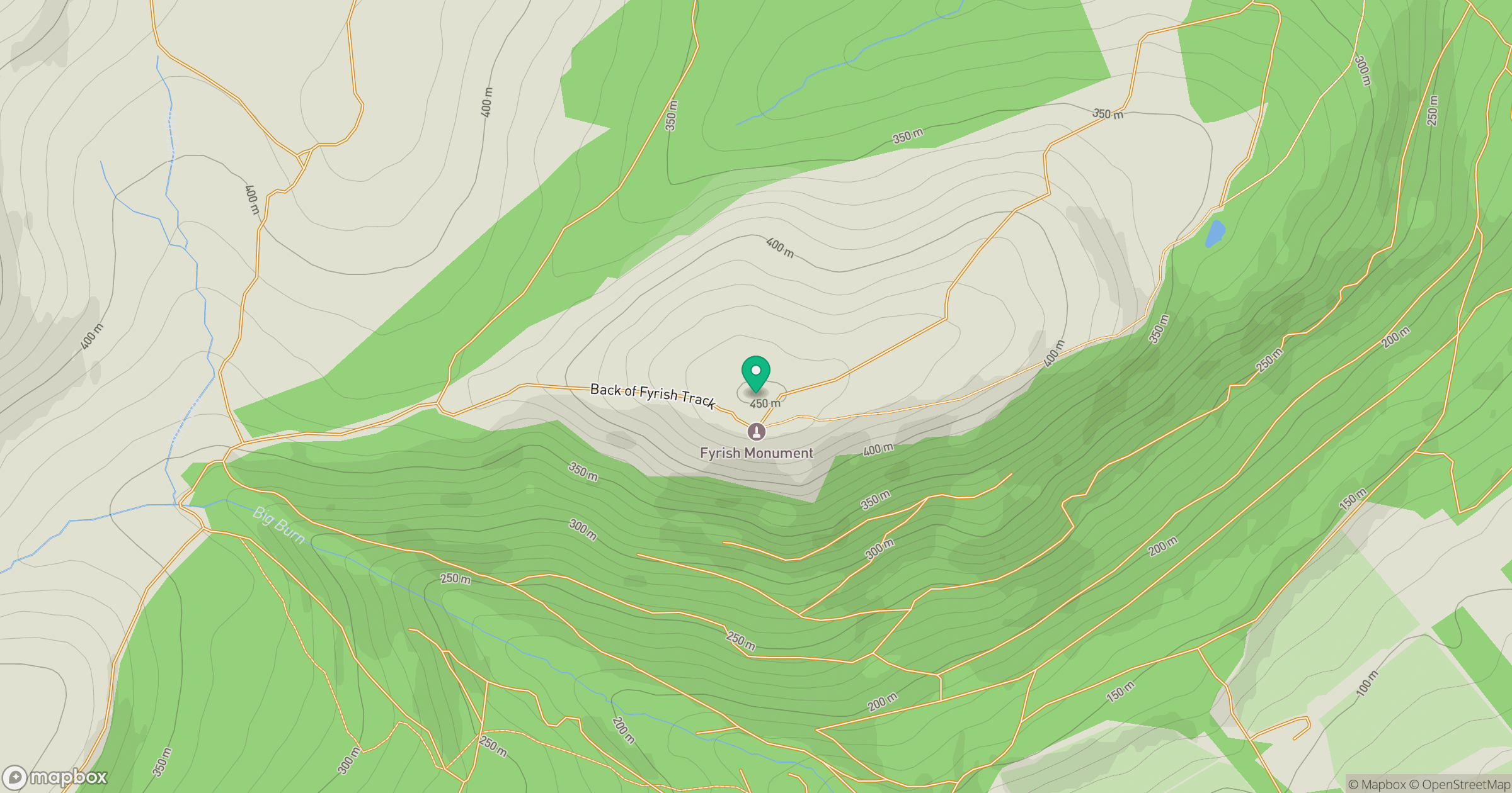
Grid reference: NH607697
View on OpenStreetMapOpens a map in a new tab, centred on the hill.
No comments yet. Be the first.