

Mount Eagle
Good walks are even better shared.
NH6458 : Microwave towers, Mount Eagle
Richard Webb Photo source
Explore routes near Mount Eagle
Walks starting near this hill. Open a route to check its map, distance and full itinerary.
Loch Migdale from Torroy: Spinningdale pinewood and loch shore walk
View route
Culbin Forest: Hill 99, Gravel Pit Ponds and Dragonfly Pool
View route
Glen Affric: Coire Loch Woodland Trail
View route
Aviemore: Loch an Eilein and the Croft Track from Rothiemurchus
View route
Route planning notes
These notes describe possible approaches. Check a route's map and access information when planning your walk.
Eastbourne Approach
A leisurely stroll starting in Eastbourne, leading you through beautiful meadows and up gentle slopes. Ideal for a crisp Sunday morning walk.
Make a day of it, together
Find someone to share the walk with, or organise a day out along a route you like.
Photo Gallery
View all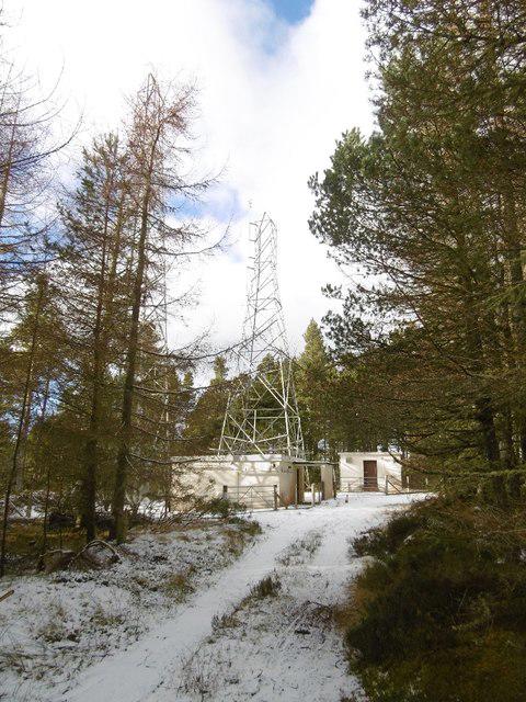 Photo could not load
NH6458 : Microwave towers, Mount Eagle
Richard Webb
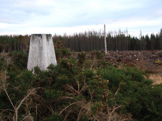 Photo could not load
NH6459 : Mount Eagle trig point
Callum Black
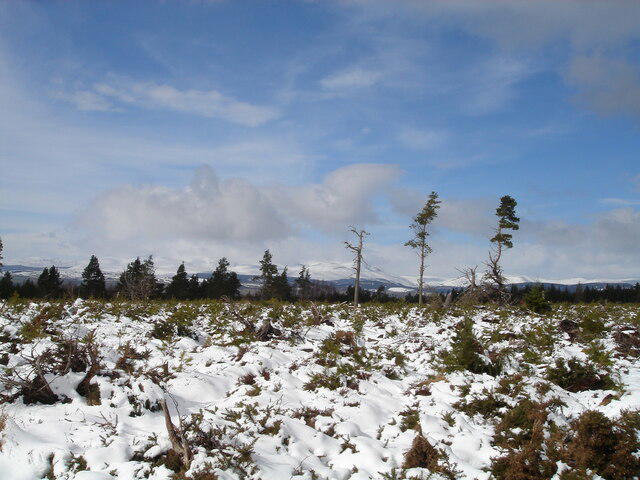 Photo could not load
NH6459 : The summit region of Mount Eagle, Black Isle
Michael Earnshaw
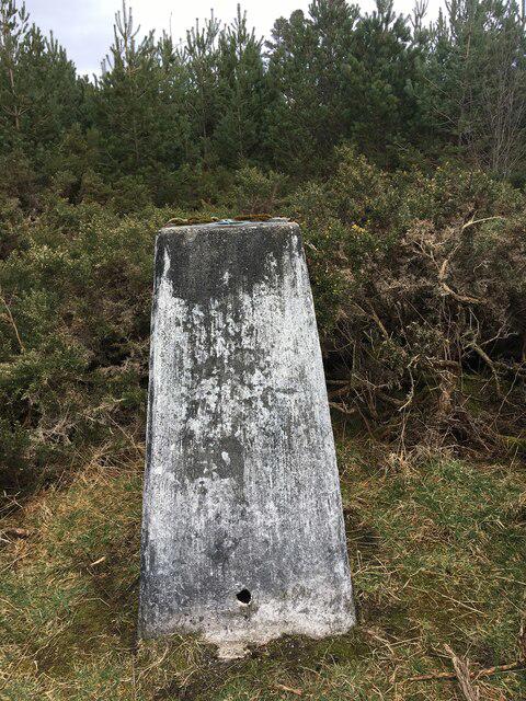 Photo could not load
NH6459 : Trig point on Mount Eagle
Steven Brown
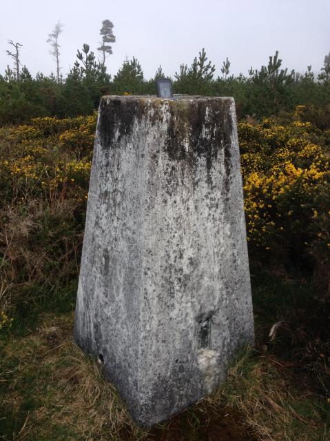 Photo could not load
NH6459 : Mount Eagle Trig Point Flush Bracket S7971
thejackrustles
Hill facts and local notes
Classifications
Elevation
256m
840 ft
Prominence
221m
Coordinates
57.6008, -4.2631
NH648590
OS Map
26
Explorer: 432
At the Summit
The summit features a well-constructed trig point and a small stone cairn, offering friendly reassurance to weary souls that they have indeed reached the top.
Terrain & Geology
Composed primarily of chalk with some flint nodules, Mount Eagle offers a critical insight into the geological history formed millions of years ago under a tropical sea. The unique chalk landscape provides a stunning white façade contrasting with the lush green of surrounding vegetation.
Views & Scenery
From the summit, you can gaze across the rolling hills of the South Downs, with the distant sight of the English Channel on clear days. Look out for Beachy Head lighthouse to the east and the sprawling city of Brighton to the west.
History & Heritage
Name Origin
The name 'Eagle' is thought to derive from the Old English word 'ealh', meaning a temple or shrine, which could hint at historical significance.
Historical Significance
Mount Eagle has long been a favourite for local walkers and holds some significance in regional folklore.
Getting There & Facilities
Parking
There is a designated parking area in Eastbourne where you can leave your car. Parking charges may apply.
Public Transport
Eastbourne train station is a short walk from the trailhead with regular services from London and surrounding areas.
Nearby Facilities
Cafés and public toilets can be found near the Eastbourne seafront, as well as various pubs offering hearty meals. Remember to hydrate—water is essential!
Safety Information
Known Hazards
- As with all hills, be wary of changing weather conditions, which can turn from delightful to dreadful in a matter of minutes. Keep an eye out for cattle and wildlife.
General Safety Tips
- Check weather conditions before setting out
- Carry appropriate clothing and equipment
- Let someone know your planned route
- Take a map, compass, and GPS device
- Carry emergency supplies: food, water, first aid kit, torch
Hills
Some common questions about the hills answered
Are there group walks up Mount Eagle?
Many walkers use Walkmates to join or organise walks with others. You can check for group walks around Mount Eagle through the maps
Are there other walkers around Mount Eagle?
Activity varies by location and time, but Walkmates lets you see whether others have shared walks or shown interest in this area. Find other people through the walking friends search walking friends for Mount Eagle search or of course create your own walk for Mount Eagle
Can I organise a walk to Mount Eagle?
Yes. If there aren’t any walks listed already, you can create a walk and make it available for others to join.
If you're signed up to Walkmates, you can create a walk to Mount Eagle.
How do I find a walk up this hill?
There are often multiple ways to walk this hill, depending on experience and route preference. Walkmates helps you explore walks and routes that others have shared.
Can I suggest a new route up Mount Eagle?
Yes. You can suggest or create routes to share with others. Walkmates focuses on the social side of walking, so routes are used to help people organise walks and explore areas together, rather than as detailed navigation tools or route libraries.
Other uses really appreciate knowledgeable walkers sharing their routes. Share your favourite route to Mount Eagle here
The is an error or something incorrect about this hill. How do I let you know?
We always strive to keep the information on Walkmates as accurate as possible. If you find an error, please let us know through the contact form and we'll aim to correct it as quickly as possible
Community Discussion
Comments
Location
View the hill's mapped position and surrounding paths.
Grid reference: NH648590
View on OpenStreetMapOpens a map in a new tab, centred on the hill.
No comments yet. Be the first.