

Cnoc Muigh-bhlaraidh
Good walks are even better shared.
Overview
Cnoc Muigh-bhlaraidh: A Hidden Gem of the Highlands
Nestled in the Scottish Highlands, Cnoc Muigh-bhlaraidh is a Marilyn that may not be the tallest peak, but it certainly holds its own when it comes to beauty and allure. Standing at 776 meters, it rewards hikers with sweeping vistas and a sense of tranquility that only the Highlands can provide.
Geology
The mountain's formation is primarily composed of various metamorphic rocks, shaped by the relentless forces of nature over millennia. This geological history adds to the rugged beauty of the landscape and presents a few interesting outcrops along your trek.
Routes
The most popular route to the summit begins at Culburnie. This moderate trail spans approximately 5.2 km and can typically be completed in about 2.5 hours. The path starts off through forestry and gradually transitions into more open hill walking, offering breathtaking views along the way. Just remember, it's not a sprint; take it slow and enjoy the scenery!
Summit Features
As you reach the top, you'll be greeted by a hearty stone cairn, a perfect spot for a picnic—or, if you're feeling cheeky, a quick nap to soak in the views. The summit really feels like a world apart, and if you're lucky, you might catch a glimpse of a soaring eagle or two!
Terrain
Expect a delightful mix of grassy slopes and rocky outcrops on your journey. It's the kind of terrain that makes you feel alive, with the wind in your hair and the scent of fresh heather filling the air. Just watch your step on the rocky sections; they can be trickier than teaching a cat to fetch.
Views
From the summit, the panorama is nothing short of stunning. To the south lies the infamous Loch Ness, and if you squint just right, you might even make out the distant hints of the northern Monadhliath mountains. Timeless beauty is abundant, and as the seasons change, so do the views—each a vibrant tapestry.
Hazards
While the mountain is generally accessible, hikers should remain wary of the unpredictable Highland weather; it can turn quicker than a squirrel up a tree. Additionally, after a rain, the rocks can be particularly slippery, so tread carefully.
Access
Accessing Cnoc Muigh-bhlaraidh is straightforward, with a small lay-by on the A9 near Culburnie, perfect for parking. If you're relying on public transport, there are regular buses from Inverness to the nearby villages, but it might require a bit of a walk from the nearest bus stop.
Nearby Summits
If you fancy a longer day in the hills, consider combining your ascent with a visit to Mullach na h-Airde, just a stone's throw away and a worthy addition to your adventure.
Facilities
After your hike, Inverness offers a plethora of cafés and shops to refuel. Whether it's a piping hot coffee or a slice of cake—because who can resist cake, right?—you'll find your reward waiting.
History
The name Cnoc Muigh-bhlaraidh translates directly to "Hill of the Muir of the Bare,” a nod to the natural beauty of this rural area. This mountain also features in stories of the Clan Chisholm, wrapping its scenic landscapes in rich historical significance.
In conclusion, whether you're a seasoned hiker or just looking to stretch your legs, Cnoc Muigh-bhlaraidh promises an experience filled with wonder and a touch of the wild. So, lace up those boots and hit the trail—adventure awaits!
Explore routes near Cnoc Muigh-bhlaraidh
Public walks starting within 80 km of this hill. Nearby does not mean a route reaches the summit; check its map and access before setting out.
Loch Migdale from Torroy: Spinningdale pinewood and loch shore walk
View route
Inverness: River Ness and Caledonian Canal circuit
View route
Culbin Forest: Hill 99, Gravel Pit Ponds and Dragonfly Pool
View route
Ben Klibreck
View route
Route planning notes
These notes describe possible approaches, not verified navigable routes or permission to cross land. Check current paths, local access rules and conditions before setting out.
Culburnie Starting Point
A pleasant ascent offering a mix of forestry track and open hill walking, starting at Culburnie with a well-defined path to reach the summit.
Make a day of it, together
Find someone to share the walk with, or organise a day out along a route you like.
Photo Gallery
View all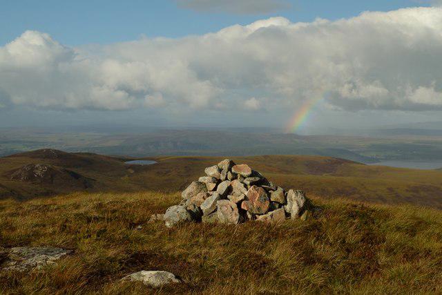 Photo could not load
NH6382 : Summit Cairn on Cnoc Muigh-Blaraidh, Ross-shire
Andrew Tryon
Hill facts and local notes
Classifications
Elevation
546m
1,791 ft
Prominence
119m
Coordinates
57.8113, -4.2948
NH637825
OS Map
21
Explorer: 438W
At the Summit
The summit features a conspicuous stone cairn, a classic sight for any bagger, as well as dramatic views of the surrounding area.
Terrain & Geology
Cnoc Muigh-bhlaraidh is primarily composed of metamorphic rock, typical of the Scottish Highlands. The landscape is characterized by rugged terrain shaped by glacial activity, with some intriguing outcrops of schist.
Views & Scenery
From the summit, you can appreciate stunning views of Loch Ness to the south and the northern Monadhliath mountains in the distance.
History & Heritage
Name Origin
The name Cnoc Muigh-bhlaraidh translates to 'Hill of the Muir of the Bare', indicating the area's natural landscape.
Historical Significance
The mountain holds local folklore, often featured in tales of the Clan Chisholm, adding a cultural flair to the trek.
Getting There & Facilities
Check current local access restrictions, parking rules and transport timetables before travelling. These notes do not confirm public access to the summit.
Parking
There is a small lay-by on the A9 near Culburnie, providing convenient access to the start of the trail.
Public Transport
Regular bus services run from Inverness to nearby villages, though you will need to walk some distance from the nearest stop.
Nearby Facilities
Cafés and shops are available in Inverness, and woodland walks are located nearby for a post-hike caffeine hit.
Safety Information
Known Hazards
- Be cautious of sudden weather changes typical in the Highlands, and watch out for slippery rocks, especially after rain.
General Safety Tips
- Check weather conditions before setting out
- Carry appropriate clothing and equipment
- Let someone know your planned route
- Take a map, compass, and GPS device
- Carry emergency supplies: food, water, first aid kit, torch
Hills
Some common questions about the hills answered
Are there group walks up Cnoc Muigh-bhlaraidh?
Many walkers use Walkmates to join or organise walks with others. You can check for group walks around Cnoc Muigh-bhlaraidh through the maps
Are there other walkers around Cnoc Muigh-bhlaraidh?
Activity varies by location and time, but Walkmates lets you see whether others have shared walks or shown interest in this area. Find other people through the walking friends search walking friends for Cnoc Muigh-bhlaraidh search or of course create your own walk for Cnoc Muigh-bhlaraidh
Can I organise a walk to Cnoc Muigh-bhlaraidh?
Yes. If there aren’t any walks listed already, you can create a walk and make it available for others to join.
If you're signed up to Walkmates, you can create a walk to Cnoc Muigh-bhlaraidh.
How do I find a walk up this hill?
There are often multiple ways to walk this hill, depending on experience and route preference. Walkmates helps you explore walks and routes that others have shared.
Can I suggest a new route up Cnoc Muigh-bhlaraidh?
Yes. You can suggest or create routes to share with others. Walkmates focuses on the social side of walking, so routes are used to help people organise walks and explore areas together, rather than as detailed navigation tools or route libraries.
Other uses really appreciate knowledgeable walkers sharing their routes. Share your favourite route to Cnoc Muigh-bhlaraidh here
The is an error or something incorrect about this hill. How do I let you know?
We always strive to keep the information on Walkmates as accurate as possible. If you find an error, please let us know through the contact form and we'll aim to correct it as quickly as possible
Community Discussion
Comments
Location
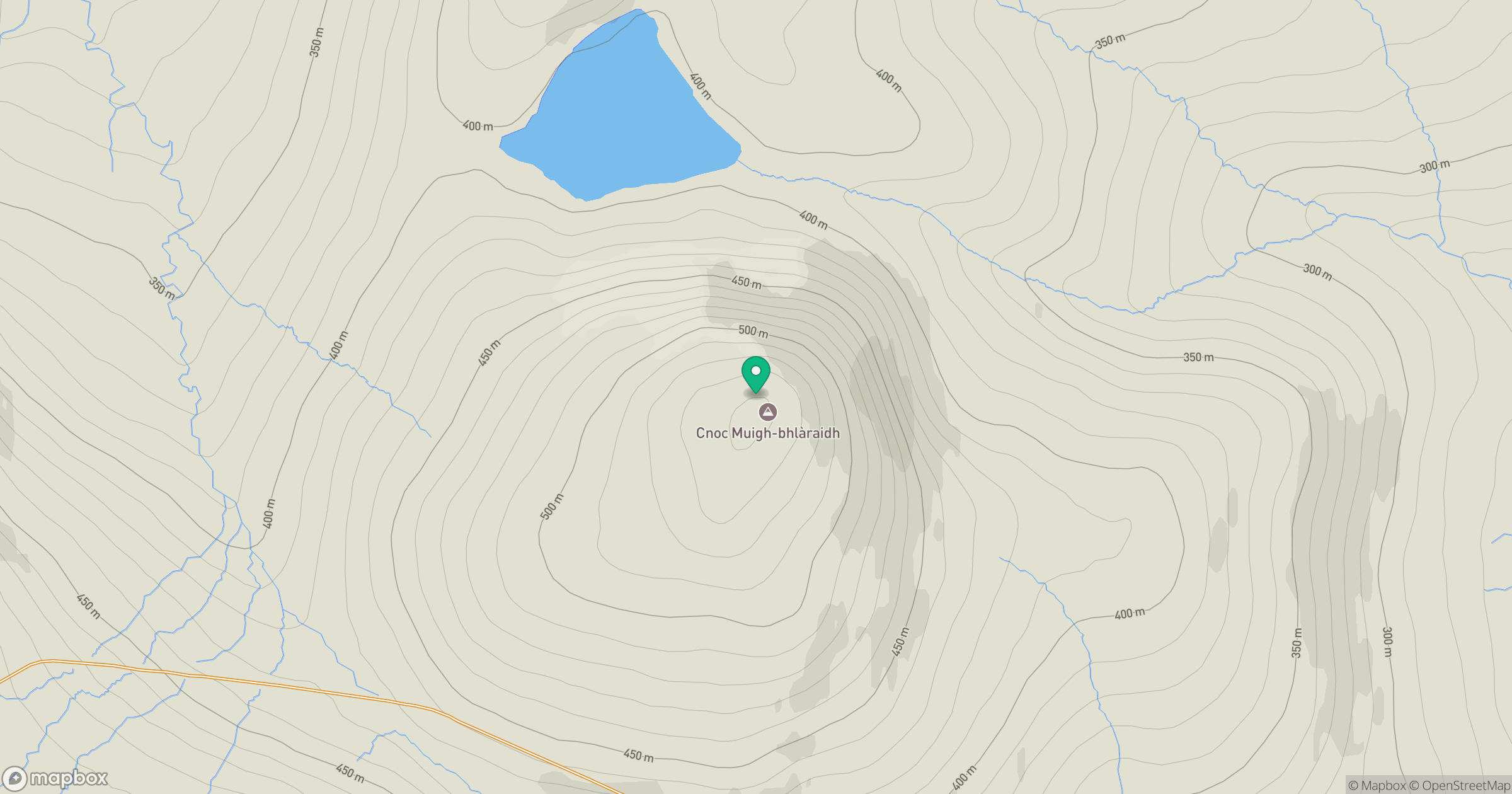
Grid reference: NH637825
View on OpenStreetMapOpens a map in a new tab, centred on the hill.
Hills within 30 km
Straight-line distance, not a walking route or confirmation of access.
No comments yet. Be the first.