

Cnoc Navie
Good walks are even better shared.
Overview
Cnoc Navie: An Adventurer's Delight
Cnoc Navie, standing proud at 604 meters, is a Marilyn located in the stunning Scottish Highlands. With its distinctive features and surrounding natural beauty, it’s a popular destination for hikers seeking both challenge and breathtaking views.
Geology
This hill showcases the classic Highland granite, with striking outcrops acting as natural artwork sculpted by centuries of weathering. It's a prime example of nature’s craftsmanship – who needs an art gallery?
Routes
The most favoured route, the Cnoc Navie Circuit, is a 5-kilometre circular trek starting from the minor road to the southwest. It provides a delightful mix of challenges, perfect for seasoned walkers looking to test their mettle.
Summit Features
Cnoc Navie’s summit features a sizeable cairn, offering comfortable seating for a picnic (and a great spot for eyes-closed, wind-in-the-hair selfies). The feeling of triumph as you stand on top is one of life’s pure joys.
Terrain Type
As with many Scottish adventures, the terrain is mixed; you'll find grassy hills that invite you to frolic and rocky outcrops that remind you to watch your footing. Beware of the minor bogs along the way – they have a talent for ambushing unsuspecting hikers!
Views
Once you reach the summit, the views are nothing short of spectacular. On a clear day, you'll see a stunning panorama of nearby peaks and glistening lochs, making every step worth it. Late spring through early autumn is the prime time for marvels, though autumn’s hues can put on a heck of a show too!
Hazards
Be prepared! Scottish weather is as unpredictable as a game of charades with your mates. Ensure you have the proper gear, and keep an eye out for sudden weather changes. Muddy patches and bogs are also on the list of potential challenges, so a good pair of wellies makes all the difference.
Nearby Summits
For those with conquered spirits, Cnoc Navie is well-placed near other glorious peaks, such as Bidean a' Ghlas Thuill and Meall a'Phuill, providing ample opportunities for extended hiking adventures.
Access
Finding your way to Cnoc Navie is as easy as pie! The nearest parking is located at NH671719, accommodating several vehicles. Public transport is a bit of a pickle, best utilising bus services to Fort Augustus and arranging further transport.
Facilities
Fort Augustus, the nearest town, is bursting with character and a few tempting cafés. And don’t worry, you’ll find public toilets nearby (just make sure to visit before hitting the trail!).
History
The name ‘Cnoc Navie’ translates to ‘Hill of the Lark’, often highlighting the natural beauty and wildlife around. Cultural significance runs deep in these hills, with generations of families holding this area dear.
In short, Cnoc Navie is more than just a hill; it’s a joyous outdoor experience waiting for you!
Happy hiking!
Explore routes near Cnoc Navie
Public walks starting within 80 km of this hill. Nearby does not mean a route reaches the summit; check its map and access before setting out.
Loch Migdale from Torroy: Spinningdale pinewood and loch shore walk
View route
Inverness: River Ness and Caledonian Canal circuit
View route
Culbin Forest: Hill 99, Gravel Pit Ponds and Dragonfly Pool
View route
Findhorn guided night walk
View route
Route planning notes
These notes describe possible approaches, not verified navigable routes or permission to cross land. Check current paths, local access rules and conditions before setting out.
Cnoc Navie Circuit
A well-trodden circular route that starts from the minor road to the southwest of the hill, taking in the sights of the surrounding glens.
Make a day of it, together
Find someone to share the walk with, or organise a day out along a route you like.
Photo Gallery
View all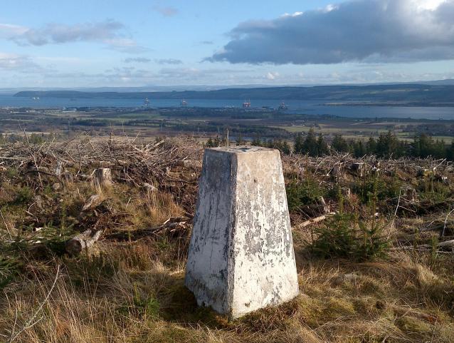 Photo could not load
NH6672 : Cnoc Navie Trig Point and View to Invergordon
thejackrustles
Hill facts and local notes
Classifications
Elevation
241m
791 ft
Prominence
102m
Coordinates
57.7224, -4.2491
NH661725
OS Map
21
Explorer: 438W
At the Summit
The summit features a prominent cairn that serves as a beacon for lost hikers and a great photo spot for the rest of us. There’s also a stunning view to be had, so don't forget to take your selfies!
Terrain & Geology
Cnoc Navie showcases classic Highland geology, primarily made up of granite with stunning outcrops and boulders. The bedrock often glints in the sunlight, a nature-inspired disco ball for the avid hiker.
Views & Scenery
From the summit, hikers can enjoy panoramic views of the surrounding peaks, including the iconic Munros in the distance and the lush valleys below. On a clear day, the lochs glisten like a thousand diamonds.
History & Heritage
Name Origin
The name 'Cnoc Navie' translates roughly to 'Hill of the Lark', which likely refers to the area's abundance of wildlife.
Historical Significance
The region has deep-rooted cultural significance to the local communities, and it's believed that this area has been a gathering place for families for generations.
Getting There & Facilities
Check current local access restrictions, parking rules and transport timetables before travelling. These notes do not confirm public access to the summit.
Parking
Parking is available at NH671719, a convenient spot along the minor road to the southwest of Cnoc Navie, which accommodates several vehicles.
Public Transport
While public transport options are limited, you can access nearby towns via bus services from Inverness, followed by a taxi or a long walk to the trailhead.
Nearby Facilities
Fort Augustus boasts several cafés and restaurants, as well as public toilets for those in need – good luck finding a free one during peak season, though!
Safety Information
Known Hazards
- Watch out for sudden weather changes, which can lead to visibility issues. Also, some areas may be boggy, so invest in some dependable footwear.
General Safety Tips
- Check weather conditions before setting out
- Carry appropriate clothing and equipment
- Let someone know your planned route
- Take a map, compass, and GPS device
- Carry emergency supplies: food, water, first aid kit, torch
Hills
Some common questions about the hills answered
Are there group walks up Cnoc Navie?
Many walkers use Walkmates to join or organise walks with others. You can check for group walks around Cnoc Navie through the maps
Are there other walkers around Cnoc Navie?
Activity varies by location and time, but Walkmates lets you see whether others have shared walks or shown interest in this area. Find other people through the walking friends search walking friends for Cnoc Navie search or of course create your own walk for Cnoc Navie
Can I organise a walk to Cnoc Navie?
Yes. If there aren’t any walks listed already, you can create a walk and make it available for others to join.
If you're signed up to Walkmates, you can create a walk to Cnoc Navie.
How do I find a walk up this hill?
There are often multiple ways to walk this hill, depending on experience and route preference. Walkmates helps you explore walks and routes that others have shared.
Can I suggest a new route up Cnoc Navie?
Yes. You can suggest or create routes to share with others. Walkmates focuses on the social side of walking, so routes are used to help people organise walks and explore areas together, rather than as detailed navigation tools or route libraries.
Other uses really appreciate knowledgeable walkers sharing their routes. Share your favourite route to Cnoc Navie here
The is an error or something incorrect about this hill. How do I let you know?
We always strive to keep the information on Walkmates as accurate as possible. If you find an error, please let us know through the contact form and we'll aim to correct it as quickly as possible
Community Discussion
Comments
Location
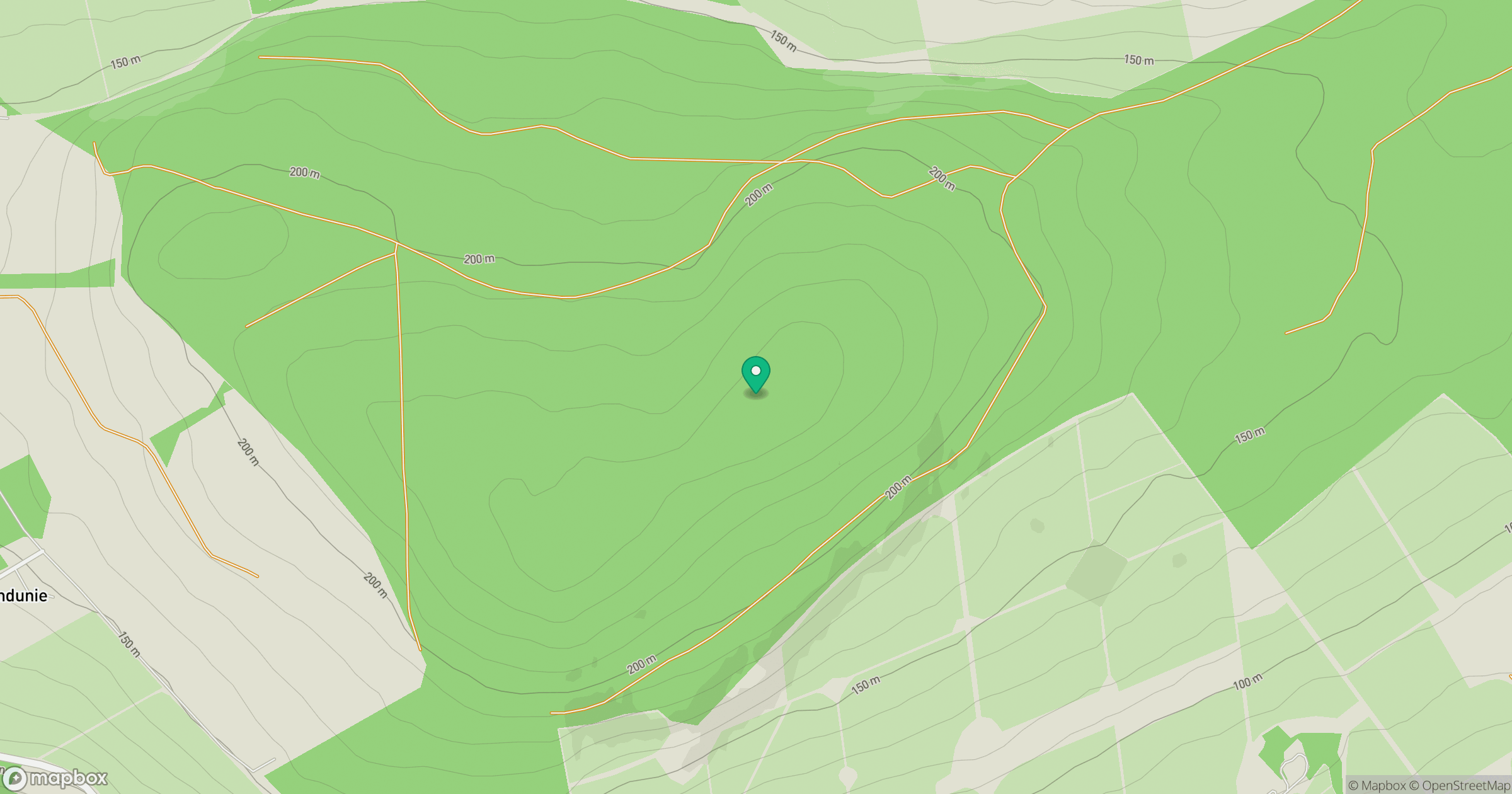
Grid reference: NH661725
View on OpenStreetMapOpens a map in a new tab, centred on the hill.
Hills within 30 km
Straight-line distance, not a walking route or confirmation of access.
No comments yet. Be the first.