

Carn Meilich
Good walks are even better shared.
Overview
Carn Meilich
Welcome to Carn Meilich, a splendid Marilyn standing proudly at 835 meters. Nestled in the heart of the Scottish Highlands, it offers a splendid array of views and a bit of a challenge for those eager to explore its slopes.
Geology
Carn Meilich showcases ancient volcanic activity with its rugged basalt formations. The unique geology not only contributes to its beauty but also tells a tale of our planet's fiery past.
Routes
The most popular route begins at the West Highland Way. As you wind your way up, keep an eye out for the stunning views that begin to reveal themselves. With a moderate difficulty, it’s just enough to get the blood pumping without sending you to the hospital.
- Distance: 10.5 km
- Time: Approximately 3.5 hours
Summit Features
At the top, you'll find a sturdy stone cairn, perfect for resting and enjoying a well-deserved snack. Don’t be shy – it’s the best spot for that cheesy selfie!
Terrain Type
Expect varied terrain that’s as unpredictable as a cat on catnip – grassy slopes, rocky outcrops, and possibly treacherous bogs waiting to swallow your wellingtons.
Views
The vistas from Carn Meilich are nothing short of spectacular. On a clear day, you can spot Loch Awe, Ben Cruachan, and the sprawling Munros of Argyll.
- Best Seasons: Spring and autumn for the best clarity; however, do take note of the midges in summer!
Hazards
As with many Scottish walks, the weather can change faster than you can say, 'Where’s my raincoat?!' Plus, watch your step—those bogs can be sneaky!
Nearby Summits
While you’re in the area, consider tackling nearby peaks like Ben Cruachan and Beinn a'Chochuill. They all make for a cracking day out in the stunning highlands.
Access
- Nearest Parking: Limited parking at the Loch Awe Dam. Arrive early to secure your spot.
- Public Transport: Buses to Dalavich run regularly, but be prepared for a bit of a walk to get going on your adventure.
- Nearest Town: Oban is the closest town, filled with the shops and eateries you'd expect.
Facilities
While the summit lacks facilities, Dalavich is home to a charming cafe and toilets to refresh yourself after the trek.
History
The name 'Carn Meilich' means 'Hill of the Blades,' a nod to its sharp, rocky features. Throughout history, it has attracted adventure seekers and nature lovers alike, embodying the spirit of the Scottish Highlands.
So, pack your bags and grab your boots—Carn Meilich is waiting to steal your breath away—literally and figuratively!
Explore routes near Carn Meilich
Public walks starting within 80 km of this hill. Nearby does not mean a route reaches the summit; check its map and access before setting out.
Aberlour to Carron Bridge: Speyside Way riverside return
View route
Craigellachie to Aberlour: Speyside Railway Path Return
View route
Rothiemurchus: Beaver Trail and Lochan Mor
View route
Aviemore: Loch an Eilein and the Croft Track from Rothiemurchus
View route
Route planning notes
These notes describe possible approaches, not verified navigable routes or permission to cross land. Check current paths, local access rules and conditions before setting out.
West Highland Way to Carn Meilich
A scenic walk starting from the famous West Highland Way, gradually ascending with beautiful views along the way.
Make a day of it, together
Find someone to share the walk with, or organise a day out along a route you like.
Photo Gallery
View all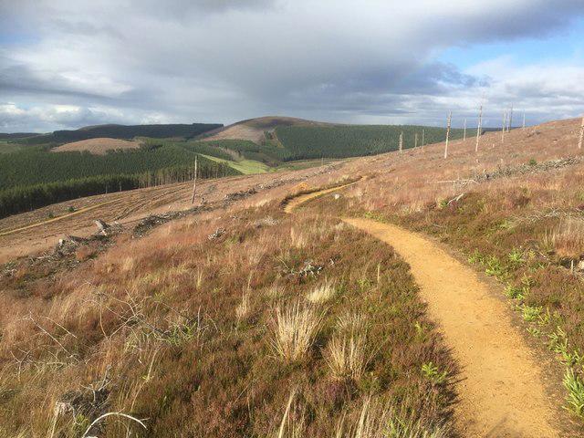 Photo could not load
NJ1623 : Blue trail on Carn Mèilich, Glenlivet
Richard Webb
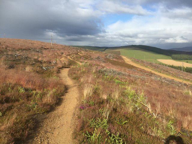 Photo could not load
NJ1623 : Blue trail on Carn Mèilich, Glenlivet
Richard Webb
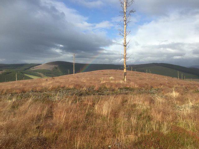 Photo could not load
NJ1623 : View towards Carn Daimh from the summit of Carn Mèilich
Richard Webb
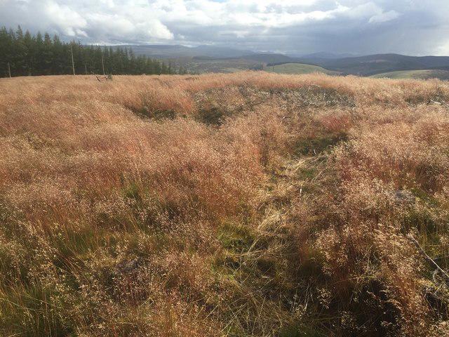 Photo could not load
NJ1623 : Summit, Carn Mèilich
Richard Webb
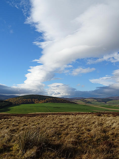 Photo could not load
NJ1623 : Dramatic Sky above Carn Mèilich
Anne Burgess
Hill facts and local notes
Classifications
Elevation
466m
1,529 ft
Prominence
128m
Coordinates
57.2905, -3.3936
NJ161230
OS Map
36
Explorer: OL61S 419S
At the Summit
The summit boasts a large stone cairn, offering a perfect spot for a celebratory snack (or a cheeky sandwich) while taking in the stunning views.
Terrain & Geology
Carn Meilich is primarily composed of ancient volcanic rock, with notable basalt formations that provide a glimpse into the Earth's fiery past. The rugged geology contributes to its distinctive landscape.
Views & Scenery
From the summit, one can admire the breathtaking expanse of Loch Awe and the surrounding peaks, including the lofty Ben Cruachan and the sprawling Munros of Argyll.
History & Heritage
Name Origin
The name 'Carn Meilich' translates to 'Hill of the Blades', likely referring to the sharp rocks found around the summit.
Historical Significance
Carn Meilich has been a popular destination for outdoor enthusiasts and hikers in Scotland, showcasing the stunning natural beauty and rich history of the Highlands.
Getting There & Facilities
Check current local access restrictions, parking rules and transport timetables before travelling. These notes do not confirm public access to the summit.
Parking
Parking is available at the Dam at Loch Awe. Space is limited, so it's advised to arrive early, especially on weekends.
Public Transport
Regular bus services run to the nearby village of Dalavich, but it's a bit of a trek to get to the start of the best routes.
Nearby Facilities
There are no facilities at the summit itself, but the village of Dalavich offers a quaint cafe and, importantly, toilets.
Safety Information
Known Hazards
- Beware of rapidly changing weather conditions, and the boggy terrain can be tricky - treat it like a good British comedy: expect the unexpected!
General Safety Tips
- Check weather conditions before setting out
- Carry appropriate clothing and equipment
- Let someone know your planned route
- Take a map, compass, and GPS device
- Carry emergency supplies: food, water, first aid kit, torch
Hills
Some common questions about the hills answered
Are there group walks up Carn Meilich?
Many walkers use Walkmates to join or organise walks with others. You can check for group walks around Carn Meilich through the maps
Are there other walkers around Carn Meilich?
Activity varies by location and time, but Walkmates lets you see whether others have shared walks or shown interest in this area. Find other people through the walking friends search walking friends for Carn Meilich search or of course create your own walk for Carn Meilich
Can I organise a walk to Carn Meilich?
Yes. If there aren’t any walks listed already, you can create a walk and make it available for others to join.
If you're signed up to Walkmates, you can create a walk to Carn Meilich.
How do I find a walk up this hill?
There are often multiple ways to walk this hill, depending on experience and route preference. Walkmates helps you explore walks and routes that others have shared.
Can I suggest a new route up Carn Meilich?
Yes. You can suggest or create routes to share with others. Walkmates focuses on the social side of walking, so routes are used to help people organise walks and explore areas together, rather than as detailed navigation tools or route libraries.
Other uses really appreciate knowledgeable walkers sharing their routes. Share your favourite route to Carn Meilich here
The is an error or something incorrect about this hill. How do I let you know?
We always strive to keep the information on Walkmates as accurate as possible. If you find an error, please let us know through the contact form and we'll aim to correct it as quickly as possible
Community Discussion
Comments
Location
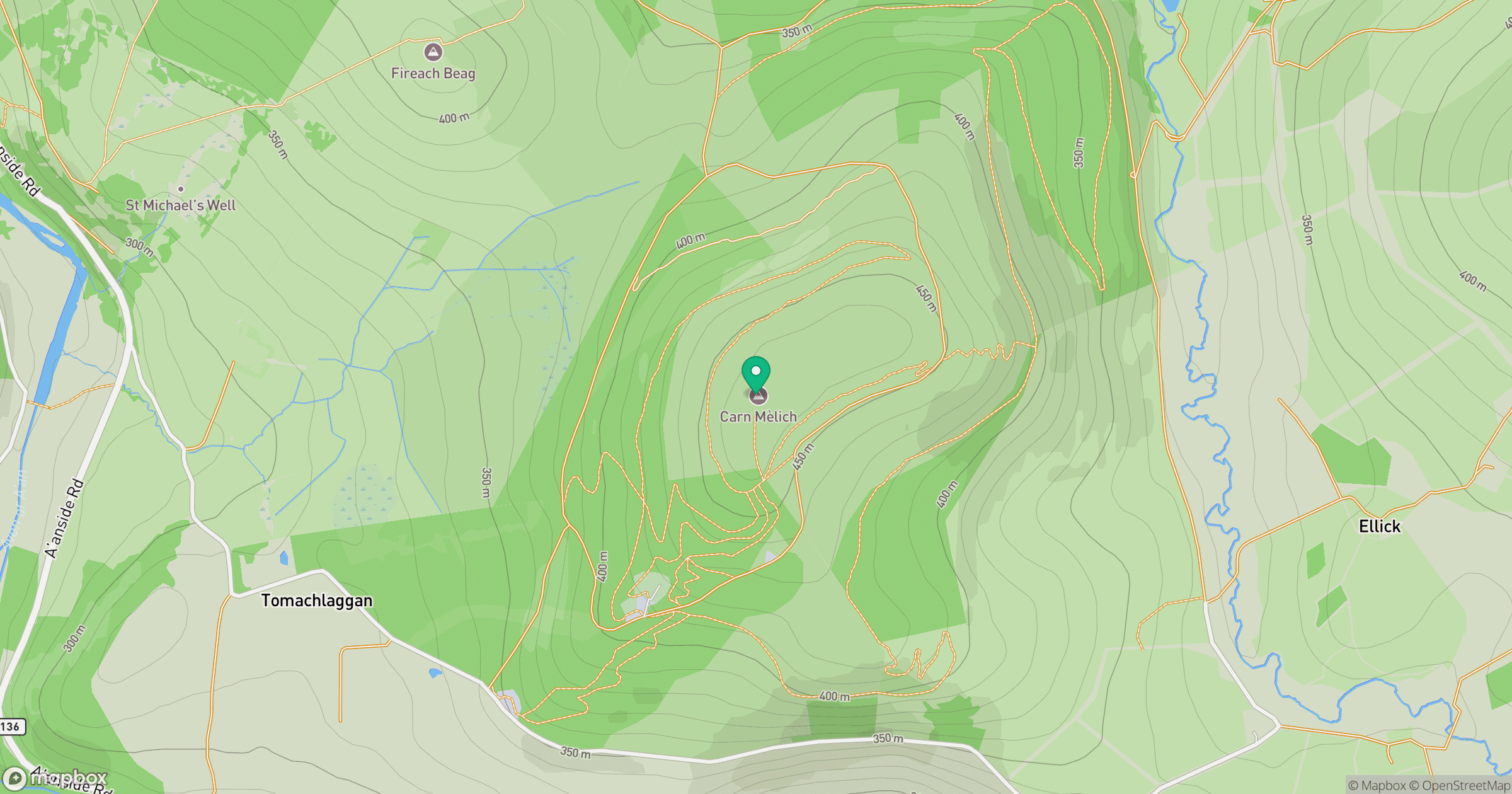
Grid reference: NJ161230
View on OpenStreetMapOpens a map in a new tab, centred on the hill.
Hills within 30 km
Straight-line distance, not a walking route or confirmation of access.
Ben Avon - Leabaidh an Daimh Bhuidhe
1,172m
Bynack More
1,090m
Beinn Mheadhoin
1,183m
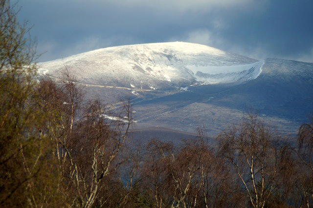
Cairn Gorm
1,245m
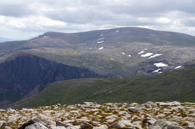
Ben Macdui [Beinn Macduibh]
1,309m
No comments yet. Be the first.