
Cnoc Calgary
Good walks are even better shared.
Overview
Cnoc Calgary: A Hidden Gem of the Isle of Mull
Cnoc Calgary, standing at 289 meters, is a delightful peak nestled in the scenic Isle of Mull. This Marilyn is an excellent choice for hikers looking for a moderately challenging route combined with stunning views.
Geology
The mountain is primarily made of ancient volcanic rock, a remnant of the Earth’s fiery past. As you traverse its slopes, you may notice various rock formations providing a glimpse into the complex geological processes at work over millions of years. Studying the rocks here could leave a geologist rather tickled pink!
Route Information
The most popular route is along the Calgary Bay Trail. Starting at Calgary Bay, this 4 km trek offers plenty of photo opportunities as you pass through lush vegetation and rocky sections. It should take around 2.5 hours to reach the summit, depending on how many times you stop to take a selfie — no judgement here!
Summit Features
The summit features a charming little cairn, perfect for those who enjoy a good rest atop their victories. While it's not the tallest peak, the sense of accomplishment is gigantic!
Terrain Type
Expect a mix of grassy fields peppered with rocky outcrops—unlike your typical stroll in the park, this hike requires a bit of getting your boots dirty (or at least a little mud on the soles).
Views
The views from the summit are nothing short of breathtaking: Calgary Bay stretches out below, with the distant Inner Hebrides islands creating a stunning backdrop. Opt for an early morning hike in the spring or summer months to catch the landscape bathed in that lovely golden sunlight. Simply put: it’s Instagram gold!
Hazards
Always keep an eye on the weather when hiking here; it can be as unpredictable as a cat on a hot tin roof. Some sections are fairly steep and can have loose rocks, so sturdy footwear is advisable.
Nearby Summits
If you feel on top of the world after conquering Cnoc Calgary, consider extending your adventure by visiting nearby peaks such as Ben More (966 m) or Cnoc Fionn (438 m).
Access
Getting there is part of the adventure! The nearest parking is at Calgary Bay, where parking spots can fill up quicker than you can say 'cream tea'. Public transport from Tobermory is available but having a car would certainly add to the ease.
Facilities
For those needing to refuel after their trek, Tobermory offers a variety of cafes and restaurants. Public toilets are conveniently located near Calgary Bay for that essential stop before heading back into nature.
Conclusion
Cnoc Calgary may not be the highest mountain, but it is certainly one of the most rewarding hikes the Isle of Mull has to offer. With spectacular views, interesting geology, and a friendly atmosphere, there's no reason not to take a hike up this wonderful hill!
Happy Hiking!
Explore routes near Cnoc Calgary
Walks starting near this hill. Open a route to check its map, distance and full itinerary.
Crinan Canal: Bellanoch and Dunardry towpath return
View route
Ben Nevis via Mountain Path
View route
Banavie to Glen Loy Aqueduct: Neptune’s Staircase Canal Towpath
View route
Route planning notes
These notes describe possible approaches. Check a route's map and access information when planning your walk.
Calgary Bay Trail
This scenic route starts at Calgary Bay and winds its way up the slopes of Cnoc Calgary, providing stunning views as you ascend.
Make a day of it, together
Find someone to share the walk with, or organise a day out along a route you like.
Hill facts and local notes
Classifications
Elevation
155m
509 ft
Prominence
33m
Coordinates
56.5799, -6.2652
NM381512
OS Map
47
Explorer: 374W
At the Summit
The summit is marked by a modest cairn, offering a delightful spot for a well-deserved rest and some photos.
Terrain & Geology
Cnoc Calgary is primarily composed of ancient volcanic rock, characteristic of the geological history of the Inner Hebrides. It offers fascinating insights into tectonic activity and erosion over millennia.
Views & Scenery
From the summit, you can see the beautiful Calgary Bay, the distant islands of the Inner Hebrides, and, on a clear day, the rugged landscape of the northwest coast of Scotland.
History & Heritage
Name Origin
Cnoc Calgary translates roughly to 'hill at Calgary', with 'Cnoc' meaning hill in Gaelic.
Historical Significance
The area around Calgary Bay has historical significance related to early settler patterns in the Hebrides and boasts rich biodiversity.
Getting There & Facilities
Parking
Parking is available at Calgary Bay, which has enough space for several cars but can get busy in the summer months.
Public Transport
Regular bus services operate from Tobermory, but a private vehicle is advisable for easier access.
Nearby Facilities
Cafes and restaurants can be found in Tobermory, with public toilets available near Calgary Bay.
Safety Information
Known Hazards
- Occasional steep sections with loose rocks; ensure proper footwear. Weather can change unexpectedly, so pay attention to the forecast.
General Safety Tips
- Check weather conditions before setting out
- Carry appropriate clothing and equipment
- Let someone know your planned route
- Take a map, compass, and GPS device
- Carry emergency supplies: food, water, first aid kit, torch
Hills
Some common questions about the hills answered
Are there group walks up Cnoc Calgary?
Many walkers use Walkmates to join or organise walks with others. You can check for group walks around Cnoc Calgary through the maps
Are there other walkers around Cnoc Calgary?
Activity varies by location and time, but Walkmates lets you see whether others have shared walks or shown interest in this area. Find other people through the walking friends search walking friends for Cnoc Calgary search or of course create your own walk for Cnoc Calgary
Can I organise a walk to Cnoc Calgary?
Yes. If there aren’t any walks listed already, you can create a walk and make it available for others to join.
If you're signed up to Walkmates, you can create a walk to Cnoc Calgary.
How do I find a walk up this hill?
There are often multiple ways to walk this hill, depending on experience and route preference. Walkmates helps you explore walks and routes that others have shared.
Can I suggest a new route up Cnoc Calgary?
Yes. You can suggest or create routes to share with others. Walkmates focuses on the social side of walking, so routes are used to help people organise walks and explore areas together, rather than as detailed navigation tools or route libraries.
Other uses really appreciate knowledgeable walkers sharing their routes. Share your favourite route to Cnoc Calgary here
The is an error or something incorrect about this hill. How do I let you know?
We always strive to keep the information on Walkmates as accurate as possible. If you find an error, please let us know through the contact form and we'll aim to correct it as quickly as possible
Community Discussion
Comments
Location
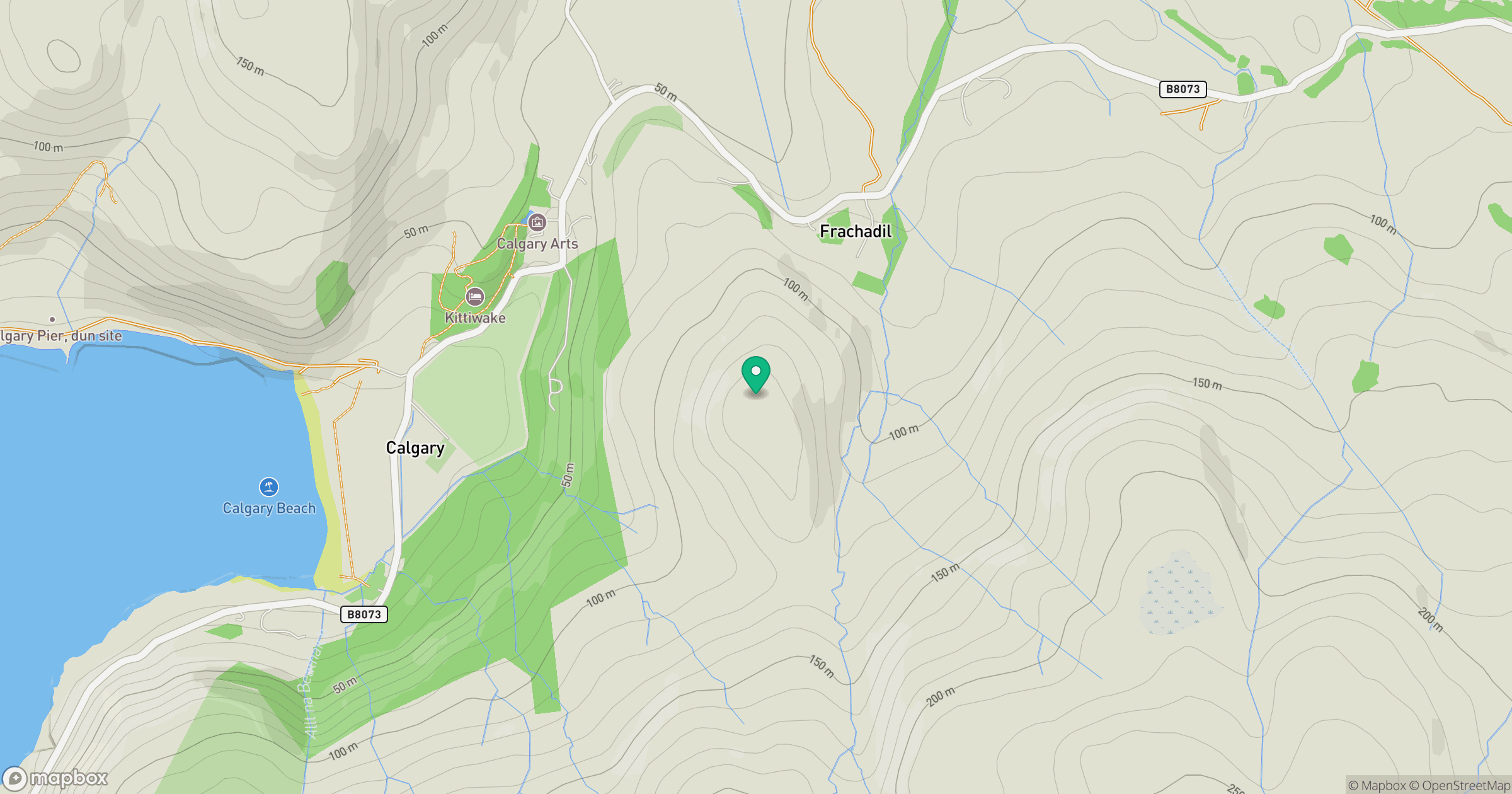
Grid reference: NM381512
View on OpenStreetMapOpens a map in a new tab, centred on the hill.
No comments yet. Be the first.