

Gometra
Good walks are even better shared.
NM3641 : Basalt exposure, Gometra
Richard Webb Photo source
Overview
Gometra: A Hidden Gem of the Inner Hebrides
Nestled in the enchanting Inner Hebrides, Gometra is not just a mountain, it's an experience waiting to happen. Rising to an elevation of 241 meters, this Marilyn offers splendid views and a sense of adventure.
Geology
Gometra's geology is fascinating, dominated by sedimentary rocks, with limestone taking centre stage. The landscape bears the marks of glacial activity, leaving behind a canvas of dramatic cliffs and serene lochs. If rocks could talk, these would tell tales of ancient seabeds!
Routes
The recommended route is the Gometra Circuit, which spans approximately 10.5 km and takes around 3.5 hours to complete. This moderate trek will take you around the island, blending rocky terrain and gentle grassy slopes.
Summit Features
Reaching the summit, expect to be greeted by a humble cairn, built from local stones. Make sure to strike a pose; your friends will be green with envy!
Terrain Type
Prepare for a variety of terrains. From grassy paths that sway in the wind to rocky outcrops that keep you on your toes—Gometra is anything but monotonous.
Views
The views from Gometra's summit are nothing short of spectacular. You'll be treated to sights of the Treshnish Isles and the famous Staffa, home to Fingal's Cave. Late spring and early autumn are prime times for clearer views and pleasant weather.
Hazards
While Gometra is a delightful hike, it does have its quirks. Be wary of slippery moss and sharp rocks near the summit; a pratfall could turn your adventure into a trip to the nearest medical centre.
Nearby Summits
If you’re looking to extend your hiking adventures, Ulva, standing at 270 meters, is a nearby summit worth checking out!
Access
Getting to Gometra is part of the adventure! With no roads, access is by boat from the Ulva Ferry. The nearest decent parking is at the jetty, but spaces fill up quicker than a tea kettle on a Sunday afternoon!
Facilities
Facilities on Gometra are limited, but you can hop back to Tobermory for a well-deserved cuppa and cake after your hike! Cafes and toilets await you there.
History
The very name Gometra conjures images of lush grazing lands, as its Gaelic name 'Gomhaire' reveals. Historically, the island was home to settlements, remnants of which you can explore.
Final Thoughts
In conclusion, Gometra is a splendid destination for those looking to escape the hustle and bustle, offering both natural beauty and historical intrigue. So lace up your hiking boots, grab your camera, and prepare for a day full of adventure—just remember to bring your sense of humour along!
Happy hiking!
Explore routes near Gometra
Walks starting near this hill. Open a route to check its map, distance and full itinerary.
Route planning notes
These notes describe possible approaches. Check a route's map and access information when planning your walk.
Gometra Circuit
A scenic loop around the island that offers varying terrains and breathtaking views of the surrounding waters.
Make a day of it, together
Find someone to share the walk with, or organise a day out along a route you like.
Photo Gallery
View all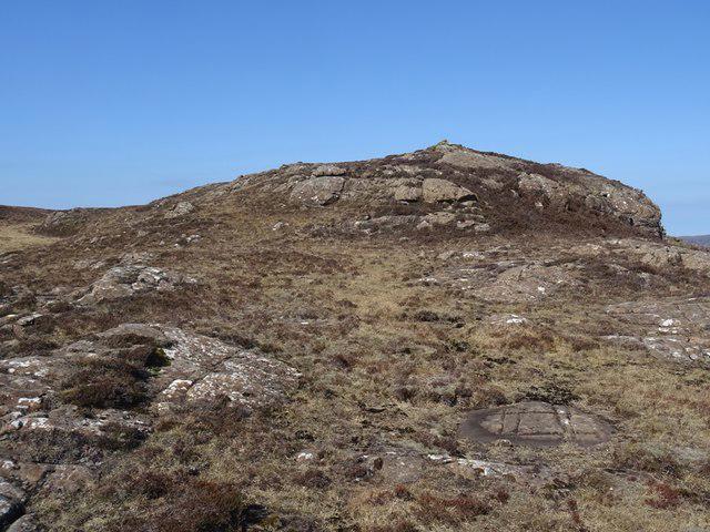 Photo could not load
NM3641 : Basalt exposure, Gometra
Richard Webb
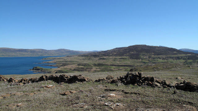 Photo could not load
NM3641 : Ruined dry stone wall crossing summit of Gometra
Trevor Littlewood
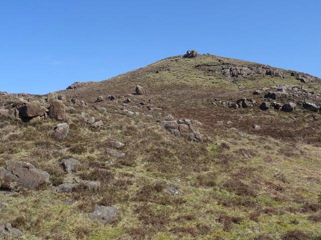 Photo could not load
NM3641 : Gometra, the high point
Richard Webb
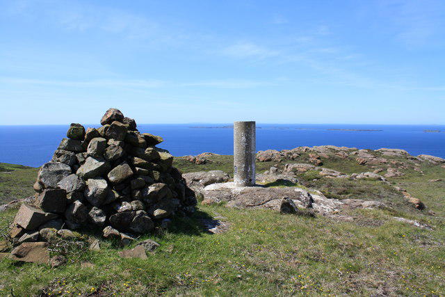 Photo could not load
NM3641 : Gometra Summit
Colin Kinnear
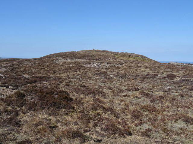 Photo could not load
NM3641 : Gometra, the summit
Richard Webb
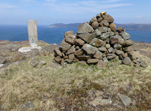 Photo could not load
NM3641 : Gometra Cairn And Vanessa Trig
Rude Health
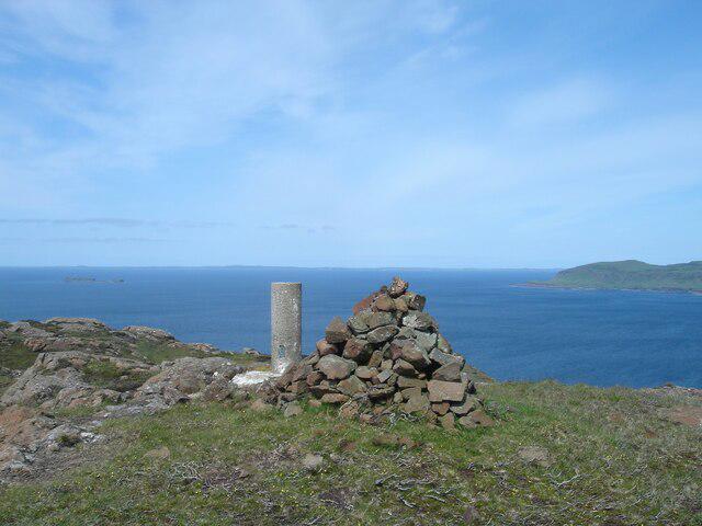 Photo could not load
NM3641 : The summit of Gometra
Michael Earnshaw
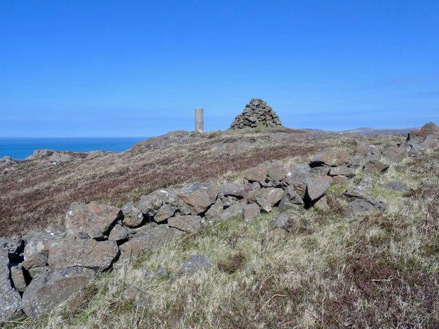 Photo could not load
NM3641 : Summit, Gometra
Richard Webb
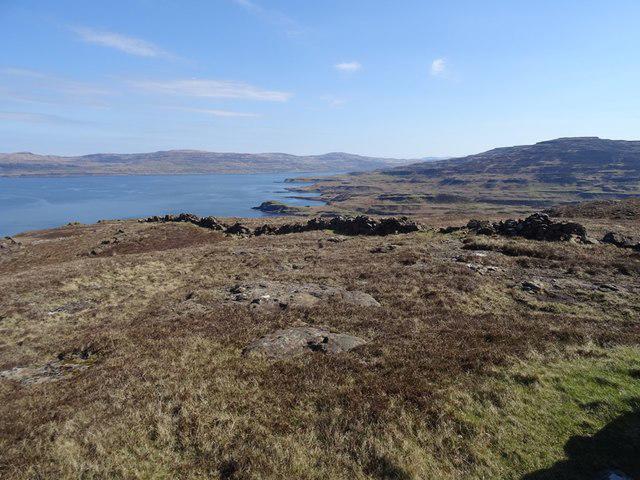 Photo could not load
NM3641 : Summit area, Gometra
Richard Webb
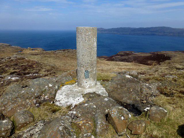 Photo could not load
NM3641 : Gometra Vanessa Trig Plus Coastal View
Rude Health
Hill facts and local notes
Classifications
Elevation
155m
509 ft
Prominence
155m
Coordinates
56.4906, -6.2885
NM361414
OS Map
47 48
Explorer: 374W
At the Summit
The summit consists of a small cairn made of local stone, perfect for those Instagram shots to prove you actually made it!
Terrain & Geology
Gometra is primarily composed of sedimentary rock, notably limestone, which gives rise to its distinctive ridges. The landscape features evidence of glacial erosion, providing stunning cliffs and peaceful lochans.
Views & Scenery
From the summit, hikers can see the stunning vistas of the nearby islands, including the Treshnish Isles and the famous Staffa with Fingal's Cave.
History & Heritage
Name Origin
The name 'Gometra' is derived from the Gaelic 'Gomhaire', meaning 'grazing land'. A fitting tribute to its lush pastures.
Historical Significance
Historically, Gometra was inhabited, and ruins of old settlements can still be explored. It's a slice of history amidst the tranquil scenery.
Getting There & Facilities
Parking
Parking is available at the small jetty on Gometra, but spaces are limited. Arrive early to secure a spot.
Public Transport
Access to Gometra is primarily by boat from Ulva Ferry; there's no public road.
Nearby Facilities
Limited facilities are available on Gometra itself; however, Tobermory offers cafes and toilet facilities.
Safety Information
Known Hazards
- Watch out for areas of slippery moss and sharp rocks near the summit; a misstep here could lead to an unscheduled trip to the local hospital.
General Safety Tips
- Check weather conditions before setting out
- Carry appropriate clothing and equipment
- Let someone know your planned route
- Take a map, compass, and GPS device
- Carry emergency supplies: food, water, first aid kit, torch
Hills
Some common questions about the hills answered
Are there group walks up Gometra?
Many walkers use Walkmates to join or organise walks with others. You can check for group walks around Gometra through the maps
Are there other walkers around Gometra?
Activity varies by location and time, but Walkmates lets you see whether others have shared walks or shown interest in this area. Find other people through the walking friends search walking friends for Gometra search or of course create your own walk for Gometra
Can I organise a walk to Gometra?
Yes. If there aren’t any walks listed already, you can create a walk and make it available for others to join.
If you're signed up to Walkmates, you can create a walk to Gometra.
How do I find a walk up this hill?
There are often multiple ways to walk this hill, depending on experience and route preference. Walkmates helps you explore walks and routes that others have shared.
Can I suggest a new route up Gometra?
Yes. You can suggest or create routes to share with others. Walkmates focuses on the social side of walking, so routes are used to help people organise walks and explore areas together, rather than as detailed navigation tools or route libraries.
Other uses really appreciate knowledgeable walkers sharing their routes. Share your favourite route to Gometra here
The is an error or something incorrect about this hill. How do I let you know?
We always strive to keep the information on Walkmates as accurate as possible. If you find an error, please let us know through the contact form and we'll aim to correct it as quickly as possible
Community Discussion
Comments
Location
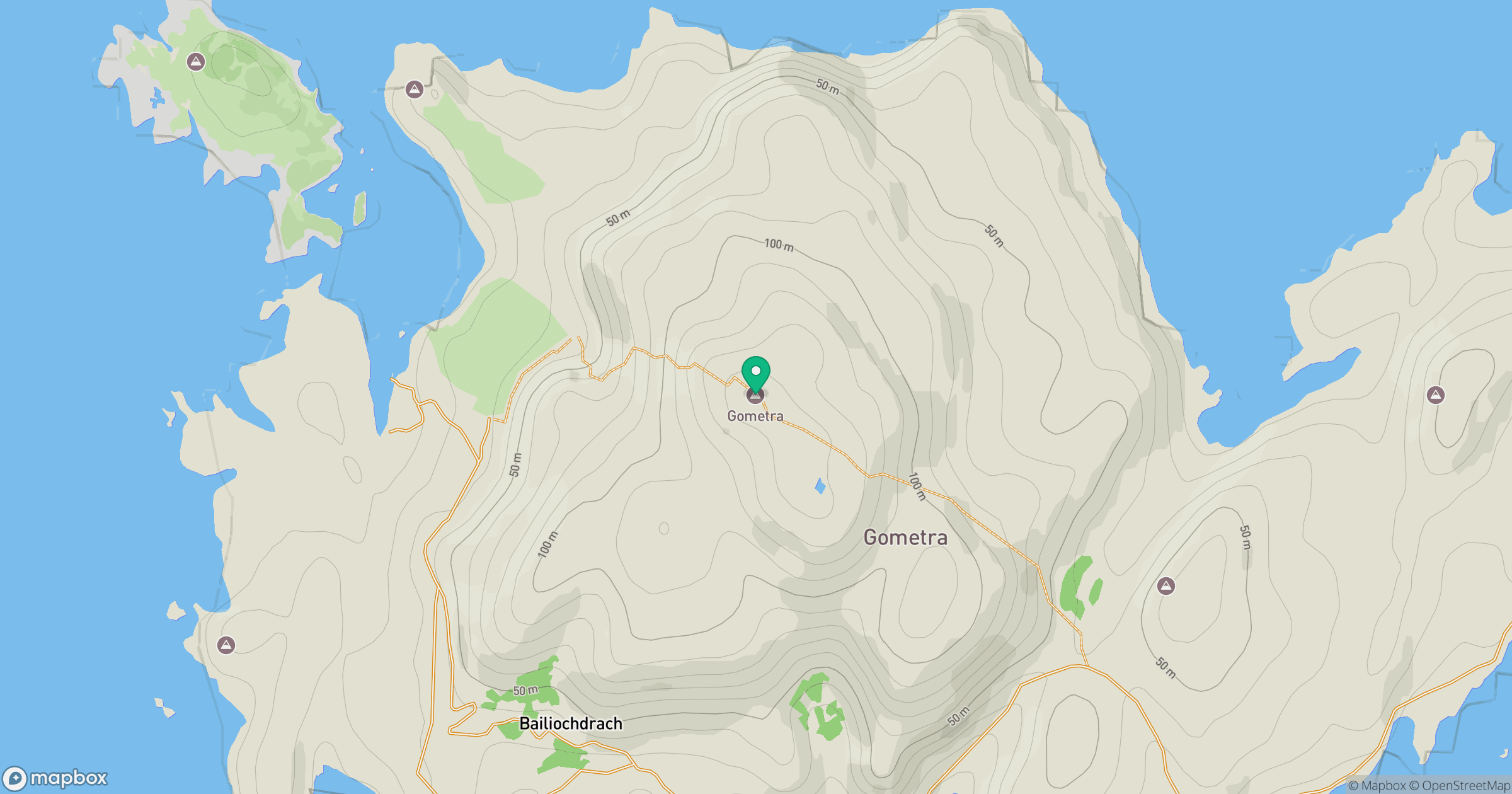
Grid reference: NM361414
View on OpenStreetMapOpens a map in a new tab, centred on the hill.
No comments yet. Be the first.