

Cnoc an da Chinn
Good walks are even better shared.
Overview
Cnoc an da Chinn
Situated in the heart of the Scottish Highlands, Cnoc an da Chinn stands proudly at an elevation of 663 meters, making it a delightful outing for hikers seeking adventure without the lengthy ascent. Known affectionately as the 'Hill of the Two Heads', this Marilyn offers a perfect mix of challenge and accessibility.
Geology
Cnoc an da Chinn's sturdy structure comes from ancient volcanic activity, with remnants of hardened lava flows forming a tough yet accessible terrain. Wanderers will find the landscape dotted with rocky outcrops, giving a small taste of the raw power that shaped these hills many millennia ago.
Routes
The popular Fisherman's Path is the starting point for many adventures, leading you through charming heathland towards a scenic summit. It spans approx. 7.5 km round trip and typically takes around 3.5 hours. While it’s moderately challenging, it's accessible enough for those with a reasonable level of fitness, and the views make every step worth it—especially when you can reward yourself at the summit!
Summit Features
Upon reaching the summit, you'll be greeted by a sizeable stone cairn. It’s customary—and downright satisfying—to add a stone of your own to this hiker’s monument. The views from the top are, I assure you, nothing short of breathtaking!
Terrain Type
Most of the ascent is grassy, with occasional rocky patches; a classic Scottish mix. Just remember, when we say 'rocky,' we’re referring to the ground, not your hiking gear—leave the boulders at home, will you?
Views
On a clear day, which admittedly can be a bit like trying to find a unicorn in the Highlands, you’ll be rewarded with sights that stretch across Glen Lochawe and beyond. Look out for the striking contours of Ben Cruachan cutting across the skyline. The best seasons for these views are late spring and autumn—just try not to overdo it on the selfie sticks!
Hazards
Be prepared for the unpredictable Scottish weather—it can turn on a dime, so check the forecast before you head out! Some sections may also be muddy; thus, a good pair of waterproof boots is your best friend—and a difference between a wholesome hike and an impromptu mud wrestling match!
Access
Accessing Cnoc an da Chinn is convenient with a small car park near Dalmally village. From there, the start of your adventure is just a brisk 4 km stroll. Public transport options are available via the West Highland Line, with trains regularly running from Glasgow.
Facilities
Post-hike, treat yourself in Dalmally, where you’ll find a café to satisfy those hunger pangs and perhaps a small shop if you need supplies. Public toilets are also nearby for your comfort.
History
The name Cnoc an da Chinn (Hill of the Two Heads) alludes to the dual characteristics of this majestic hill. The area has rich historical significance; archaeological endeavors reveal evidence of prehistoric life, lending a sense of connection to those who have walked these grounds long before us.
So, lace up those boots and embark on your own adventure at Cnoc an da Chinn—who knows, you might just make a new friend at the cairn!
Explore routes near Cnoc an da Chinn
Public walks starting within 80 km of this hill. Nearby does not mean a route reaches the summit; check its map and access before setting out.
Crinan Canal: Bellanoch and Dunardry towpath return
View route
Ben Nevis via Mountain Path
View route
Banavie to Glen Loy Aqueduct: Neptune’s Staircase Canal Towpath
View route
Route planning notes
These notes describe possible approaches, not verified navigable routes or permission to cross land. Check current paths, local access rules and conditions before setting out.
The Fisherman's Path
A scenic route beginning from the shores of Loch Awe, following a well-trodden track up through the heathland towards the summit. Ideal for those who enjoy a mix of woodland and open skies.
Make a day of it, together
Find someone to share the walk with, or organise a day out along a route you like.
Photo Gallery
View all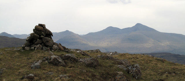 Photo could not load
NM4445 : Cairn with rocks at summit of Cnoc an dà Chinn
Trevor Littlewood
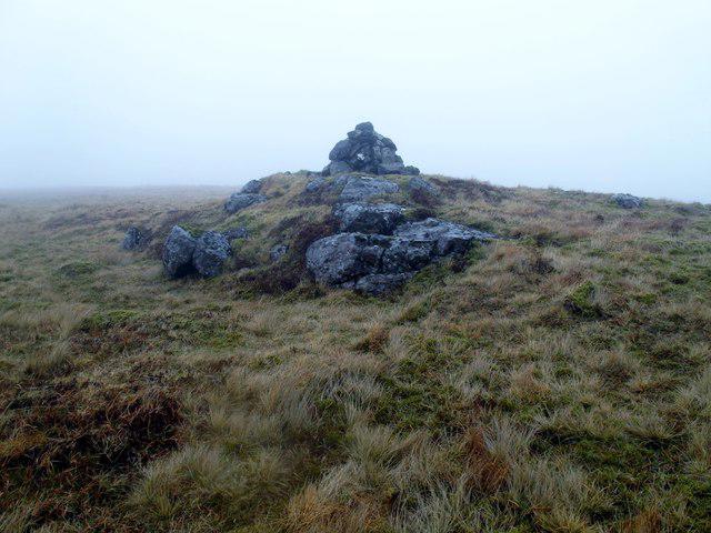 Photo could not load
NM4445 : Cnoc an da Chinn
Rude Health
Hill facts and local notes
Classifications
Elevation
391m
1,283 ft
Prominence
105m
Coordinates
56.5276, -6.1632
NM440450
OS Map
47 48
Explorer: 374E
At the Summit
The summit is crowned by a large stone cairn, providing a perfect spot to revel in the breathtaking views of the surrounding hills and lochs. There's a certain satisfaction in adding your stone to the pile!
Terrain & Geology
The mountain is primarily composed of tough volcanic rock, providing a solid and stable terrain for hikers. The underlying geology features ancient lava flows that have shaped the landscape into the stunning vistas we see today.
Views & Scenery
From the summit, gaze upon Glen Lochawe, the magnificent Ben Cruachan, and the rolling hills extending towards the horizon. You might even spot a few otters frolicking in the loch below!
History & Heritage
Name Origin
Cnoc an da Chinn translates to 'Hill of the Two Heads', possibly reflecting the dual summits or the sense of duality in its dramatic landscape.
Historical Significance
The area around Cnoc an da Chinn has been populated for centuries, with archaeological finds indicating human presence and activity dating back to the prehistoric times.
Getting There & Facilities
Check current local access restrictions, parking rules and transport timetables before travelling. These notes do not confirm public access to the summit.
Parking
There is a small car park near the village of Dalmally, located approximately 4 km from the trailhead. Keep an eye out for the signage indicating the path to Loch Awe.
Public Transport
Dalmally is served by the West Highland Line with regular trains from Glasgow. From the station, it's a short taxi ride to the car park.
Nearby Facilities
In Dalmally, you can find a small café and shop for those post-hike refreshments. Public toilets are also available near the train station.
Safety Information
Known Hazards
- Be cautious of sudden weather changes typical of the Highlands. Additionally, some sections of the path can be muddy, so waterproof boots are a wise choice.
General Safety Tips
- Check weather conditions before setting out
- Carry appropriate clothing and equipment
- Let someone know your planned route
- Take a map, compass, and GPS device
- Carry emergency supplies: food, water, first aid kit, torch
Hills
Some common questions about the hills answered
Are there group walks up Cnoc an da Chinn?
Many walkers use Walkmates to join or organise walks with others. You can check for group walks around Cnoc an da Chinn through the maps
Are there other walkers around Cnoc an da Chinn?
Activity varies by location and time, but Walkmates lets you see whether others have shared walks or shown interest in this area. Find other people through the walking friends search walking friends for Cnoc an da Chinn search or of course create your own walk for Cnoc an da Chinn
Can I organise a walk to Cnoc an da Chinn?
Yes. If there aren’t any walks listed already, you can create a walk and make it available for others to join.
If you're signed up to Walkmates, you can create a walk to Cnoc an da Chinn.
How do I find a walk up this hill?
There are often multiple ways to walk this hill, depending on experience and route preference. Walkmates helps you explore walks and routes that others have shared.
Can I suggest a new route up Cnoc an da Chinn?
Yes. You can suggest or create routes to share with others. Walkmates focuses on the social side of walking, so routes are used to help people organise walks and explore areas together, rather than as detailed navigation tools or route libraries.
Other uses really appreciate knowledgeable walkers sharing their routes. Share your favourite route to Cnoc an da Chinn here
The is an error or something incorrect about this hill. How do I let you know?
We always strive to keep the information on Walkmates as accurate as possible. If you find an error, please let us know through the contact form and we'll aim to correct it as quickly as possible
Community Discussion
Comments
Location
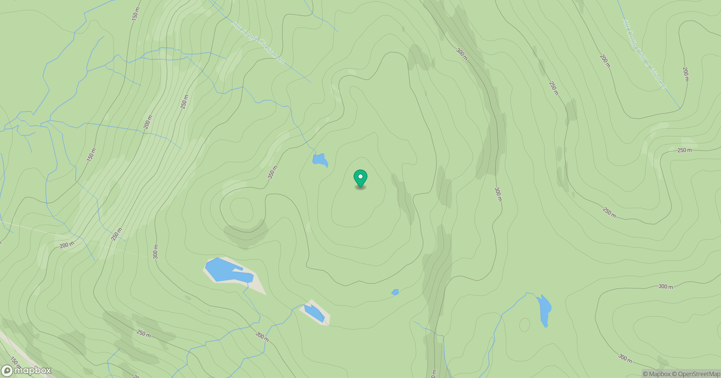
Grid reference: NM440450
View on OpenStreetMapOpens a map in a new tab, centred on the hill.
Hills within 30 km
Straight-line distance, not a walking route or confirmation of access.
No comments yet. Be the first.