

Cruach Sleibhe
Good walks are even better shared.
Overview
Cruach Sleibhe: A Gem in the Scottish Highlands
Cruach Sleibhe might not be the tallest mountain in the Highlands, but what it lacks in height, it makes up for in charm and beautiful vistas. Standing at an elevation of 714 meters, this Marilyn is a fine choice for both seasoned walkers and those new to hillwalking.
Geology
The mountain's geology tells a story of ancient geological forces, as it is primarily crafted from sandstone and schist. The soils here are famously acidic, creating an ideal environment for diverse flora. With each step, you can almost feel the weight of history!
Routes
The most popular route starts from the A82 near Crianlarich. It’s a straightforward path that is relatively well-maintained, making it accessible for moderate walkers. Expect to cover 8.5 kilometers in just about 3.5 hours. Not only does this route offer gorgeous landscapes, but it’s also a delightful way to get accustomed to Highland walking.
Summit Features
On reaching the summit, trekkers are greeted by a rather photogenic stone cairn. The 360-degree view is akin to the icing on the cake—complete with a panoramic vista of Ben More and Loch Awe. Don’t forget to snap a few pictures; the summit is Instagram-worthy!
Terrain
Be prepared for a variety of terrains! The slopes are primarily rocky or grassy, which is standard fare for the Highlands. However, some boggy patches may attempt to slow you down. A sturdy pair of hiking boots is recommended unless you prefer a good splash!
Views
From the summit, the views are nothing short of spectacular. Notable landmarks include Ben More and the picturesque Loch Awe. Late spring through autumn is the best time to visit for clear views and vibrant landscapes, although don’t be surprised if the weather decides to play tricks on you—it’s all part of the fun!
Hazards
As with any mountain adventure, there are some hazards to be mindful of. The weather can change swiftly, turning a serene day into a challenging one. Watch your step on the rocky areas, and bring suitable clothing to combat changing conditions. After all, getting caught in a rain shower can be less than delightful!
Nearby Summits
For those keen on extending their adventure, consider visiting nearby summits such as Ben More (966 meters) or Stobinian (942 meters). Each one offers its unique challenges and views, ensuring that your hiking appetite is well-satisfied.
Access
Parking can be found at a convenient A82 layby approximately 3.5 km from the starting trail. Public transport is also an option, with regular bus services connecting Glasgow to Crianlarich. Be sure to plan ahead if you plan to hitch a ride!
Facilities
While high up on the mountain you’re pretty much out in the wild, Crianlarich serves as your friendly base with a cafe and public facilities, including toilets—because nobody wants to be caught unprepared in the wilderness!
History
The name ‘Cruach Sleibhe’ translates to ‘Hill of the Slopes’. This name reflects the gentle, rolling nature of the mountain, alongside its rugged characteristics. This mountain has been an integral part of local history and culture, forming a backdrop to the lives of many who have wandered through its stunning landscapes.
In conclusion, Cruach Sleibhe provides a delightful combination of scenic beauty, historical insight, and a good hike. So grab your boots, pack a sandwich, and be ready for a day of stunning views and Highland adventures!
Explore routes near Cruach Sleibhe
Public walks starting within 80 km of this hill. Nearby does not mean a route reaches the summit; check its map and access before setting out.
Crinan Canal: Bellanoch and Dunardry towpath return
View route
Ben Nevis via Mountain Path
View route
Banavie to Glen Loy Aqueduct: Neptune’s Staircase Canal Towpath
View route
Route planning notes
These notes describe possible approaches, not verified navigable routes or permission to cross land. Check current paths, local access rules and conditions before setting out.
Starting from A82 near Crianlarich
A well-marked path that winds its way through scenic glens and up to the summit, offering a taste of the Highlands’ natural beauty.
Make a day of it, together
Find someone to share the walk with, or organise a day out along a route you like.
Photo Gallery
View all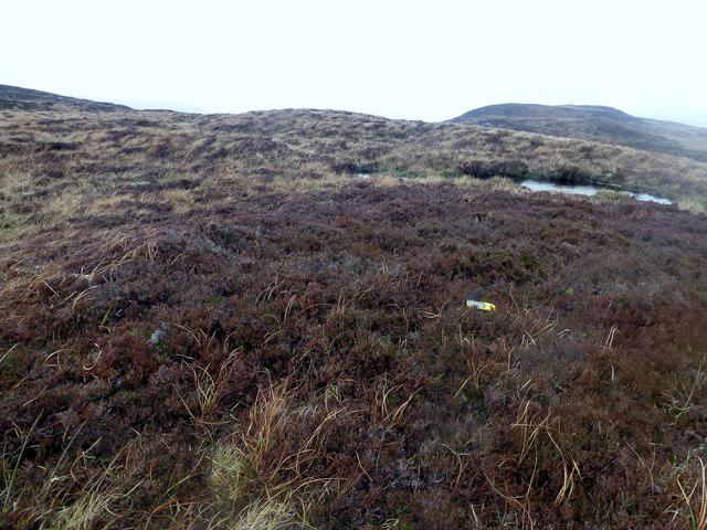 Photo could not load
NM3752 : Cruach Sleibhe
Rude Health
Hill facts and local notes
Classifications
Elevation
166m
545 ft
Prominence
118m
Coordinates
56.5883, -6.2820
NM371522
OS Map
47
Explorer: 374W
At the Summit
The summit is marked by a small stone cairn and provides a breathtaking panoramic view of the surrounding hills and lochs.
Terrain & Geology
Composed primarily of sandstone and schist, Cruach Sleibhe showcases the complex geological history of the Highlands. The mountain's flanks are adorned with a variety of alpine flora, thriving in the acidic soils.
Views & Scenery
On a clear day, look out for the iconic Ben More and the tranquil Loch Awe shimmering below.
History & Heritage
Name Origin
Cruach Sleibhe translates approximately to 'Hill of the Slopes' in Gaelic, which is quite fitting, wouldn’t you agree?
Historical Significance
The mountain has been a silent witness to centuries of Scottish history, from ancient clans to modern adventurers.
Getting There & Facilities
Check current local access restrictions, parking rules and transport timetables before travelling. These notes do not confirm public access to the summit.
Parking
Parking is available at the A82 layby approximately 3.5 km from the trailhead.
Public Transport
Regular bus services link Glasgow with Crianlarich, the nearest village, making it reachable by public transport.
Nearby Facilities
Although facilities are sparse high up, Crianlarich offers a cafe and basic amenities, including public toilets.
Safety Information
Known Hazards
- Be wary of sudden weather changes and slippery rocks, particularly in the wetter months. The terrain can be uneven, so watch your step!
General Safety Tips
- Check weather conditions before setting out
- Carry appropriate clothing and equipment
- Let someone know your planned route
- Take a map, compass, and GPS device
- Carry emergency supplies: food, water, first aid kit, torch
Hills
Some common questions about the hills answered
Are there group walks up Cruach Sleibhe?
Many walkers use Walkmates to join or organise walks with others. You can check for group walks around Cruach Sleibhe through the maps
Are there other walkers around Cruach Sleibhe?
Activity varies by location and time, but Walkmates lets you see whether others have shared walks or shown interest in this area. Find other people through the walking friends search walking friends for Cruach Sleibhe search or of course create your own walk for Cruach Sleibhe
Can I organise a walk to Cruach Sleibhe?
Yes. If there aren’t any walks listed already, you can create a walk and make it available for others to join.
If you're signed up to Walkmates, you can create a walk to Cruach Sleibhe.
How do I find a walk up this hill?
There are often multiple ways to walk this hill, depending on experience and route preference. Walkmates helps you explore walks and routes that others have shared.
Can I suggest a new route up Cruach Sleibhe?
Yes. You can suggest or create routes to share with others. Walkmates focuses on the social side of walking, so routes are used to help people organise walks and explore areas together, rather than as detailed navigation tools or route libraries.
Other uses really appreciate knowledgeable walkers sharing their routes. Share your favourite route to Cruach Sleibhe here
The is an error or something incorrect about this hill. How do I let you know?
We always strive to keep the information on Walkmates as accurate as possible. If you find an error, please let us know through the contact form and we'll aim to correct it as quickly as possible
Community Discussion
Comments
Location
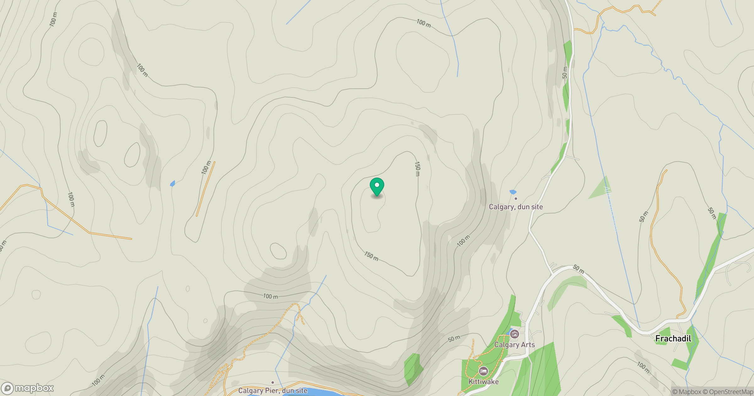
Grid reference: NM371522
View on OpenStreetMapOpens a map in a new tab, centred on the hill.
Hills within 30 km
Straight-line distance, not a walking route or confirmation of access.
No comments yet. Be the first.