
Beinn Bhuidhe
Good walks are even better shared.
Overview
Beinn Bhuidhe
Welcome to Beinn Bhuidhe, the proud Munro standing at a majestic height of 948 meters in the heart of the Scottish Highlands. Known for its rugged terrain and breathtaking vistas, this mountain is a treat for hikers looking to stretch their legs and soak in stunning scenery.
Geology
Beinn Bhuidhe is primarily composed of metamorphic schists, which were shaped by intense geological processes over millennia. This gives the mountain its distinctive ruggedness and creates a varied landscape that is both beautiful and challenging for hikers.
Routes
The most popular starting point for ascending Beinn Bhuidhe is the Glen Fyne Approach. This route stretches approximately 9.5 km and typically takes about 4.5 hours to complete, depending on your pace and enthusiasm for breaks at stunning viewpoints. Although this route is moderately challenging, it rewards hikers with spectacular scenery and a true sense of wilderness.
Summit Features
At the summit, you’ll find a well-built cairn that serves not only as a marker but also as a great spot to catch your breath and chuckle at the tiny creatures scurrying below. The views from the top are simply out of this world!
Terrain
Expect a delightful mix of rocky paths and grassy slopes, but keep an eye out for some potential boggy patches near the base—standard Scottish fare!
Views
Once at the top, enjoy the incredible panorama! Notably, Loch Fyne is to the west, surrounded by lush green hills and the magnificent Jura mountains in the distance—perfect for those Insta-worthy shots! The best times for views are during spring or early summer and, of course, the vibrant autumn scenery is a lovely sight as well.
Hazards
Hiking Beinn Bhuidhe is no walk in the park. Be prepared for sudden changes in weather, steep inclines, and those cheeky bogs lurking in wait to suck in your wellies. Always check the forecast before heading out!
Access
To access this Highland beauty, you’ll find a car park at the head of Glen Fyne, just off the A83. Grab your parking space early, as it can fill up quicker than a cuppa tea at a British café!
Public Transport
While the nearest bus service drops you off at Cairndow, having your own set of wheels makes access a lot smoother.
Facilities
Before you set off, or after your epic adventure, pop into the quaint village of Cairndow, where you can refuel at a cafe or find a toilet—always a bonus after a day in the wild!
History
The name Beinn Bhuidhe translates to 'Yellow Mountain' from Gaelic, a nod to its seasonal blooms. The mountain holds a special place in the hearts of outdoor enthusiasts, symbolising Scottish natural beauty and adventure.
So don your hiking boots, pack a picnic, and take on Beinn Bhuidhe—an adventure that promises satisfaction and ample photo opportunities!
Explore routes near Beinn Bhuidhe
Public walks starting within 80 km of this hill. Nearby does not mean a route reaches the summit; check its map and access before setting out.
Banavie to Glen Loy Aqueduct: Neptune’s Staircase Canal Towpath
View route
Ben Nevis via Mountain Path
View route
Route planning notes
These notes describe possible approaches, not verified navigable routes or permission to cross land. Check current paths, local access rules and conditions before setting out.
Glen Fyne Approach
A popular and scenic route starting from the car park near the head of Glen Fyne. This trail offers a mix of good paths and rougher sections as you gain elevation.
Make a day of it, together
Find someone to share the walk with, or organise a day out along a route you like.
Hill facts and local notes
Classifications
Elevation
161m
528 ft
Prominence
125m
Coordinates
56.7269, -6.1892
NM438673
OS Map
47
Explorer: 390W
At the Summit
The summit of Beinn Bhuidhe is marked by a prominent cairn, standing proud against the sweeping views of the surrounding Glen Fyne and beyond.
Terrain & Geology
Composed primarily of metamorphic schists, Beinn Bhuidhe's rugged landscape is a testament to the forces of nature, shaped by glaciers and time, providing a fantastic playground for those who love geology and vistas.
Views & Scenery
From the summit, one can see the stunning Loch Fyne, the rolling hills of Argyll, and on a clear day, the distant peaks of the Jura mountains.
History & Heritage
Name Origin
Beinn Bhuidhe translates to 'Yellow Mountain' in Gaelic, likely referring to the colour of its gorse and heather cover during the flowering season.
Historical Significance
The mountain is a popular hiking destination due to its challenging routes and striking views, making it a significant landmark in local outdoor culture.
Getting There & Facilities
Check current local access restrictions, parking rules and transport timetables before travelling. These notes do not confirm public access to the summit.
Parking
There is a small car park located at the head of Glen Fyne, just off the A83. It fills up quickly on sunny weekends, so an early start is advisable.
Public Transport
The nearest bus service stops in nearby Cairndow, but the best access is by car.
Nearby Facilities
While there are no facilities directly on the mountain, the nearby village of Cairndow has a cafe and toilets, perfect for grabbing a bite before or after your hiking adventure.
Safety Information
Known Hazards
- Potential for sudden weather changes, steep slopes, and boggy conditions, particularly after rainfall.
General Safety Tips
- Check weather conditions before setting out
- Carry appropriate clothing and equipment
- Let someone know your planned route
- Take a map, compass, and GPS device
- Carry emergency supplies: food, water, first aid kit, torch
Hills
Some common questions about the hills answered
Are there group walks up Beinn Bhuidhe?
Many walkers use Walkmates to join or organise walks with others. You can check for group walks around Beinn Bhuidhe through the maps
Are there other walkers around Beinn Bhuidhe?
Activity varies by location and time, but Walkmates lets you see whether others have shared walks or shown interest in this area. Find other people through the walking friends search walking friends for Beinn Bhuidhe search or of course create your own walk for Beinn Bhuidhe
Can I organise a walk to Beinn Bhuidhe?
Yes. If there aren’t any walks listed already, you can create a walk and make it available for others to join.
If you're signed up to Walkmates, you can create a walk to Beinn Bhuidhe.
How do I find a walk up this hill?
There are often multiple ways to walk this hill, depending on experience and route preference. Walkmates helps you explore walks and routes that others have shared.
Can I suggest a new route up Beinn Bhuidhe?
Yes. You can suggest or create routes to share with others. Walkmates focuses on the social side of walking, so routes are used to help people organise walks and explore areas together, rather than as detailed navigation tools or route libraries.
Other uses really appreciate knowledgeable walkers sharing their routes. Share your favourite route to Beinn Bhuidhe here
The is an error or something incorrect about this hill. How do I let you know?
We always strive to keep the information on Walkmates as accurate as possible. If you find an error, please let us know through the contact form and we'll aim to correct it as quickly as possible
Community Discussion
Comments
Location
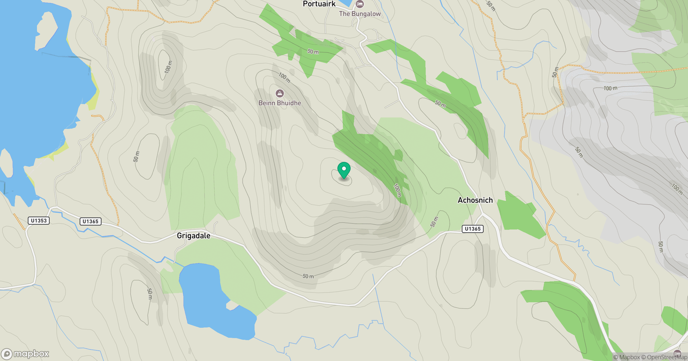
Grid reference: NM438673
View on OpenStreetMapOpens a map in a new tab, centred on the hill.
Hills within 30 km
Straight-line distance, not a walking route or confirmation of access.
No comments yet. Be the first.