

Cnoc Bad a' Choille
Good walks are even better shared.
Overview
Cnoc Bad a' Choille
Overview
Cnoc Bad a' Choille, standing proudly at an elevation of 639 meters, is a captivating Marilyn nestled in the majestic Scottish Highlands. With its panoramic vistas and relatively accessible routes, this mountain attracts hikers seeking both tranquility and adventure.
Geology
Composed mainly of granite, Cnoc Bad a' Choille exhibits the classic rugged beauty of the Highlands. This sturdy rock has weathered the elements, offering unique landforms that tell tales of ancient geological processes. Keep an eye out for the fascinating erosion patterns!
Routes
The most popular route is from the Glen Affric car park. This moderate 10.5 km trek promises scenic views, with the surrounding natural beauty keeping your spirits high as you ascend. You’ll find diverse landscapes, including lush valleys and rocky outcrops. Just remember to pack a picnic for that pit stop at the summit!
Summit Features
Upon reaching the top, you’ll encounter a small yet significant cairn. It meticulously marks the summit, making it the perfect spot for a well-earned break. Just don’t forget to take some selfies—proof of your conquest!
Terrain Type
The terrain is a delightful mix of grassy paths and rocky sections that may cause a short pause for thought (or a short scramble). The beauty of this mountain is that it caters to a variety of hiking styles—just wear the right gear!
Views
Once at the summit, the views are nothing short of spectacular. You’ll catch sight of the tranquil Loch Affric glinting in the sunlight and distant peaks that seem to kiss the sky. Aim for the afternoon for optimal sunlight and clarity, especially in late spring to early autumn.
Hazards
Be wary of the rapidly changing weather conditions typical to the Highlands—always pack for rain even if the sun is shining brightly. And, as lovely as it looks, watch out for those boggy patches on the way up; you don't want your boots to go for an unexpected swim!
Nearby Summits
Cnoc Bad a' Choille is surrounded by other significant heights, including Mullach Fraoch-Choire and Carn Ghluasaid, both worth exploring if you’re feeling particularly adventurous.
Access
The nearest facility for parking is located at Glen Affric car park, providing ample space for vehicles. Public transport is limited, so a car or taxi is recommended. The charming town of Drumnadrochit is about 15 miles away and offers a refreshing post-hike reward, including various cafes.
Facilities
Although you won't find amenities on the mountain, Drumnadrochit has several cafes and public toilets, allowing you to fuel up before or after your adventure.
History
The name Cnoc Bad a' Choille loosely translates to 'Hill of the Badger's Bush', suggesting a connection with local wildlife and the rich ecological tapestry of the area. The mountain and its surroundings are steeped in Scottish folklore, making it a treasure trove for history buffs.
Conclusion
Cnoc Bad a' Choille is more than just a hill; it is an adventure waiting to unfold. With its natural beauty, intriguing geology, and connections to local folklore, this mountain is a wonderful addition to any Scottish hiking itinerary. Bring your sense of adventure—and perhaps a good sandwich!
Explore routes near Cnoc Bad a' Choille
Public walks starting within 80 km of this hill. Nearby does not mean a route reaches the summit; check its map and access before setting out.
Ben Klibreck
View route
Loch Migdale from Torroy: Spinningdale pinewood and loch shore walk
View route
Beinn Eighe Lancaster Wreckage at Coire Mhic Fhearchair
View route
Fairy Lochs Liberator Wreckage Circuit
View route
Route planning notes
These notes describe possible approaches, not verified navigable routes or permission to cross land. Check current paths, local access rules and conditions before setting out.
Glen Affric Route
A popular route starting from the Glen Affric car park, offers a scenic ascent with views of nearby lochs and glens.
Make a day of it, together
Find someone to share the walk with, or organise a day out along a route you like.
Photo Gallery
View all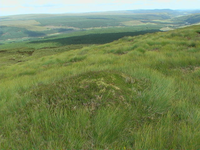 Photo could not load
NH3499 : Dry mound over-looking Strath Oykel from the ridge of Cnoc Bad a' Choille
ian shiell
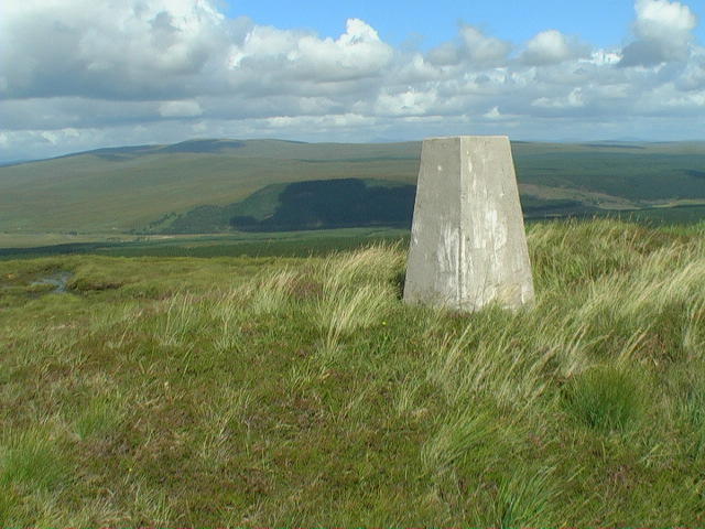 Photo could not load
NH3499 : Cnoc Bad a' Choille trig point
ian shiell
Hill facts and local notes
Classifications
Elevation
340m
1,115 ft
Prominence
107m
Coordinates
57.9513, -4.7965
NH346992
OS Map
20
Explorer: 440S
At the Summit
At the summit, there is a small cairn marking the highest point, offering a perfect spot for a well-deserved snack break or some serious summit selfies.
Terrain & Geology
The mountain is predominantly composed of granite, which gives it a rugged appearance. The weathering of this rock has created interesting landforms in the area.
Views & Scenery
From the summit, you can see the rolling hills of the Scottish Highlands, the shimmering waters of Loch Affric, and the distant peaks of the Aonach Mòr range.
History & Heritage
Name Origin
Cnoc Bad a' Choille translates to 'Hill of the Badger's Bush', highlighting the local wildlife.
Historical Significance
The region is rich in Scottish folklore and history, often associated with stories of clans and the natural beauty of the Highlands.
Getting There & Facilities
Check current local access restrictions, parking rules and transport timetables before travelling. These notes do not confirm public access to the summit.
Parking
Glen Affric car park, which has space for several vehicles and is located approximately 7 miles from the nearest village.
Public Transport
Buses run from Inverness to Drumnadrochit, but the final stretch to Glen Affric may require a taxi or a car hire.
Nearby Facilities
There are no facilities on the mountain itself, but the nearby town of Drumnadrochit has cafes and toilets.
Safety Information
Known Hazards
- Weather changes rapidly in the Highlands; be prepared for sudden rain or wind. There may also be boggy patches in lower areas.
General Safety Tips
- Check weather conditions before setting out
- Carry appropriate clothing and equipment
- Let someone know your planned route
- Take a map, compass, and GPS device
- Carry emergency supplies: food, water, first aid kit, torch
Hills
Some common questions about the hills answered
Are there group walks up Cnoc Bad a' Choille?
Many walkers use Walkmates to join or organise walks with others. You can check for group walks around Cnoc Bad a' Choille through the maps
Are there other walkers around Cnoc Bad a' Choille?
Activity varies by location and time, but Walkmates lets you see whether others have shared walks or shown interest in this area. Find other people through the walking friends search walking friends for Cnoc Bad a' Choille search or of course create your own walk for Cnoc Bad a' Choille
Can I organise a walk to Cnoc Bad a' Choille?
Yes. If there aren’t any walks listed already, you can create a walk and make it available for others to join.
If you're signed up to Walkmates, you can create a walk to Cnoc Bad a' Choille.
How do I find a walk up this hill?
There are often multiple ways to walk this hill, depending on experience and route preference. Walkmates helps you explore walks and routes that others have shared.
Can I suggest a new route up Cnoc Bad a' Choille?
Yes. You can suggest or create routes to share with others. Walkmates focuses on the social side of walking, so routes are used to help people organise walks and explore areas together, rather than as detailed navigation tools or route libraries.
Other uses really appreciate knowledgeable walkers sharing their routes. Share your favourite route to Cnoc Bad a' Choille here
The is an error or something incorrect about this hill. How do I let you know?
We always strive to keep the information on Walkmates as accurate as possible. If you find an error, please let us know through the contact form and we'll aim to correct it as quickly as possible
Community Discussion
Comments
Location
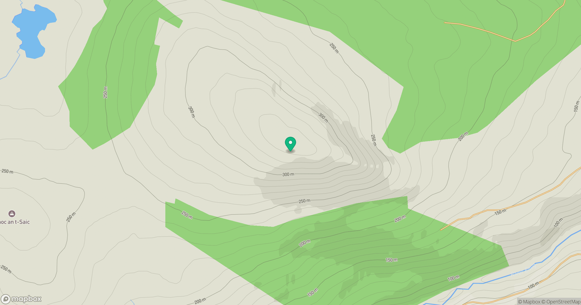
Grid reference: NH346992
View on OpenStreetMapOpens a map in a new tab, centred on the hill.
Hills within 30 km
Straight-line distance, not a walking route or confirmation of access.
No comments yet. Be the first.