

Clougha Pike
Good walks are even better shared.
SD5459 : Trig Pillar - Clougha Pike
Anthony Parkes Photo source
Overview
Clougha Pike: A Hiker's Delight
Clougha Pike, standing proudly at 416 metres, is a marvellous Marilyn that beckons outdoor enthusiasts from near and far. Nestled within the enchanting Forest of Bowland, Clougha Pike is not just a peak; it's an adventure waiting to unfold.
Geology
The predominant Carboniferous limestone that makes up Clougha is not only fascinating from a geological perspective, but it also features intriguing crags that have been sculpted by the erosive forces of nature. So, don’t be surprised if you find yourself unexpectedly enthused about geology during your hike. The rocks tell a story—just make sure to bring along a local expert or look up the right textbooks, lest you confuse a limestone feature for an ancient petrified snail.
Routes
The most favoured route is the Clougha Pike Circular Walk starting from Quernmore. Spanning roughly 8.0 km, this moderate trail meanders through picturesque landscapes, including lush woodlands and verdant pastures, before leading you to the summit provides rewarding views. Be sure to take your time; this is a journey best enjoyed at a leisurely pace, with occasional stops for snacks—after all, a hiker’s fuel is nothing to scoff at!
Summit Features
Upon reaching the summit, look for the stone cairn that stands guard over the views. It’s the perfect place to pause, catch your breath, and take in the beauty around you. Remember, it may not be a five-star restaurant, but the view is to die for!
Terrain
Expect a varied terrain consisting mostly of grassy slopes, with rocky outcrops that are just asking to be scrambled over. A word of caution, however: keep your eyes peeled for the occasional boggy patch. It’s all fun and games until someone loses a wellington boot!
Views
The views from Clougha Pike are nothing short of spectacular. On a clear day, you’ll feast your eyes on the breathtaking sights of the Forest of Bowland, the winding Lune Valley, and even Morecambe Bay. Best seasons for these views? Late spring and early autumn when the weather plays nice, and the landscape is a riot of colour and clarity.
Hazards
As with any hike, keep an ear attuned to the weather because Clougha Pike is renowned for its unpredictable conditions. A sunny start can turn into a soggy affair before you know it, so pack your waterproofs—trust me, your future self will thank you.
Nearby Summits
If you’re in the mood for more exploration, consider visiting nearby summits like Ward's Stone (619m) or Longridge Fell (365m). Both provide an excellent continuation of your mountainous jaunt!
Access
Parking can be a bit of a squeeze near Quernmore Village, so plan accordingly. If you’re relying on public transport, Lancaster is your nearest train station, with several bus options heading toward Quernmore. Lancaster itself is a vibrant town, making it the perfect starting point for your adventure.
Facilities
While facilities in Quernmore are limited, Lancaster has more than enough cafes and shops to replenish your supplies and bladder. Planning ahead is key so you can enjoy the hike without unwanted surprises.
History
Curiously, the name ‘Clougha’ has its roots in Old English, referring to a ravine—a fitting homage to the landscape that surrounds this splendid peak. Historically, Clougha Pike has been a cherished destination for walkers and offers pathways steeped in the tales of countless adventurers before you.
So gear up, lace those boots tightly, and venture into the world of Clougha Pike. Whether you’re looking for a leisurely stroll or a more challenging trek, Clougha has it all. Just remember, not all who wander are lost, but a map is a good safety net!
Happy trekking!
Explore routes near Clougha Pike
Walks starting near this hill. Open a route to check its map, distance and full itinerary.
Bolton-le-Sands to Hest Bank: Lancaster Canal Towpath Return
View route
Ingleton Waterfalls Walk
View route
Ingleborough from Clapham
View route
Clitheroe Walk with Men Walking & Talking
View route
Route planning notes
These notes describe possible approaches. Check a route's map and access information when planning your walk.
Clougha Pike Circular Walk
A popular circular route starting from the nearby village of Quernmore, offering a mix of woodland, pasture, and open moorland.
Make a day of it, together
Find someone to share the walk with, or organise a day out along a route you like.
Photo Gallery
View all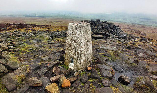 Photo could not load
SD5459 : Trig Pillar - Clougha Pike
Anthony Parkes
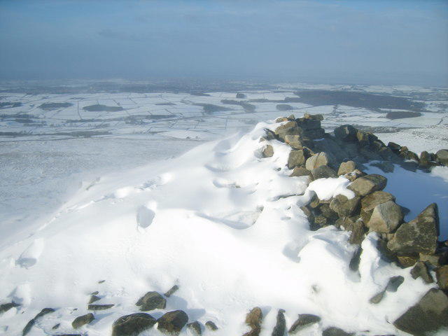 Photo could not load
SD5459 : Cairn on Clougha Pike
Michael Graham
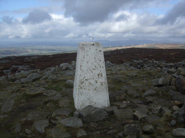 Photo could not load
SD5459 : Trig Point on Clougha
Adie Jackson
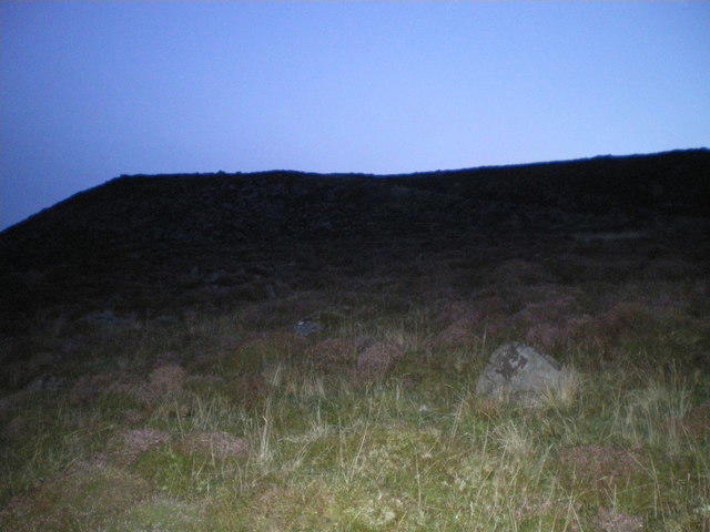 Photo could not load
SD5459 : Early morning light Clougha Pike - Bowland Fells
Tom Howard
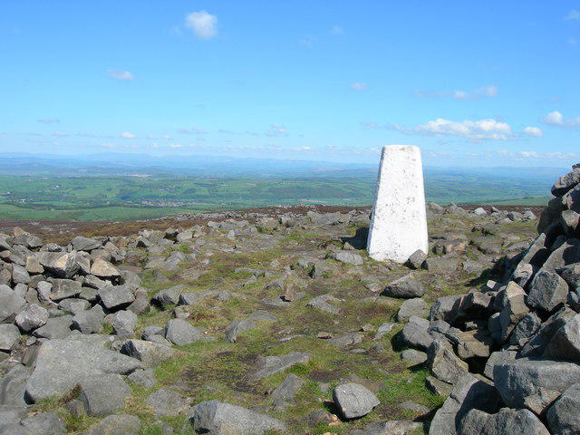 Photo could not load
SD5459 : Clougha Pike Trig Pillar
John Topping
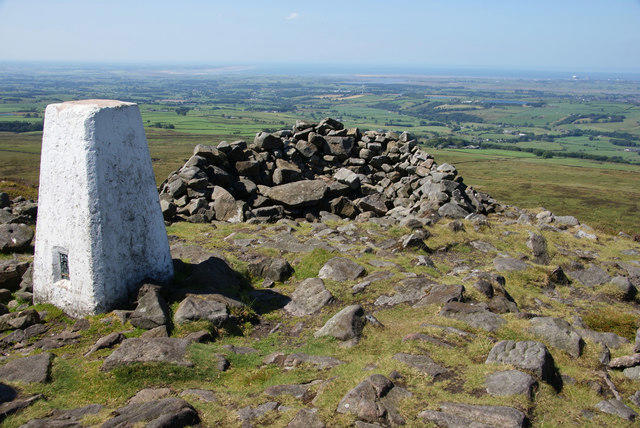 Photo could not load
SD5459 : Trig point on Clougha Pike
Bill Boaden
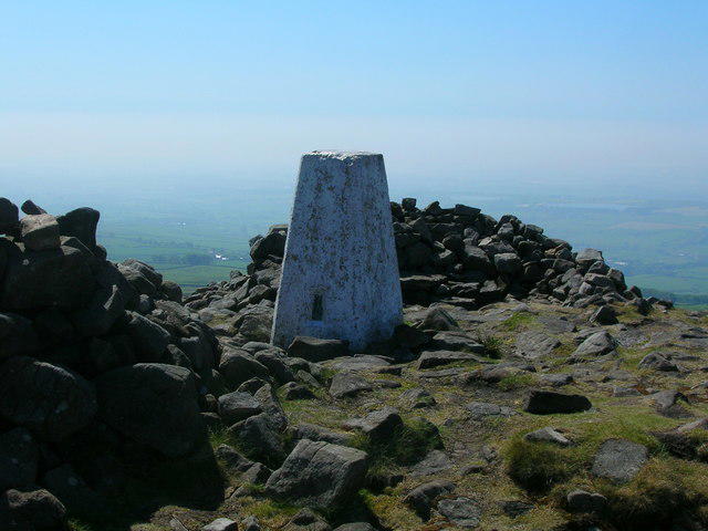 Photo could not load
SD5459 : Trig point on Clougha Pike 1355' / 423m
John H Darch
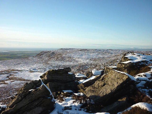 Photo could not load
SD5459 : Clougha Pike from the east
Karl and Ali
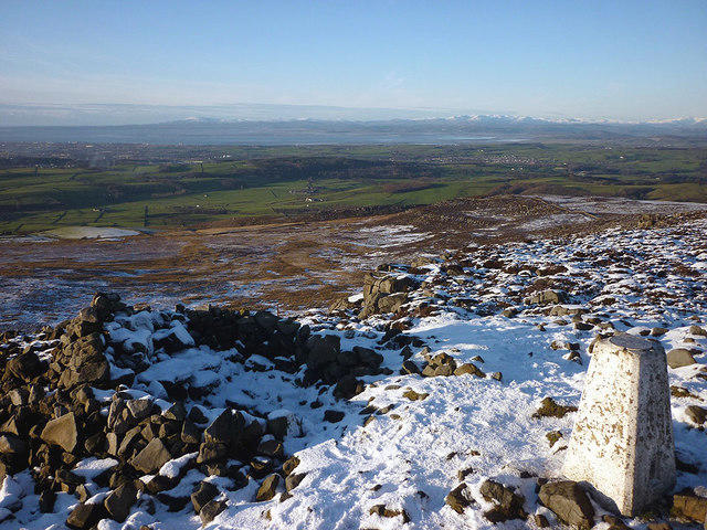 Photo could not load
SD5459 : The summit of Clougha Pike
Karl and Ali
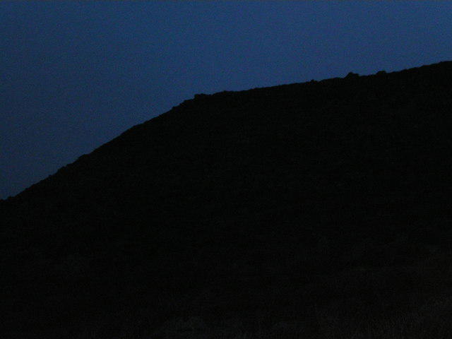
SD5459 : Clougha Pike at Dawn - Bowland Fells
Tom Howard
Hill facts and local notes
Classifications
Elevation
416m
1,365 ft
Prominence
5m
Coordinates
54.0288, -2.6962
SD544594
OS Map
102
Explorer: OL41W
At the Summit
At the summit, you’ll find a stone cairn that provides an excellent spot for a well-deserved break and some fine views.
Terrain & Geology
Clougha Pike is primarily composed of Carboniferous limestone, with stunning crags and limestone features that showcase the power of erosion over millennia.
Views & Scenery
Panoramic views of the Forest of Bowland, the Lune Valley, and on clear days, you might even catch a glimpse of Morecambe Bay.
History & Heritage
Name Origin
The name 'Clougha' derives from the Old English word for a ravine or a steep-sided valley, fitting for its landscape.
Historical Significance
Clougha Pike has long been a popular spot for walkers and offers significant historical routes through its surrounding area.
Getting There & Facilities
Parking
There is limited parking available near Quernmore Village, but please be considerate of local residents.
Public Transport
The nearest train station is in Lancaster, from which you can catch a bus towards Quernmore.
Nearby Facilities
Quernmore offers a small local shop, and Lancaster boasts numerous cafes and toilets as a larger centre for amenities.
Safety Information
Known Hazards
- Be cautious of sudden weather changes; the upland areas can be notoriously unpredictable.
General Safety Tips
- Check weather conditions before setting out
- Carry appropriate clothing and equipment
- Let someone know your planned route
- Take a map, compass, and GPS device
- Carry emergency supplies: food, water, first aid kit, torch
Hills
Some common questions about the hills answered
Are there group walks up Clougha Pike?
Many walkers use Walkmates to join or organise walks with others. You can check for group walks around Clougha Pike through the maps
Are there other walkers around Clougha Pike?
Activity varies by location and time, but Walkmates lets you see whether others have shared walks or shown interest in this area. Find other people through the walking friends search walking friends for Clougha Pike search or of course create your own walk for Clougha Pike
Can I organise a walk to Clougha Pike?
Yes. If there aren’t any walks listed already, you can create a walk and make it available for others to join.
If you're signed up to Walkmates, you can create a walk to Clougha Pike.
How do I find a walk up this hill?
There are often multiple ways to walk this hill, depending on experience and route preference. Walkmates helps you explore walks and routes that others have shared.
Can I suggest a new route up Clougha Pike?
Yes. You can suggest or create routes to share with others. Walkmates focuses on the social side of walking, so routes are used to help people organise walks and explore areas together, rather than as detailed navigation tools or route libraries.
Other uses really appreciate knowledgeable walkers sharing their routes. Share your favourite route to Clougha Pike here
The is an error or something incorrect about this hill. How do I let you know?
We always strive to keep the information on Walkmates as accurate as possible. If you find an error, please let us know through the contact form and we'll aim to correct it as quickly as possible
Community Discussion
Comments
Location
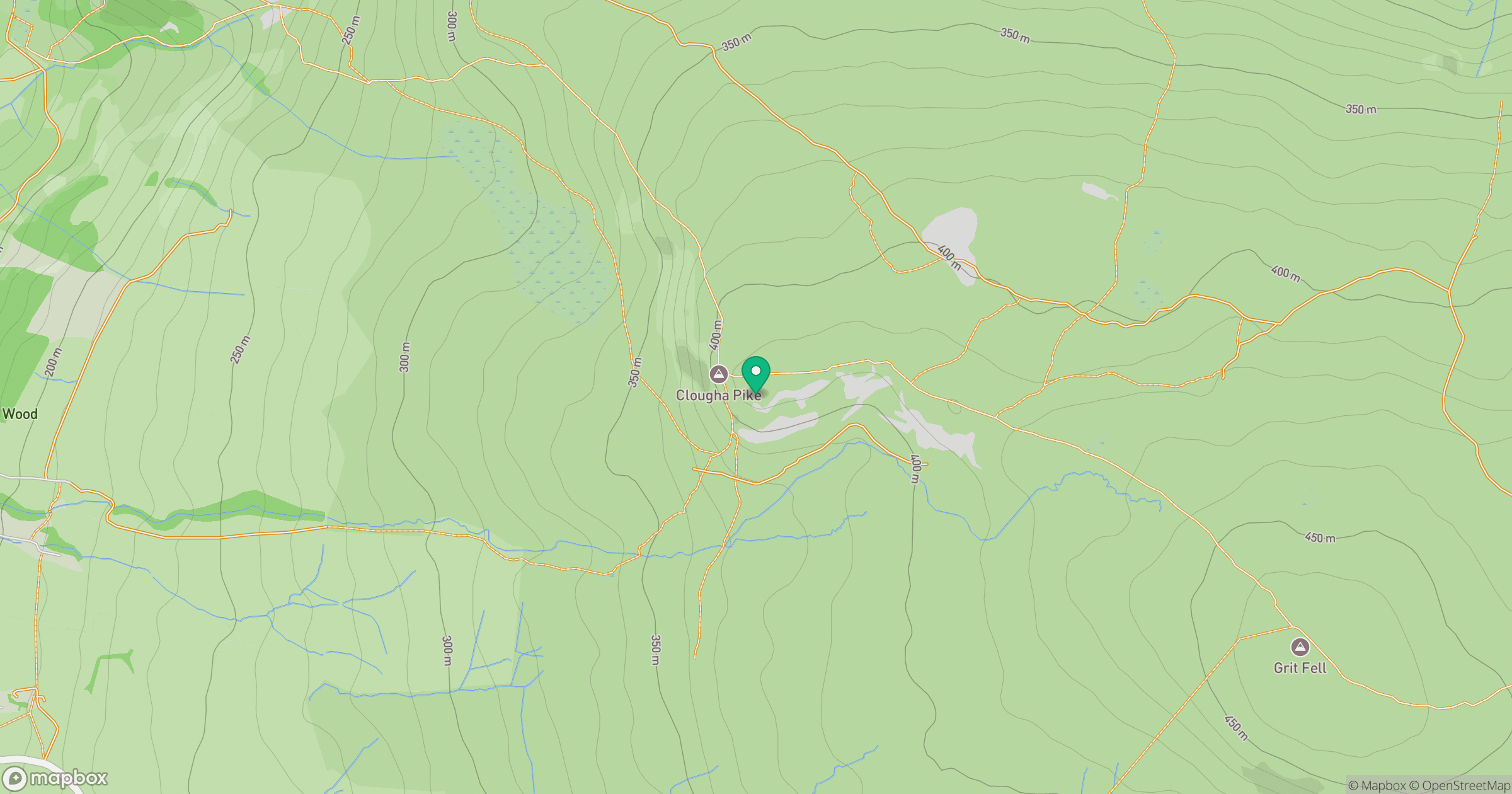
Grid reference: SD544594
View on OpenStreetMapOpens a map in a new tab, centred on the hill.



No comments yet. Be the first.