

Castle Crag
Good walks are even better shared.
NY2415 : Trees on Castle Crag
Philip Jeffrey Photo source
Overview
Castle Crag is the 290 m rocky fell in the Jaws of Borrowdale, south of Derwent Water. The lowest Wainwright has old slate workings, a First World War memorial and views along the valley. The Seatoller circuit follows a high path out and the river back, with a steep slate-spoil ascent and a short chain-assisted rocky passage on the return.
Castle Crag
Overview
Castle Crag is the 290 m rocky fell in the Jaws of Borrowdale, south of Derwent Water. The lowest Wainwright has old slate workings, a First World War memorial and views along the valley. The Seatoller circuit follows a high path out and the river back, with a steep slate-spoil ascent and a short chain-assisted rocky passage on the return. It is a Wainwright in the North Western Fells, not a Marilyn.
Summit and views
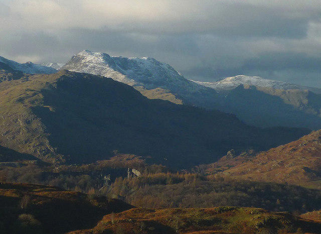
The 290 m summit is a rock outcrop at NY 24932 15942. The catalogue describes a large shelter cairn on rock, but dated photographs show the cairn changes and can be absent. The war memorial tablet is set into the summit rock; do not rely on finding an intact shelter. In clear weather the summit looks north over Derwent Water towards Skiddaw and south into Borrowdale, with Glaramara, Great End and the Scafell fells beyond. High Spy rises to the west and Great Crag across the valley.
Route from Seatoller
Start and finish at Seatoller National Trust car park. Walk through the hamlet and climb to the high contour path; follow it across Tongue Gill to the ladder-stile approach to Castle Crag. Ascend the slate-spoil zigzags and pass right of the quarry to the summit. Descend the same summit path, then continue downhill into the woods and take the footbridge towards the River Derwent. Follow the riverside route south, passing the optional Millican Dalton cave turn without taking it. At the stone packhorse bridge near Rosthwaite stay on the same bank, cross the wooden footbridge and continue to Longthwaite. Beyond the hostel negotiate the short chain-assisted rocky passage, then follow Johnny Wood back to the original car park. The National Trust gives 8 km and 3–4¼ hours. Steep loose slate, stiles and the riverside scramble require sure-footedness; do not attempt the river passage in flood or if footing is unsafe. The optional cave detour and shorter Rosthwaite or Grange walks are not included as separate measured routes here.
Terrain and safety
Valley tracks, rough and pitched stone paths, stiles, woodland roots, steep loose slate-spoil zigzags, summit rock and a short chain-assisted riverside scramble on the Seatoller circuit.
- Loose slate on the summit zigzags can slide underfoot. Keep to the path and avoid dislodging stones onto walkers below.
- Quarry faces and steep summit edges have serious drops. Keep children close; do not scramble directly through workings or use quarry faces as shortcuts.
- The Seatoller circuit has a short chain-assisted rocky passage beside the river beyond Longthwaite. Wet rock, ice or a swollen river make it more serious; the chain does not remove the risk of a fall. Turn back if the passage is unsafe.
- Heavy rain can flood riverside paths and cover stepping stones. This circuit stays on the riverside path and does not require the Rosthwaite stepping stones; do not improvise a river crossing.
- Millican Dalton’s quarry caves are below the summit, reached from a separate riverside branch. Their presence on walking guides is not assurance that underground workings are stable or permission to enter restricted areas.
- Follow signed paths and local closures. Keep dogs on leads near livestock; ladder stiles and the chain section can be awkward for dogs.
Rain makes slate, stone steps and the riverside rock passage slippery; flooding can block lower paths. Ice makes the steep summit approach and chain-assisted section hazardous. Short winter daylight and seasonal toilet closures affect planning; allow time to return before dark.
Access and facilities
For the described circuit use Seatoller National Trust car park, NY246137, CA12 5XN. Pay-and-display; NT members park free. Carry coins because mobile reception can be poor. No overnight parking. Rosthwaite NT car park, NY257148, CA12 5XB, serves different shorter approaches; their distances are not the Seatoller circuit’s. Stagecoach 78 links Keswick, Grange Bridge, Rosthwaite and Seatoller, where it turns at the National Trust car park. Check the timetable for your walking date and the last return; seasonal 77/77A services may provide another option. Seatoller car park has toilets, including an accessible toilet requiring a Radar key, but the National Trust warns that toilets are often closed in winter. Rosthwaite has a café and toilets, also subject to winter closure. Carry food and water; check refreshment opening times.
Geology
Castle Crag exposes the Eagle Crag Sandstone Member of the Borrowdale Volcanic Group. These Ordovician rocks include layers of volcaniclastic siltstone, sandstone, conglomerate and breccia, with tuffs and intrusive andesite sills. Slate quarrying has left terraces, faces and spoil heaps; glacial erosion shaped the surrounding Borrowdale valley.
History
Castle Crag’s summit land was given to the National Trust in memory of John Hamer and the men of Borrowdale killed in the First World War. The slate tablet is distinct from the summit cairn. The Atlas of Hillforts records a possible hillfort, partly lost to quarrying, with uncertain interpretation and dating. Below the summit, Millican Dalton used quarry caves as a summer home while working as an outdoor guide.
Explore routes near Castle Crag
Walks starting near this hill. Open a route to check its map, distance and full itinerary.
Scafell Pike from Seathwaite via the Corridor Route
View route
Whinlatter dark skies walk
View route
Whinlatter dark skies walk
View route
Bow Fell from Langdale
View route
Route planning notes
These notes describe possible approaches. Check a route's map and access information when planning your walk.
Castle Crag from Seatoller: high path and riverside return
Start and finish at Seatoller National Trust car park. Walk through the hamlet and climb to the high contour path; follow it across Tongue Gill to the ladder-stile approach to Castle Crag. Ascend the slate-spoil zigzags and pass right of the quarry to the summit. Descend the same summit path, then continue downhill into the woods and take the footbridge towards the River Derwent. Follow the riverside route south, passing the optional Millican Dalton cave turn without taking it. At the stone packhorse bridge near Rosthwaite stay on the same bank, cross the wooden footbridge and continue to Longthwaite. Beyond the hostel negotiate the short chain-assisted rocky passage, then follow Johnny Wood back to the original car park. The National Trust gives 8 km and 3–4¼ hours. Steep loose slate, stiles and the riverside scramble require sure-footedness; do not attempt the river passage in flood or if footing is unsafe.
Make a day of it, together
Find someone to share the walk with, or organise a day out along a route you like.
Photo Gallery
View all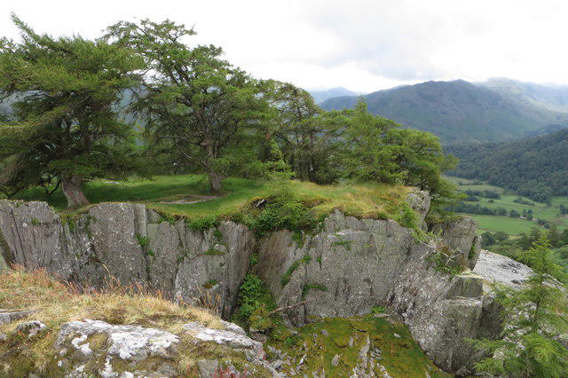 Photo could not load
NY2415 : Trees on Castle Crag
Philip Jeffrey
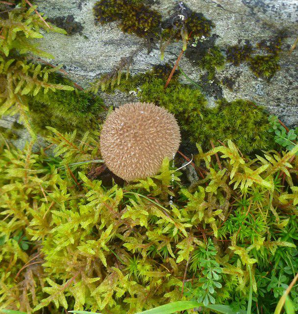 Photo could not load
NY2415 : Fungi on Castle Crag
Michael Graham
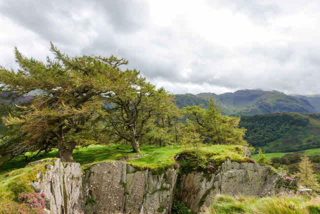 Photo could not load
NY2415 : Larch trees at quarry rim
Trevor Littlewood
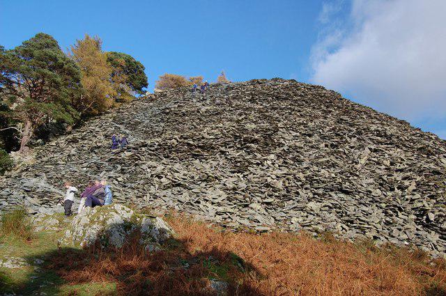 Photo could not load
NY2415 : Slate Hillside - The Tay Up Castle Crag
Trevor Harris
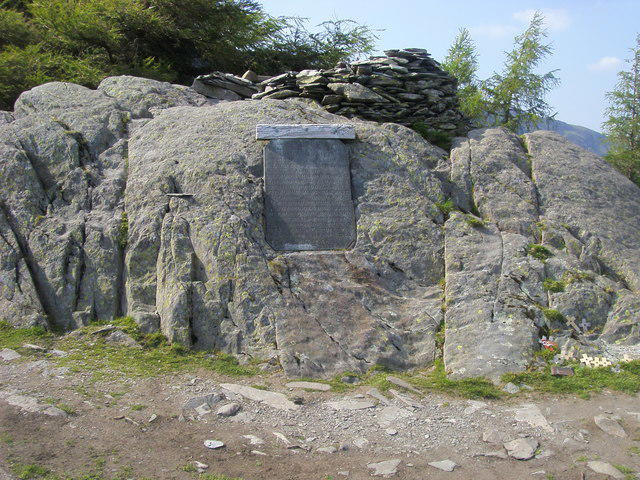 Photo could not load
NY2415 : Castle Crag Summit
Shaun Ferguson
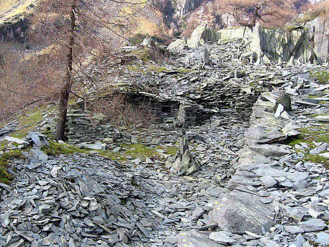 Photo could not load
NY2415 : Disused quarry on Castle Crag
Roger Smith
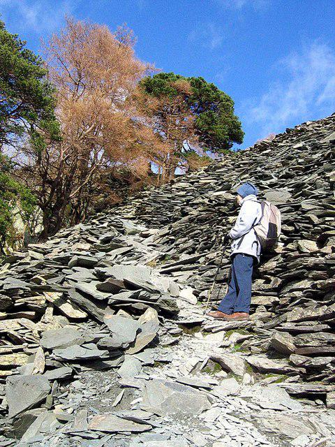 Photo could not load
NY2415 : Footpath up Castle Crag
Roger Smith
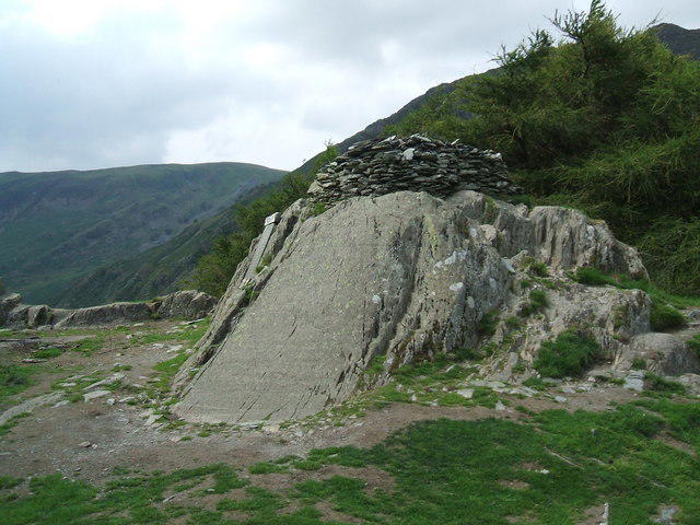 Photo could not load
NY2415 : Summit of Castle Crag
David Brown
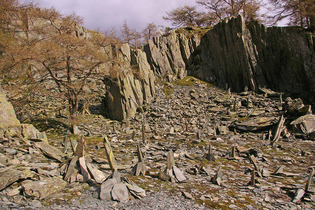 Photo could not load
NY2415 : Old quarry, Castle Crag
Ian Capper
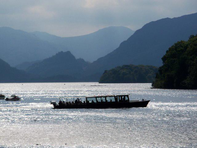
NY2415 : Castle Crag in Borrowdale
Brian Balfe
Hill facts and local notes
Classifications
Elevation
290m
951 ft
Prominence
76m
Coordinates
54.5332, -3.1616
NY249159
OS Map
89 90
Explorer: OL4S
At the Summit
The 290 m summit is a rock outcrop at NY 24932 15942. The catalogue describes a large shelter cairn on rock, but dated photographs show the cairn changes and can be absent. The war memorial tablet is set into the summit rock; do not rely on finding an intact shelter.
Terrain & Geology
Castle Crag exposes the Eagle Crag Sandstone Member of the Borrowdale Volcanic Group. These Ordovician rocks include layers of volcaniclastic siltstone, sandstone, conglomerate and breccia, with tuffs and intrusive andesite sills. Slate quarrying has left terraces, faces and spoil heaps; glacial erosion shaped the surrounding Borrowdale valley.
Views & Scenery
In clear weather the summit looks north over Derwent Water towards Skiddaw and south into Borrowdale, with Glaramara, Great End and the Scafell fells beyond. High Spy rises to the west and Great Crag across the valley.
History & Heritage
Historical Significance
Castle Crag’s summit land was given to the National Trust in memory of John Hamer and the men of Borrowdale killed in the First World War. The slate tablet is distinct from the summit cairn. The Atlas of Hillforts records a possible hillfort, partly lost to quarrying, with uncertain interpretation and dating. Below the summit, Millican Dalton used quarry caves as a summer home while working as an outdoor guide.
Getting There & Facilities
Parking
For the described circuit use Seatoller National Trust car park, NY246137, CA12 5XN. Pay-and-display; NT members park free. Carry coins because mobile reception can be poor. No overnight parking. Rosthwaite NT car park, NY257148, CA12 5XB, serves different shorter approaches; their distances are not the Seatoller circuit’s.
Public Transport
Stagecoach 78 links Keswick, Grange Bridge, Rosthwaite and Seatoller, where it turns at the National Trust car park. Check the timetable for your walking date and the last return; seasonal 77/77A services may provide another option.
Nearby Facilities
Seatoller car park has toilets, including an accessible toilet requiring a Radar key, but the National Trust warns that toilets are often closed in winter. Rosthwaite has a café and toilets, also subject to winter closure. Carry food and water; check refreshment opening times.
Safety Information
Known Hazards
- Loose slate on the summit zigzags can slide underfoot. Keep to the path and avoid dislodging stones onto walkers below.
- Quarry faces and steep summit edges have serious drops. Keep children close; do not scramble directly through workings or use quarry faces as shortcuts.
- The Seatoller circuit has a short chain-assisted rocky passage beside the river beyond Longthwaite. Wet rock, ice or a swollen river make it more serious; the chain does not remove the risk of a fall. Turn back if the passage is unsafe.
- Heavy rain can flood riverside paths and cover stepping stones. This circuit stays on the riverside path and does not require the Rosthwaite stepping stones; do not improvise a river crossing.
- Millican Dalton’s quarry caves are below the summit, reached from a separate riverside branch. Their presence on walking guides is not assurance that underground workings are stable or permission to enter restricted areas.
- Follow signed paths and local closures. Keep dogs on leads near livestock; ladder stiles and the chain section can be awkward for dogs.
Seasonal Hazards
Rain makes slate, stone steps and the riverside rock passage slippery; flooding can block lower paths. Ice makes the steep summit approach and chain-assisted section hazardous. Short winter daylight and seasonal toilet closures affect planning; allow time to return before dark.
General Safety Tips
- Check weather conditions before setting out
- Carry appropriate clothing and equipment
- Let someone know your planned route
- Take a map, compass, and GPS device
- Carry emergency supplies: food, water, first aid kit, torch
Hills
Some common questions about the hills answered
Are there group walks up Castle Crag?
Many walkers use Walkmates to join or organise walks with others. You can check for group walks around Castle Crag through the maps
Are there other walkers around Castle Crag?
Activity varies by location and time, but Walkmates lets you see whether others have shared walks or shown interest in this area. Find other people through the walking friends search walking friends for Castle Crag search or of course create your own walk for Castle Crag
Can I organise a walk to Castle Crag?
Yes. If there aren’t any walks listed already, you can create a walk and make it available for others to join.
If you're signed up to Walkmates, you can create a walk to Castle Crag.
How do I find a walk up this hill?
There are often multiple ways to walk this hill, depending on experience and route preference. Walkmates helps you explore walks and routes that others have shared.
Can I suggest a new route up Castle Crag?
Yes. You can suggest or create routes to share with others. Walkmates focuses on the social side of walking, so routes are used to help people organise walks and explore areas together, rather than as detailed navigation tools or route libraries.
Other uses really appreciate knowledgeable walkers sharing their routes. Share your favourite route to Castle Crag here
The is an error or something incorrect about this hill. How do I let you know?
We always strive to keep the information on Walkmates as accurate as possible. If you find an error, please let us know through the contact form and we'll aim to correct it as quickly as possible
Community Discussion
Comments
Location
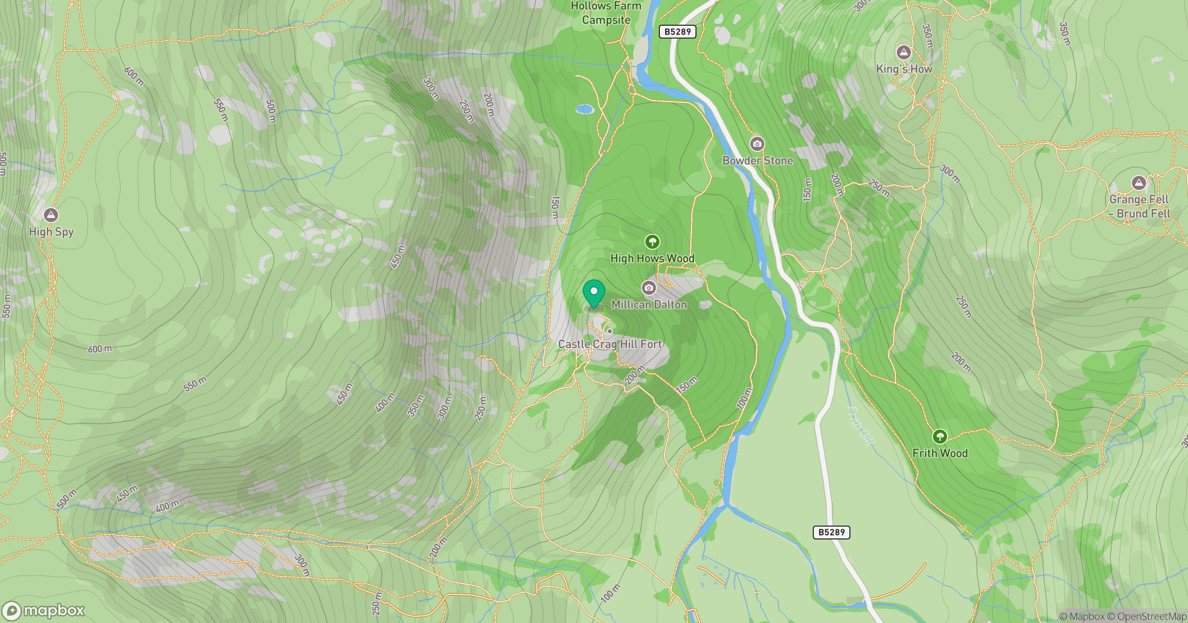
Grid reference: NY249159
View on OpenStreetMapOpens a map in a new tab, centred on the hill.

No comments yet. Be the first.