

Castell y Gwynt
Good walks are even better shared.
SH6558 : On the quest for Castell y Gwynt
Hansjoerg Lipp Photo source
Overview
Castell y Gwynt
Castell y Gwynt stands proudly within Snowdonia National Park, a hidden gem for those willing to traverse its slopes. At 950 meters, it may not be the tallest peak in the park, but its rugged beauty and magnificent views make it a must-visit.
Geology
This mighty mountain is composed of ancient volcanic rock, specifically andesite. As part of the Snowdon Volcanic Group, its striking natural features provide insights into the geological history of North Wales.
Access and Parking
Accessing Castell y Gwynt is relatively straightforward. The nearest parking can be found at Capel Curig, a charming village that serves as a gateway to many hiking routes in the region. Just remember, on sunny weekends, the car park can resemble a busy marketplace, so arrive early!
There is a bus service connecting Capel Curig with larger towns such as Bangor and Llandudno, so you can leave your car behind and enjoy the local atmosphere.
Route Description
The most popular route starts in Capel Curig and leads you through lush valleys before the final push to the summit. The trek is moderate in terms of effort; a bit of fitness is required to get your heart racing, but the stunning vistas along the way help ease the exertion. Expect to cover around 7.5 km in approximately 3.5 hours.
Summit Features and Views
At the summit, you'll find a small cairn marking your achievement amidst rock formations that resemble nature's very own sculpture gallery. The views are simply breathtaking—look out for the prominent peaks of Snowdon and Y Garn, as well as Llyn Ogwen gleaming in the valley below. On clear days, you might even catch a glimpse of Anglesey!
Best Times to Visit
For the most stunning visuals, spring and early autumn are the ideal seasons. The local flora bursts into colour and the skies tend to be clearer, providing perfect photo opportunities.
Hazards
As tempting as it may be to race to the top, exercise caution on the steeper sections, especially in wet conditions. The loose rocks can be sneaky and may remind you why hiking boots were invented!
Nearby Summits
Take the opportunity to explore nearby landmarks such as Tryfan and Y Garn; after all, what's a hike without adding a few more peaks to your collection?
Facilities
While there are no facilities on the mountain, Capel Curig is ready to welcome you with a cup of tea, should you desire one after your expedition. Public toilets are also available in the village to freshen up before heading back into the wild.
Conclusion
In summary, Castell y Gwynt may not be the tallest, but it surely competes for the best views in Snowdonia. Remember to take your camera, keep your wits about you, and enjoy the journey to the summit! After all, every mountain has its stories; let this be one of yours!
Explore routes near Castell y Gwynt
Walks starting near this hill. Open a route to check its map, distance and full itinerary.
Snowdon Pyg Track returning by Miner's Track
View route
Llyn Crafnant: Lakeside Circuit from the NRW Car Park
View route
Beddgelert Forest: Derwen Circuit and Llyn Llywelyn
View route
Beddgelert Forest: Llyn Llywelyn Woodland Circuit
View route
Route planning notes
These notes describe possible approaches. Check a route's map and access information when planning your walk.
Capel Curig to Castell y Gwynt
A direct route that takes you through picturesque valleys and up to the craggy summit. Perfect for those with a moderate level of fitness and a love for stunning landscapes.
Make a day of it, together
Find someone to share the walk with, or organise a day out along a route you like.
Photo Gallery
View all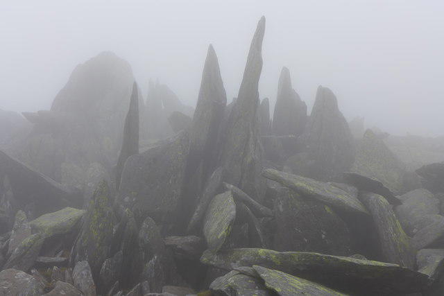 Photo could not load
SH6558 : On the quest for Castell y Gwynt
Hansjoerg Lipp
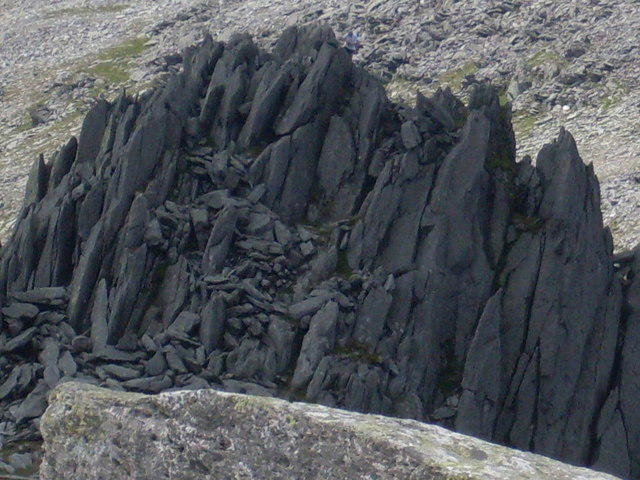 Photo could not load
SH6558 : Castell y Gwynt
Peter S
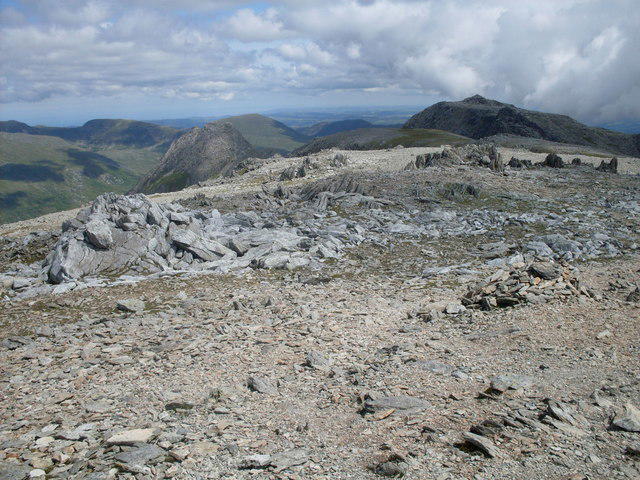 Photo could not load
SH6558 : Glyder Fawr summit view
Peter S
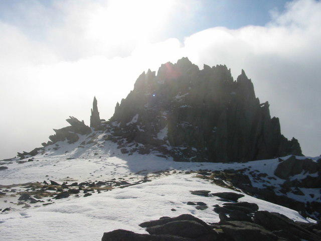 Photo could not load
SH6558 : Winter Castell y Gwynt
Dewi
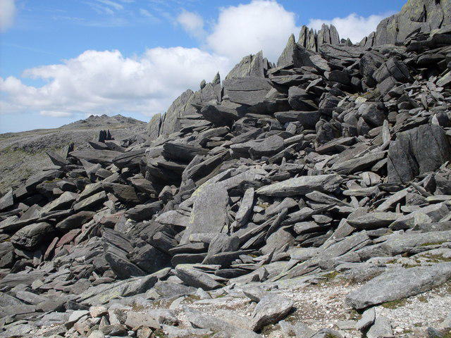 Photo could not load
SH6558 : Castell y Gwynt (Castle of the Winds)
Peter S
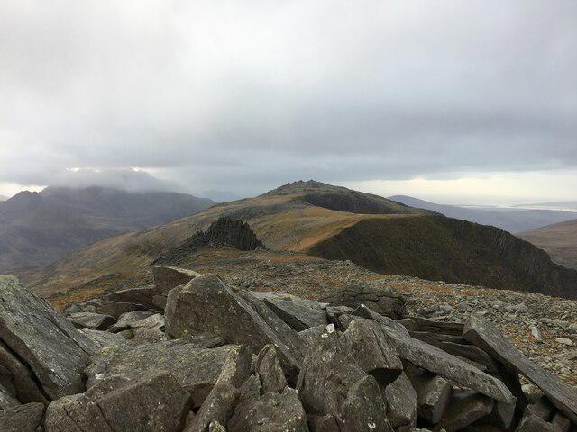 Photo could not load
SH6558 : View from the summit of Glyder Fach
Steven Brown
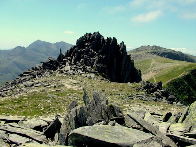 Photo could not load
SH6558 : Castell y Gwynt on Glyder Fach
George Tod
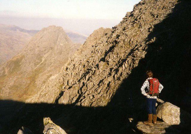 Photo could not load
SH6558 : Tryfan from Glyder Fach
Graham Pritchard
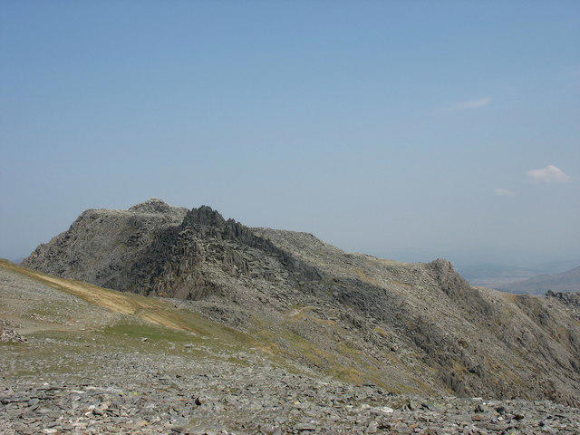 Photo could not load
SH6558 : Approaching Bwlch y Ddwy Glyder
Eric Jones
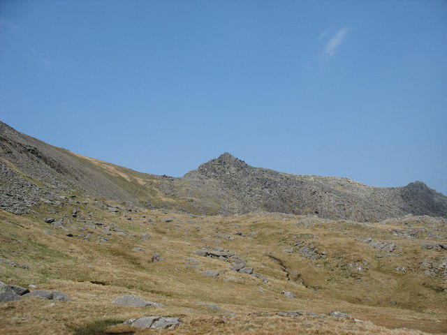
SH6558 : A North-Easterly View Towards Bwlch y Ddwy Glyder and Castell y Gwynt
Eric Jones
Hill facts and local notes
Classifications
Elevation
972m
3,189 ft
Prominence
16m
Coordinates
53.1038, -4.0120
SH653581
OS Map
115
Explorer: OL17W
At the Summit
The summit features a distinct rocky outcrop with a small cairn marking the apex. On a clear day, this spot offers some of the best views in Snowdonia.
Terrain & Geology
The mountain is largely composed of ancient volcanic rock, specifically andesitic lavas, which is part of the Snowdon Volcanic Group. The rugged terrain and striking cliff faces offer a unique insight into the geological history of the region.
Views & Scenery
From the summit, you can see the breathtaking peaks of Snowdon, the glistening waters of Llyn Ogwen, and even the coastline of Anglesey on a clear day.
History & Heritage
Name Origin
Castell y Gwynt translates to 'Castle of the Wind', aptly named for its often blustery conditions at the summit.
Historical Significance
The mountain has been a popular site for climbers and hikers for generations, featuring in local folklore and inspiring many adventure stories.
Getting There & Facilities
Parking
There is a small parking area near Capel Curig, which accommodates a good number of vehicles but can fill up quickly on weekends. A donation cup is often set up to help maintain local paths.
Public Transport
Buses run from Bangor and Llandudno to Capel Curig, making it accessible without a car.
Nearby Facilities
There are no facilities directly on the mountain, but Capel Curig offers a café and public toilets. Perfect for grabbing a hot drink before or after your hike!
Safety Information
Known Hazards
- Steep sections require caution, especially in wet conditions. Loose rocks can pose a risk during the ascent.
General Safety Tips
- Check weather conditions before setting out
- Carry appropriate clothing and equipment
- Let someone know your planned route
- Take a map, compass, and GPS device
- Carry emergency supplies: food, water, first aid kit, torch
Hills
Some common questions about the hills answered
Are there group walks up Castell y Gwynt?
Many walkers use Walkmates to join or organise walks with others. You can check for group walks around Castell y Gwynt through the maps
Are there other walkers around Castell y Gwynt?
Activity varies by location and time, but Walkmates lets you see whether others have shared walks or shown interest in this area. Find other people through the walking friends search walking friends for Castell y Gwynt search or of course create your own walk for Castell y Gwynt
Can I organise a walk to Castell y Gwynt?
Yes. If there aren’t any walks listed already, you can create a walk and make it available for others to join.
If you're signed up to Walkmates, you can create a walk to Castell y Gwynt.
How do I find a walk up this hill?
There are often multiple ways to walk this hill, depending on experience and route preference. Walkmates helps you explore walks and routes that others have shared.
Can I suggest a new route up Castell y Gwynt?
Yes. You can suggest or create routes to share with others. Walkmates focuses on the social side of walking, so routes are used to help people organise walks and explore areas together, rather than as detailed navigation tools or route libraries.
Other uses really appreciate knowledgeable walkers sharing their routes. Share your favourite route to Castell y Gwynt here
The is an error or something incorrect about this hill. How do I let you know?
We always strive to keep the information on Walkmates as accurate as possible. If you find an error, please let us know through the contact form and we'll aim to correct it as quickly as possible
Community Discussion
Comments
Location
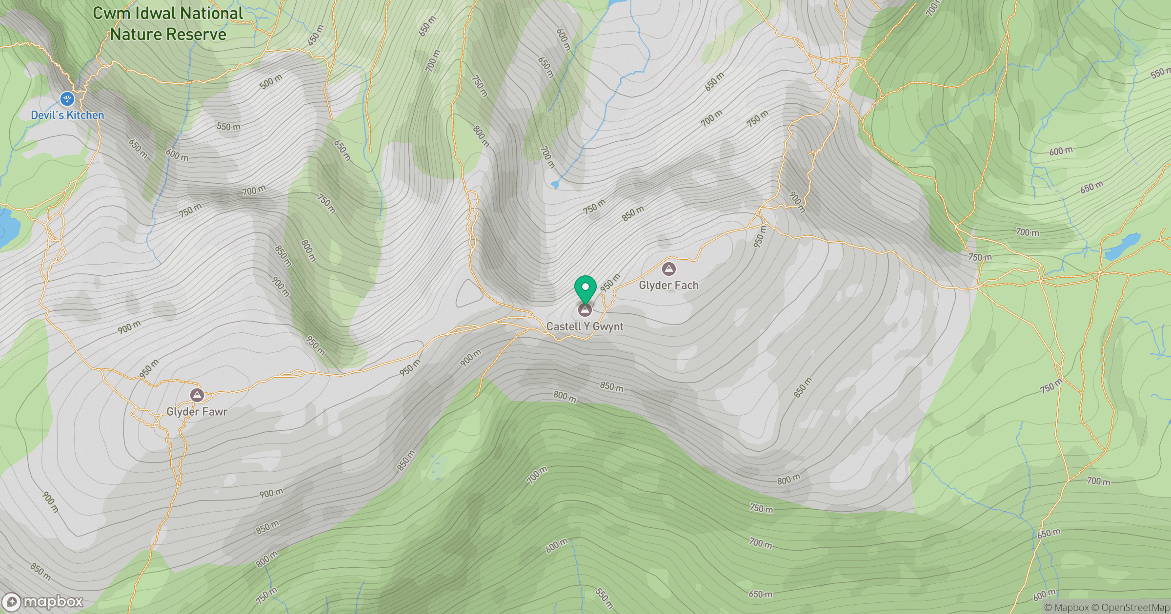
Grid reference: SH653581
View on OpenStreetMapOpens a map in a new tab, centred on the hill.
No comments yet. Be the first.