

Carrock Fell
Good walks are even better shared.
NY3433 : Summit Cairn, Carrock Fell
Michael Graham Photo source
Overview
Carrock Fell
Overview
Carrock Fell, standing proudly at 651 meters, is a charming hill in the Lake District, perfect for those wanting to escape the hustle and bustle of everyday life and savour some fresh mountain air. Known as a Hewitt, it beckons to hikers with its rugged charm and stunning views.
Geology
The mountain’s volcanic origins give it a unique flair. Its andesite rock features tell a story millions of years in the making. Geology buffs may find it fascinating to explore the remnants of ancient lava flows as they traverse its pathways.
Routes
Carrock Beck Route
This should be your go-to route if you fancy an engaging trek through woodlands before reaching the summit. It’s moderately difficult, so bring your charm—and maybe a snack or two!
Wainwright’s Route
This classic provides a steady incline, offering views that will make you think you’ve stepped into a postcard. A little harder than the first route, but hey, no pain, no gain!
Summit Features
At the top, the rocky outcrop combines with a humble cairn that acts like a mountain guardian. Just be careful not to trip over any excited hikers; they often come to rest and enjoy the vistas!
Terrain Type
Expect to navigate a mix of rocky paths and soft, grassy patches, with a few sponge-like bogs thrown in for good measure. Perfect for putting your waterproof boots to the test!
Views
The summit rewards those who make the effort with sweeping vistas of the surrounding fells—and if you squint hard enough, perhaps you’ll even spot your house from up there!
Best Seasons
Spring and early summer are prime time for views as the flowers bloom and the clouds play nice. Grab those walking poles and don’t look back!
Hazards
While nearly perfect for walking, beware of the whims of the British weather—it can turn in a jiffy! Remember that slippery patches can turn your hike into an unexpected ballroom dance!
Nearby Summits
If you're in a mood to collect summits, consider a quick jaunt over to Blencathra or Skiddaw. Both offer their own unique challenges and glorious views!
Access
Nearest Parking
You’ll want to park at Carrock Beck car park—just be sure to arrive early, or you might be left finding street parking like it's a game of musical chairs!
Public Transport
Busses from Penrith will drop you off near Scales. A little planning will save you from an unexpected, uh, fitness test!
Nearest Town
Threlkeld is the closest village where you can stock up on snacks or celebrate your triumphant trek with a pint.
Facilities
This mountain is as bare as a church mouse when it comes to facilities. However, hit up Threlkeld before you set out for some well-deserved refreshments after your adventure!
History
With 'Carrock' meaning 'rocky hill', this place has been a silent witness to countless historic tales. Generations have climbed its slopes, each leaving their footprints in the fabric of its lore.
So lace up those boots and get trekking! You won’t regret it.
Explore routes near Carrock Fell
Walks starting near this hill. Open a route to check its map, distance and full itinerary.
Mungrisdale Common and Bowscale Fell from Mosedale Valley Wainwright
View route
Bannerdale Crags from Mungrisdale Wainwright
View route
Brae Fell from Longlands Wainwright
View route
Binsey from Binsey Lodge Direct Out and Back Wainwright
View route
Route planning notes
These notes describe possible approaches. Check a route's map and access information when planning your walk.
Carrock Beck Route
A popular route starting from the Carrock Beck parking area, winding its way up through scenic woodlands before tackling the steeper ascent to the summit.
Wainwright’s Route
Following Wainwright's guide, this route offers a steady climb with stunning views along the way. Ideal for those who want to keep their legs moving at a manageable pace.
Make a day of it, together
Find someone to share the walk with, or organise a day out along a route you like.
Photo Gallery
View all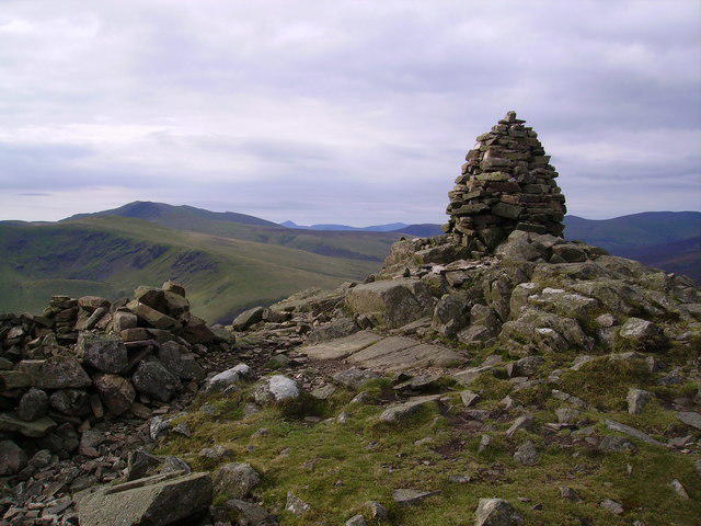 Photo could not load
NY3433 : Summit Cairn, Carrock Fell
Michael Graham
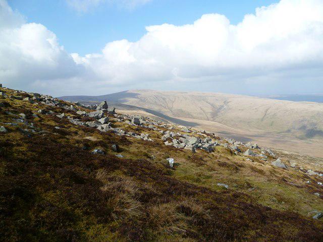 Photo could not load
NY3433 : Descending Carrock Fell
Michael Graham
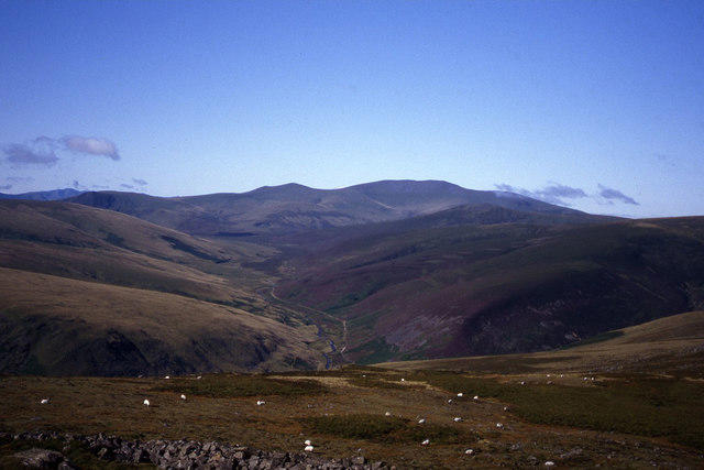 Photo could not load
NY3433 : South western slopes of Carrock Fell with view towards Skiddaw
Colin Park
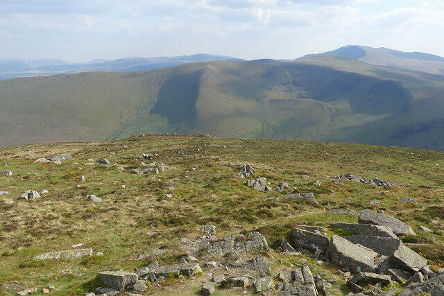 Photo could not load
NY3433 : Carrock Fell, Mungrisdale
Andrew Smith
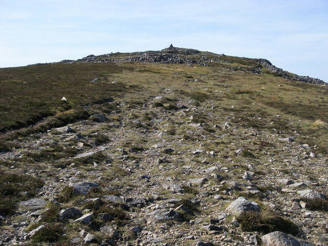 Photo could not load
NY3433 : Carrock Fell
Shaun Ferguson
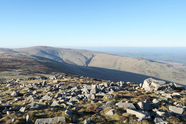 Photo could not load
NY3433 : Angular boulders on Carrock Fell
Trevor Littlewood
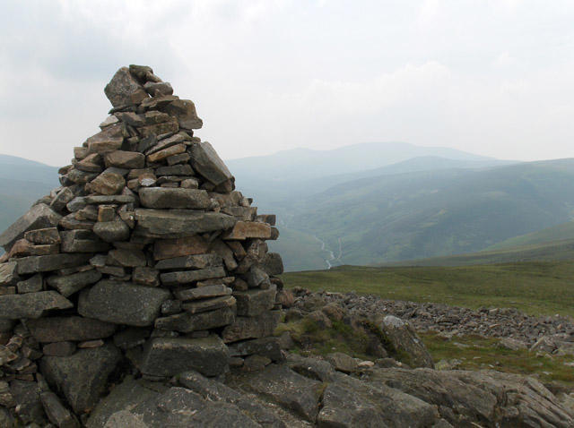 Photo could not load
NY3433 : Summit, Carrock Fell
Andrew Smith
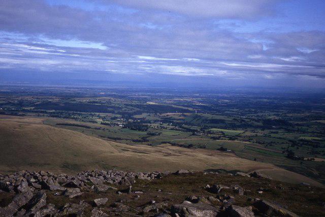 Photo could not load
NY3433 : Summit terrain at Carrock Fell with view towards Solway Firth
Colin Park
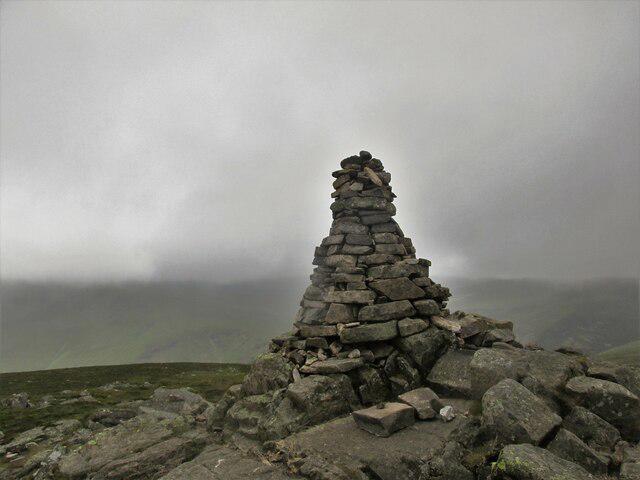 Photo could not load
NY3433 : Summit cairn on Carrock Fell
steven ruffles
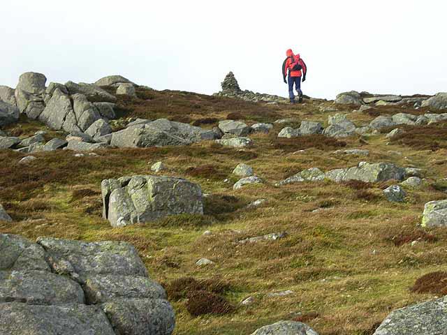
NY3433 : Summit of Carrock Fell
Oliver Dixon
Hill facts and local notes
Classifications
Elevation
662m
2,173 ft
Prominence
90m
Coordinates
54.6935, -3.0229
NY341336
OS Map
90
Explorer: OL5N
At the Summit
The summit features a distinct rocky outcrop and a cairn, marking the high point of Carrock Fell. On a good day, it's a perfect picnic spot, provided the wind doesn't get too cheeky!
Terrain & Geology
Carrock Fell is primarily composed of volcanic rock, specifically andesite, providing fascinating insights into the region's geological history. The rugged terrain is a testament to ancient volcanic activity, and the rocky outcrops are quite the sight.
Views & Scenery
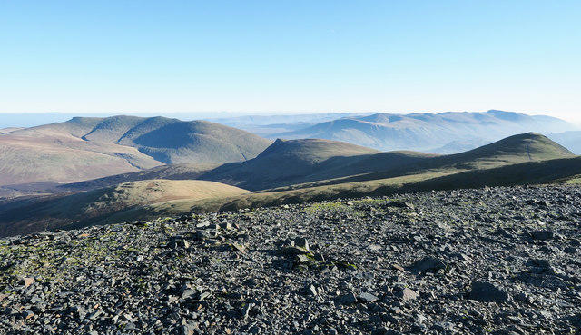
From the summit, hikers can enjoy panoramic views of the northwest Lake District, including Blencathra, Skiddaw, and the distant fells of the North Pennines.
History & Heritage
Name Origin
The name 'Carrock' is derived from Old Norse, meaning 'rocky hill', which is quite fitting. It's been a popular spot for wayfarers for centuries.
Historical Significance
Carrock Fell has been part of the local heritage, often mentioned in folk tales and guides, making it a treasured spot for locals and visitors alike.
Getting There & Facilities
Parking
Carrock Beck car park, located at NY339330. Ensure you arrive early as it fills up quickly on sunny weekends.
Public Transport
The nearest main town is Penrith, from where regular bus services run to nearby villages. The closest bus stop to the starting point is in Scales.
Nearby Facilities
There are no facilities directly on the mountain, but the nearby village of Threlkeld has a pub and a shop for snacks and refreshments.
Safety Information
Known Hazards
- Variable weather can change rapidly; be prepared for rain or winds. The boggy sections can also be quite slippery, so watch your step!
General Safety Tips
- Check weather conditions before setting out
- Carry appropriate clothing and equipment
- Let someone know your planned route
- Take a map, compass, and GPS device
- Carry emergency supplies: food, water, first aid kit, torch
Hills
Some common questions about the hills answered
Are there group walks up Carrock Fell?
Many walkers use Walkmates to join or organise walks with others. You can check for group walks around Carrock Fell through the maps
Are there other walkers around Carrock Fell?
Activity varies by location and time, but Walkmates lets you see whether others have shared walks or shown interest in this area. Find other people through the walking friends search walking friends for Carrock Fell search or of course create your own walk for Carrock Fell
Can I organise a walk to Carrock Fell?
Yes. If there aren’t any walks listed already, you can create a walk and make it available for others to join.
If you're signed up to Walkmates, you can create a walk to Carrock Fell.
How do I find a walk up this hill?
There are often multiple ways to walk this hill, depending on experience and route preference. Walkmates helps you explore walks and routes that others have shared.
Can I suggest a new route up Carrock Fell?
Yes. You can suggest or create routes to share with others. Walkmates focuses on the social side of walking, so routes are used to help people organise walks and explore areas together, rather than as detailed navigation tools or route libraries.
Other uses really appreciate knowledgeable walkers sharing their routes. Share your favourite route to Carrock Fell here
The is an error or something incorrect about this hill. How do I let you know?
We always strive to keep the information on Walkmates as accurate as possible. If you find an error, please let us know through the contact form and we'll aim to correct it as quickly as possible
Community Discussion
Comments
Location
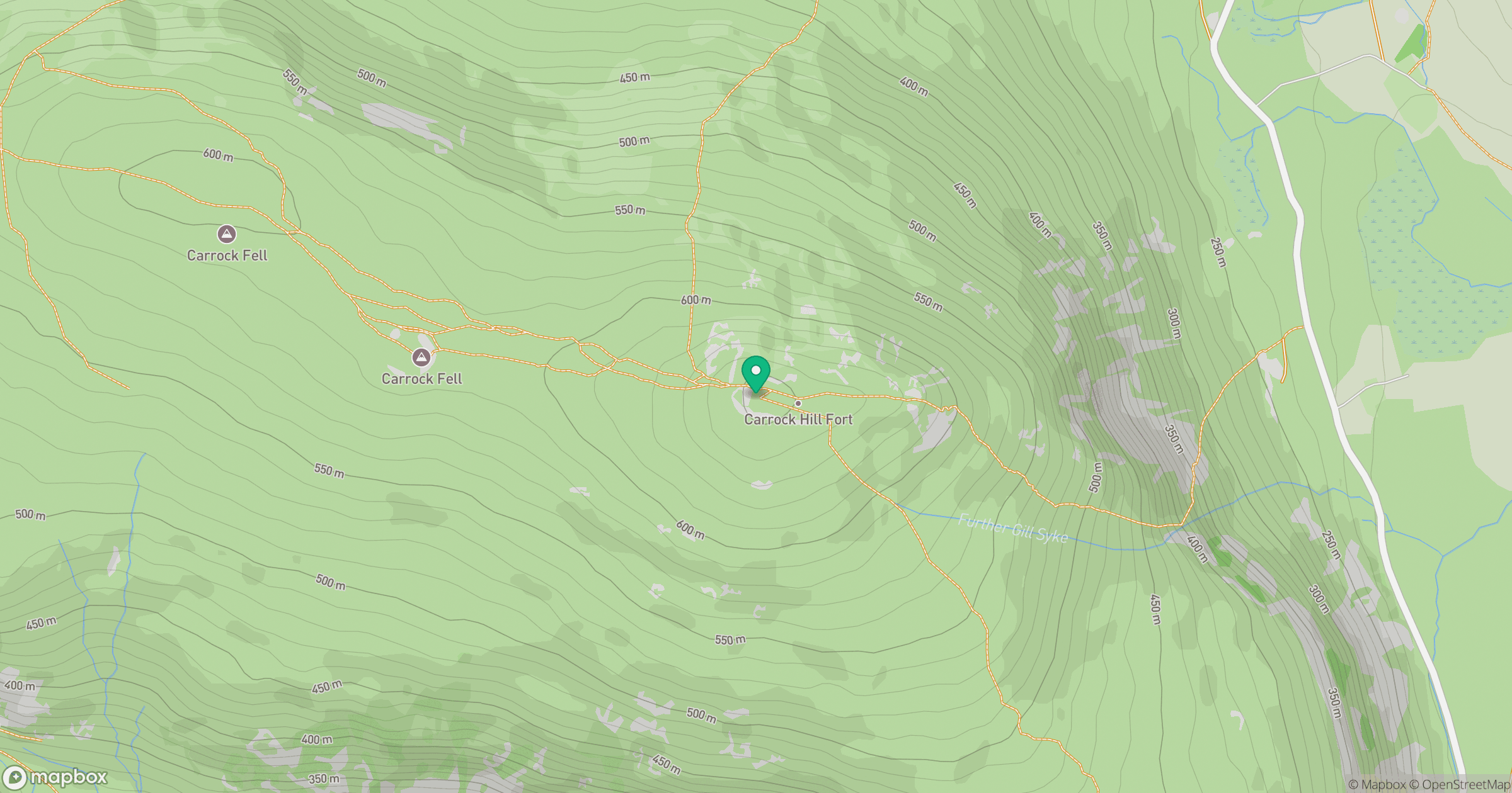
Grid reference: NY341336
View on OpenStreetMapOpens a map in a new tab, centred on the hill.


No comments yet. Be the first.