

Carn Sgumain
Good walks are even better shared.
Overview
Introduction
Carn Sgumain stands majestically at 962 meters and is a captivating Munro in the heart of the Scottish Highlands. Touted as a gem in the crown of the Monadhliath range, it offers hikers an invigorating climb with breathtaking views.
Geology
The mountain is predominantly made up of schist, a metamorphic rock formed under intense pressure and heat. As you trek, you may notice the unique banding and textures that reveal the mountain's ancient history. These stones have not only survived the test of time but do quite well at holding up against the whims of the elements.
Route
The most popular route starts from the Garva Bridge car park and journeys through Coire nan Clach. This winding path is your golden ticket to stunning vistas, taking about 4.5 hours to cover approximately 12.5 km. Take your time and don’t forget to pack some snacks – the summit is a perfect spot for a picnic, albeit a windy one!
Summit Features
At the top, you won't find a McDonald's or a gift shop, but you will be rewarded with a substantial cairn perfect for taking in the views or a quick catnap – just don’t doze off too long or you might miss the descent!
Terrain
Expect a mix of rocky pathways and grassy areas, with sections that may require some scrambling. It's essential to keep your footing secure and watch out for those sneaky loose rocks eager to trip you up.
Views
Once you reach the summit, it’s like lifting the veil off a new world! The scenery stretches far and wide, showcasing majestic mountains and the glistening Loch Ness. Time your ascent for spring or early autumn to catch nature at its most vibrant.
Hazards
As with any adventure in the mountains, be wary of changing weather conditions and loose terrain. Ensure that you’re equipped with proper gear – looking like an over-prepared tourist is far better than not being prepared at all!
Nearby Summits
If you're on a summit-bagging spree, consider visiting Carn Dearg and Cairn Gorm nearby. Both offer varied landscapes and stunning vistas that are plain delightful.
Access
Begin your journey at the Garva Bridge car park, from where the well-marked trail beckons. If you’re relying on public transport, be advised that options are scant, so a lift or a hearty pair of legs to walk from Aviemore might be on the cards.
Facilities
Once you descend, the lively town of Aviemore awaits – a treasure trove of cafes and perhaps a pint to celebrate your feat.
Conclusion
So, if you’re in the mood for some splendid Scottish scenery and a heart-pumping hike, Carn Sgumain is calling your name. Just grab your boots, some good company, and set out on an adventure you'll remember for years to come!
Explore routes near Carn Sgumain
Public walks starting within 80 km of this hill. Nearby does not mean a route reaches the summit; check its map and access before setting out.
Inverness: River Ness and Caledonian Canal circuit
View route
Culbin Forest: Hill 99, Gravel Pit Ponds and Dragonfly Pool
View route
Findhorn guided night walk
View route
Aviemore: Loch an Eilein and the Croft Track from Rothiemurchus
View route
Route planning notes
These notes describe possible approaches, not verified navigable routes or permission to cross land. Check current paths, local access rules and conditions before setting out.
Coire nan Clach route
A scenic route through Coire nan Clach, offering stunning views and a well-defined path to the summit.
Make a day of it, together
Find someone to share the walk with, or organise a day out along a route you like.
Photo Gallery
View all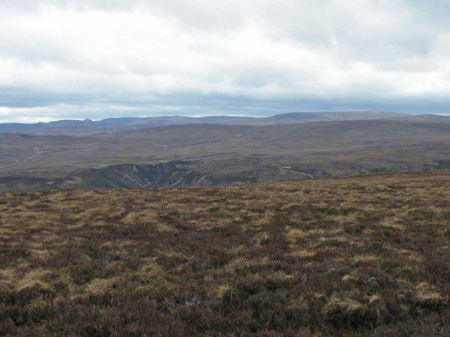 Photo could not load
NH8740 : Looking South from Cairn Sgùmain Plateau above Carnoch
Sarah McGuire
Hill facts and local notes
Classifications
Elevation
417m
1,368 ft
Prominence
110m
Coordinates
57.4452, -3.8686
NH879409
OS Map
27
Explorer: OL60 418 422
At the Summit
The summit features a sizable cairn, which serves as a great spot to take a well-deserved rest and enjoy the views that make the climb worthwhile.
Terrain & Geology
Carn Sgumain is predominantly composed of ancient Scottish metamorphic rock known as schist, giving it a rugged and resilient character. These rocks date back over a billion years, making them some of the oldest in the UK.
Views & Scenery
From the summit, adventurers can witness the stunning expanse of the Monadhliath Mountains and the picturesque Loch Ness to the west. Ben Nevis, the highest peak in Scotland, can also be seen on clear days.
History & Heritage
Name Origin
The name 'Carn Sgumain' translates to ‘the hill of the things that are pointed,’ possibly referencing the sharp peaks in the area.
Historical Significance
This mountain is significant to local hikers and climbers, being part of classic Munro bagging routes, and contributes to the rich cultural heritage surrounding Scotland's Highlands.
Getting There & Facilities
Check current local access restrictions, parking rules and transport timetables before travelling. These notes do not confirm public access to the summit.
Parking
There is parking available at the car park near Garva Bridge (NH 890 400), which serves as a good starting point for the hike.
Public Transport
Public transport options are limited; the nearest bus service runs to Inverness, from where one may need to arrange further transport.
Nearby Facilities
While there are no facilities on the mountain, Aviemore offers a range of cafes, restaurants, and essential services including toilets.
Safety Information
Known Hazards
- Be cautious of loose rocks and sudden weather changes. The terrain can become slippery when wet, and visibility may drop quickly in fog.
General Safety Tips
- Check weather conditions before setting out
- Carry appropriate clothing and equipment
- Let someone know your planned route
- Take a map, compass, and GPS device
- Carry emergency supplies: food, water, first aid kit, torch
Hills
Some common questions about the hills answered
Are there group walks up Carn Sgumain?
Many walkers use Walkmates to join or organise walks with others. You can check for group walks around Carn Sgumain through the maps
Are there other walkers around Carn Sgumain?
Activity varies by location and time, but Walkmates lets you see whether others have shared walks or shown interest in this area. Find other people through the walking friends search walking friends for Carn Sgumain search or of course create your own walk for Carn Sgumain
Can I organise a walk to Carn Sgumain?
Yes. If there aren’t any walks listed already, you can create a walk and make it available for others to join.
If you're signed up to Walkmates, you can create a walk to Carn Sgumain.
How do I find a walk up this hill?
There are often multiple ways to walk this hill, depending on experience and route preference. Walkmates helps you explore walks and routes that others have shared.
Can I suggest a new route up Carn Sgumain?
Yes. You can suggest or create routes to share with others. Walkmates focuses on the social side of walking, so routes are used to help people organise walks and explore areas together, rather than as detailed navigation tools or route libraries.
Other uses really appreciate knowledgeable walkers sharing their routes. Share your favourite route to Carn Sgumain here
The is an error or something incorrect about this hill. How do I let you know?
We always strive to keep the information on Walkmates as accurate as possible. If you find an error, please let us know through the contact form and we'll aim to correct it as quickly as possible
Community Discussion
Comments
Location
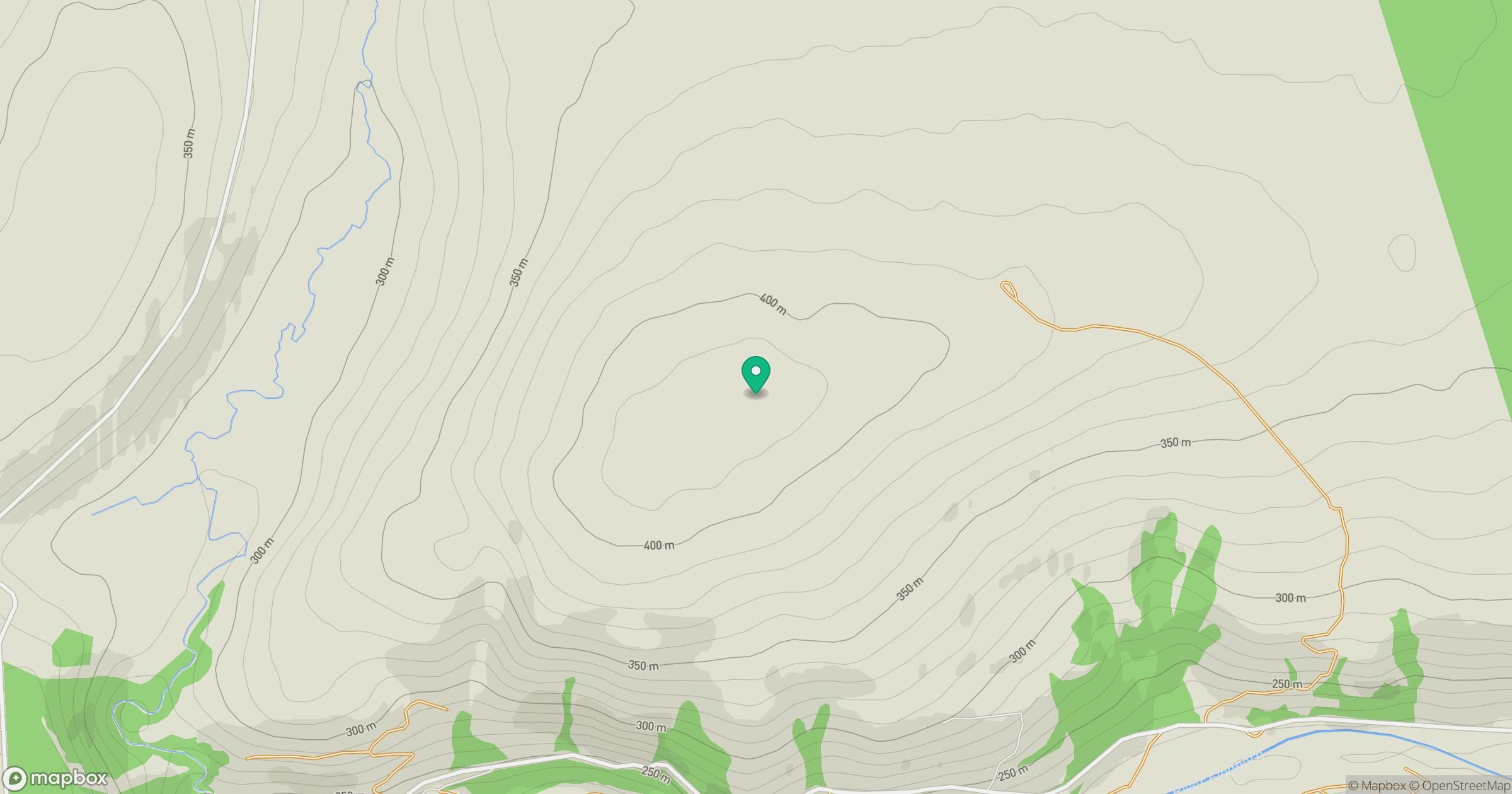
Grid reference: NH879409
View on OpenStreetMapOpens a map in a new tab, centred on the hill.
Hills within 30 km
Straight-line distance, not a walking route or confirmation of access.
Carn nan Tri-tighearnan
615m
Carn Glas-choire
659m
Tom na Slaite
426m
Creag Ealraich
504m
Lethen Bar
258m
No comments yet. Be the first.