

Lethen Bar
Good walks are even better shared.
Overview
Lethen Bar
Nestled in the heart of the Scottish Highlands, Lethen Bar stands at an elevation of 490 meters and is classified as a Marilyn, offering splendid views and a delightful hiking experience.
Geology
Lethen Bar features fascinating geological formations dominated by old red sandstone, hinting at the extensive natural history that is woven into the landscape. Be sure to take a moment and ponder the millennia that shaped this remarkable terrain while you catch your breath!
Hiking Routes
The main hiking route is the Lethen Bar Circular Route, which is approximately 6.5 km long and can be completed in about 2.5 hours. This moderate trek loops around the mountain, presenting hikers with multiple perspectives and stunning views. Don’t forget to pack a snack—after all, a hiker's best friend (after a good pair of boots!) is a hearty sandwich!
Terrain and Hazards
Expect a mix of grassy slopes and occasional rocky outcrops on your ascent. The path is generally well-drained, but if it has rained recently, you might find a few slippery spots that could turn your hike into an unintentional slip 'n slide adventure!
Views
On a clear day, the summit delivers breathtaking vistas towards the Moray Firth and the distant heights of the Cairngorms. For the best sights, spring and autumn are your friends, offering crisp air and clarity that makes for unforgettable photographs.
Access
For those venturing to this enchanting area, the nearest parking can be found at Rothes, roughly 3 km away from the trailhead, with regular bus services from Elgin ensuring you can leave the car behind. Rothes itself offers a handful of local amenities, so you can refuel with a nice cup of tea and a piece of cake before taking on the mountain.
Nearby Summits
Nearby, you may also want to explore Carn Fhìr-eoin and Ben Rinnes, both of which present their own unique challenges and rewards.
Conclusion
In summary, Lethen Bar is a tremendous spot for hikers seeking a blend of charming landscapes, moderate challenges, and perhaps a few laughs along the way. Whether you’re new to hiking or a seasoned pro, this hill offers something special for everyone.
Happy hiking!
Explore routes near Lethen Bar
Public walks starting within 80 km of this hill. Nearby does not mean a route reaches the summit; check its map and access before setting out.
Culbin Forest: Hill 99, Gravel Pit Ponds and Dragonfly Pool
View route
Findhorn guided night walk
View route
Elgin guided night walk
View route
Inverness: River Ness and Caledonian Canal circuit
View route
Route planning notes
These notes describe possible approaches, not verified navigable routes or permission to cross land. Check current paths, local access rules and conditions before setting out.
Lethen Bar Circular Route
A scenic route that loops around the mountain, providing various vantage points of the summit.
Make a day of it, together
Find someone to share the walk with, or organise a day out along a route you like.
Photo Gallery
View all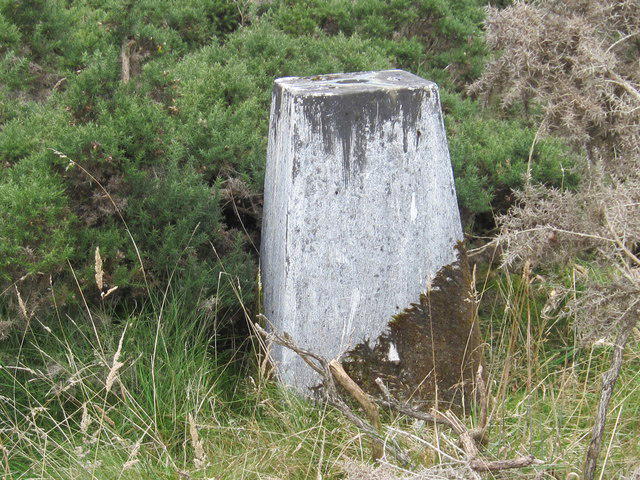 Photo could not load
NH9549 : Triangulation Pillar S7414 at Lethens Bar
Peter Wood
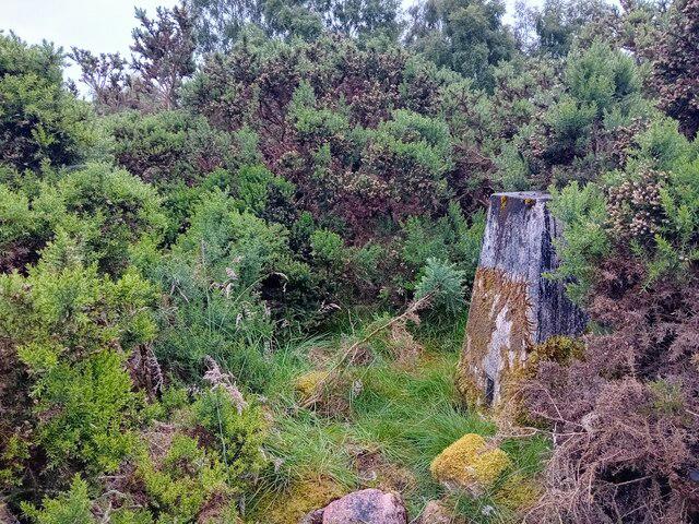 Photo could not load
NH9549 : Trig Point
David Bremner
Hill facts and local notes
Classifications
Elevation
258m
846 ft
Prominence
115m
Coordinates
57.5233, -3.7449
NH955494
OS Map
27
Explorer: 422
At the Summit
The summit boasts a small stone cairn and offers a dramatic panoramic view of the surrounding landscape.
Terrain & Geology
Primarily composed of sedimentary rock formations, Lethen Bar features a mix of old red sandstone that showcases interesting geological history.
Views & Scenery
From the summit, you can enjoy views of the Moray Firth, Dava Way, and the rolling hills of the Cairngorms in the distance.
History & Heritage
Name Origin
The name 'Lethen' is derived from Gaelic, meaning 'a group of elm trees', indicative of the area's rich ecology.
Historical Significance
Lethen Bar is etched into local folklore, often considered a hidden gem within the Highlands, frequented more by locals than tourists.
Getting There & Facilities
Check current local access restrictions, parking rules and transport timetables before travelling. These notes do not confirm public access to the summit.
Parking
The nearest parking is available at the village of Rothes, approximately 3 km from the base of the mountain.
Public Transport
There are regular bus services from Elgin to Rothes. Check local timetables.
Nearby Facilities
Rothes offers local cafes, shops, and public toilets, making it a handy stop before or after your hike.
Safety Information
Known Hazards
- Beware of sudden weather changes typical in the Highlands. Some muddy sections can be slippery, especially after rainfall.
General Safety Tips
- Check weather conditions before setting out
- Carry appropriate clothing and equipment
- Let someone know your planned route
- Take a map, compass, and GPS device
- Carry emergency supplies: food, water, first aid kit, torch
Hills
Some common questions about the hills answered
Are there group walks up Lethen Bar?
Many walkers use Walkmates to join or organise walks with others. You can check for group walks around Lethen Bar through the maps
Are there other walkers around Lethen Bar?
Activity varies by location and time, but Walkmates lets you see whether others have shared walks or shown interest in this area. Find other people through the walking friends search walking friends for Lethen Bar search or of course create your own walk for Lethen Bar
Can I organise a walk to Lethen Bar?
Yes. If there aren’t any walks listed already, you can create a walk and make it available for others to join.
If you're signed up to Walkmates, you can create a walk to Lethen Bar.
How do I find a walk up this hill?
There are often multiple ways to walk this hill, depending on experience and route preference. Walkmates helps you explore walks and routes that others have shared.
Can I suggest a new route up Lethen Bar?
Yes. You can suggest or create routes to share with others. Walkmates focuses on the social side of walking, so routes are used to help people organise walks and explore areas together, rather than as detailed navigation tools or route libraries.
Other uses really appreciate knowledgeable walkers sharing their routes. Share your favourite route to Lethen Bar here
The is an error or something incorrect about this hill. How do I let you know?
We always strive to keep the information on Walkmates as accurate as possible. If you find an error, please let us know through the contact form and we'll aim to correct it as quickly as possible
Community Discussion
Comments
Location
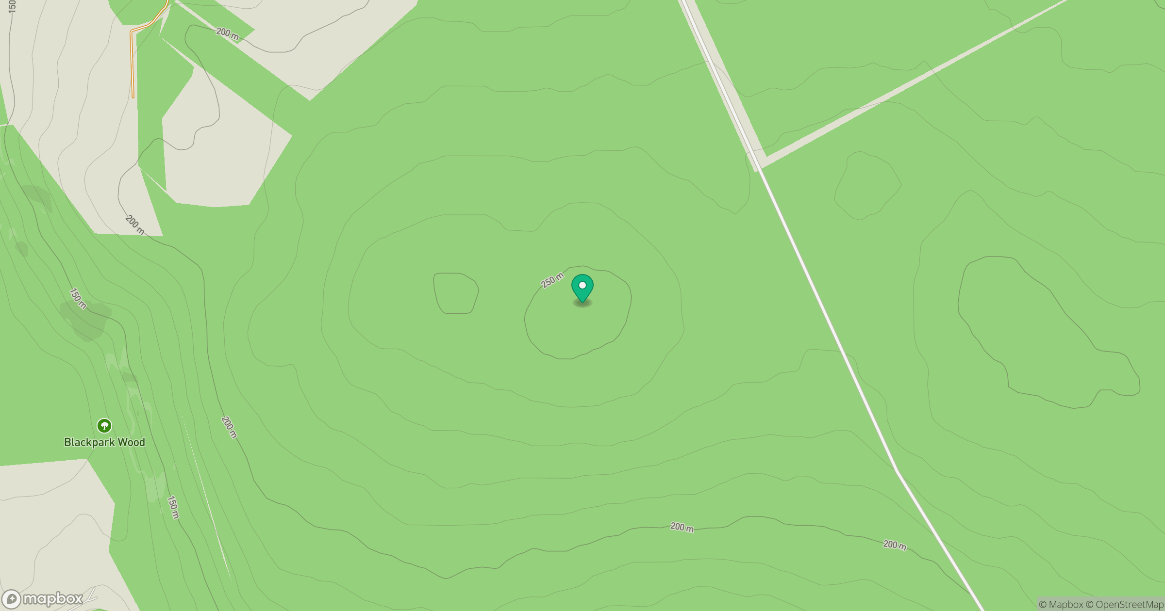
Grid reference: NH955494
View on OpenStreetMapOpens a map in a new tab, centred on the hill.
Hills within 30 km
Straight-line distance, not a walking route or confirmation of access.
No comments yet. Be the first.