

Cam Sgriob
Good walks are even better shared.
Overview
Cam Sgriob
Cam Sgriob, towering at 804 meters, is a stunning Munro situated in the heart of the Scottish Highlands. With its delightful blend of granite geology and historical significance, this mountain is a must-visit for both hikers and history buffs alike.
Geology
As mentioned, the predominant rock type is granite, with glacial formations that enrich the terrain's character. The area showcases the typical features of highland geology, including ancient outcrops and glacial erratics that prompt many hikers to stop and ponder the forces of nature.
Access
Situated near the quaint village of Invermoriston, access is straightforward. The nearby Invermoriston car park not only offers ample parking but also serves as a great starting point for various routes. Public transport from Inverness can drop you nearby, making the journey even easier, unless you prefer a leisurely hour-long hike from the bus stop. Don't forget to grab a scone from local cafés; they’re reputed to fuel even the most ambitious ascent!
Routes
Invermoriston Trail: A scenic 12 km route—great if you’re feeling moderately adventurous but not ready to sell your soul for a summit. It's perfect for a half-day outing with stunning views of Loch Ness.
Glen Moriston Approach: A more challenging 10 km route that takes you deeper into the wilds, this path offers a chance to embrace the rugged Scottish beauty in all its forms.
Summit Features
When you reach the top, you'll be greeted not only by the impressive stone cairn but also by panoramic views that seem to stretch on forever. There’s nothing quite like feeling on top of the world—literally!
Views
On clear days, expect to see the shimmering waters of Loch Ness below and the distant peaks of Monadh Liath standing proud against the skyline. Spring and autumn are considered the best times for this experience—so plan your visit accordingly and keep your fingers crossed for clear skies!
Hazards
As tempting as it is to run to the summit, be sure to watch your step! Loose rocks abound, and the unpredictable Highland weather can mean a quick change from sun to rain. That’s Scotland for you—always keeping you on your toes!
Nearby Summits
If you're feeling particularly ambitious, the nearby peaks of Meall na Teanga and Sgurr na Lapaich offer further challenges and stunning vistas.
History
The name Cam Sgriob translates to 'the crooked ridge', a fitting descriptor for this magnificent mount. Historically, it holds significance to local clans and is surrounded by fascinating folklore, making it both a nature lover’s paradise and a cultural treasure.
In conclusion, Cam Sgriob is more than just a mountain; it’s an unforgettable experience steeped in beauty and intrigue. So lace up those hiking boots, pack your sense of adventure (and a snack or two), and get ready to explore!
Explore routes near Cam Sgriob
Public walks starting within 80 km of this hill. Nearby does not mean a route reaches the summit; check its map and access before setting out.
Aviemore: Loch an Eilein and the Croft Track from Rothiemurchus
View route
Rothiemurchus: Beaver Trail and Lochan Mor
View route
Culbin Forest: Hill 99, Gravel Pit Ponds and Dragonfly Pool
View route
Aberlour to Carron Bridge: Speyside Way riverside return
View route
Route planning notes
These notes describe possible approaches, not verified navigable routes or permission to cross land. Check current paths, local access rules and conditions before setting out.
Invermoriston Trail
A scenic route starting from Invermoriston, it's a gradual ascent leading to breathtaking views of Loch Ness.
Glen Moriston Approach
Starting from Glen Moriston, this route takes you through scenic forestry before ascending to the summit.
Make a day of it, together
Find someone to share the walk with, or organise a day out along a route you like.
Photo Gallery
View all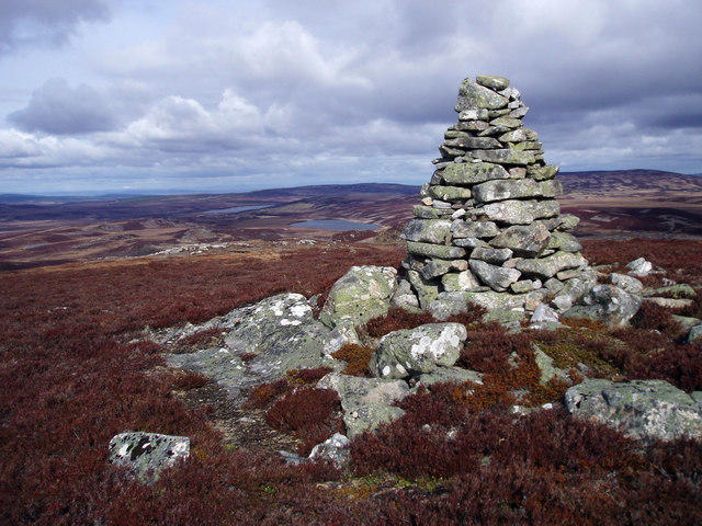 Photo could not load
NH9730 : Cam Sgriob Summit
Dorothy Carse
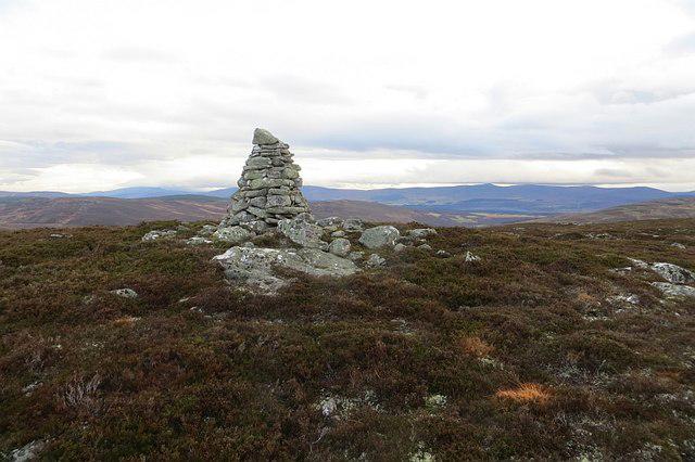 Photo could not load
NH9730 : Cam Sgriob
Richard Webb
Hill facts and local notes
Classifications
Elevation
485m
1,591 ft
Prominence
101m
Coordinates
57.3503, -3.7051
NH974301
OS Map
27 36
Explorer: OL60 418
At the Summit
The summit features a large stone cairn and magnificent panoramic views stretching to the surrounding hills and inlets.
Terrain & Geology
Cam Sgriob is primarily composed of ancient granite, which has weathered over millennia to form the distinctive rugged landscapes typical of the Scottish Highlands. The presence of glacial features adds to its captivating scenery.
Views & Scenery
On a clear day, you can enjoy views of Loch Ness, the Great Glen, and the distant peaks of the Monadh Liath hills.
History & Heritage
Name Origin
The name 'Cam Sgriob' derives from Gaelic, meaning 'the crooked ridge', indicative of its contouring form.
Historical Significance
Historically, the mountain area has been important for local clans and is rich in folklore, including stories of the Loch Ness monster and local legends.
Getting There & Facilities
Check current local access restrictions, parking rules and transport timetables before travelling. These notes do not confirm public access to the summit.
Parking
The most accessible parking is located at the Invermoriston car park, which accommodates several vehicles and includes information boards.
Public Transport
Regular bus services operate from Inverness to Invermoriston. Plan ahead, though, as times can be sporadic.
Nearby Facilities
There are local cafes and shops in Invermoriston for supplies, and public toilets available near the parking area.
Safety Information
Known Hazards
- Loose rocks on trail, potential for sudden weather changes, and boggy sections can lead to slips.
General Safety Tips
- Check weather conditions before setting out
- Carry appropriate clothing and equipment
- Let someone know your planned route
- Take a map, compass, and GPS device
- Carry emergency supplies: food, water, first aid kit, torch
Hills
Some common questions about the hills answered
Are there group walks up Cam Sgriob?
Many walkers use Walkmates to join or organise walks with others. You can check for group walks around Cam Sgriob through the maps
Are there other walkers around Cam Sgriob?
Activity varies by location and time, but Walkmates lets you see whether others have shared walks or shown interest in this area. Find other people through the walking friends search walking friends for Cam Sgriob search or of course create your own walk for Cam Sgriob
Can I organise a walk to Cam Sgriob?
Yes. If there aren’t any walks listed already, you can create a walk and make it available for others to join.
If you're signed up to Walkmates, you can create a walk to Cam Sgriob.
How do I find a walk up this hill?
There are often multiple ways to walk this hill, depending on experience and route preference. Walkmates helps you explore walks and routes that others have shared.
Can I suggest a new route up Cam Sgriob?
Yes. You can suggest or create routes to share with others. Walkmates focuses on the social side of walking, so routes are used to help people organise walks and explore areas together, rather than as detailed navigation tools or route libraries.
Other uses really appreciate knowledgeable walkers sharing their routes. Share your favourite route to Cam Sgriob here
The is an error or something incorrect about this hill. How do I let you know?
We always strive to keep the information on Walkmates as accurate as possible. If you find an error, please let us know through the contact form and we'll aim to correct it as quickly as possible
Community Discussion
Comments
Location
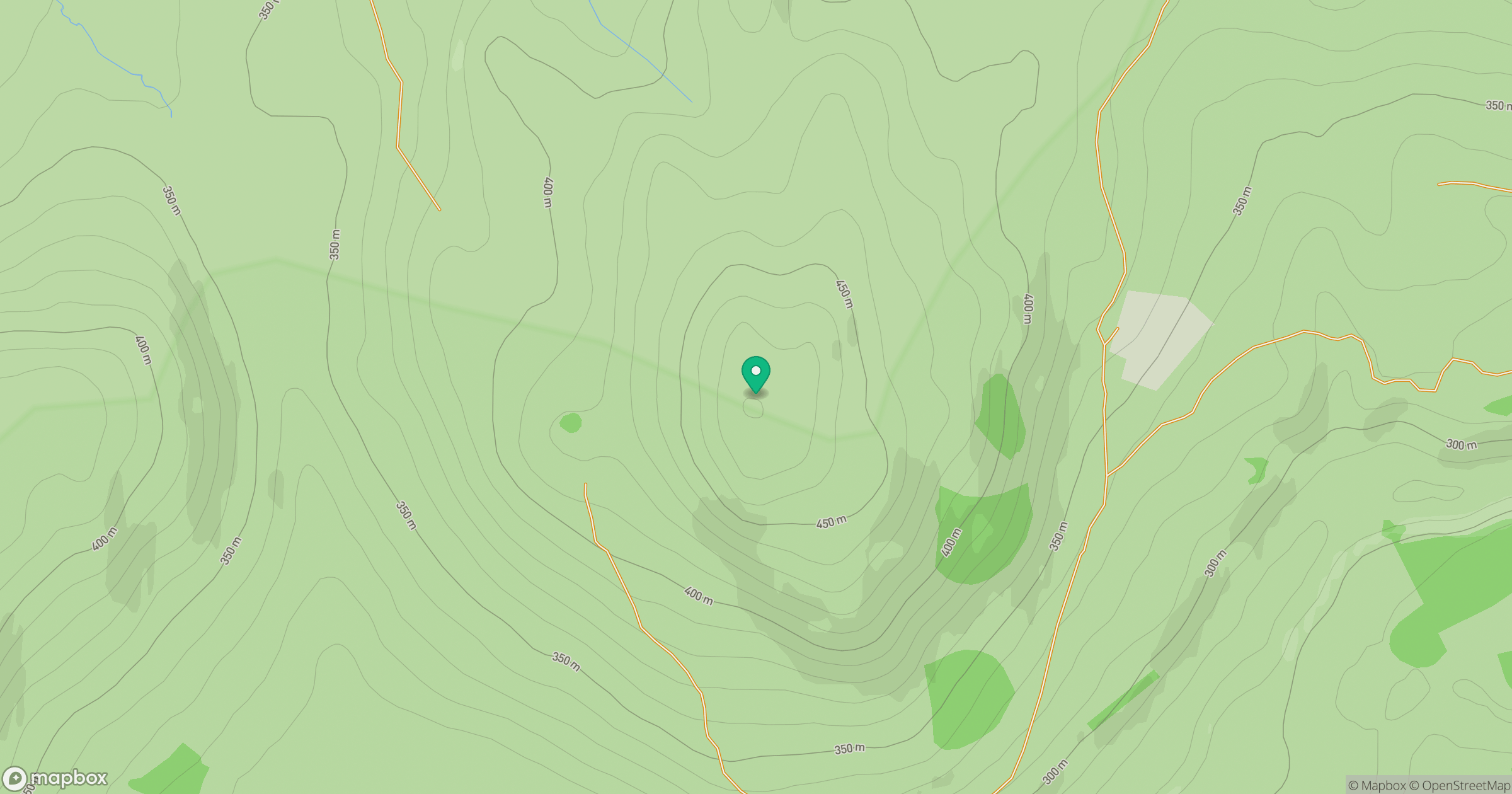
Grid reference: NH974301
View on OpenStreetMapOpens a map in a new tab, centred on the hill.
Hills within 30 km
Straight-line distance, not a walking route or confirmation of access.
No comments yet. Be the first.