
Carn Greannach
Good walks are even better shared.
Overview
Carn Greannach: A Scottish Gem
Carn Greannach is a delightful hill nestled in the Scottish Highlands, offering both challenging and moderate routes for hikers and outdoor enthusiasts. Situated at NN950822, this Corbett** stands at an elevation of 850 meters, making it a perfect goal for those looking to bag a few peaks without the grueling effort associated with Munros.
Geology
Primarily composed of granite and schist, the geology of Carn Greannach provides a stable footing for your hike while also showcasing stunning natural formations. The rocks tell a tale of ancient geological processes that have shaped this beautiful landscape over millions of years.
Routes
North Approach from Bridge of Gaur
- Distance: 10.5 km
- Time: Approximately 4.5 hours
- Difficulty: Moderate
This route is popular for a reason! It follows well-maintained paths through gorgeous heather and moorland, providing picturesque vistas of the loch below.
South Approach from Insch Farm
- Distance: 12 km
- Time: Roughly 5 hours
- Difficulty: Challenging
For those seeking solitude, this approach offers a more intimate experience of Scotland's wild beauty, taking you through hidden glens and alongside babbling brooks.
Summit Features
Upon reaching the summit, you’ll find a classic rocky cairn, perfect for a photo-op. The views from here are nothing short of breathtaking. You can see the mesmerizing curves of Loch Rannoch and the grand peaks of Schiehallion in the distance. And remember, don’t forget to eat—just keep an eye out for those pesky seagulls seeking a snack!
Terrain
The terrain varies from rocky to grassy with stretches of boggy ground after heavy rainfall—so, as always, wear your best hiking boots to avoid an unexpected dip!
Views
Highlights
From the summit, majestic vistas extend in all directions, showcasing the natural beauty of the Highlands. You can spot Loch Rannoch, with its shimmering waters, and the breathtaking expanses of Rannoch Moor, a wilderness that seems to stretch on forever.
Best Seasons
For the best views, aim for late Spring or early Autumn. During these times, you'll enjoy clear skies and delightful weather that’s hard to beat.
Hazards
As with any highland adventure, it's vital to remain aware of the rapidly changing weather, which can turn a pleasant hike into a damp affair in mere moments. Also, don’t be overly adventurous around bogs—those squishy areas can be sneaky!
Nearby Summits
If you're feeling extra ambitious, you can also include nearby summits like Beinn a' Ghlo and Schiehallion in your hiking itinerary. They offer stunning views and additional challenges.
Access
Nearest Parking
Visitor parking is available at Bridge of Gaur, accommodating about 10 cars. Good luck finding a space on a busy day!
Public Transport
Public transport is somewhat limited in the area; a car is recommended for the most convenience.
Nearest Town
The charming town of Pitlochry, about 20 miles away, serves as the closest town, providing ample facilities, including cafés and restrooms.
Facilities
After your hike, why not treat yourself to a slice of cake at one of Pitlochry's delightful cafés? You’ve earned it!
History
Name Meaning
The name Carn Greannach literally means 'the hill of the gorse' in Gaelic.
Significance
This peak holds cultural significance, often serving as a shared space for community events and outdoor lovers.
In summary, Carn Greannach is not just a mountain—it’s an experience. So lace up those boots, pack a snack (and maybe a spare sandwich for a seagull), and enjoy the Scottish Highlands at their finest!
Explore routes near Carn Greannach
Walks starting near this hill. Open a route to check its map, distance and full itinerary.
Rothiemurchus: Beaver Trail and Lochan Mor
View route
Aviemore: Loch an Eilein and the Croft Track from Rothiemurchus
View route
Aberfeldy: Glassie Woodland and River Tay Circular
View route
Kenmore: Drummond Hill Black Rock Trail above Loch Tay
View route
Route planning notes
These notes describe possible approaches. Check a route's map and access information when planning your walk.
North Approach from Bridge of Gaur
A straightforward ascent from the Bridge of Gaur with lovely views over the loch. Follow the well-maintained paths through heather and moorland.
South Approach from Insch Farm
This route offers a more secluded experience, taking you through glens and alongside streams. It’s less trodden but equally rewarding.
Make a day of it, together
Find someone to share the walk with, or organise a day out along a route you like.
Hill facts and local notes
Classifications
Elevation
880m
2,886 ft
Prominence
22m
Coordinates
56.9193, -3.7255
NN950822
OS Map
43
Explorer: OL51E 394E
At the Summit
The summit has a typical rocky cairn, with stunning 360-degree views achievable on clear days. It’s an ideal spot for a scenic picnic—just watch out for the seagulls!
Terrain & Geology
Carn Greannach is primarily composed of granite and schist, common to the Highlands, providing excellent footing for hiking while affording striking formations along its slopes.
Views & Scenery
From the summit, you can spot Loch Rannoch, the distant peaks of Schiehallion, and the sprawling expanse of Rannoch Moor. An excellent reward for your ascent!
History & Heritage
Name Origin
The name Carn Greannach translates to 'the hill of the gorse' in Gaelic, referencing the local flora that might resemble a bright yellow carpet in blooming seasons.
Historical Significance
This area has significant cultural importance among locals and hikers alike, often used as a gathering place for community events and outdoor activities.
Getting There & Facilities
Parking
There is a small car park at Bridge of Gaur, which can accommodate about 10 vehicles. Arrive early to secure a spot, especially at weekends.
Public Transport
Limited bus services run to nearby villages, but it's best to check schedules as they can be infrequent. A car is generally recommended.
Nearby Facilities
You’ll find several cafes and pubs in Pitlochry, where you can enjoy a well-deserved slice of cake. Restrooms are available in the town.
Safety Information
Known Hazards
- Be cautious of changing weather conditions, which can turn from sunny to stormy in no time. Also, be aware of the occasional bog—your boots will thank you!
General Safety Tips
- Check weather conditions before setting out
- Carry appropriate clothing and equipment
- Let someone know your planned route
- Take a map, compass, and GPS device
- Carry emergency supplies: food, water, first aid kit, torch
Hills
Some common questions about the hills answered
Are there group walks up Carn Greannach?
Many walkers use Walkmates to join or organise walks with others. You can check for group walks around Carn Greannach through the maps
Are there other walkers around Carn Greannach?
Activity varies by location and time, but Walkmates lets you see whether others have shared walks or shown interest in this area. Find other people through the walking friends search walking friends for Carn Greannach search or of course create your own walk for Carn Greannach
Can I organise a walk to Carn Greannach?
Yes. If there aren’t any walks listed already, you can create a walk and make it available for others to join.
If you're signed up to Walkmates, you can create a walk to Carn Greannach.
How do I find a walk up this hill?
There are often multiple ways to walk this hill, depending on experience and route preference. Walkmates helps you explore walks and routes that others have shared.
Can I suggest a new route up Carn Greannach?
Yes. You can suggest or create routes to share with others. Walkmates focuses on the social side of walking, so routes are used to help people organise walks and explore areas together, rather than as detailed navigation tools or route libraries.
Other uses really appreciate knowledgeable walkers sharing their routes. Share your favourite route to Carn Greannach here
The is an error or something incorrect about this hill. How do I let you know?
We always strive to keep the information on Walkmates as accurate as possible. If you find an error, please let us know through the contact form and we'll aim to correct it as quickly as possible
Community Discussion
Comments
Location
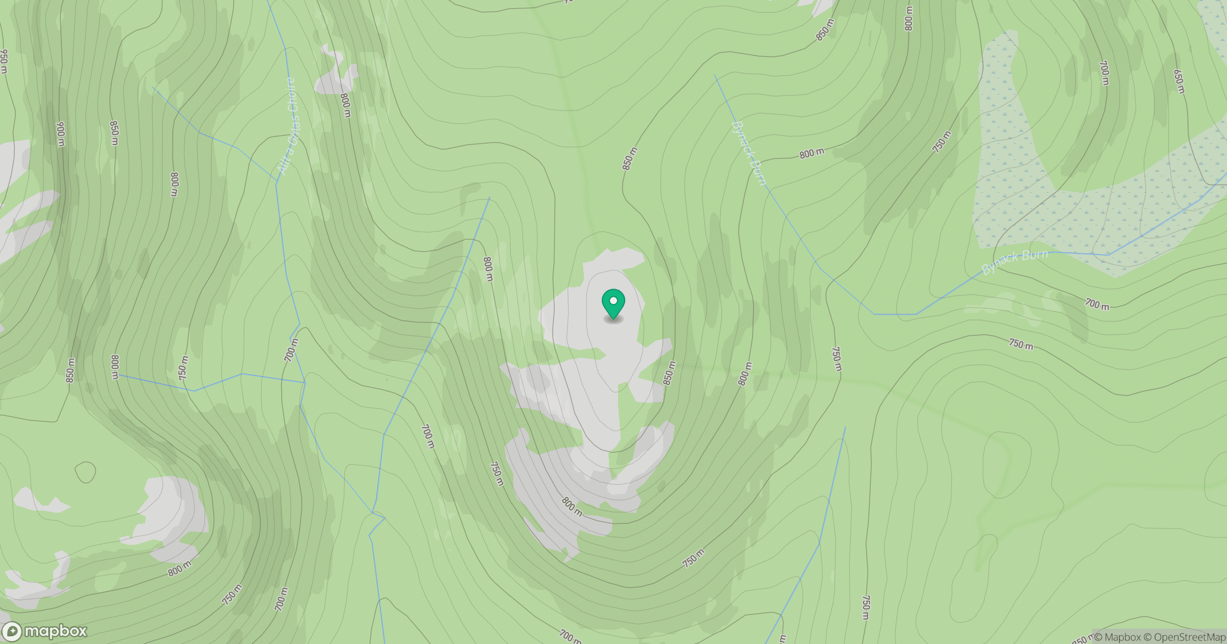
Grid reference: NN950822
View on OpenStreetMapOpens a map in a new tab, centred on the hill.
No comments yet. Be the first.