
A' Chailleach
Good walks are even better shared.
Overview
A' Chailleach: An Enchanting Munro in the Scottish Highlands
Overview
A' Chailleach stands proud at 1,010 meters, demanding respect from any aspiring hiker. Nestled in the stunning Scottish Highlands, this Munro isn't just a peak; it's a stone-cold icon surrounded by rich folklore.
Geology
Formed from schist and granitic gneiss, the rock formations tell tales older than your grandfather. Donning their geological hats, adventurers can marvel at the ancient processes that sculpted this magnificent peak over millions of years. Remember, rocks won't judge your fitness level!
Routes
The route via Glen Spean takes you on an absolute scenic joyride; don't forget to bring your camera! At about 10 kilometers, it’ll take approximately 5 hours, so set off at a leisurely pace—there’s no rush when you’re taking in nature's beauty.
Summit Features
The summit features a well-built stone cairn, a classic touch for any self-respecting Munro. It's the perfect place to catch your breath, eat your packed lunch, and take selfies that will make your friends green with envy.
Terrain
Prepare for a blend of grassy slopes and rocky outcrops—definitely a mixed bag. Watch for the odd boggy patch; they have a knack for ambushing unsuspecting hikers!
Views
Once you’ve conquered the summit, relish breathtaking views of Ben Nevis and the surrounding hills. Remember, the best time for a clear view is during spring or autumn—so pick your climbing season wisely!
Hazards
Keep an eye on the clouds—visibility can drop quicker than a bad joke! Loose rocks are another concern, especially on the steeper slopes. It’s not all fun and games out there, but with a bit of caution and good sense, you’ll be golden.
Access
The Glen Spean car park (NH667022) is your gateway to adventure. A quick jaunt from the A86 gets you to a decent parking spot.
Public transport options exist, with the nearest train station at Spean Bridge, just a hop and a skip away. If you find yourself in the charming village of Roybridge, you’re already halfway to your hiking adventure!
Facilities
Though there are no facilities on the mountain itself, Roybridge offers some cafes where you can treat yourself after a long hike. Don't forget the all-important refreshments!
History
The name A' Chailleach—meaning 'The Old Woman'—adds a splash of folklore to your hike. Local legends tell of spirits that guard the peaks, adding a mystical layer to your journey.
So, lace up those hiking boots, grab your walking stick, and prepare to be enchanted by A' Chailleach. Just don’t forget your lunch; the cairn won’t share their snacks!
Happy Hiking!
Explore routes near A' Chailleach
Walks starting near this hill. Open a route to check its map, distance and full itinerary.
Aviemore: Loch an Eilein and the Croft Track from Rothiemurchus
View route
Rothiemurchus: Beaver Trail and Lochan Mor
View route
Fort Augustus to Kytra Lock: Caledonian Canal Towpath
View route
Glen Affric: Coire Loch Woodland Trail
View route
Route planning notes
These notes describe possible approaches. Check a route's map and access information when planning your walk.
The Glen Spean Approach
A popular and picturesque route starting from the Glen Spean area that winds through scenic glens and wooded areas before heading upwards.
Make a day of it, together
Find someone to share the walk with, or organise a day out along a route you like.
Hill facts and local notes
Classifications
Elevation
929m
3,049 ft
Prominence
108m
Coordinates
57.1096, -4.1793
NH681041
OS Map
35
Explorer: OL56 402
At the Summit
The summit of A' Chailleach is crowned by a traditional stone cairn, offering a perfect spot for a well-deserved break. There’s also a spectacular view down to Loch Laggan.
Terrain & Geology
A' Chailleach is predominantly composed of schist and granitic gneiss typical of the Cairngorms. The geological processes that created these rocks date back over 400 million years, making it a fascinating study for geology enthusiasts.
Views & Scenery
From the summit, enjoy panoramic views of the surrounding peaks, including Ben Nevis to the south and the vast expanse of the Great Glen.
History & Heritage
Name Origin
A' Chailleach translates to 'The Old Woman', referring to Scottish folklore around mountain spirits.
Historical Significance
A' Chailleach holds historical significance in local Scottish culture, often tied to legends and tales among the Highland communities.
Getting There & Facilities
Parking
Parking is available at the Glen Spean car park (NH667022), which is well signposted along the A86.
Public Transport
The nearest train station is at Spean Bridge, approximately 5 miles away. Local bus services may operate from Fort William.
Nearby Facilities
There are no facilities on the mountain itself, but nearby Roybridge has a few cafes and public toilets.
Safety Information
Known Hazards
- Misty conditions can reduce visibility significantly. Be cautious of loose rocks and slippery terrain after rainfall.
General Safety Tips
- Check weather conditions before setting out
- Carry appropriate clothing and equipment
- Let someone know your planned route
- Take a map, compass, and GPS device
- Carry emergency supplies: food, water, first aid kit, torch
Hills
Some common questions about the hills answered
Are there group walks up A' Chailleach?
Many walkers use Walkmates to join or organise walks with others. You can check for group walks around A' Chailleach through the maps
Are there other walkers around A' Chailleach?
Activity varies by location and time, but Walkmates lets you see whether others have shared walks or shown interest in this area. Find other people through the walking friends search walking friends for A' Chailleach search or of course create your own walk for A' Chailleach
Can I organise a walk to A' Chailleach?
Yes. If there aren’t any walks listed already, you can create a walk and make it available for others to join.
If you're signed up to Walkmates, you can create a walk to A' Chailleach.
How do I find a walk up this hill?
There are often multiple ways to walk this hill, depending on experience and route preference. Walkmates helps you explore walks and routes that others have shared.
Can I suggest a new route up A' Chailleach?
Yes. You can suggest or create routes to share with others. Walkmates focuses on the social side of walking, so routes are used to help people organise walks and explore areas together, rather than as detailed navigation tools or route libraries.
Other uses really appreciate knowledgeable walkers sharing their routes. Share your favourite route to A' Chailleach here
The is an error or something incorrect about this hill. How do I let you know?
We always strive to keep the information on Walkmates as accurate as possible. If you find an error, please let us know through the contact form and we'll aim to correct it as quickly as possible
Community Discussion
Comments
Location
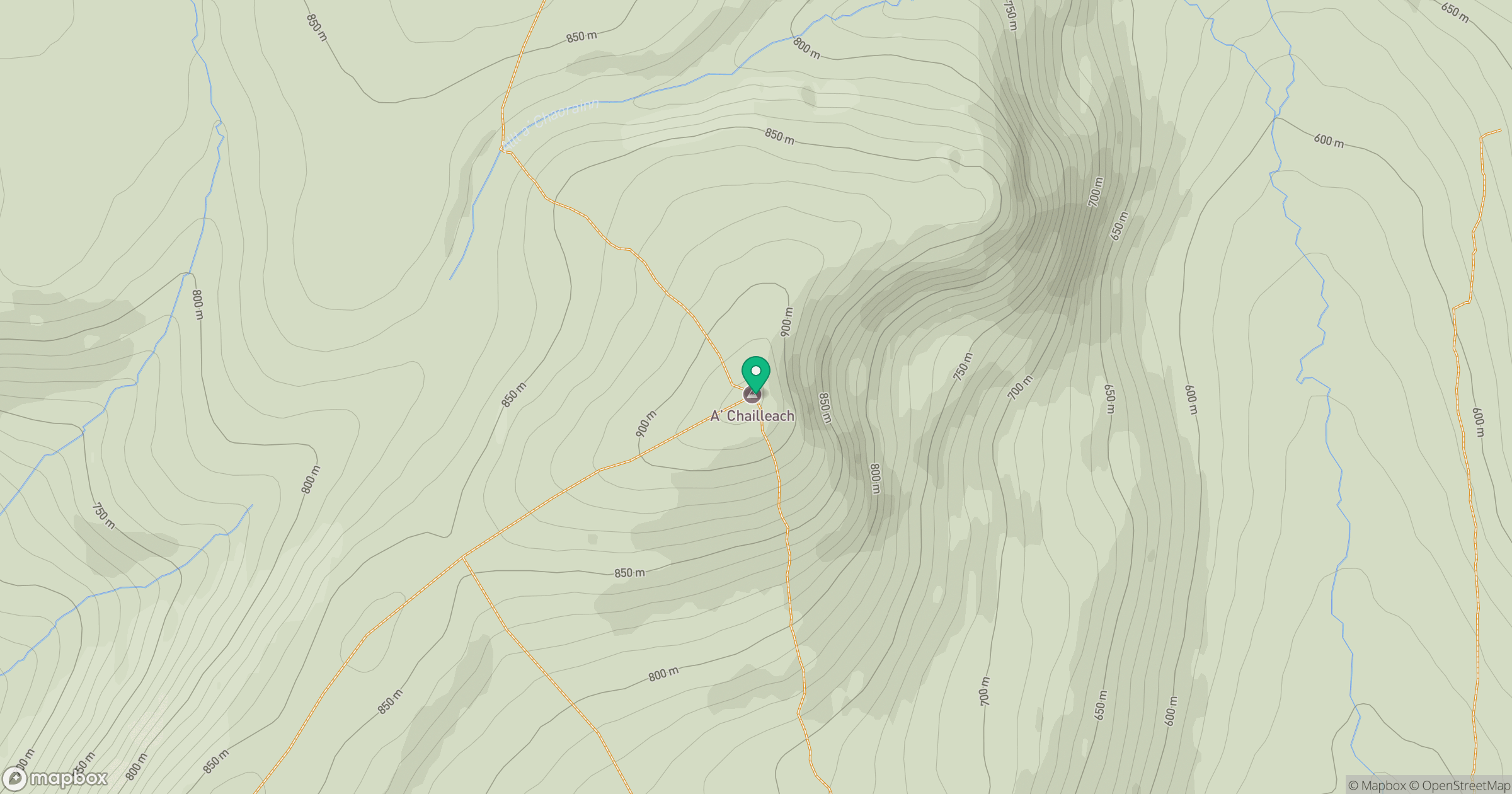
Grid reference: NH681041
View on OpenStreetMapOpens a map in a new tab, centred on the hill.
No comments yet. Be the first.