

Cappagh Mountain
Good walks are even better shared.
Overview
Cappagh Mountain
Overview
Cappagh Mountain, peaking at 566 meters, is a gem set in the Slieve Bloom Mountains of Ireland. It may not be the highest peak in the range, but what it lacks in altitude, it more than makes up for in beauty and character. This mountain serves both as a backdrop for local story and as a destination for modern hikers alike.
Geology
The mountain's geology is characterised by Old Red Sandstone, which has formed striking rock formations and steep hillsides. The combination of this unique geology and the local environment creates fertile ground for diverse flora and fauna, along with a complex array of hiking trails sure to satisfy adventure seekers.
Routes
For those looking to conquer its heights, the Cappagh Loop is an excellent choice. This 10.5 km moderate trek takes you on a delightful journey through scenic woodland and panoramic views.
The more adventurous can brave the Direct Ascent from Red Door, a 5 km climb that promises a rewarding challenge with a hearty helping of rugged terrain.
Summit Features
Upon reaching the summit, you'll be greeted by the modest cairn, which offers an excellent photo opportunity against a backdrop of sweeping hills and valleys. The views from the top are truly breathtaking!
Terrain
Expect a mix of grassy slopes ideal for easy walking and rocky outcrops that can occasionally test your footing. Watch out for the boggy patches!
Views
From the summit, expect to spot various notable landmarks including the ancient Arderin and the evocative Sugarloaf Mountain in the distance. Spring or Autumn is the best time to experience the stunning views, as the landscape bursts into life.
Hazards
While hiking, be cautious of muddy paths and the possibility of sudden weather changes typical of mountainous regions. Always check your gear and be prepared!
Nearby Summits
Cappagh Mountain is surrounded by other peaks, such as the taller Arderin at 599 meters and the gentle slopes of Ballycumber Hill at 341 meters, worth exploring.
Access
For a convenient starting point, the Red Door Car Park is easily accessible. If you're relying on public transport, prepare for a bit of a walk from Kinnitty, the nearest town. But don't worry; the quaint charm of the village will add to your adventure!
Facilities
After your conquest, Kinnitty offers some delightful cafes where you can refuel and share your stories. Public toilets are also available, so no need to fear the call of nature too much.
History
The name 'Cappagh' reminds us of the rich history of the land. The tales of yore, like that of Táin Bó Cúailnge, add a mystical layer to your hiking experience – who knows what stories the mountains whisper?
So lace up those boots, grab your hiking sticks, and make sure to take a moment to enjoy the beauty of Cappagh Mountain – where nature meets history in a perfect harmony.
Happy Hiking!
Explore routes near Cappagh Mountain
Public walks starting within 80 km of this hill. Nearby does not mean a route reaches the summit; check its map and access before setting out.
Peatlands Park Red Trail: Annagarriff Wood and Derryadd Lough
View route
Portadown to Knock Bridge: Bann Boulevard and Moneypenny’s Lock
View route
Banagher Glen and Forest: complete higher-return circuit
View route
Scarva to Poyntzpass: Newry Canal and Lough Shark Return
View route
Route planning notes
These notes describe possible approaches, not verified navigable routes or permission to cross land. Check current paths, local access rules and conditions before setting out.
Cappagh Loop
A scenic loop starting from the village of Kinnitty, offering a gradual ascent with lovely views of the surrounding landscape.
Direct Ascent from Red Door
A more challenging route directly up from the Red Door car park, which includes some steep and rocky sections.
Make a day of it, together
Find someone to share the walk with, or organise a day out along a route you like.
Photo Gallery
View all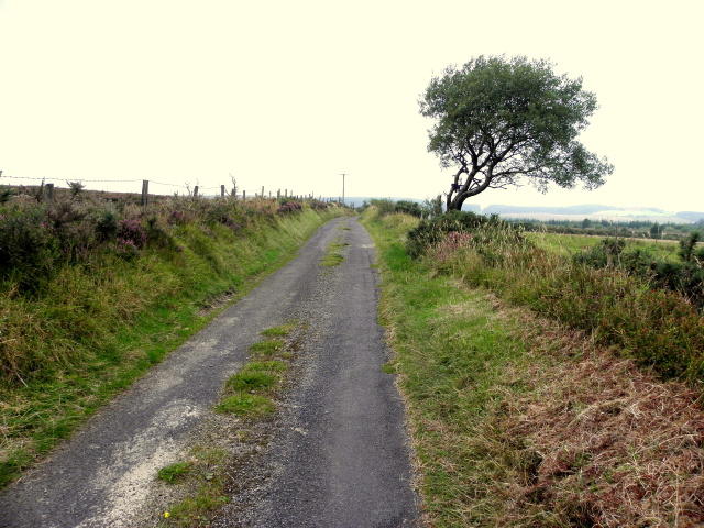 Photo could not load
H6766 : Cappagh Road, Cappagh Mountain
Kenneth Allen
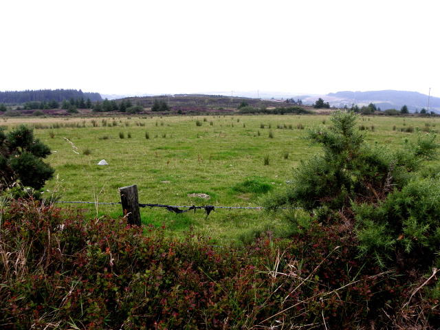 Photo could not load
H6766 : Cappagh Townland
Kenneth Allen
Hill facts and local notes
Classifications
Elevation
286m
938 ft
Prominence
103m
Coordinates
54.5414, -6.9532
H678664
OS Map
19
At the Summit
The summit features a modest cairn and stunning panoramic views over the Slieve Bloom Mountains and the surrounding valleys.
Terrain & Geology
The mountain is primarily composed of Old Red Sandstone, which creates a unique terrain with steep cliffs and rolling hills, making it a prime example of geological history in the area.
Views & Scenery
On a clear day, summits such as Arderin and the distant Sugarloaf Mountain can be seen, not to mention the undulating hills of the south.
History & Heritage
Name Origin
Cappagh comes from the Gaelic 'Ceapach', meaning 'a piece of land', which seems fitting given the lush hills.
Historical Significance
The area has a rich cultural heritage, including tales of the legendary Táin Bó Cúailnge, adding a sprinkle of myth to your hike.
Getting There & Facilities
Check current local access restrictions, parking rules and transport timetables before travelling. These notes do not confirm public access to the summit.
Parking
Red Door Car Park located at O 159 120, offers a convenient spot to start your hike.
Public Transport
Limited; the nearest bus service operates from Roscrea to Kinnitty, approximately 7 km away.
Nearby Facilities
The nearby village of Kinnitty has a couple of quaint cafes and public toilets, perfect for a pre-hike coffee break or a post-hike treat.
Safety Information
Known Hazards
- Muddy paths and potential for sudden weather changes. It's a good idea to check your gear before heading out!
General Safety Tips
- Check weather conditions before setting out
- Carry appropriate clothing and equipment
- Let someone know your planned route
- Take a map, compass, and GPS device
- Carry emergency supplies: food, water, first aid kit, torch
Hills
Some common questions about the hills answered
Are there group walks up Cappagh Mountain?
Many walkers use Walkmates to join or organise walks with others. You can check for group walks around Cappagh Mountain through the maps
Are there other walkers around Cappagh Mountain?
Activity varies by location and time, but Walkmates lets you see whether others have shared walks or shown interest in this area. Find other people through the walking friends search walking friends for Cappagh Mountain search or of course create your own walk for Cappagh Mountain
Can I organise a walk to Cappagh Mountain?
Yes. If there aren’t any walks listed already, you can create a walk and make it available for others to join.
If you're signed up to Walkmates, you can create a walk to Cappagh Mountain.
How do I find a walk up this hill?
There are often multiple ways to walk this hill, depending on experience and route preference. Walkmates helps you explore walks and routes that others have shared.
Can I suggest a new route up Cappagh Mountain?
Yes. You can suggest or create routes to share with others. Walkmates focuses on the social side of walking, so routes are used to help people organise walks and explore areas together, rather than as detailed navigation tools or route libraries.
Other uses really appreciate knowledgeable walkers sharing their routes. Share your favourite route to Cappagh Mountain here
The is an error or something incorrect about this hill. How do I let you know?
We always strive to keep the information on Walkmates as accurate as possible. If you find an error, please let us know through the contact form and we'll aim to correct it as quickly as possible
Community Discussion
Comments
Location
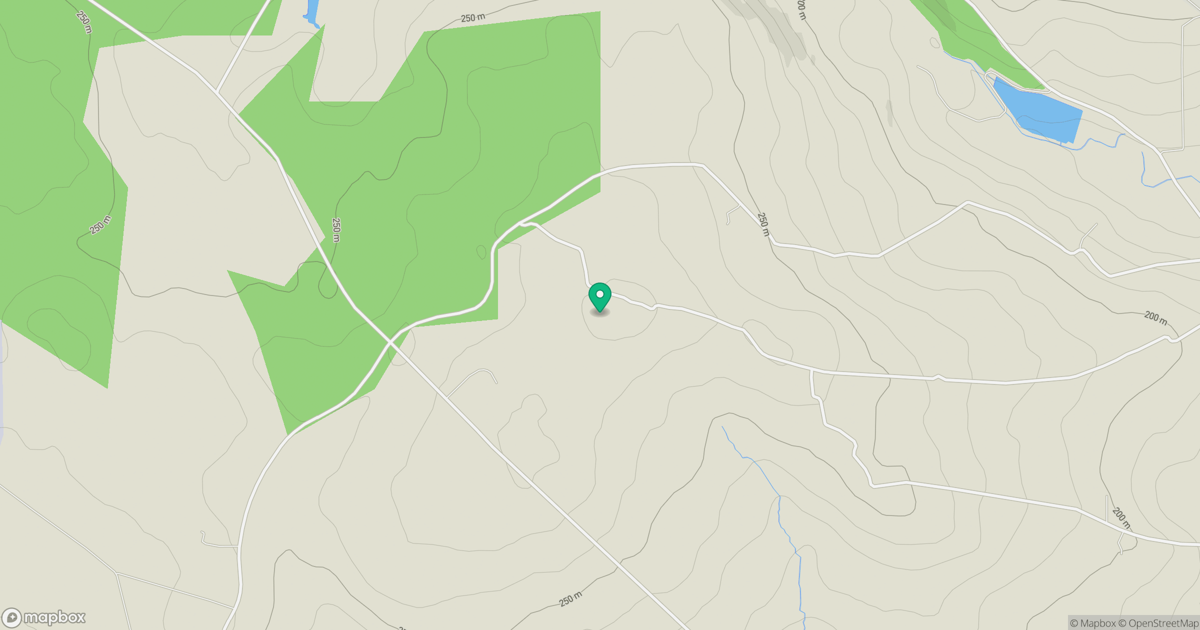
Grid reference: H678664
View on OpenStreetMapOpens a map in a new tab, centred on the hill.
Hills within 30 km
Straight-line distance, not a walking route or confirmation of access.
No comments yet. Be the first.