

Cairnoch Hill
Good walks are even better shared.
Overview
Cairnoch Hill
Cairnoch Hill, standing tall at an elevation of 702 meters, is a delightful Marilyn nestled in the heart of the Scottish Highlands. Whether you’re a seasoned hiker or a casual wanderer, this hill offers stunning views and a moderate challenge that’s sure to invigorate the spirit.
Geology
The hill is primarily formed of schist, a metamorphic rock that has undergone great pressure and heat – proper tough stuff! Interspersed are granite intrusions, which add to the geological complexity of the region and are quite the conversation starter around the campfire.
Routes
One popular route is the Cairnoch Hill Loop. Starting from Glenogle road, this 8 km loop takes approximately 3.5 hours to complete. Expect moderate difficulty as you traverse a combination of grassy paths and rocky ascents with the odd squelchy patch to keep it lively. Perfect for a bit of an adventure without losing your lunch!
Summit Features
The summit itself features a rugged rocky outcrop, more impressive than your uncle's fish stories. There’s a small cairn that many a hiker has constructed over the years, providing a perfect backdrop for selfies.
Terrain Type
The terrain of Cairnoch Hill is predominantly rocky with stretches of grass. Some areas can be a bit boggy, especially after rain, so keep your feet at the ready!
Views
Once you reach the summit, prepare to be captivated by the expansive vistas. You’ll be able to see the distant peaks of the Ben Lawers range and enjoy a lovely view of Loch Tay shimmering in the distance. Late spring or early autumn is typically the best time for clear skies, perfect for your Instagram post!
Hazards
As with any Highland hike, be prepared for a variety of weather conditions — remember, it’s not called unpredictable for nothing! And watch out for muddy paths; they have a cheeky habit of sneaking up on unsuspecting hikers.
Nearby Summits
Cairnoch Hill is not alone in the landscape. Nearby, you’ll find notable peaks such as Beinn Slovak (915m) and Ben Ledi (879m), both of which are inviting options for those wanting to extend their hiking adventure.
Access
Nearest Parking
There’s a convenient lay-by on Glenogle road suitable for parking several vehicles. Be considerate; you’re sharing the space with fellow outdoor enthusiasts!
Public Transport
If you're relying on public transport, services from Killin are available but they can be a bit limited, so check the current schedules or consider a taxi.
Nearest Town
Everything you need can be found in Killin, a quaint village where you can grab a post-hike cuppa.
Facilities
In Killin, you will find charming cafes, shops, and public toilets to refresh yourself before or after your hike, which we highly recommend.
History
The name 'Cairnoch' carries a rich history, meaning 'the place of the cairn' in Gaelic. The hill is steeped in local folklore, often told by old souls, recounting tales of battles and historical significance to the area.
Cairnoch Hill is not just a hike; it's a mini adventure wrapped in history, geology, and stunning nature! So, grab your boots and head up this charming Highland gem.
Happy hiking!
Explore routes near Cairnoch Hill
Public walks starting within 80 km of this hill. Nearby does not mean a route reaches the summit; check its map and access before setting out.
King's Park to Cambusbarron
View route
Kirkintilloch to Twechar Bridge: Forth and Clyde Canal Return
View route
Fallin Bing Wednesday Walk
View route
Bonnybridge wellbeing walk
View route
Route planning notes
These notes describe possible approaches, not verified navigable routes or permission to cross land. Check current paths, local access rules and conditions before setting out.
Cairnoch Hill Loop
A scenic loop starting from the Glenogle road, offering a blend of gentle slopes and steep ascents.
Make a day of it, together
Find someone to share the walk with, or organise a day out along a route you like.
Photo Gallery
View all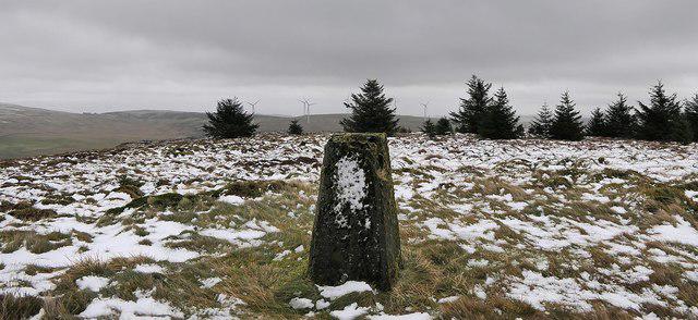 Photo could not load
NS6985 : Triangulation pillar, Cairnoch Hill, Stirlingshire
Claire Pegrum
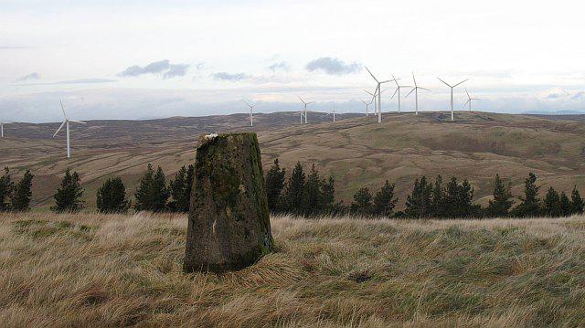 Photo could not load
NS6985 : Triangulation pillar, Cairnoch Hill
Richard Webb
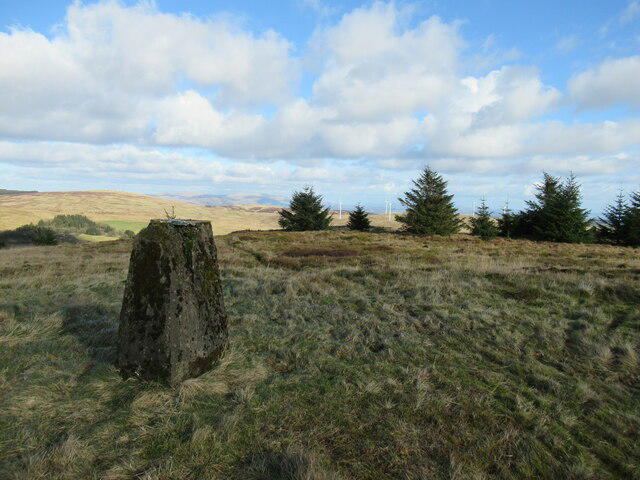 Photo could not load
NS6985 : Trig point on summit of Cairnoch Hill
Alan O'Dowd
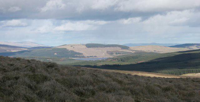 Photo could not load
NS6985 : Cairnoch Hill and Carron Valley Reservoir
Richard Sutcliffe
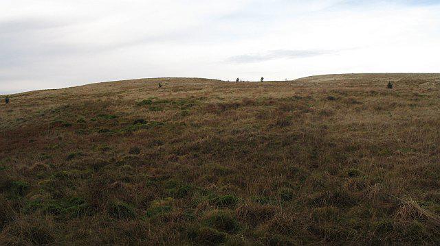 Photo could not load
NS6985 : Summit clearing, Cairnoch Hill
Richard Webb
Hill facts and local notes
Classifications
Elevation
414m
1,357 ft
Prominence
123m
Coordinates
56.0463, -4.0932
NS697856
OS Map
57
Explorer: 348
At the Summit
The summit features a rugged rocky outcrop with stunning vistas and a modest cairn that suggests many a weary hiker has found respite here.
Terrain & Geology
Cairnoch Hill is predominantly composed of classic schists typical of the Highlands, giving the mountain its rugged charm. The schist is interspersed with granite intrusions, making it a fascinating study for geology lovers and an excellent backdrop for hikers.
Views & Scenery
From the top, one can admire the expansive views of the surrounding mountains, Loch Tay, and even the distant peaks of the Ben Lawers range.
History & Heritage
Name Origin
The name 'Cairnoch' derives from Gaelic, meaning 'the place of the cairn'.
Historical Significance
Cairnoch Hill holds significance in local folklore, often associated with tales of ancient warriors and a historical landmark for local clans.
Getting There & Facilities
Check current local access restrictions, parking rules and transport timetables before travelling. These notes do not confirm public access to the summit.
Parking
Parking is available at the start of the Glenogle road, where there is a lay-by suitable for several vehicles.
Public Transport
Limited bus service is available from Killin, so it’s advisable to check local schedules or consider a taxi.
Nearby Facilities
Killin has a few cafes, shops, and public toilets, making it a convenient stop before or after your hike.
Safety Information
Known Hazards
- Keep an eye out for sudden weather changes typical of the Highlands. Muddy or slippery conditions can be an issue, particularly after rainfall.
General Safety Tips
- Check weather conditions before setting out
- Carry appropriate clothing and equipment
- Let someone know your planned route
- Take a map, compass, and GPS device
- Carry emergency supplies: food, water, first aid kit, torch
Hills
Some common questions about the hills answered
Are there group walks up Cairnoch Hill?
Many walkers use Walkmates to join or organise walks with others. You can check for group walks around Cairnoch Hill through the maps
Are there other walkers around Cairnoch Hill?
Activity varies by location and time, but Walkmates lets you see whether others have shared walks or shown interest in this area. Find other people through the walking friends search walking friends for Cairnoch Hill search or of course create your own walk for Cairnoch Hill
Can I organise a walk to Cairnoch Hill?
Yes. If there aren’t any walks listed already, you can create a walk and make it available for others to join.
If you're signed up to Walkmates, you can create a walk to Cairnoch Hill.
How do I find a walk up this hill?
There are often multiple ways to walk this hill, depending on experience and route preference. Walkmates helps you explore walks and routes that others have shared.
Can I suggest a new route up Cairnoch Hill?
Yes. You can suggest or create routes to share with others. Walkmates focuses on the social side of walking, so routes are used to help people organise walks and explore areas together, rather than as detailed navigation tools or route libraries.
Other uses really appreciate knowledgeable walkers sharing their routes. Share your favourite route to Cairnoch Hill here
The is an error or something incorrect about this hill. How do I let you know?
We always strive to keep the information on Walkmates as accurate as possible. If you find an error, please let us know through the contact form and we'll aim to correct it as quickly as possible
Community Discussion
Comments
Location
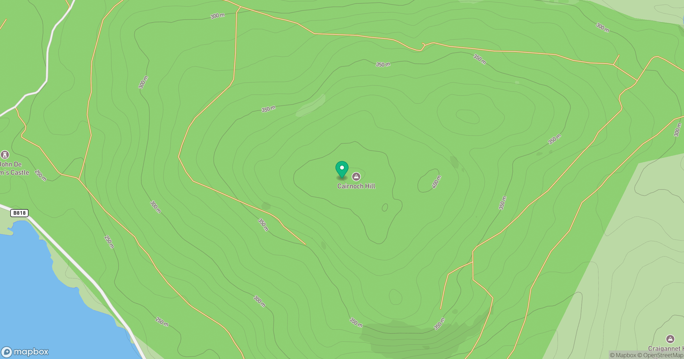
Grid reference: NS697856
View on OpenStreetMapOpens a map in a new tab, centred on the hill.
Hills within 30 km
Straight-line distance, not a walking route or confirmation of access.
No comments yet. Be the first.