

Burrow Hill
Good walks are even better shared.
ST0623 : Hillside near Gipsy Cross
Derek Harper Photo source
Overview
Burrow Hill: A Hidden Gem in South West England
Burrow Hill, standing at an elevation of 229 meters, may not be the highest hill in the South West England, but it surely packs a punch in terms of views and charm. Perfect for a leisurely hike or a family day out, this Marilyn offers an easy escape into nature without a degree in mountaineering.
Geology
The hill is a showcase of sedimentary geology, predominantly featuring clay and limestone. Fossilised remains can occasionally be spotted, reminding us that this was once an ancient seabed. Keep your eyes peeled; you might find a prehistoric treasure!
Routes
The Burrow Hill Circular Walk is the most popular route starting from Kingweston. It stretches 5.5 km, taking around 2.5 hours to complete. The path is well-trodden and perfect for a family outing with kids and dogs in tow. Just remember to keep Fido on a lead, lest he decides to chase after a squirrel!
Summit Features
At the summit, hikers are greeted by a stone cairn that marks the high point. A simple wooden bench invites weary legs to take a break. It’s the ideal spot for a picnic while soaking up the sights — no one will judge your cheese and pickle sandwiches!
Terrain Type
The terrain is primarily grassy, with some rocky outcrops that add a bit of character to the ascent. The paths are generally well-defined, making them accessible for walkers of all abilities.
Views
From the top of Burrow Hill, you can gaze out over the stunning southern Somerset landscape. On particularly clear days, the Mendip Hills to the west and the rolling Somerset Levels to the south unfold beneath you like a giant patchwork quilt. Spring and autumn are undoubtedly the best seasons for views, when the flora is particularly vibrant and the countryside comes alive.
Hazards
As with any hill, caution is advised. Certain sections can become slippery after rain, so sturdy footwear is recommended. And remember, if you’re wearing the latest in fashionable outdoor gear, check that it’s not too slick!
Nearby Summits
Adventurous spirits may want to tackle nearby Dunkers Hill or Cox Hill, both offering their own unique charm and views to supplement your Burrow Hill experience.
Access
The nearest parking is available in the quaint village of Kingweston. Public transport options include a bus route that connects to Yeovil — perfect for those who prefer to leave the car behind. Should you need supplies, Somerton is the closest town, roughly 5 km from Kingweston, where options abound.
Facilities
Although amenities near Burrow Hill aren't extensive, visitors can find a delightful pub in Kingweston, ideal for a post-hike pint. Public toilets can be accessed in Somerton, ensuring that every hiker’s need is catered for before and after conquering the hill.
History
The name 'Burrow' has its roots in Old English, referring to a dwelling or ancient fortification — a sign of the hill's long-standing significance in local culture.
In summary, Burrow Hill invites seekers of serenity and beauty to step away from the bustle of everyday life. With just a hop, skip, and a jump, or perhaps a gentle stroll, Burrow Hill awaits you with open arms and breathtaking views. Happy hiking!
Explore routes near Burrow Hill
Walks starting near this hill. Open a route to check its map, distance and full itinerary.
Wellington (Somerset) Walk with Men Walking & Talking
View route
Sampford Peverell to Whipcott Bridge: Grand Western Canal return
View route
Tiverton Grand Western Canal: Crownhill Bridge Return
View route
Taunton Walk with Men Walking & Talking
View route
Route planning notes
These notes describe possible approaches. Check a route's map and access information when planning your walk.
Burrow Hill Circular Walk
A scenic circular route starting from the village of Kingweston that offers delightful views and a gentle climb.
Make a day of it, together
Find someone to share the walk with, or organise a day out along a route you like.
Photo Gallery
View all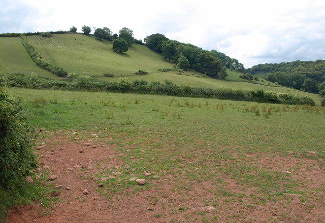 Photo could not load
ST0623 : Hillside near Gipsy Cross
Derek Harper
Hill facts and local notes
Classifications
Elevation
221m
725 ft
Prominence
50m
Coordinates
51.0030, -3.3402
ST060234
OS Map
181
Explorer: 128W
At the Summit
The summit features a stone cairn and stunning panoramic views of the surrounding countryside. A small bench is available for those who want to rest and take in the scenery.
Terrain & Geology
Burrow Hill is primarily composed of sedimentary rock, predominantly clay and limestone, with interesting fossil formations that intrigue geological enthusiasts. The surrounding area showcases the unique features of the Cotswolds, with rolling hills and valleys.
Views & Scenery
On a clear day, one can catch glimpses of the Mendip Hills to the west and the Somerset Levels sprawling below.
History & Heritage
Name Origin
The name 'Burrow' is derived from Old English meaning 'a dwelling' or 'an earthwork', indicative of settlement in the area.
Historical Significance
The hill has likely been a notable landmark for centuries, often used for local gatherings and events due to its commanding views.
Getting There & Facilities
Parking
There is a small parking area in the village of Kingweston, approximately 1 km from the trailhead.
Public Transport
The nearest bus service runs from Yeovil, with a stop in Kingweston. Check local timetables for the latest schedules.
Nearby Facilities
While facilities are limited, the village of Kingweston has a local pub where hikers can wet their whistle after a day on the hill. Public toilets can be found in Somerton.
Safety Information
Known Hazards
- Be wary of occasional steep sections that may be slippery when wet, particularly after rainfall.
General Safety Tips
- Check weather conditions before setting out
- Carry appropriate clothing and equipment
- Let someone know your planned route
- Take a map, compass, and GPS device
- Carry emergency supplies: food, water, first aid kit, torch
Hills
Some common questions about the hills answered
Are there group walks up Burrow Hill?
Many walkers use Walkmates to join or organise walks with others. You can check for group walks around Burrow Hill through the maps
Are there other walkers around Burrow Hill?
Activity varies by location and time, but Walkmates lets you see whether others have shared walks or shown interest in this area. Find other people through the walking friends search walking friends for Burrow Hill search or of course create your own walk for Burrow Hill
Can I organise a walk to Burrow Hill?
Yes. If there aren’t any walks listed already, you can create a walk and make it available for others to join.
If you're signed up to Walkmates, you can create a walk to Burrow Hill.
How do I find a walk up this hill?
There are often multiple ways to walk this hill, depending on experience and route preference. Walkmates helps you explore walks and routes that others have shared.
Can I suggest a new route up Burrow Hill?
Yes. You can suggest or create routes to share with others. Walkmates focuses on the social side of walking, so routes are used to help people organise walks and explore areas together, rather than as detailed navigation tools or route libraries.
Other uses really appreciate knowledgeable walkers sharing their routes. Share your favourite route to Burrow Hill here
The is an error or something incorrect about this hill. How do I let you know?
We always strive to keep the information on Walkmates as accurate as possible. If you find an error, please let us know through the contact form and we'll aim to correct it as quickly as possible
Community Discussion
Comments
Location
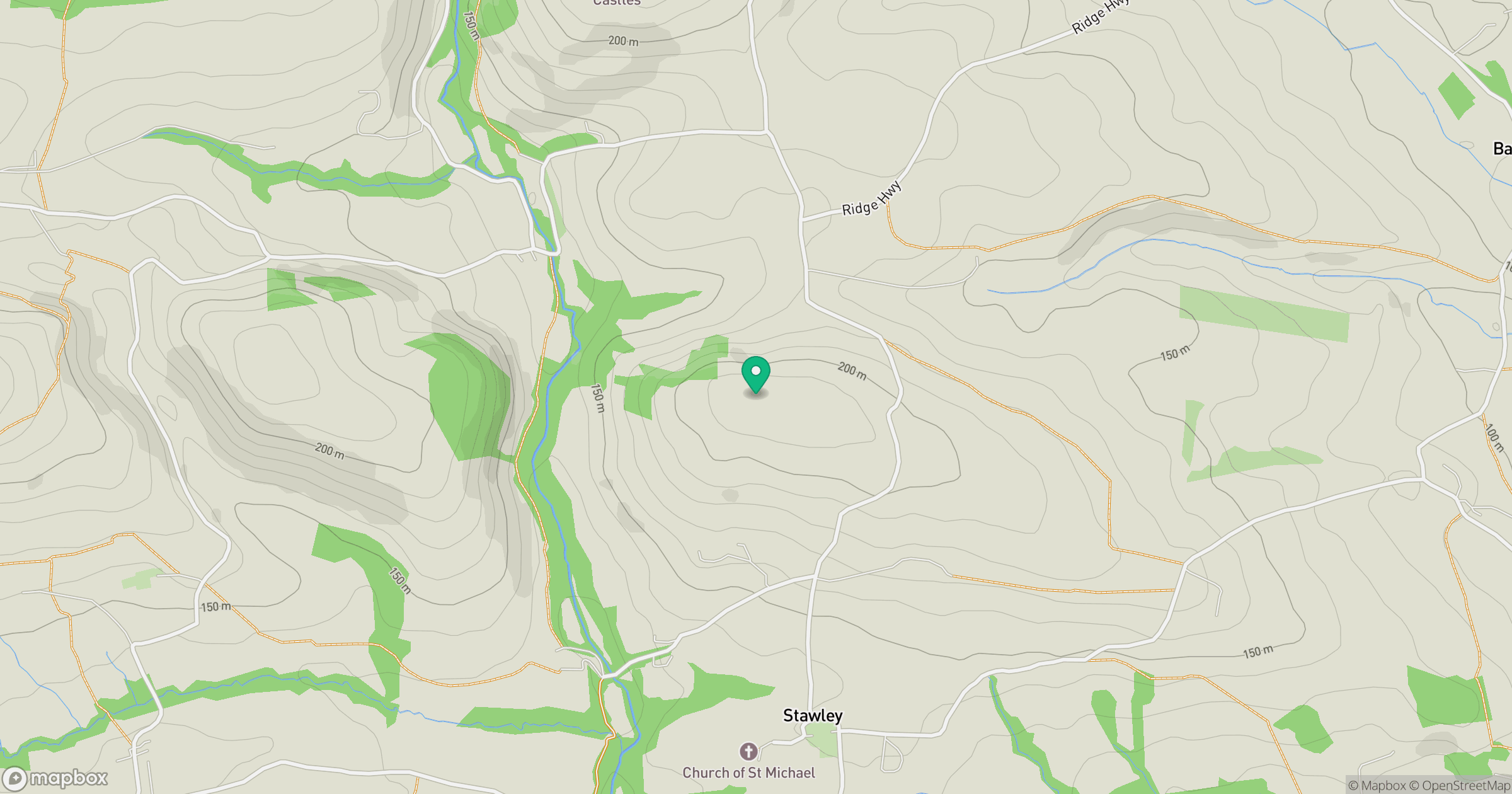
Grid reference: ST060234
View on OpenStreetMapOpens a map in a new tab, centred on the hill.



No comments yet. Be the first.