
Bryn Dol Fawr
Good walks are even better shared.
Overview
Bryn Dol Fawr
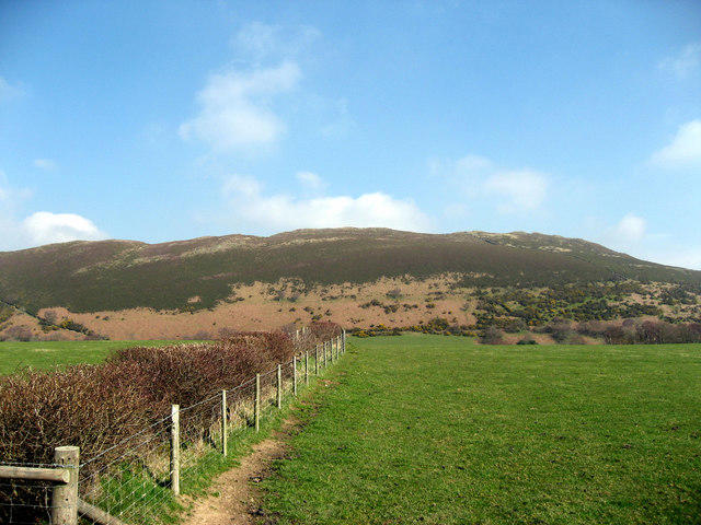
Nestled in the breathtaking Snowdonia National Park, Bryn Dol Fawr stands at an elevation of 285 meters. This charming hill is classified as a Hewitt and offers a delightful escape for hikers seeking both tranquillity and views.
Geology
The mountain's geology is predominantly composed of the Snowdonian slate, a visual testament to the Earth’s history formed during the Ordovician period. The slate's characteristic layers not only create stunning landscapes but also drain well, allowing the area to thrive with lush and diverse flora.
Hiking Routes
A popular choice is the Bryn Dol Fawr Circular Route, beginning in the quaint village of Llanfihangel-y-pennant. This route spans approximately 7.5 km and typically takes around 3 hours to complete. It's a moderate trek, ideal for most walkers who enjoy a good stretch of the legs without being entirely knackered at the end.
Summit Features
Upon reaching the summit, walkers are greeted by a small stone cairn alongside a windbreak—a perfect spot to catch your breath. Many have enjoyed a cheeky snack here while soaking in the panoramic views, making it an excellent place for some social media bragging!
Terrain Type
The terrain is primarily grassy with the occasional rocky outcrop to navigate. Although quite manageable, there can be boggy areas, particularly after rainfall. Approach with caution and perhaps consider gaiters if the weather has been particularly wet!
Views
From the summit, one is rewarded with breathtaking views of the Rhinogs sprawling to the north, alongside occasional glimpses of Cardigan Bay on clear days. The best time to experience these views is during spring or autumn when the landscape shows off its most vibrant colours. Summer, although popular, can lead to a crowded summit, so if solitude is your aim, aim for the shoulder seasons.
Hazards
It’s important to be mindful of the potential hazards, including sudden weather changes that can sweep through the area—especially in the colder months. Wet conditions can lead to slippery ground, so a good pair of hiking boots is a must!
Nearby Summits
If you’re in the mood for a bit more exploring, take a jaunt over to Garn Fadryn, which stands at 497 meters. A worthy companion to the Bryn Dol Fawr adventure!
Access
Parking is available in the village, but it’s somewhat limited. Reachable by local bus service, be sure to check the latest timetable, as they can be sporadic. The nearest town, Machynlleth, lies about 11 miles south and is your best bet for more extensive facilities.
Facilities
While the village cafe serves basic refreshments, it’s wise to carry your own snacks and drinks. After all, you wouldn’t want to be caught hungry on the hillside!
History
The name 'Bryn Dol Fawr' translates to the 'Hill of the Big Meadow', aptly describing the picturesque settings that frame this lovely hill. With a rich backdrop of folklore and history, walkers can almost feel the stories of ancient past whispering through the landscape.
Bryn Dol Fawr may be humble in stature, but don't let its size fool you—it's a treasure waiting to be explored, ideal for anyone with a love for the great outdoors and a nose for adventure!
Enjoy your hike and pack your knapsack well!
Explore routes near Bryn Dol Fawr
Walks starting near this hill. Open a route to check its map, distance and full itinerary.
Llangollen to Horseshoe Falls: Canal Towpath from Market Street
View route
World’s End and back
View route
Oswestry Walk with Men Walking & Talking
View route
Ellesmere Walk with Men Walking & Talking
View route
Route planning notes
These notes describe possible approaches. Check a route's map and access information when planning your walk.
Bryn Dol Fawr Circular Route
A popular circular walk starting from the village of Llanfihangel-y-pennant, offering a scenic loop around the mountain.
Make a day of it, together
Find someone to share the walk with, or organise a day out along a route you like.
Hill facts and local notes
Classifications
Elevation
259m
850 ft
Prominence
87m
Coordinates
52.9854, -3.2212
SJ181438
OS Map
125
Explorer: 255 256
At the Summit
The summit features a small stone cairn and a windbreak, perfect for a quick sandwich stop while taking in the views!
Terrain & Geology
Bryn Dol Fawr is primarily composed of the distinctive Snowdonian slate, formed during the Ordovician period. The slate is known for its fine layers and is often greyish in colour, providing excellent drainage and a characteristic rugged appearance.
Views & Scenery
From the summit, you can see the stunning peaks of the Rhinogs and, on a clear day, even the sweeping coast of Cardigan Bay.
History & Heritage
Name Origin
The name 'Bryn Dol Fawr' translates to 'Hill of the Big Meadow' in Welsh, hinting at the verdant slopes that surround the area.
Historical Significance
Bryn Dol Fawr is not only a scenic spot for hikers but is also steeped in local folklore, with tales of ancient settlements and mythical creatures entwined in the landscape.
Getting There & Facilities
Parking
There is limited parking available near the village of Llanfihangel-y-pennant, close to the start of the walking route.
Public Transport
Local buses run to the village, but services can be infrequent, so check the latest timetable before setting off.
Nearby Facilities
The village of Llanfihangel-y-pennant has a small cafe that serves refreshments, but amenities are limited, so plan accordingly.
Safety Information
Known Hazards
- Beware of sudden changes in weather conditions, especially in winter and early spring. Wet or boggy parts can be slippery.
General Safety Tips
- Check weather conditions before setting out
- Carry appropriate clothing and equipment
- Let someone know your planned route
- Take a map, compass, and GPS device
- Carry emergency supplies: food, water, first aid kit, torch
Hills
Some common questions about the hills answered
Are there group walks up Bryn Dol Fawr?
Many walkers use Walkmates to join or organise walks with others. You can check for group walks around Bryn Dol Fawr through the maps
Are there other walkers around Bryn Dol Fawr?
Activity varies by location and time, but Walkmates lets you see whether others have shared walks or shown interest in this area. Find other people through the walking friends search walking friends for Bryn Dol Fawr search or of course create your own walk for Bryn Dol Fawr
Can I organise a walk to Bryn Dol Fawr?
Yes. If there aren’t any walks listed already, you can create a walk and make it available for others to join.
If you're signed up to Walkmates, you can create a walk to Bryn Dol Fawr.
How do I find a walk up this hill?
There are often multiple ways to walk this hill, depending on experience and route preference. Walkmates helps you explore walks and routes that others have shared.
Can I suggest a new route up Bryn Dol Fawr?
Yes. You can suggest or create routes to share with others. Walkmates focuses on the social side of walking, so routes are used to help people organise walks and explore areas together, rather than as detailed navigation tools or route libraries.
Other uses really appreciate knowledgeable walkers sharing their routes. Share your favourite route to Bryn Dol Fawr here
The is an error or something incorrect about this hill. How do I let you know?
We always strive to keep the information on Walkmates as accurate as possible. If you find an error, please let us know through the contact form and we'll aim to correct it as quickly as possible
Community Discussion
Comments
Location
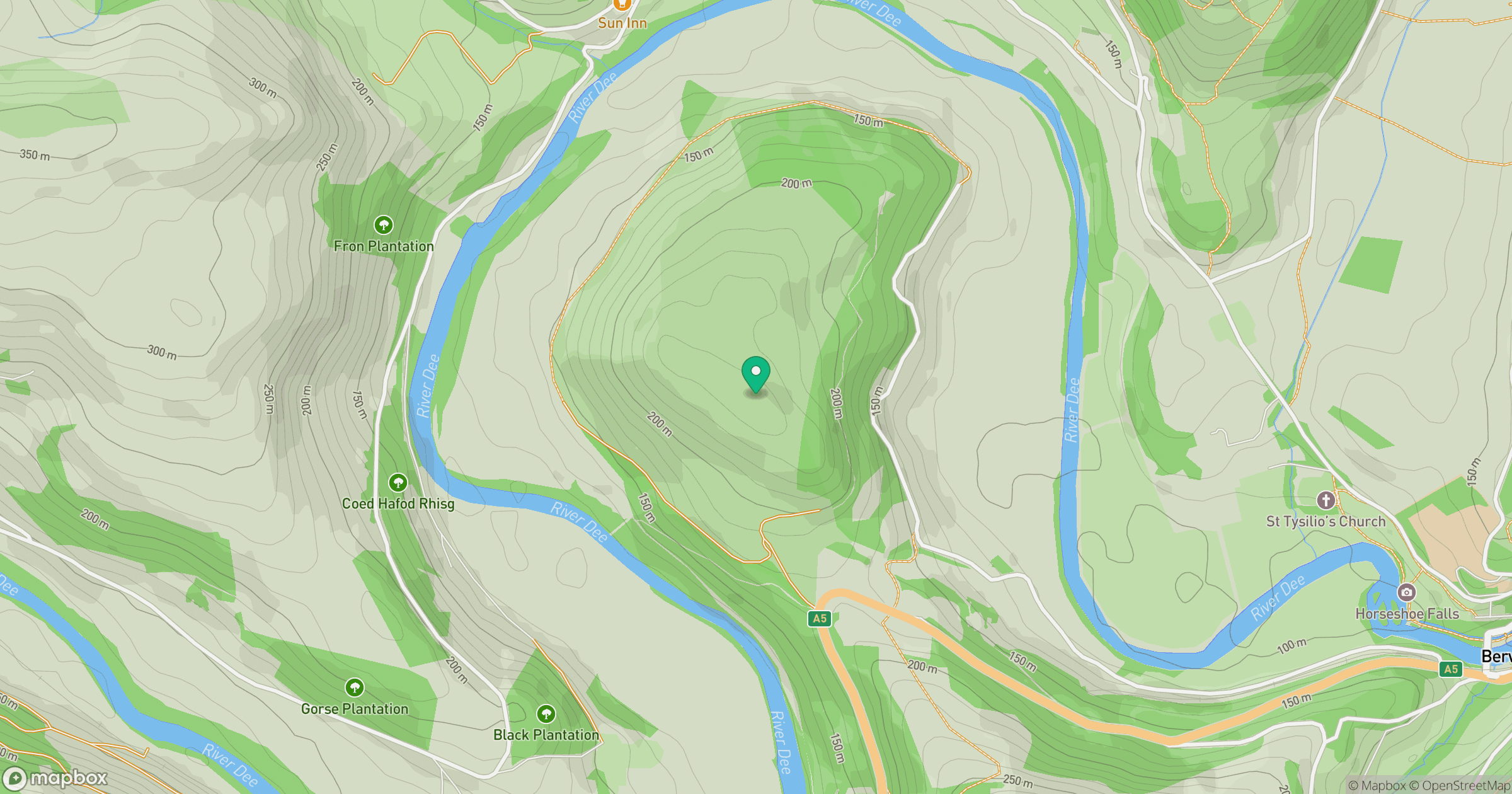
Grid reference: SJ181438
View on OpenStreetMapOpens a map in a new tab, centred on the hill.
No comments yet. Be the first.