
Pen-y-coed
Good walks are even better shared.
Overview
Pen-y-coed
Introduction
Nestled in the picturesque Clwydian Range, Pen-y-coed is a hidden gem for outdoor enthusiasts. Its gentle slopes make it accessible while offering stunning views that’ll leave you breathless (but hopefully not from exertion alone!).
Geology
The mountain features a mix of limestone and sandstone, creating unique karst formations. It’s a great spot for geology buffs eager to see the effects of erosion and time. Who knew rocks could be so fascinating?
Routes
The most popular route begins at the Nant y Felin car park. It's a mere 4.5 km round trip and will reward you with spectacular views, not to mention a good cardio workout. The woodland route takes you through peaceful glades before opening onto moorland where you'll catch sight of your destination. Don’t forget your camera!
Summit Features
At the top, you’ll find a trig point—an iconic feature for British peaks—and a small stone shelter, perfect for a lunch break or a selfie. Just be sure to use your inside voice; wildlife doesn’t appreciate being disturbed!
Terrain
The terrain is predominantly grassy with rocky outcrops, making it ideal for those seeking a bit of challenge in their stroll. Watch your step as you navigate the bracken; it’s more than just a pretty view!
Views
From the summit, clear days unveil the magnificent Snowdonia mountains and the valleys below. The best times to capture these sights are during spring and autumn, when nature puts on her best outfit.
Hazards
Be wary of those slippery patches after rain, as the Welsh weather is ever changeable! Always monitor local forecasts before heading out to avoid being caught in a downpour.
Nearby Summits
Popping into the area doesn't stop at Pen-y-coed! Nearby Moel Famau and Penycloddiau offer more trails and stunning vistas for the keen adventurer.
Access
To get here, park your car at Nant y Felin—it’s a snug fit but manageable. If you’re relying on public transport, buses run from Ruthin to nearby villages. Ruthin also has plenty of eateries to satisfy your post-hike hunger.
Facilities
After your mountain escapade, Ruthin boasts charming pubs and cafes for a well-deserved pint or slice of cake, alongside public toilets for a bit of comfort.
Conclusion
Pen-y-coed may not be the tallest mountain on the block, but it packs a punch with its natural beauty and accessibility. Whether you're a seasoned hiker or a Sunday stroller, it's a delightful spot to spend a day in the great outdoors. Remember, every hill conquered just adds to your mountain tales!
Enjoy your adventure on Pen-y-coed where the skies are blue, and the views are simply unbe-leaf-able!
Explore routes near Pen-y-coed
Public walks starting within 80 km of this hill. Nearby does not mean a route reaches the summit; check its map and access before setting out.
World’s End and back
View route
Llangollen to Horseshoe Falls: Canal Towpath from Market Street
View route
Oswestry Walk with Men Walking & Talking
View route
Ellesmere Walk with Men Walking & Talking
View route
Route planning notes
These notes describe possible approaches, not verified navigable routes or permission to cross land. Check current paths, local access rules and conditions before setting out.
Climb from Nant y Felin
A moderate ascent through lovely woodlands leading to open moorland.
Make a day of it, together
Find someone to share the walk with, or organise a day out along a route you like.
Hill facts and local notes
Classifications
Elevation
220m
722 ft
Prominence
105m
Coordinates
52.9650, -3.1544
SJ225414
OS Map
117
Explorer: 255 256
At the Summit
The summit boasts a trig point, with a small stone shelter that provides a perfect resting spot for weary hikers.
Terrain & Geology
Predominantly limestone with some sandstone layers, characteristic of the Clwydian Range, providing interesting karst features.
Views & Scenery
Panoramic views of the Snowdonia mountains to the west and the Vale of Clwyd to the east.
History & Heritage
Name Origin
The name 'Pen-y-coed' translates to 'Head of the Woods', reflecting the area's lush woodland.
Historical Significance
Historically, the area was a hunting ground and is steeped in local folklore, adding a mystical charm to your hike.
Getting There & Facilities
Check current local access restrictions, parking rules and transport timetables before travelling. These notes do not confirm public access to the summit.
Parking
Nant y Felin car park, located at SJ225423, suitable for a few vehicles and adjacent to the start of the walking route.
Public Transport
Local buses run from Ruthin to the nearest village, with a short walk to the trailhead.
Nearby Facilities
Pub and food options are available in Ruthin, along with public toilets in the town centre.
Safety Information
Known Hazards
- Watch for slippery patches, especially after rain, and be cautious of sudden weather changes common in the region.
General Safety Tips
- Check weather conditions before setting out
- Carry appropriate clothing and equipment
- Let someone know your planned route
- Take a map, compass, and GPS device
- Carry emergency supplies: food, water, first aid kit, torch
Hills
Some common questions about the hills answered
Are there group walks up Pen-y-coed?
Many walkers use Walkmates to join or organise walks with others. You can check for group walks around Pen-y-coed through the maps
Are there other walkers around Pen-y-coed?
Activity varies by location and time, but Walkmates lets you see whether others have shared walks or shown interest in this area. Find other people through the walking friends search walking friends for Pen-y-coed search or of course create your own walk for Pen-y-coed
Can I organise a walk to Pen-y-coed?
Yes. If there aren’t any walks listed already, you can create a walk and make it available for others to join.
If you're signed up to Walkmates, you can create a walk to Pen-y-coed.
How do I find a walk up this hill?
There are often multiple ways to walk this hill, depending on experience and route preference. Walkmates helps you explore walks and routes that others have shared.
Can I suggest a new route up Pen-y-coed?
Yes. You can suggest or create routes to share with others. Walkmates focuses on the social side of walking, so routes are used to help people organise walks and explore areas together, rather than as detailed navigation tools or route libraries.
Other uses really appreciate knowledgeable walkers sharing their routes. Share your favourite route to Pen-y-coed here
The is an error or something incorrect about this hill. How do I let you know?
We always strive to keep the information on Walkmates as accurate as possible. If you find an error, please let us know through the contact form and we'll aim to correct it as quickly as possible
Community Discussion
Comments
Location
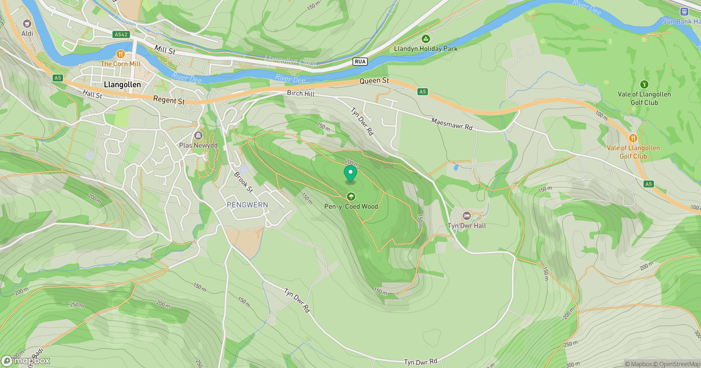
Grid reference: SJ225414
View on OpenStreetMapOpens a map in a new tab, centred on the hill.
Hills within 30 km
Straight-line distance, not a walking route or confirmation of access.
No comments yet. Be the first.