

Bruthach nan Creagan
Good walks are even better shared.
Overview
Bruthach nan Creagan: A Stalwart of the Scottish Highlands
Introduction
Nestled amidst the rolling hills of the Scottish Highlands, Bruthach nan Creagan is a Marilyn that beckons hikers with promises of stunning views and an invigorating climb. At an elevation of 720 meters, this hill may not be the highest in Scotland, but it certainly holds its own when it comes to charm and panoramic vistas.
Geology
The mountain's geological composition primarily features ancient volcanic rock, along with granite and schist, creating a visually striking landscape. The diverse geology adds an interesting dimension to your hike, as you’ll encounter varied rock formations along the route—ideal for geology enthusiasts and those who enjoy a good rock-spotting challenge.
Routes
There are a couple of popular routes that lead to the summit:
- Glen Lochy Approach: This delightful trail begins at the Glen Lochy car park and takes approximately 3.5 hours to complete, sharing a scenic journey through lush forestry.
- Inverlochy Trail: For those looking for a more challenging trek, the trail from Inverlochy offers stunning views and an uphill workout. It typically takes around 4 hours to reach the summit.
Summit Features
Upon reaching the peak, hikers are welcomed by a substantial cairn—perfect for snapping those all-important summit selfies. The expansive views offered are quite the reward after a satisfying climb, so don't forget to take in the scenery before heading back down.
Terrain
Expect rocky outcrops interspersed with grassy patches. While the terrain can be forgiving in dry conditions, beware of boggy patches that might try to swallow your boots if the weather has been particularly moist.
Views
From the summit, you’ll be graced with views of Ben Nevis and the Mamores range. On clear days, Loch Linnhe twinkles in the distance, providing a breathtaking backdrop to your well-earned victory.
Hazards
Hiking in the Highlands can come with its share of risks. One of the top hazards include rapidly changing weather conditions—what starts as a sunny day can quickly turn foggy. Additionally, keep an eye on your footing in moist areas, especially after rain.
Nearby Summits
Expand your mountain adventures by also considering a trip to the nearby summits:
- An Gearanach (985 meters)
- Aonach Beag (940 meters)
Access
Getting to Bruthach nan Creagan is a straightforward affair:
- Nearest Parking: Glen Lochy car park offers free parking, but spaces are limited—arrive early to claim your spot.
- Public Transport: The nearest bus stop is located in Tyndrum; from there, a taxi service can whisk you away to the Glen Lochy trailhead.
- Nearest Town: Tyndrum is the closest town, approximately 6 miles south of the parking area.
Facilities
If you’re looking for post-hike refreshments, head back to Tyndrum where you’ll find multiple cafes, including the Refreshment Room, and public toilets at the station. Perfect for a well-deserved bite after conquering the hill!
History
The name 'Bruthach nan Creagan' translates to 'The Hill of the Rocks', and the significance of this mountain lies not just in its beauty, but also in its historical importance as a part of the Scottish landscape that has captivated walkers for generations.
So lace up your hiking boots, grab a friend, and channel your inner adventurer on Bruthach nan Creagan! You won't be disappointed.
Explore routes near Bruthach nan Creagan
Public walks starting within 80 km of this hill. Nearby does not mean a route reaches the summit; check its map and access before setting out.
Glen Banvie Trail with the Bruar viewpoint
View route
Coire Ardair lochan from Aberarder and back
View route
Aberfeldy: Glassie Woodland and River Tay Circular
View route
Rothiemurchus: Beaver Trail and Lochan Mor
View route
Route planning notes
These notes describe possible approaches, not verified navigable routes or permission to cross land. Check current paths, local access rules and conditions before setting out.
Glen Lochy Approach
A scenic route starting from the Glen Lochy car park that meanders through lush forestry before ascending to the summit.
Inverlochy Trail
An alternative route starting near Inverlochy, offering stunning views of the surrounding hills and valleys.
Make a day of it, together
Find someone to share the walk with, or organise a day out along a route you like.
Photo Gallery
View all Photo could not load
NN7580 : Plateau above Bruthach nan Creagan
Richard Webb
Hill facts and local notes
Classifications
Elevation
854m
2,803 ft
Prominence
102m
Coordinates
56.8990, -4.0535
NN750805
OS Map
42
Explorer: OL51W 394W
At the Summit
The summit features a prominent cairn and stunning panoramic views, making it an ideal photo opportunity for summit selfies and victorious arm-raises.
Terrain & Geology
Bruthach nan Creagan is primarily composed of ancient volcanic rock, with a mix of granite and schist, which gives it a rugged appearance and fascinating geological history.
Views & Scenery
From the summit, you can see Ben Nevis to the south and the impressive peaks of the Mamores range. On a clear day, the views extend out to Loch Linnhe.
History & Heritage
Name Origin
Bruthach nan Creagan translates to 'The Hill of the Rocks' in Gaelic, fitting for a peak that wears its rocky crown with pride.
Historical Significance
The area is steeped in Scottish history and is a popular destination for hillwalkers looking to explore the rugged beauty of the Highlands.
Getting There & Facilities
Check current local access restrictions, parking rules and transport timetables before travelling. These notes do not confirm public access to the summit.
Parking
The nearest parking is at Glen Lochy, which has a small, free car park suitable for a few vehicles. Arrive early to get a spot.
Public Transport
The nearest bus stop is in the village of Tyndrum, from where you can take a taxi to the Glen Lochy car park.
Nearby Facilities
In Tyndrum, you'll find several cafes, including the Refreshment Room, where you can grab a snack, and public toilets available at the station.
Safety Information
Known Hazards
- Watch out for sudden changes in weather, which can transform the landscape from sunny to shrouded in mist. Also, sections of the route can be slippery after rain.
General Safety Tips
- Check weather conditions before setting out
- Carry appropriate clothing and equipment
- Let someone know your planned route
- Take a map, compass, and GPS device
- Carry emergency supplies: food, water, first aid kit, torch
Hills
Some common questions about the hills answered
Are there group walks up Bruthach nan Creagan?
Many walkers use Walkmates to join or organise walks with others. You can check for group walks around Bruthach nan Creagan through the maps
Are there other walkers around Bruthach nan Creagan?
Activity varies by location and time, but Walkmates lets you see whether others have shared walks or shown interest in this area. Find other people through the walking friends search walking friends for Bruthach nan Creagan search or of course create your own walk for Bruthach nan Creagan
Can I organise a walk to Bruthach nan Creagan?
Yes. If there aren’t any walks listed already, you can create a walk and make it available for others to join.
If you're signed up to Walkmates, you can create a walk to Bruthach nan Creagan.
How do I find a walk up this hill?
There are often multiple ways to walk this hill, depending on experience and route preference. Walkmates helps you explore walks and routes that others have shared.
Can I suggest a new route up Bruthach nan Creagan?
Yes. You can suggest or create routes to share with others. Walkmates focuses on the social side of walking, so routes are used to help people organise walks and explore areas together, rather than as detailed navigation tools or route libraries.
Other uses really appreciate knowledgeable walkers sharing their routes. Share your favourite route to Bruthach nan Creagan here
The is an error or something incorrect about this hill. How do I let you know?
We always strive to keep the information on Walkmates as accurate as possible. If you find an error, please let us know through the contact form and we'll aim to correct it as quickly as possible
Community Discussion
Comments
Location
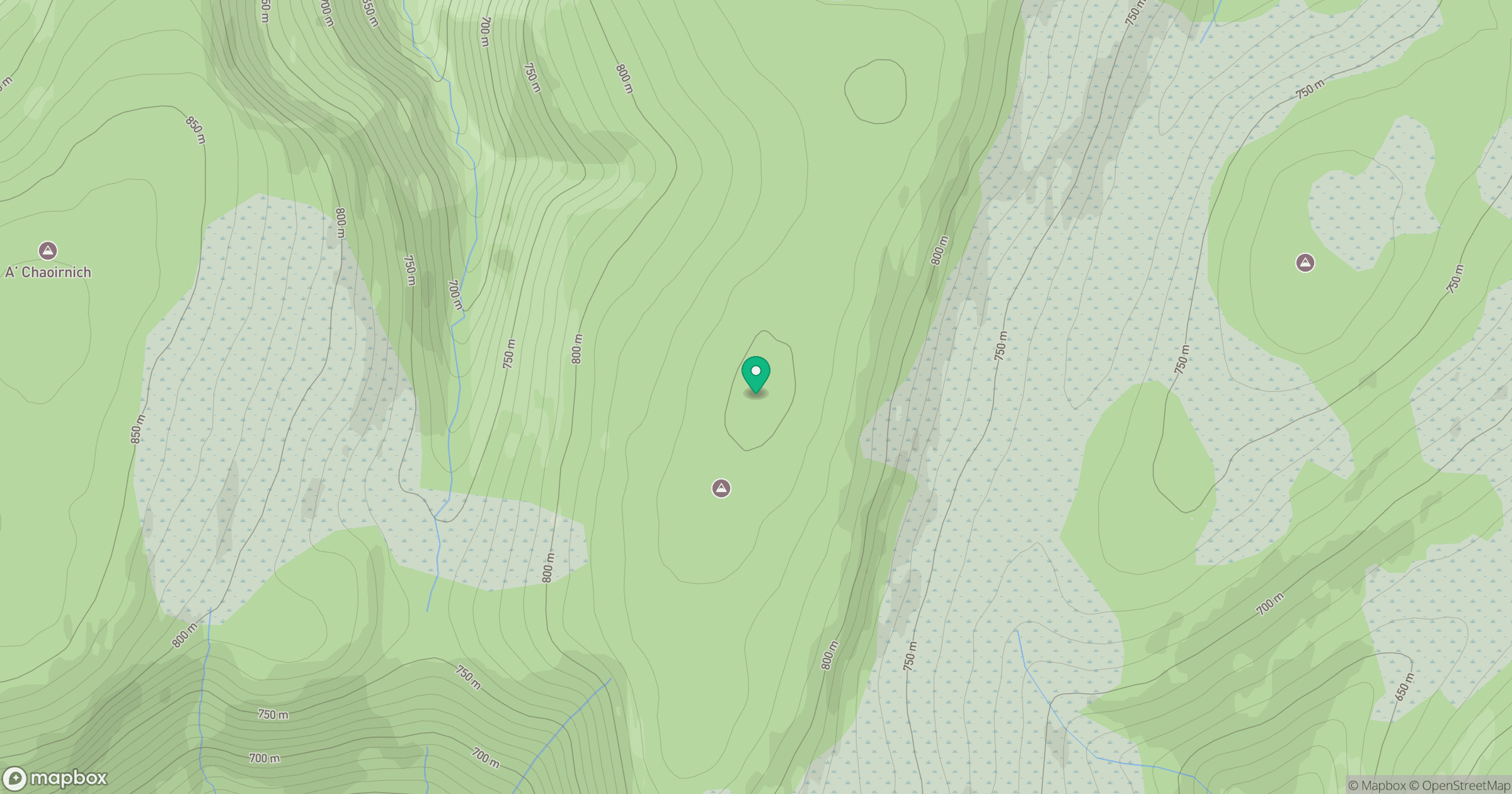
Grid reference: NN750805
View on OpenStreetMapOpens a map in a new tab, centred on the hill.
Hills within 30 km
Straight-line distance, not a walking route or confirmation of access.
Binnein Mor
550m
Schiehallion
1,083m
Sgor Gaoith
1,116m
Beinn a' Ghlo - Carn Liath
976m
Beinn a' Ghlo - Braigh Coire Chruinn-bhalgain
1,070m
No comments yet. Be the first.